McLean, Texas

Last updated

McLean, Texas
McLean Commercial Historic District.jpg
TXMap-doton-McLean.PNG
Location of McLean, Texas
Gray County McLean.svg
Coordinates: 35°13′56″N100°36′0″W / 35.23222°N 100.60000°W / 35.23222; -100.60000
Country United States
State Texas
County Gray
Area
[1]
  Total1.16 sq mi (3.00 km2)
  Land1.16 sq mi (3.00 km2)
  Water0.00 sq mi (0.00 km2)
Elevation
[2]
2,861 ft (872 m)
Population
 (2010)
  Total778
  Estimate 
(2019) [3]
744
  Density642.49/sq mi (248.02/km2)
Time zone UTC-6 (Central (CST))
  Summer (DST) UTC-5 (CDT)
ZIP code
79057
Area code 806
FIPS code 48-45780 [4]
GNIS feature ID2412968 [2]

McLean is a town in Gray County, Texas, United States. It is part of the Pampa micropolitan statistical area. Its population was 778 as of the 2010 census. [5]

Contents

Geography

McLean is located in southeastern Gray County. Interstate 40 passes through the southern part of the town, leading east 185 miles (298 km) to Oklahoma City and west 74 miles (119 km) to Amarillo. Interstate 40 Business (Old U.S. 66) passes through the town as First Street (westbound) and Railroad Street (eastbound), connecting to I-40 at Exit 141 west of town and Exit 143 to the east. Texas State Highway 273 runs along the western edge of McLean, accessing I-40 at Exit 142 and running north then northwest 35 miles (56 km) to Pampa, the Gray County seat.

According to the United States Census Bureau, McLean has a total area of 1.2 sq mi (3.0 km2), all land. [5]

History

McLean as seen from an airplane, looking south McLean Texas aerial view.JPG
McLean as seen from an airplane, looking south

In 1901, Alfred Rowe, an English rancher who later perished in the sinking of the Titanic, donated land near a railroad cattle-loading stop for the establishment of a town site. [6] The Choctaw, Oklahoma and Texas Railroad Company constructed a water well and a switch and section house there. The town was named for Judge William P. McLean (1836–1925) of the Texas Legislature and Railroad Commission. [7] [8] The town grew rapidly. By 1904, McLean had three general stores, a bank, two wagon yards and livery stables, a lumber yard, and a newspaper, the McLean News. A windmill pumped water from a well drilled in the middle of Main Street, and citizens hauled the water in barrels and buckets. The town was incorporated in 1909, with C. S. Rice as mayor, and became a center for agriculture. [9]

In 1927, the Mother Road, U.S. Route 66, was built through the town, and it became a stop for tourists and a center for oil, livestock, and agriculture processing and shipping. By 1940, the population had risen to 1,500 with six churches, 59 businesses, and a newspaper. In 1942, a prisoner-of-war camp was built east-northeast of the town, and was operated until 1945, housing about 3,000 German prisoners.

As the prominence of other Texas Panhandle cities, especially Amarillo and Pampa, surpassed McLean, the town began to decrease slowly in size. In 1984, the town was bypassed as part of the final phase of construction of Interstate 40, which replaced the old U.S. Route 66 through that area. [10]

Demographics

Historical population
CensusPop.Note
1910 633
1920 74117.1%
1930 1,521105.3%
1940 1,489−2.1%
1950 1,439−3.4%
1960 1,330−7.6%
1970 1,183−11.1%
1980 1,160−1.9%
1990 849−26.8%
2000 830−2.2%
2010 778−6.3%
2019 (est.)744 [3] −4.4%
U.S. Decennial Census [11]
Former Phillips 66 station Phillips 66 station, McLean, TX.jpg
Former Phillips 66 station

As of the census [4] of 2000, 830 people, 343 households, and 186 families were residing in the town. The population density was 706.2 people/sq mi (271.6/km2). The 459 housing units averaged 390.6/sq mi (150.2/km2). The racial makeup of the town was 96.87% White, 0.36% African American, 0.60% Native American, 0.24% Asian, 0.60% from other races, and 1.33% from two or more races. Hispanics or Latinos of any race were 2.17% of the population.

Of the 343 households, 23.3% had children under 18 living with them, 45.5% were married couples living together, 6.7% had a female householder with no husband present, and 45.5% were not families. About 42.6% of all households were made up of individuals, and 25.4% had someone living alone who was 65 or older. The average household size was 2.12, and the average family size was 2.96.

In the town, age distribution was 20.7% under the age of 18, 5.8% from 18 to 24, 17.7% from 25 to 44, 20.1% from 45 to 64, and 35.7% who were 65 or older. The median age was 50 years. For every 100 females, there were 80.4 males. For every 100 females age 18 and over, there were 70.0 males.

The median income for a household in the town was $22,847, and for a family was $34,286. Males had a median income of $26,667 versus $20,000 for females. The per capita income for the town was $13,843. About 12.9% of families and 16.4% of the population were below the poverty line, including 17.9% of those under age 18 and 15.2% of those age 65 or over.

Education

The town is served by the McLean Independent School District and is home to the McLean Tigers.

Public library

The Lovett Memorial Library was established August 9, 1940, in the City Hall of McLean. The city council voted to give $10.00 a month to help finance the new library, and appointed a library board to be the governing body. Mrs. Lady Bryant was hired to open the library from 12:00 noon until 5:00 pm daily (closed on Sundays). Since 1940, the library has seen some changes. The current location of 302 N. Main Street in McLean now houses five public-access computers, Wi-Fi access, fax, coping, printing, movies, audio books, and a selection of large-print, fiction, mystery, Western and nonfiction titles. The library is a member of the Texas Panhandle Library System and the Harrington Library Consortium. [12]

National Register of Historical Places

The McLean Commercial District, consisting of most of the downtown area, was listed in the historical register on December 20, 2006. [13]

Related Research Articles

<span class="mw-page-title-main">Randall County, Texas</span> County in Texas, United States

Randall County is a county located in the U.S. state of Texas. As of the 2020 census, its population was 140,753. Its county seat is Canyon. The county was created in 1876 and later organized in 1889. It is named for Horace Randal, a Confederate brigadier general killed at the Battle of Jenkins Ferry. The reason the county name differs from his is because the bill creating the county misspelled Randal's name.

<span class="mw-page-title-main">Oldham County, Texas</span> County in Texas, United States

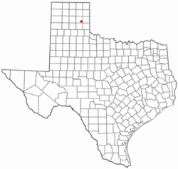
Oldham County is a county located in the U.S. state of Texas. As of the 2020 census, its population was 1,758. Its county seat is Vega. The county was created in 1876 and organized in 1881. Oldham County is included in the Amarillo, TX Metropolitan Statistical Area.

<span class="mw-page-title-main">Hemphill County, Texas</span> County in Texas, United States

Hemphill County is a county located in the U.S. state of Texas. As of the 2020 census, its population was 3,382. The county seat and only incorporated community in the county is the city of Canadian. The county was created in 1876 and organized in 1887. It is named for John Hemphill, a judge and Confederate congressman. Hemphill County is the most recent Texas county to permit alcohol sales.

<span class="mw-page-title-main">Gray County, Texas</span> County in Texas, United States

Gray County is a county located in the U.S. state of Texas. As of the 2020 census, its population was 21,227. The county seat is Pampa. The county was created in 1876 and later organized in 1902. is named for Peter W. Gray, a Confederate lawyer and soldier in the American Civil War.

<span class="mw-page-title-main">Deaf Smith County, Texas</span> County in Texas, United States

Deaf Smith County is a county located in the U.S. state of Texas. As of the 2020 census, the population was 18,583. The county seat is Hereford, which is known as the "Beef Capital of the World". The county was created in 1876 and later organized in 1890. The Hereford, TX Micropolitan Statistical Area includes all of Deaf Smith County.

<span class="mw-page-title-main">Carson County, Texas</span> County in Texas, United States

Carson County is a county located in the U.S. state of Texas. As of the 2020 census, its population was 5,807. The county seat is Panhandle. The county was founded in 1876 and later organized in 1888. It is named for Samuel Price Carson, the first secretary of state of the Republic of Texas.

<span class="mw-page-title-main">Armstrong County, Texas</span> County in Texas, United States

Armstrong County is a county located in the U.S. state of Texas. As of the 2020 census, the population of Armstrong County was 1,848. It is in the Texas Panhandle and its county seat is Claude.

<span class="mw-page-title-main">El Paso, Illinois</span> City in Illinois, United States

El Paso is a city in Woodford and McLean counties in the U.S. state of Illinois. The population was 2,756 at the 2020 census. The Woodford County portion of El Paso is part of the Peoria Metropolitan Statistical Area.

<span class="mw-page-title-main">Texhoma, Oklahoma</span> Town in Oklahoma Texas, United States

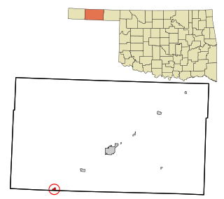
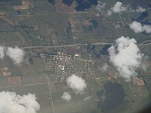
Texhoma is a town in Texas County, Oklahoma, United States. The population was 596 at the 2020 census. Texhoma is a divided city with the Texas–Oklahoma state border separating the town from Texhoma, Texas. The name of the town is a portmanteau of Texas and Oklahoma. Founded around the Rock Island Railroad laying tracks through the area, much of the town's local economy is from ranching and livestock.

<span class="mw-page-title-main">Groom, Texas</span> Town in Texas, United States

Groom is a town in Carson County, Texas, United States. The population was 552 at the 2020 census. It is part of the Amarillo, Texas Metropolitan Statistical Area. It is on Interstate 40 42 miles (68 km) east of Amarillo and 215 miles (346 km) west of Oklahoma City.

<span class="mw-page-title-main">Panhandle, Texas</span> Town in Texas, United States

Panhandle is the county seat of Carson County, Texas, United States. The population of the town was 2,452 at the 2010 census. Panhandle is part of the Amarillo metropolitan statistical area.

<span class="mw-page-title-main">Skellytown, Texas</span> Town in Texas, United States

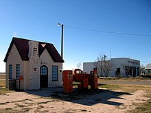
Skellytown is a town in Carson County, Texas, United States. Its population was 473 at the 2010 census, down from 610 at the 2000 census. Located in the Texas Panhandle, it is part of the Amarillo metropolitan area. In 1926, Skelly Oil Company purchased a 320-acre (130 ha) lease from Henry Schafer, a local rancher on whose land the Roxana oil pool was located. Schafer platted a new townsite, which he named "Skelly" in honor of the company's founder and president, William Grove Skelly of Tulsa, Oklahoma.

<span class="mw-page-title-main">Clarendon, Texas</span> City in Texas, United States

Clarendon is a city in Donley County, Texas, United States. Its population was 2,026 at the 2010 census. The county seat of Donley County, Clarendon is located on U.S. Highway 287 in the Texas Panhandle, 60 miles (97 km) east of Amarillo.

<span class="mw-page-title-main">Lefors, Texas</span> Town in Texas, United States

Lefors is a town in Gray County, Texas, United States. It is part of the Pampa, Texas micropolitan statistical area. Its population was 420 at the 2020 census.

<span class="mw-page-title-main">Pampa, Texas</span> City in Texas, United States

Pampa is a city in Gray County, Texas, United States. Its population was 16,867 as of the 2020 census. Pampa is the county seat of Gray County and is the principal city of the Pampa micropolitan statistical area, which includes both Gray and Roberts Counties. Pampa is named after the Pampas Lowlands in Argentina, Uruguay, and southern Brazil.

<span class="mw-page-title-main">Memphis, Texas</span> City in Texas, United States

Memphis is a city and the county seat of Hall County, Texas, United States. As of the 2010 census, the population was 2,290.

<span class="mw-page-title-main">Vega, Texas</span> City in Texas, United States

Vega is a city and county seat of Oldham County, Texas, United States. The population was 884 at the 2010 census, down from 936 at the 2000 census.

<span class="mw-page-title-main">Amarillo, Texas</span> City in Texas, United States

Amarillo is a city in the U.S. state of Texas and the seat of Potter County. It is the 14th-most populous city in Texas and the most populous city in the Texas Panhandle. A portion of the city extends into Randall County. The estimated population of Amarillo was 200,393 as of April 1, 2020, comprising nearly half of the population of the panhandle. The Amarillo metropolitan area had an estimated population of 308,297 as of 2020.

<span class="mw-page-title-main">Texas panhandle</span> Region in Texas, United States

The Texas panhandle is a region of the U.S. state of Texas consisting of the northernmost 26 counties in the state. The panhandle is a square-shaped area bordered by New Mexico to the west and Oklahoma to the north and east. It is adjacent to the Oklahoma Panhandle, land which Texas previously claimed. The 1820 Missouri Compromise declared no slavery would be allowed in states admitted from the Louisiana Purchase above 36°30′ north latitude. Texas was annexed in 1845 from still more westerly land. The Compromise of 1850 removed territory north of this line from Texas, and set the border between the Texas Pandhandle and the New Mexico Territory at the 103rd meridian west. The eastern border at the 100th meridian west was inherited from the Adams–Onís Treaty of 1819, which defined the border between the United States and New Spain. The Handbook of Texas defines the southern border of Swisher County as the southern boundary of the Texas Panhandle region.

<span class="mw-page-title-main">Moore County, Texas</span> County in Texas, United States

Moore County is a county located in the U.S. state of Texas. As of the 2020 census, its population was 21,358. The county seat is Dumas. The county was created in 1876 and organized in 1892. It is named for Edwin Ward Moore, the commander of the Texas Navy. The Dumas micropolitan statistical area includes all of Moore County.

References

  1. "2019 U.S. Gazetteer Files". United States Census Bureau. Retrieved August 7, 2020.
  2. 1 2 U.S. Geological Survey Geographic Names Information System: McLean, Texas
  3. 1 2 "Population and Housing Unit Estimates". United States Census Bureau. May 24, 2020. Retrieved May 27, 2020.
  4. 1 2 "U.S. Census website". United States Census Bureau . Retrieved January 31, 2008.
  5. 1 2 "Geographic Identifiers: 2010 Demographic Profile Data (G001): McLean town, Texas". American Factfinder. U.S. Census Bureau. Retrieved March 15, 2017.[ dead link ]
  6. Alfred Rowe in the Handbook of Texas Online
  7. WP McLean in the Texas State Library & Archives
  8. McLean, Texas in Texas Escapes Online Magazine.
  9. McLean, Texas in the Handbook of Texas Online.
  10. McLean - Where Time Stands Still
  11. "Census of Population and Housing". Census.gov. Retrieved June 4, 2015.
  12. "Harrington Library Consortium - Lovett Memorial Library, McLean". Archived from the original on May 16, 2010. Retrieved May 23, 2008.
  13. "National Register Information System". National Register of Historic Places . National Park Service. July 9, 2010.