
Harlem is a neighborhood in Upper Manhattan, New York City. It is bounded roughly by the Hudson River on the west; the Harlem River and 155th Street on the north; Fifth Avenue on the east; and Central Park North on the south. The greater Harlem area encompasses several other neighborhoods and extends west and north to 155th Street, east to the East River, and south to Martin Luther King Jr. Boulevard, Central Park, and East 96th Street.

Yorkville is a neighborhood on the Upper East Side of Manhattan, New York City, United States. Its southern boundary is East 79th Street, its northern East 96th Street, its western Third Avenue, and its eastern the East River. Yorkville is one of the most densely populated city subdivisions in the world.
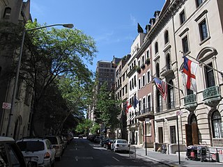
The Upper East Side, sometimes abbreviated UES, is a neighborhood in the borough of Manhattan in New York City, bounded approximately by 96th Street to the north, the East River to the east, 59th Street to the south, and Central Park and Fifth Avenue to the west. The area incorporates several smaller neighborhoods, including Lenox Hill, Carnegie Hill, and Yorkville. Once known as the Silk Stocking District, it has long been the most affluent neighborhood in New York City.

East Harlem, also known as Spanish Harlem or El Barrio, is a neighborhood of Upper Manhattan in New York City, north of the Upper East Side and bounded by 96th Street to the south, Fifth Avenue to the west, and the East and Harlem Rivers to the east and north. Despite its name, it is generally not considered to be a part of Harlem proper, but it is one of the neighborhoods included in Greater Harlem.
The Second Avenue Subway is a New York City Subway line that runs under Second Avenue on the East Side of Manhattan. The first phase of this new line, with three new stations on Manhattan's Upper East Side, opened on January 1, 2017. The full Second Avenue Line, if it will be funded, will be built in three more phases to eventually connect Harlem–125th Street in Harlem to Hanover Square in Lower Manhattan. The proposed full line would be 8.5 miles (13.7 km) and 16 stations long, serve a projected 560,000 daily riders, and cost more than $17 billion.

Harlem–125th Street station is a commuter rail stop serving the Metro-North Railroad's Hudson, Harlem, and New Haven Lines. It is located at East 125th Street and Park Avenue in East Harlem, Manhattan, New York City. The station also serves as an important transfer point between the Metro-North trains and the New York City Subway's IRT Lexington Avenue Line for access to the Upper East Side of Manhattan. It is the only station besides Grand Central Terminal that serves all three lines east of the Hudson River. Trains leave for Grand Central Terminal, as well as to the Bronx and the northern suburbs, regularly.

The 125th Street station is an express station with four tracks and two island platforms. It is the northernmost Manhattan station on the IRT Lexington Avenue Line of the New York City Subway. Located at Lexington Avenue and East 125th Street in East Harlem, it is served by the 4 and 6 trains at all times, the 5 train at all times except late nights, and the <6> train during weekdays in peak direction. This station was constructed as part of the Dual Contracts by the Interborough Rapid Transit Company and opened in 1918.
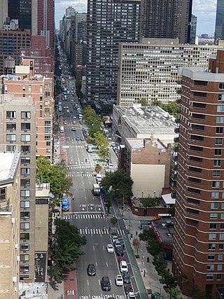
Second Avenue is located on the East Side of the New York City borough of Manhattan extending from Houston Street at its south end to the Harlem River Drive at 128th Street at its north end. A one-way street, vehicular traffic on Second Avenue runs southbound (downtown) only, except for a one-block segment of the avenue in Harlem. South of Houston Street, the roadway continues as Chrystie Street south to Canal Street.
125th Street, co-named Martin Luther King Jr. Boulevard, is a two-way street that runs east–west in the New York City borough of Manhattan, from First Avenue on the east to Marginal Street, a service road for the Henry Hudson Parkway along the Hudson River in the west. It is often considered to be the "Main Street" of Harlem.
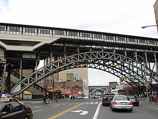
The Lenox Avenue Line is a line of the New York City Subway, part of the A Division, mostly built as part of the first subway line. Located in Manhattan, New York City, it consists of six stations between Central Park North–110th Street and Harlem–148th Street, all of which are situated within the neighborhood of Harlem in Upper Manhattan.

First Avenue is a north-south thoroughfare on the East Side of the New York City borough of Manhattan, running from Houston Street northbound to 127th Street. At 125th Street, most traffic continues onto the Willis Avenue Bridge over the Harlem River, which continues into the Bronx. South of Houston Street, the roadway continues as Allen Street south to Division Street. Traffic on First Avenue runs northbound (uptown) only.

Randalls Island and Wards Island are conjoined islands, collectively called Randalls and Wards Island, in New York City. Part of the borough of Manhattan, is separated from Manhattan Island by the Harlem River, from Queens by the East River and Hell Gate, and from the Bronx by the Bronx Kill. A channel named Little Hell Gate separated Randalls Island to the north from Wards Island to the south; the channel was filled by the early 1960s. A third, smaller island, Sunken Meadow Island, was located east of Randalls Island and was connected to it in 1955.

The IRT Second Avenue Line, also known as the Second Avenue Elevated or Second Avenue El, was an elevated railway in Manhattan, New York City, United States, from 1878 to 1942. It was operated by the Interborough Rapid Transit Company until 1940, when the city took over the IRT. Service north of the 57th Street station ended on June 11, 1940; the rest of the line closed on June 13, 1942.

The 96th Street station is an express station on the IRT Broadway–Seventh Avenue Line of the New York City Subway. Located at the intersection of 96th Street and Broadway on the Upper West Side of Manhattan, it is served by the 1, 2, and 3 trains at all times.

96th Street is a major two-way street on the Upper East Side and Upper West Side sections of the New York City borough of Manhattan. It runs in two major sections: between the FDR Drive and Fifth Avenue on the Upper East Side, and between Central Park West and Henry Hudson Parkway on the Upper West Side. The two segments are connected by the 97th Street transverse across Central Park, which links the disconnected segments of 96th and 97th Streets on each side.
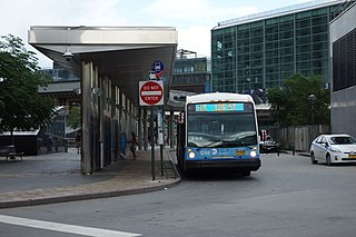
The First and Second Avenues Line, also known as the Second Avenue Line, is a bus line in Manhattan, New York City, running mostly along Second Avenue from Lower Manhattan to East Harlem. Originally a streetcar line along Second Avenue, it is now the M15 bus route, the busiest bus route in the city and United States, carrying 16.4 million riders annually. MTA Regional Bus Operations, under the New York City Bus and Select Bus Service brands, operates the local out of the Tuskegee Airmen Bus Depot and the SBS from the Mother Clara Hale Bus Depot. Service is operated exclusively with articulated buses.

The 96th Street station is a station on the IND Second Avenue Line of the New York City Subway. Located at the intersection of Second Avenue and 96th Street on the border of the Upper East Side/Yorkville and East Harlem neighborhoods in Manhattan, it is the northern terminus for the Q train at all times. It is also served by limited southbound rush hour N trains and one northbound morning rush hour R train. The station is the terminus for the first phase of the Second Avenue Line.

The Second Avenue Subway, a New York City Subway line that runs under Second Avenue on the East Side of Manhattan, has been proposed since 1920; the first phase of the line did not open until 2017. Up until the 1960s, many distinct plans for the Second Avenue subway line were never carried out, though small segments were built in the 1970s. The complex reasons for these delays are why the line is sometimes called "the line that time forgot".

