
Papatoetoe is a suburb in Auckland, New Zealand. It is the largest suburb in Auckland by population and is located to the northwest of Manukau Central, and 18 kilometres southeast of Auckland CBD.

Māngere is a major suburb in South Auckland, New Zealand, located on mainly flat land on the northeastern shore of the Manukau Harbour, to the northwest of Manukau City Centre and 15 kilometres south of the Auckland city centre. It is the location of Auckland Airport, which lies close to the harbour's edge to the south of the suburb.

Clevedon, previously known as Wairoa South, is a rural town to the south-east of Auckland, New Zealand, located in Franklin. The area is a part of the rohe of Ngāi Tai ki Tāmaki, who settled around the Wairoa River. The township was founded in the 1850s, and was named Clevedon in 1866. Over time, Clevedon developed into a centre for the dairy industry in south-eastern Auckland.

Bucklands Beach is a suburb 13 kilometres (8.1 mi) east of Auckland's CBD in New Zealand. The suburb is in the Howick ward, one of the thirteen administrative divisions of Auckland Council.

Beachlands is an outer suburb of Auckland, New Zealand, established in the 1920s, where development increased in the 1950s due to its popularity as a beach holiday destination. It is located on the Pōhutukawa Coast and in close proximity to Maraetai.

Favona is a mostly industry-dominated suburb of Auckland, New Zealand, and is part of the Māngere area. The suburb is in the Manukau ward, one of the thirteen administrative divisions of Auckland city, and is under governance of the Auckland Council.
Cockle Bay is a suburb of East Auckland, New Zealand. The suburb is in the Howick ward, one of the 13 administrative divisions of Auckland city and currently under governance of the Auckland Council.
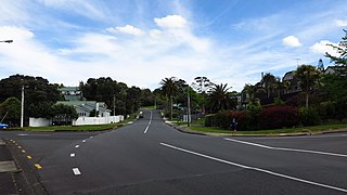
Highland Park is a suburb of Auckland, New Zealand, located between Howick and Pakuranga. It belongs to the Pakuranga electorate which is currently represented by Simeon Brown.

Ōtāhuhu is a suburb of Auckland, New Zealand – 13 kilometres (8.1 mi) to the southeast of the CBD, on a narrow isthmus between an arm of the Manukau Harbour to the west and the Tāmaki River estuary to the east. The Auckland isthmus is the narrowest connection between the North Auckland Peninsula and the rest of the North Island, being only some 1,200 metres (3,900 ft) wide at its narrowest point, between the Ōtāhuhu Creek and the Māngere Inlet. As the southernmost suburb of the former Auckland City, it is considered part of South Auckland.

Whitford is a rural town to the south-east of Auckland, New Zealand, located on the Pōhutukawa Coast. The area is a part of the rohe of Ngāi Tai ki Tāmaki, who settled around the Turanga Creek area. Whitford developed into a rural township in the 19th Century, known for its ostriches, thoroughbred horses, and quarry.

Maraetai is a coastal town to the east of Auckland in New Zealand, on the Pōhutukawa Coast. Part of the traditional rohe of Ngāi Tai Ki Tāmaki, the area developed into a coastal holiday community in the early 20th Century.

Middlemore Hospital is a major public hospital in the suburb of Ōtāhuhu, Auckland, New Zealand. The hospital has approximately 800 beds. There are 24 operating theatres across two sites.

Ōtara is a suburb of South Auckland, New Zealand, situated 18 kilometres to the southeast of the Auckland City Centre. Ōtara lies near the head of the Tamaki River, and is surrounded by the suburbs of Papatoetoe, East Tāmaki, Clover Park and Flat Bush. The area is traditionally part of the rohe of Ngāi Tai ki Tāmaki, and the name Ōtara refers to Ōtara Hill / Te Puke ō Tara, a former Ngāi Tai ki Tāmaki pā and volcanic hill to the north of the suburb. From 1851 to 1910 the area was part of the Goodfellow family farm, and during the 1910s the area was an agricultural college run by the Dilworth Trust.

The Counties Manukau District Health Board was a district health board which focused on providing healthcare to the Counties Manukau area in southern Auckland, New Zealand. As of 2016, it ws responsible for 534,750 residents; or 11% of New Zealand's population. In July 2022, CM Health was merged into the national health service Te Whatu Ora.

Māngere East or Mangere East is a suburb of Auckland, New Zealand, under the governance of Auckland Council. It is located to the south of Favona, north of Papatoetoe, west of Middlemore, east of Māngere and Māngere Bridge, and southwest of Ōtāhuhu.

Manukau Ward is an Auckland Council ward that elects two councillors and covers the Māngere-Ōtāhuhu and Ōtara-Papatoetoe Local Boards. The two councillors are currently Alf Filipaina and Lotu Fuli.

Māngere-Ōtāhuhu Local Board is one of the 21 local boards of the Auckland Council, and is overseen by the council's Manukau ward councillors. The board is governed by seven board members elected at-large. The board's administrative area includes the suburbs Māngere Bridge, Māngere, Ōtāhuhu, and Favona, and covers areas south of the Manukau Harbour.
Burswood is a residential suburb of Auckland which is separated from the rest of the city by the Pakuranga Stream on its west, north and eastern sides, and the major road Ti Rakau Drive on its south. Population density is higher than in most of Auckland, with no quarter acre sections.

Golflands is an eastern suburb of the city of Auckland, New Zealand. The Pakuranga Golf Club is part of the suburb, and many of the streets have names related to golf or notable golf players, such as Bob Charles drive.

Somerville is an eastern suburb of the city of Auckland, New Zealand. Most of the houses were built in the 1990s. Before 1990, the area was rural.

