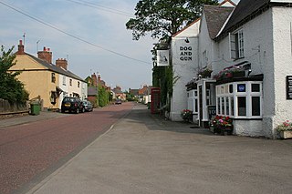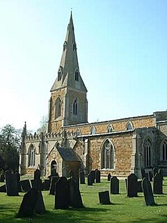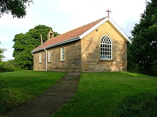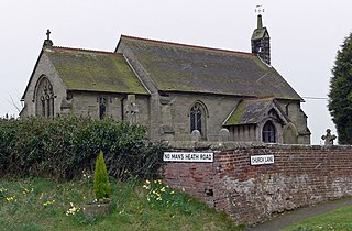
Breedon on the Hill is a village and civil parish about 5 miles (8 km) north of Ashby-de-la-Zouch in North West Leicestershire, England. The parish adjoins the Derbyshire county boundary and the village is only about 2 miles (3 km) south of the Derbyshire town of Melbourne. The 2001 Census recorded a parish population of 958 people in 404 households. The parish includes the hamlets of Tonge 1 mile (1.6 km) east of the village and Wilson 1.3 miles (2 km) north of the village on the county boundary. The population at the 2011 census was 1,029 in 450 households.

East Farndon is a small linear village and civil parish about one mile south of Market Harborough in West Northamptonshire, England. The village is close to the border with Leicestershire, and has a Leicestershire post code and telephone dialling code. At the time of the 2001 census, the parish's population was 258 people, increasing to 307 at the 2011 census.

Narborough is a large village and civil parish in the Blaby district of Leicestershire, England, around six miles southwest of Leicester. The population of the civil parish at the 2011 census was 8,498.

Wilbarston is a village and civil parish in the English county of Northamptonshire in the Welland valley. It is administered as part of North Northamptonshire and is five miles east of the Leicestershire town of Market Harborough, via the A427. At the time of the 2001 census, the parish's population was 767 people, including Pipewell but reducing slightly to 753 at the 2011 Census. A Community Governance Review concluded in February 2015 resulted in the ward of Pipewell becoming part of the civil parish of Rushton.

Stoughton is a village and civil parish in the Harborough district of Leicestershire. The population at the 2011 census was 351.

Kilby is a village and civil parish in the Blaby district of Leicestershire, England. It is the easternmost village in the district, and is 6 miles south east of Leicester. Nearby places are Fleckney, Arnesby, Wistow and Kilby Bridge.

Ashby Woulds is a civil parish in Leicestershire, England. The population at the 2011 census was 3,763. It is in the North West Leicestershire district, to the west of Ashby de la Zouch. The main settlements in the parish are Moira and Norris Hill.

East Langton is a village and civil parish in the Harborough district of Leicestershire, England.

Bardon is a civil parish and former village in North West Leicestershire about 1.5 miles (2.4 km) southeast of the centre of Coalville. The parish includes Bardon Hill, which at 912 feet (278 m) above sea level is the highest point in Leicestershire. With the population remaining less than 100, information from the 2011 census was included in the civil parish of Ellistown and Battleflat.

Hale is a village and civil parish in the Halton unitary authority of Cheshire, England. According to the 2001 census it had a population of 1,898, decreasing to 1,841 by the 2011 census. The village is north of the River Mersey, and just to the east of the boundary with Merseyside. It is 2½ miles east of Speke in Liverpool, and 4 miles south-west of Widnes. The nearby village of Halebank is to the north-east.

Stanton-under-Bardon is a village and civil parish about 4 miles (6.4 km) southeast of Coalville, Leicestershire, England. The 2011 Census recorded the parish's population as 634.

Sheepy is a civil parish in the Borough of Hinckley and Bosworth in Leicestershire, England. It contains the villages of Sheepy Magna, Sheepy Parva, Sibson, Wellsborough, Upton, Pinwall and Cross Hands—collectively 449 homes. At the 2001 census, the parish had a population of 1,192, including Orton on the Hill but falling slightly to 1,174 at the 2011 census.

Overton is a village and civil parish in Lancashire, England, south west of Lancaster and south of Morecambe between Heysham and the estuary of the River Lune. Neighbouring villages include Middleton and Sunderland Point; Glasson is on the opposite side of the river. The parish had a population of 1,069 at the 2011 Census.

Gaddesby is a village and civil parish in the Melton borough of Leicestershire, England. The population of the civil parish at the 2011 census was 762. It is located around 5.5 miles (8.9 km) southwest of Melton Mowbray and 8 miles (13 km) northeast of Leicester.

Middleton-on-Leven is a hamlet and civil parish in the Hambleton District of North Yorkshire, England. At the 2011 Census, the population was less than 100, and was recorded with the civil parish of Rudby. In the 2001 census, the parish had a population of 97.

South Kilworth is a village and civil parish in the southern part of Leicestershire, England, south of North Kilworth. The parish has a population of 430, according to the 2001 Census, and is part of the district of Harborough. The population had risen to 513 at the 2011 census.

Hoby with Rotherby is a civil parish in Leicestershire, England. In the 2001 census it had a population of 594, reducing to 556 at the time of the 2011 census. It includes the villages of Hoby, Rotherby, Ragdale and Brooksby. The parish is part of Melton local government district, and within the Rutland and Melton constituency.

Coleorton is a village and civil parish in North West Leicestershire, England. It is situated on the A512 road approximately 2 miles (3.2 km) east of Ashby de la Zouch. Nearby villages include Newbold, to the north, Thringstone to the east, and Swannington to the south-east.

Twyford and Thorpe is a civil parish in Leicestershire, England, comprising the villages of Twyford and Thorpe Satchville, and the hamlet of John O'Gaunt. The parish, which is in the Melton district, has a population of 612 at the time of the 2001 census, increasing to 628 at the 2011 census.

Chilcote is a village and civil parish in the North West Leicestershire district of Leicestershire, England. Until 1897 it was in Derbyshire. The parish had a population of 108 according to the 2001 census, including Stretton-en-le-Field and increasing to 200 at the 2011 census.


