Related Research Articles

A Nissen hut is a prefabricated steel structure originally for military use, especially as barracks, made from a 210° portion of a cylindrical skin of corrugated iron. It was designed during the First World War by the Canadian-American-British engineer and inventor Major Peter Norman Nissen. It was used also extensively during the Second World War and was adapted as the similar Quonset hut in the United States.

One Tree Hill is a town on the outskirts of Adelaide, South Australia. It is located in the City of Playford.

Elizabeth is an outer northern suburb of the Adelaide metropolitan area, South Australia, 24 km north of the Adelaide city centre. It is located in the City of Playford. At the 2021 census, Elizabeth had a population of 40,343.

Main North Road is the major north–south arterial route through the suburbs north of the Adelaide City Centre in the city of Adelaide, South Australia, and linking to Gawler on Adelaide's outer north-eastern fringes.
Pennington is a northern suburb of Adelaide, South Australia, located about 10 km from the Adelaide city centre. It is located in the City of Charles Sturt.

The Metropolitan Adelaide Transport Study, or "MATS Plan" as it became known, was a comprehensive transport plan released in 1968 proposing a number of road and rail transport projects for the metropolitan area of Adelaide, South Australia.

Taylor is a single-member electoral district for the South Australian House of Assembly. This district is named after Doris Irene Taylor MBE, a leading force in the founding of Meals on Wheels, and Labor activist. Taylor is a 246.2 km2 semi-urban electorate in Adelaide's outer northern suburbs and market gardens on the Adelaide Northern plains. A large portion of the district lives in the western half of the City of Playford and it is regarded as a safe Labor seat. It now includes the suburbs and townships of Andrews Farm, Angle Vale, Bolivar, Buckland Park, Davoren Park, Edinburgh, Edinburgh North, Elizabeth North, Eyre, Macdonald Park, Munno Para West, Penfield, Penfield Gardens, Riverlea Park, Smithfield, Smithfield Plains, St Kilda, Virginia, and Waterloo Corner.
Grand Junction Road is the longest east–west thoroughfare in the Adelaide metropolitan area, traversing through Adelaide's northern suburbs approximately 8 kilometres north of the Adelaide city centre.
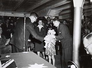
Post-war immigration to Australia deals with migration to Australia in the decades immediately following World War II, and in particular refers to the predominantly European wave of immigration which occurred between 1945 and the end of the White Australia policy in 1973. In the immediate aftermath of World War II, Ben Chifley, Prime Minister of Australia (1945–1949), established the federal Department of Immigration to administer a large-scale immigration program. Chifley commissioned a report on the subject which found that Australia was in urgent need of a larger population for the purposes of defence and development and it recommended a 1% annual increase in population through increased immigration.

The Northfield railway line was a railway in northern Adelaide running Dry Creek and Northfield. The line branched east from the Gawler railway line just north of Dry Creek station. In earlier years, it saw mixed freight including livestock in and meat out of the Gepps Cross abattoirs and sale yards. In its later years, it was operated as part of the metropolitan passenger rail network and served three stations: Cavan, Pooraka, and Northfield.
Craigmore is a large suburb north of Adelaide, South Australia. It is in the City of Playford local government area, just east of Elizabeth and south of Gawler.
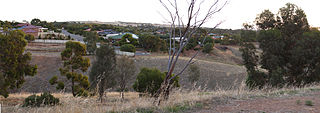
Smithfield is a suburb in the northern outskirts of Adelaide, South Australia. It is in the City of Playford.
The City of Munno Para, formerly the District Council of Munno Para, was a local government area of South Australia from 6 November 1958 to 1997, seated at the township of Smithfield. In 1997 the City of Munno Para merged with the City of Elizabeth to form the new City of Playford.
Munno Para is a northern suburb of Adelaide, South Australia. It is located in the City of Playford.
Evanston South is a northern suburb of Adelaide, South Australia in the Town of Gawler. It is on the eastern side of Main North Road on the southern side of Gawler.

The Hundred of Munno Para is a cadastral unit of hundred covering the outer northern suburbs of Adelaide north of the Little Para River and the flanking semi-rural areas in South Australia. It is one of the eleven hundreds of the County of Adelaide. It was named in 1846 by Governor Frederick Robe, Munno Para being a term from a local Kaurna Aboriginal people meaning golden wattle creek. This name refers to either the Gawler River or the Little Para River.
The District Council of Munno Mara West was a local government area of South Australia on the central Adelaide Plains from 1854 to 1933.
Balgownie Migrant Workers Hostel is a heritage-listed former migrant hostel at Squires Way, Fairy Meadow, City of Wollongong, New South Wales, Australia. It was built from 1950 to 1951 by Concrete Constructions Pty Ltd. The surviving remnants of the hostel are Huts 201, 204 and 210. It is also known as the Fairy Meadow Migrant Hostel. The site is now used for student accommodation as part of the University of Wollongong's Campus East. It was added to the New South Wales State Heritage Register on 28 August 2009.
References
- ↑ 'AUSTRALIA: Populate or Perish'
- ↑ Jupp, James 2004, The English in Australia, Cambridge University Press, Cambridge
- ↑ National Archives of Australia files D608 IM230; D4441 5/8/21
- ↑ The Advertiser newspaper, Adelaide, 22 May 2008, p.23
- ↑ Reynolds, Norm (ed), YMCA Peterborough, Adelaide, 1996
- ↑ Donnelly, Patricia 1999, Migrant journeys or "What the hell have we done?", Adelaide, pp 51, 138, 208, 224
- ↑ "Smithfield". Migration Museum. History SA. Archived from the original on 2 March 2016. Retrieved 23 February 2016.
- ↑ Allery, Linda and Trimboli, Grace, City of Playford: a brief history, City of Playford, SA