London Docklands is the riverfront and former docks in London. It is located in inner east and southeast London, in the boroughs of Southwark, Tower Hamlets, Lewisham, Newham, and Greenwich. The docks were formerly part of the Port of London, at one time the world's largest port. After the docks closed, the area had become derelict and poverty-ridden by the 1980s. The Docklands' regeneration began later that decade; it has been redeveloped principally for commercial and residential use. The name "London Docklands" was used for the first time in a government report on redevelopment plans in 1971 and has since been almost universally adopted. The redevelopment created wealth, but also led to some conflict between the new and old communities in the area.
Limehouse is a district in the London Borough of Tower Hamlets in East London. It is 3.9 miles (6.3 km) east of Charing Cross, on the northern bank of the River Thames. Its proximity to the river has given it a strong maritime character, which it retains through its riverside public houses and steps, such as The Grapes and Limehouse Stairs. It is part of the traditional county of Middlesex. It became part of the ceremonial County of London following the passing of the Local Government Act 1888, and then part of Greater London in 1965.

Poplar is a district in East London, England, now part of the London Borough of Tower Hamlets. Five miles (8 km) east of Charing Cross, it is part of the East End.

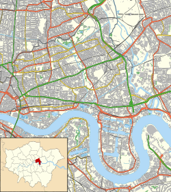
The London Borough of Tower Hamlets is a borough of London, England. Situated on the north bank of the River Thames and immediately east of the City of London, the borough spans much of the traditional East End of London and includes much of the regenerated London Docklands area. The 2019 mid-year population for the borough is estimated at 324,745.

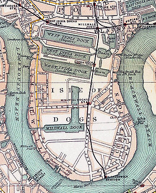
Canary Wharf is an area of East London, England, located near the Isle of Dogs in the London Borough of Tower Hamlets. Canary Wharf is defined by the Greater London Authority as being part of London's central business district, alongside Central London. Alongside the City of London, it constitutes one of the main financial centres in the United Kingdom and the world, containing many high-rise buildings including the third-tallest in the UK, One Canada Square, which opened on 26 August 1991.

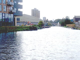
Bromley, commonly known as Bromley-by-Bow, is a district in the London Borough of Tower Hamlets in East London, located on the western banks of the River Lea, in the Lower Lea Valley in East London.
The Hertford Union Canal or Duckett's Cut, just over 1 mile (1.6 km) long, connects the Regent's Canal to the Lee Navigation in the London Borough of Tower Hamlets in East London. It was opened in 1830 but quickly proved to be a commercial failure. It was acquired by the Regents Canal Company in 1857, and became part of the Grand Union Canal in 1927.

Mile End is a district of the London Borough of Tower Hamlets in the East End of London, England, 4.2 miles (6.8 km) east-northeast of Charing Cross. It is situated on the part of the London-to-Colchester road called Mile End Road., it was one of the earliest suburbs of London.

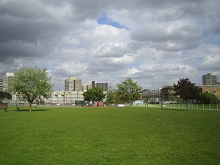
Mile End Park is a park located in the London Borough of Tower Hamlets. It is a linear park of some 32 hectares, and was created on industrial land devastated by World War II bombing. Some of the park is within Limehouse and Globe Town/Bethnal Green, with the park lying on land to the east of the Regent's Canal. In the north, it is separated from the southern edge of Victoria Park by the Hertford Union Canal. It is open 24 hours a day.

The Highway, part of which was formerly known as the Ratcliffe Highway, is a road in the London Borough of Tower Hamlets, in the East End of London. The route dates back to Roman times. In the 19th century it had a reputation for vice and crime and was the location of the Ratcliff Highway murders. Prior to a renaming programme of 1937, different parts of the route had different names depending on what district they were in.

The London Borough of Tower Hamlets, in spite of being close to the centre of London and perhaps retaining the idea of it being the docklands area, has over 100 areas of parks and open spaces within its boundaries. These range from the huge to small gardens and squares. In common with all the London boroughs, these green spaces provide "lungs" for the leisure pursuits of the inhabitants.

National Cycle Route 1 is a route of the National Cycle Network, running from Dover to Tain. The 1,264 mi-long (2,034-kilometre) cycle-path is located in the United Kingdom.

The Lea Valley Walk is a 50-mile (80 km) long-distance path located between Leagrave, the source of the River Lea near Luton, and the Thames, at Limehouse Basin, Limehouse, east London. From its source much of the walk is rural. At Hertford the path follows the towpath of the River Lee Navigation, and it becomes increasingly urbanised as it approaches London. The walk was opened in 1993 and is waymarked throughout using a swan logo.

Bromley Stop Lock was a lock on the Limehouse Cut in the London Borough of Tower Hamlets that was situated near the junction of Limehouse Cut and the River Lee Navigation by Bow Locks.
Britannia Stop Lock was a lock on the Limehouse Cut in the London Borough of Tower Hamlets. It was built in 1853. The gates were either side of Commercial Road bridge and were oriented such that a boat travelling from south-west to north-east would ascend in height.

Tower Hamlets Football Club is a football club based in the London Borough of Tower Hamlets. They are currently members of the Eastern Counties League Division One South and play at the Phoenix Sports Ground in Barnehurst.

The Angel is an area on the northern fringes of Central London within the London Borough of Islington. It is 2 miles (3.2 km) north-northeast of Charing Cross on the Inner Ring Road at a busy transport intersection. The area is identified in the London Plan as one of 35 major centres in London. It is a significant commercial and retail centre, and a business improvement district. The Angel straddles the ancient boundary of the parishes of Clerkenwell and Islington that later became the metropolitan boroughs of Finsbury and Islington. It is named from the former Angel Inn which stood on the corner of Islington High Street and Pentonville Road. Since 1965 the whole area has formed part of the London Borough of Islington in Greater London.
National Cycle Route 61 is part of the National Cycle Network managed by the charity Sustrans. It runs for 34 miles from Maidenhead (Berkshire) to Rye House (Hertfordshire) via Uxbridge, Watford, St Albans, Hatfield, Welwyn Garden City and Hertford in the United Kingdom.