Alamance is a village in Alamance County, North Carolina, United States. It is part of the Burlington, North Carolina Metropolitan Statistical Area. The population was 951 at the 2010 census, up from 310 at the 2000 census.
Elon is a town in Alamance County, North Carolina, United States. It is part of the Burlington, North Carolina Metropolitan Statistical Area. The population as of the 2010 census was 9,419. The town of Elon is home to Elon University.
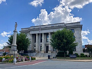
Graham is a city in Alamance County, North Carolina, United States. It is part of the Burlington, North Carolina Metropolitan Statistical Area. As of the 2010 census the population was 14,153. It is the county seat of Alamance County.

Green Level is a town in Alamance County, North Carolina, United States. It is part of the Burlington, North Carolina Metropolitan Statistical Area. As of the 2010 census, the population was 2,100.
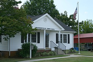
Swepsonville is a town in Alamance County, North Carolina, United States. It is part of the Burlington, North Carolina Metropolitan Statistical Area. The population at the 2010 census was 1,154.

Woodlawn is a census-designated place in Alamance County, North Carolina, United States.

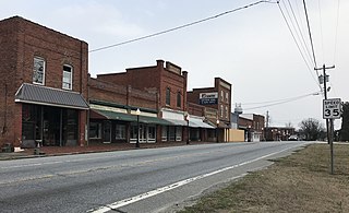
McFarlan is a town in Anson County, North Carolina, United States. The population was 117 at the 2010 census. The town was named after Alan McFarland, a railroad official.

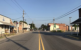
Milton is a town in Caswell County, North Carolina, United States. The population was 166 at the 2010 census. It is adjacent to the Virginia International Raceway, just across the state line in Virginia.
Bunn is a town in Franklin County, North Carolina, United States. The population was 327 at the 2020 census.

Oak Ridge is a town in northwestern Guilford County, North Carolina, United States. The population was 6,185 at the 2010 census, up from 3,988 at the 2000 census. As of 2018 the population had risen to an estimated 6,977. Oak Ridge is 15 miles (24 km) northwest of the center of Greensboro, North Carolina's third-largest city, and it is a part of the Piedmont Triad urban area.

Sedalia is a town in Guilford County, North Carolina, United States. The population was 623 at the 2010 census.
Stokesdale is a town in the northwestern corner of Guilford County, and the southwest part of Rockingham County, North Carolina, United States. The population was 3,267 at the 2000 census. At the 2010 census, the population had risen to 5,047. Belews Lake is located nearby, and North Carolina Highway 68 and North Carolina Highway 65 both intersect U.S. Route 158 near the town's center.

South Weldon is an unincorporated community and census-designated place (CDP) in Halifax County, North Carolina, United States. As of the 2010 census, the CDP population was 705. It is part of the Roanoke Rapids, North Carolina Micropolitan Statistical Area.
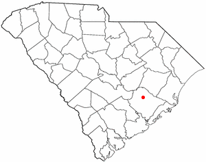
Bonneau is a town in Berkeley County, South Carolina, United States. The population was 487 at the 2010 census. It is part of the Charleston–North Charleston–Summerville Metropolitan Statistical Area.

Ridgeway is a town in Henry County, Virginia, United States. The population was 742 at the 2010 census. It is part of the Martinsville Micropolitan Statistical Area. Martinsville Speedway, a NASCAR racetrack, is located between Ridgeway and the Martinsville city limits.

Mebane is a city located mostly in Alamance County, North Carolina, United States, and partly in Orange County. The town was named for Alexander Mebane, an American Revolutionary War general and member of the U.S. Congress. It was incorporated as "Mebanesville" in 1881, and in 1883 the name was changed to "Mebane". It was incorporated as a city in 1987. The population as of the 2010 census was 11,393. Mebane is one of the fastest-growing municipalities in North Carolina. Mebane straddles the Research Triangle and Piedmont Triad Regions of North Carolina. The bulk of the city is in Alamance County, which comprises the Burlington Metropolitan Statistical Area, itself a component of the Greensboro-Winston-Salem-High Point Combined Statistical Area. Two slivers in the eastern portion of the city are in Orange County, which is part of the Durham-Chapel Hill Metropolitan Statistical Area, itself a component of the Raleigh-Durham-Chapel Hill Combined Statistical Area.
Macpherson Stadium, located in Browns Summit, North Carolina's Bryan Park, is a USL League Two stadium that seats 7,000 and is the home to PDL club North Carolina Fusion U23 and the Greensboro College men's soccer team. Prior to the opening of Macpherson Stadium, the team played at UNCG Soccer Stadium. The stadium hosted the soccer events for the 2007 State Games of North Carolina.

The Overmountain Victory National Historic Trail (OVHT) is part of the U.S. National Trails System, and N.C. State Trail System. It recognizes the Revolutionary War Overmountain Men, Patriots from what is now East Tennessee who crossed the Unaka Mountains and then fought in the Battle of Kings Mountain in South Carolina.
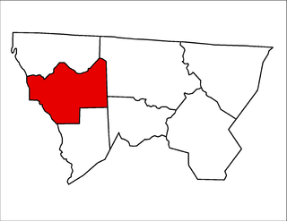
Prathers Creek Township is one of seven townships in Alleghany County, North Carolina, United States. The township had a population of 869 according to the 2010 census. Before 1880, it included Cranberry Township.

Ace Speedway is a 4/10 (.400) mile oval stock car racing track in Altamahaw, North Carolina. The track was constructed by Roy Maddren and opened in 1956 as a 1/3 mile dirt oval. In 1984, the track was expanded to a 3/8 mile dirt oval. In 1990, under the ownership of Fred and Jim Turner, the track was paved and was under the NASCAR Winston Racing Series banner. In 1999, the track was re-expanded to a 4/10 mile paved oval, the pits was expanded and other stuff was added to the track such as new bleachers.


