John Eves, a native of Ireland living in Mill Creek Hundred, Delaware, is thought to have been one of the men to visit the Greenwood Valley and Little Fishing Creek area in 1770. (One account of this visit indicates that he purchased a sizable portion of the land he explored in the area from the Indians who had served as his guides on his journey.) Although he returned to Delaware after this initial visit, he returned the following year with his son Thomas and built a log cabin on the property. The entire Eves family arrived the next year, in 1772, and began tilling the fields adjacent to the cabin as soon as they could be cleared.
In 1774, the Eves family received a deed for their 1,203-acre (4.87km2) property in the valley, the largest land holding at the time in what would later become Columbia County. Title for the land, originally obtained by William and Elizabeth McMean in 1769, was passed to Reuben Haines, and then to John Eves.
An Indian uprising, the Battle of Wyoming, in mid-summer of 1778, caused the Eves family to flee their home in the valley and take refuge at a stockade near Washingtonville. Upon their return in 1785, they found their cabin burned and their fields overgrown, but immediately set about to recreate their homestead.
When the Eves family returned in the mid-1780s, they were determined to make the settlement permanent. They were accompanied or were soon followed by several other families, including Masters, Kisner, Battin, Parker, Lundy, Lemon, Oliver, and Rich. With 17 children and 104 grandchildren, John Eves looked after the building of homes for the family, a gristmill that was to stand for 100 years, and later a sawmill and several other essential structures.
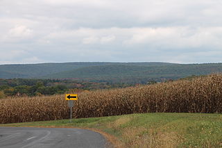
Growth of the community was slow because it was not located along a main traveled route or major waterway. Until 1798, Indian trails, which crossed at Millville, were the only accessways to the area. In that year, a road was surveyed across the Mount Pleasant hills to the Susquehanna River. It was 1856 through before the road from Bloomsburg to Laporte was laid out through Millville.
Early residents were almost entirely self-sufficient. Thomas Eves succeeded his father in ownership of the grist mill and built the first house in what is now Millville Borough. According to an early historian, David and Andrew Eves opened the first store in the area in 1827. David Eves was also commissioned the first postmaster in 1831, followed by his brother Andrew some years later.
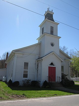
While the early population was scattered, provision was made for both worship and education. In the early years of the community, services and classes were held in the homes, but in 1785, a school was started in Millville and a two-room meeting house was erected in 1795.
Local industry at the time consisted of those operations which were necessary to meet the needs of the early population. Sawmills and grist mills were the first, followed by a woolen mill, started in 1813 by John Watson, several brick plants, and a wagon shop, established by Charles Eves, in 1837.
One spurt of growth in Millville occurred in 1856 when the road from Bloomsburg to Laporte was constructed. The town experienced considerable growth in the years following construction of this roadway because the community now had adequate access to markets and other transportation links in Bloomsburg. A second period of growth was experienced in 1887 when the railroad was constructed through town. Numerous businesses and industries were created and buildings were erected to service the railroad. A local newspaper, the Weekly Tablet, published its first edition in April 1887.
Census data shows that as of 2021,[8] there were 976 people, 360 households, and 398 housing units in Millville. 54% of the population was female and 46% male. The racial makeup of the borough was 88% White, 1% African American, 5% Asian, 0% from other races, and 4% from two or more races. Hispanic or Latino of any race were 2% of the population. 6.7% of the population was foreign born, with 72% coming from Asia, 22% from Europe, and 6% from Africa. 41% of the population was married and 59% single.
Of the 360 households, 62% were married couples living together, 13% had a female householder, 2% male householder, and 24% were non-families. The average household size was 2.4. Of the 398 housing units, 90% were occupied and 51% owner-occupied. 63% of the housing units were single unit and 37% multi-unit. The median value of owner-occupied housing units was $145,400 - about 75% of the state median.
The median age of borough residents was 41.9, about 1% higher than the state median. 15% of residents were under the age of 18, 65% from 18 to 64, and 20% were 65 years of age or older.
The median household income in the borough was $52,692 while per capita income was $25,061, both below the state medians. 15.6% of the population were below the poverty line, including 6% of those under age 18 and 14% of those age 65 or over. 91.6% had a high school degree or better, and 22.7% had a bachelor's degree or better.
Related Research Articles
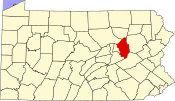
Columbia County is a county in the Commonwealth of Pennsylvania. It is located in Northeastern Pennsylvania. As of the 2020 census, the population was 64,727. Its county seat is Bloomsburg. The county was created on March 22, 1813, from part of Northumberland County. It was named Columbia, alluding to the United States and Christopher Columbus.
Benton is a borough in Columbia County, Pennsylvania, United States. It is part of Northeastern Pennsylvania. The population was 824 at the 2020 census. It is part of the Bloomsburg-Berwick micropolitan area.
Bloomsburg is a town and the county seat of Columbia County, Pennsylvania, United States. It is part of Northeastern Pennsylvania and is located 40 miles (64 km) southwest of Wilkes-Barre along the Susquehanna River. It is the only Pennsylvania municipality incorporated as a town. As of the 2010 census, Bloomsburg had a population of 14,855, with an estimated population of 13,811 in 2019.
Briar Creek is a borough in Columbia County, Pennsylvania, United States. It is part of Northeastern Pennsylvania. The population was 597 at the 2020 census. It is part of the Bloomsburg-Berwick micropolitan area.
Buckhorn is a census-designated place (CDP) in Columbia County, Pennsylvania, United States. It is part of Northeastern Pennsylvania. The population was 332 at the 2020 census. It is part of the Bloomsburg-Berwick micropolitan area. It uses the Bloomsburg ZIP code of 17815.
Eyers Grove is a census-designated place in Columbia County, Pennsylvania, United States. It is part of Northeastern Pennsylvania. The population was 102 at the 2020 census. It is part of the Bloomsburg-Berwick micropolitan area.
Fernville is a census-designated place (CDP) in Columbia County, Pennsylvania, United States. It is part of Northeastern Pennsylvania. The population was 481 at the 2020 census. It is part of the Bloomsburg-Berwick micropolitan area.
Fishing Creek Township is a township in Columbia County, Pennsylvania. It is part of Northeastern Pennsylvania. The population was 1,416 at the 2010 census.
Greenwood Township is a township in Columbia County, Pennsylvania. It is part of Northeastern Pennsylvania. The population was 1,888 at the 2020 census.
Hemlock Township is a township in Columbia County, Pennsylvania. It is part of Northeastern Pennsylvania. As of the 2020 census the population was 2,218, a decline from the figure of 2,249 tabulated in 2010.
Iola is a census-designated place in Columbia County, Pennsylvania, United States. It is part of Northeastern Pennsylvania. The population was 154 at the 2020 census. It is part of the Bloomsburg-Berwick micropolitan area.
Jerseytown is a census-designated place (CDP) that is located in Madison Township, Columbia County, Pennsylvania, United States. It is part of Northeastern Pennsylvania and of the Bloomsburg-Berwick micropolitan area.
Lightstreet is a census-designated place (CDP) in Columbia County, Pennsylvania, United States. It is part of Northeastern Pennsylvania. The population was 1,093 at the 2010 census. It is part of the Bloomsburg-Berwick micropolitan area. The CDP is named after a street in Baltimore.
Mount Pleasant Township is a township in Columbia County, Pennsylvania. It is part of Northeastern Pennsylvania. As of the 2020 census, the township population was 1,506.
Roaring Creek Township is a township in Columbia County, Pennsylvania. It is part of Northeastern Pennsylvania. The population was five hundred and forty-five at the time of the 2010 census.
Rohrsburg is a census-designated place (CDP) in Columbia County, Pennsylvania, United States. It is part of Northeastern Pennsylvania. The population was 145 at the 2010 census. It is part of the Bloomsburg-Berwick micropolitan area.
Stillwater is a borough in Columbia County, Pennsylvania, United States. It is part of Northeastern Pennsylvania. The population was 200 at the 2020 census. It is part of the Bloomsburg-Berwick micropolitan area.
Waller is a census-designated place (CDP) in Columbia County, Pennsylvania, United States. It is part of the Bloomsburg–Berwick micropolitan area in Northeastern Pennsylvania. The population was 48 at the 2010 census.
Forks Township is a township in Sullivan County, Pennsylvania, United States. The population was 372 at the 2020 census.
The Bloomsburg–Berwick Metropolitan Statistical Area (MSA), as defined by the United States Census Bureau, is an area consisting of two counties in Pennsylvania, anchored by the town of Bloomsburg and the borough of Berwick. As of the 2010 census, the MSA had a population of 85,562.
This page is based on this Wikipedia article Text is available under the CC BY-SA 4.0 license; additional terms may apply. Images, videos and audio are available under their respective licenses.