Monetta, South Carolina

Last updated

Monetta, South Carolina
MonettaWaterTower.jpg
Water tower in Monetta
USA South Carolina location map.svg
Red pog.svg
Monetta
Location within the state of South Carolina
Coordinates: 33°50′59″N81°36′30″W / 33.84972°N 81.60833°W / 33.84972; -81.60833
Country Flag of the United States.svg  United States of America
State Flag of South Carolina.svg  South Carolina
Counties Aiken, Saluda
Area
[1]
  Total0.69 sq mi (1.79 km2)
  Land0.69 sq mi (1.79 km2)
  Water0.00 sq mi (0.00 km2)
Elevation
630 ft (192 m)
Population
 (2020) [2]
  Total205
  Density297.10/sq mi (114.74/km2)
Time zone UTC-5 (Eastern (EST))
  Summer (DST) UTC-4 (EDT)
ZIP code
29105
Area code(s) 803, 839
FIPS code 45-47320 [3]
GNIS feature ID1224618 [4]

Monetta is a town in Aiken and Saluda counties, South Carolina, United States. The population was 236 at the 2010 census. [5]

Contents

The Aiken County portion of Monetta is part of the Augusta, Georgia metropolitan area. The Saluda County portion of Monetta is part of the Columbia, SC Metropolitan Area.

Geography

Monetta is located at 33°50′59″N81°36′30″W / 33.849642°N 81.608200°W / 33.849642; -81.608200 (33.849642, -81.608200), [6] near the southern corner of Saluda County and the northern corner of Aiken County. U.S. Route 1 passes through the town, leading northeast to Batesburg-Leesville and then Columbia, the state capital, and southwest to Aiken.

According to the United States Census Bureau, the town has a total area of 0.73 square miles (1.9 km2), all land. [5]

Demographics

Historical population
CensusPop.Note
1910 122
1920 13712.3%
1930 20348.2%
1940 114−43.8%
1950 84−26.3%
1960 10929.8%
1970 269146.8%
1980 2731.5%
1990 2854.4%
2000 220−22.8%
2010 2367.3%
2020 205−13.1%
U.S. Decennial Census [7] [2]

As of the census [3] of 2000, there were 220 people, 92 households, and 64 families living in the town. The population density was 298.7 inhabitants per square mile (115.3/km2). There were 108 housing units at an average density of 146.6 per square mile (56.6/km2). The racial makeup of the town was 73.64% White, 24.55% African American, and 1.82% from two or more races. Hispanic or Latino of any race were 5.00% of the population.

There were 92 households, out of which 34.8% had children under the age of 18 living with them, 51.1% were married couples living together, 15.2% had a female householder with no husband present, and 30.4% were non-families. 28.3% of all households were made up of individuals, and 15.2% had someone living alone who was 65 years of age or older. The average household size was 2.39 and the average family size was 2.92.

In the town, the population was spread out, with 24.5% under the age of 18, 6.8% from 18 to 24, 27.3% from 25 to 44, 26.8% from 45 to 64, and 14.5% who were 65 years of age or older. The median age was 40 years. For every 100 females, there were 76.0 males. For every 100 females age 18 and over, there were 78.5 males.

The median income for a household in the town was $28,750, and the median income for a family was $39,167. Males had a median income of $30,000 versus $21,875 for females. The per capita income for the town was $16,867. About 8.1% of families and 6.5% of the population were below the poverty line, including none of those under the age of eighteen and 10.3% of those 65 or over.

2010 Demographics

The following is from the 2010 Demographics Total Population 236 (100.00%)

Population by Race Black or African American alone 44 (18.64%) Some other race alone 9 (3.81%) Two or more races 10 (4.24%) White alone 173 (73.31%)

Population by Hispanic or Latino Origin (of any race) Persons Not of Hispanic or Latino Origin 204 (86.44%) Persons of Hispanic or Latino Origin 32 (13.56%)

Population by Gender Female 129 (54.66%) Male 107 (45.34%)

Population by Age Persons 0 to 4 years 8 (3.39%) Persons 5 to 17 years 43 (18.22%) Persons 18 to 64 years 147 (62.29%) Persons 65 years and over 38 (16.10%) [8]

Related Research Articles

<span class="mw-page-title-main">Saluda County, South Carolina</span> County in South Carolina, United States

Saluda County is a county in the U.S. state of South Carolina. As of the 2020 census, the population was 18,862. Its county seat is Saluda. The county was formed from northern and eastern portions of Edgefield County.

<span class="mw-page-title-main">Aiken County, South Carolina</span> County in South Carolina, United States

Aiken County is a county in the U.S. state of South Carolina. As of the 2020 census, its population was 168,808. Its county seat and largest community is Aiken. Aiken County is a part of the Augusta-Richmond County, GA-SC Metropolitan Statistical Area. It is mostly in the Sandhills region, with the northern parts reaching in the Piedmont and southern parts reaching into the Coastal Plain.

<span class="mw-page-title-main">Oakland, Florida</span> Town in the state of Florida, United States

Oakland is a town in Orange County, Florida, United States. The population was 3,516 at the 2020 Census, representing a growth of 38.5% over the population of 2,538 recorded during the 2010 census. It is part of the Orlando–Kissimmee Metropolitan Statistical Area.

<span class="mw-page-title-main">Pierson, Florida</span> Town in the state of Florida, United States

Pierson is a town in Volusia County, Florida, United States. The town is part of the Deltona–Daytona Beach–Ormond Beach, Florida Metropolitan Statistical Area. The population was 1,542 as of the 2020 census.

<span class="mw-page-title-main">Black Jack, Missouri</span> City in Missouri, United States

Black Jack is a second-ring suburb of St. Louis, located in northern St. Louis County, Missouri, United States. The population was 6,929 at the 2010 census.

<span class="mw-page-title-main">Oak City, North Carolina</span> Town in North Carolina, United States

Oak City, formerly known as Goose Nest, is a town in Martin County, North Carolina, United States. The population was 266 at the 2020 census.

<span class="mw-page-title-main">Burnettown, South Carolina</span> Town in South Carolina, United States of America

Burnettown is a town in Aiken County, South Carolina, United States. The population was 3,105 at the 2020 census. It is part of the Augusta, Georgia metropolitan area. Burnettown is located in historic Horse Creek Valley.

<span class="mw-page-title-main">Clearwater, South Carolina</span> Census-designated place in South Carolina, United States of America

Clearwater is a census-designated place (CDP) in Aiken County, South Carolina. It lies near North Augusta, South Carolina, and is part of the Augusta, Georgia metropolitan area. Clearwater is located in historic Horse Creek Valley. The population was 4,370 at the time of the 2010 census.

<span class="mw-page-title-main">Jackson, South Carolina</span> Town in South Carolina, United States of America

Jackson is a town in Aiken County, South Carolina, United States. The population was 1,700 at the 2010 census. It is part of the Augusta, Georgia metropolitan area.

<span class="mw-page-title-main">New Ellenton, South Carolina</span> City in South Carolina

New Ellenton is a city in Aiken County, South Carolina, United States. The population was 2,210 at the 2020 census. It is part of the Augusta, Georgia metropolitan area.

<span class="mw-page-title-main">Salley, South Carolina</span> Town in South Carolina, United States of America

Salley is a town in Aiken County, South Carolina, United States. The population was 398 at the 2010 census. It is part of the Augusta, Georgia metropolitan area. Salley is known for hosting the Chitlin Strut, a town-wide festival, every November.

<span class="mw-page-title-main">Windsor, South Carolina</span> Town in South Carolina, United States of America

Windsor is a town in Aiken County, South Carolina, United States. The population was 121 at the 2010 census. It is part of the Augusta, Georgia metropolitan area.

<span class="mw-page-title-main">Silverstreet, South Carolina</span> Town in South Carolina, United States

Silverstreet is a town in Newberry County, South Carolina, United States. The population was 162 at the 2010 census. Arguably its biggest tourist attraction is its Thunderbolt siren, tested on the 4th Saturday of every month for three minutes, and one of the only active Thunderbolts left In the state of South Carolina. With there only being five others remaining.

<span class="mw-page-title-main">Cope, South Carolina</span> Town in South Carolina, United States

Cope is a town in Orangeburg County, South Carolina, United States. The population was 65 at the 2020 census, a decline from 80 in 2010.

<span class="mw-page-title-main">Woodford, South Carolina</span> Town in South Carolina, United States

Woodford is a town in Orangeburg County, South Carolina, United States. The population was 185 at the 2010 census.

<span class="mw-page-title-main">Ridge Spring, South Carolina</span> Town in South Carolina, United States

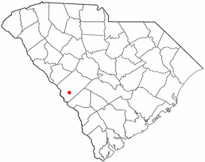
Ridge Spring is a town in Saluda County, South Carolina, United States. The population was 737 at the 2010 census. It is part of the Columbia, SC Metropolitan Statistical Area. The Mayor-Elect is Ms. Qwendolyn Etheredge.

<span class="mw-page-title-main">Saluda, South Carolina</span> Town in South Carolina, United States

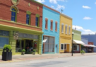
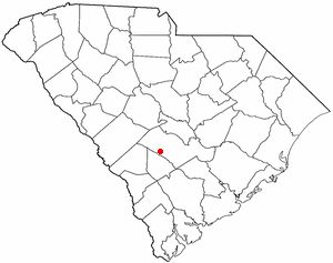
Saluda is a town in Saluda County, South Carolina, United States, along the Little Saluda River. The population was 3,565 at the 2010 census. It is the county seat of Saluda County.

<span class="mw-page-title-main">New Haven, West Virginia</span> Town in West Virginia, United States

New Haven is a town in Mason County, West Virginia, United States, along the Ohio River. The population was 1,485 at the 2020 census. It is part of the Point Pleasant, WV–OH Micropolitan Statistical Area.

<span class="mw-page-title-main">Northfork, West Virginia</span> Town in West Virginia, United States

Northfork is a town in McDowell County, West Virginia, United States, located on U.S. Route 52 between Welch and Bluefield.

<span class="mw-page-title-main">Westerly (CDP), Rhode Island</span> CDP in Rhode Island, United States

Westerly is a census-designated place (CDP) in the town of Westerly in Washington County, Rhode Island, United States. The population was 17,682 at the 2000 census. The CDP includes the majority of the town of Westerly's population, with only the rural eastern and coastal southern portions of towns excluded.

References

  1. "ArcGIS REST Services Directory". United States Census Bureau. Retrieved October 15, 2022.
  2. 1 2 "Census Population API". United States Census Bureau. Retrieved October 15, 2022.
  3. 1 2 "U.S. Census website". United States Census Bureau . Retrieved January 31, 2008.
  4. "US Board on Geographic Names". United States Geological Survey. October 25, 2007. Retrieved January 31, 2008.
  5. 1 2 "Geographic Identifiers: 2010 Demographic Profile Data (G001): Monetta town, South Carolina". U.S. Census Bureau, American Factfinder. Archived from the original on February 12, 2020. Retrieved August 5, 2013.
  6. "US Gazetteer files: 2010, 2000, and 1990". United States Census Bureau. February 12, 2011. Retrieved April 23, 2011.
  7. "Census of Population and Housing". Census.gov. Retrieved June 4, 2015.
  8. "2010 Census Population of Monetta, South Carolina - CensusViewer".