Mono, Ontario

Last updated

Mono
Town of Mono
Mono ON 2.JPG
Town of Mono.png
Mono within the Dufferin County.svg
Location of Mono within Dufferin County.
Canada Southern Ontario location map 2.png
Red pog.svg
Mono
Location of Mono within southern Ontario
Coordinates: 44°01′N80°04′W / 44.017°N 80.067°W / 44.017; -80.067
Country Flag of Canada (Pantone).svg  Canada
Province Flag of Ontario.svg  Ontario
County Dufferin
IncorporatedJanuary 1, 1850 (township)
IncorporatedJune 1, 1999 (town)
Government
  TypeTown
  MayorJohn Creelman
  Governing BodyTown of Mono Council
   MP Kyle Seeback  (CPC)
   MPP Sylvia Jones  (OPC)
Area
[1]
  Land277.83 km2 (107.27 sq mi)
Population
 (2016) [1]
  Total8,609
  Density31.0/km2 (80/sq mi)
Time zone UTC-5 (EST)
  Summer (DST) UTC-4 (EDT)
Postal code FSA
L9W
Area code(s) 519
Website www.townofmono.com

Mono is a town situated in south-central Ontario, Canada, at the south-east corner of Dufferin County. It stretches from Highway 9 along its southern border to Highway 89 along its northern border. Its border to the west is with the Township of Amaranth and in the east, it is bordered by the Township of Adjala-Tosorontio. It was previously known as the Township of Mono.

Contents

Mono is a rural community in both geography and character. It has a wide variation in topography, being composed of mostly rolling, tree-covered hills. It holds many streams and creeks which form the headwaters of three rivers - the Humber River, Nottawasaga River and Credit River and most of the town is located on high land relative to the rest of Southern Ontario. This leads to its current slogan of 'the heart of the headwaters'.

Mono's residents live on farms, rural estates, and in small settlements. Mono Centre, Hockley Village, and Camilla are just some of the small communities which exist within the Town of Mono.

Mono's population represents many different backgrounds, including the farming community, local businesses, numerous artists and artisans, commuters to neighboring towns and cities, and weekend escapees from the urban bustle. The origins of the name is believed to be from Sir Peregrine Maitland from Spanish for monkey. [2]

History

The Town of Mono as it currently is organized is the result of governmental changes that were made as the population grew and land uses change.

When "Simcoe District" was formed in 1843 by the Legislative Assembly of Upper Canada, it contained 19 original townships. Simcoe District was restructured in 1845, changing its composition to 24 townships including the Township of Mono. Effective January 1, 1850, An Act for abolishing the Territorial Divisions of Upper Canada into Districts abolished Simcoe "District" in favour of the Simcoe "County", still composed of the Townships noted in the Act of 1845.

The "Provisional County of Dufferin" was initially organized as authorized by the Legislative Assembly of Ontario in 1875 [3] and the actual formation taking effect in 1881, [4] from parts of the counties of Grey, Simcoe and Wellington Counties. The Township of Mulmur and the Township of Mono were transferred from Simcoe to Dufferin in 1881.

To better coordinate common services provided to the communities and consolidate governance within the township, the township reorganized as the Town of Mono on 1 June 1999.

Communities

The town of Mono comprises a number of villages and hamlets, including the following communities such as Blount, [5] Camilla, Cardwell, Elba, Elder, Glen Cross, Granger, Hockley (partially), Lucille, Mono Centre, Primrose (partially), Relessey, Salem, Woodside; Coopertown, Coulterville, Glenoe, Gooseville, Lavertyville, Lorraine (partially), Mono College, Mono Mills (partially), Purple Hill, Rocktown, Sheldon (partially), Springbrook, White's Corners; Cardinal Woods, Leathertown (partially), Mulmur Corners (partially), Rosemont (partially), Starrview Acres (partially), Violet Hill (partially)

Demographics

Historical population
YearPop.±%
19915,782    
1996 6,552+13.3%
2001 6,922+5.6%
2006 7,071+2.2%
2011 7,546+6.7%
2016 8,609+14.1%
[6] [7] [1]
The 2001 population was 6,912 when adjusted according to the 2006 boundaries of the town.

In the 2021 Census of Population conducted by Statistics Canada, Mono had a population of 9,421 living in 3,131 of its 3,327 total private dwellings, a change of

Recreation and tourism

Ontario Highway 10 through Mono Mono ON 1.JPG
Ontario Highway 10 through Mono

Mono Cliffs Provincial Park is one place where the Niagara Escarpment puts out a dramatic appearance. The dominant features of the park are three Escarpment outcrops known as the Mono Rocks. The Toronto District School Board operates an outdoor education and conference centre located within the park. [9] Also, the Bruce Trail goes through this area, linking it to the nearby Hockley Valley Provincial Nature Reserve.

The Hockley Valley itself is a popular destination for tourists in the fall wishing to take in the changing colors of the leaves in autumn. Outside of the Bruce Trail, there are several parks and the Niagara Escarpment is a UNESCO protected Biosphere reserve, one of only 12 in Canada.

There are several recreational attractions in the region as well. The Hockley Valley Resort is located on the 3rd Line of Mono. The Resort has both a golf course for activities in the summer and a popular ski resort for winter get-aways. There are also cross country skiing trails at Monora Park. There is much debate between residents and non residents as to the correct way to pronounce the name Mono, the correct way is mow-no.[ citation needed ] The Indigenous name Mahnoo, means "let it be so." The original name was Monadh (Irish pronounced it Monaah and later residents, Mowna) named by the Irish potato farmers who came to these higher elevations to get early crops.

There are several historic hamlets or villages in the Town of Mono. They include Camilla, Elba, Relessey, Mono Centre, Glen Cross, Granger, Hockley and Blount. The first woman lawyer in Canada, Clara Brett Martin, received her elementary education at Perry's School built in 1866, located in the Hamlet of Blount in South Mono.[ citation needed ] The Hamlet's post office was established in 1888 and the first postmaster was William Woods.[ citation needed ] Mono Cliff Inn in Mono Centre was Baker's General Store.

James Cameron, the director of the 1997 film Titanic , spent time in his childhood in the Caledon region to the south and still has family there. As a tribute to his youth, he named the villain in Titanic, Caledon Hockley, after both Caledon and the Hockley Valley area.

The Wingfield Series of plays is set in a fictional small town in Ontario called Persephone Township. Many of the jokes and personalities are taken from, among other sources, Mono Township. For example, the debate over the pronunciation of Persephone reflects the debate over the pronunciation of Mono. Playwright Dan Needles created the character while working in Shelburne, Ontario.

Portions of the TV series Schitt's Creek are filmed at a motel located in Mono. [10]

See also

Related Research Articles

<span class="mw-page-title-main">Caledon, Ontario</span> Town in Ontario, Canada

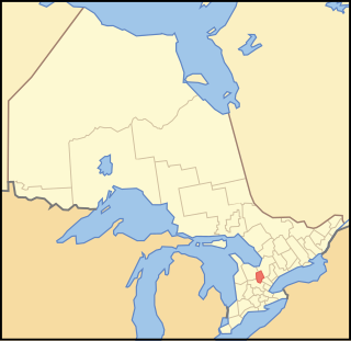
Caledon is a town in the Regional Municipality of Peel in the Greater Toronto Area of Ontario, Canada. The name comes from a shortened form of Caledonia, the Roman name for what is now Scotland. Caledon is primarily rural with a number of hamlets and small villages, but also contains the larger community of Bolton in its southeastern quadrant, adjacent to York Region. Some spillover urbanization also occurs in the south bordering the City of Brampton.

<span class="mw-page-title-main">King, Ontario</span> Township in Ontario, Canada

King is a township in York Region north of Toronto, within the Greater Toronto Area in Ontario, Canada.

<span class="mw-page-title-main">Erin, Ontario</span> Town in Ontario, Canada

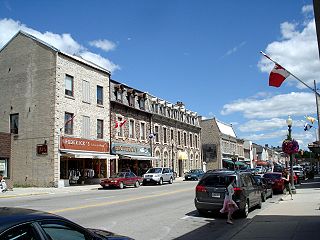
Erin is a town in Wellington County, approximately 80 kilometres (50 mi) northwest of Toronto, Ontario, Canada. Erin is bordered by the Town of Caledon, Ontario to the east, the Town of Halton Hills to the south, the Township of Guelph/Eramosa to the west and the Township of East Garafraxa to the north.

<span class="mw-page-title-main">Wellington County, Ontario</span> County in Ontario, Canada

Wellington County is a county located in Southwestern Ontario, Canada and is part of the Greater Golden Horseshoe. The county, made up of two towns and five townships, is predominantly rural in nature. However many of the residents in the southern part of the county commute to urban areas such as Guelph, Kitchener, Waterloo, Brampton, Mississauga, Toronto and Hamilton for employment. The northern part of the county is made up of mainly rural farming communities, except for a few larger towns such as Mount Forest and Arthur. According to the 2021 census, the population of the county was 241,026.

<span class="mw-page-title-main">Adjala-Tosorontio</span> Township in Ontario, Canada

Adjala–Tosorontio is a township in south-central Ontario, Canada, in the County of Simcoe.

<span class="mw-page-title-main">Essa, Ontario</span> Township in Ontario, Canada

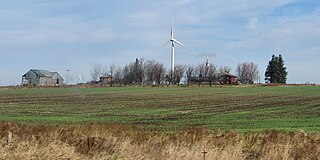
Essa is a township in Ontario, Canada, west and south of the city of Barrie in Simcoe County. It is bounded by County Road 90 to its north, County Road 27 to its east, and Ontario Highway 89 to its south. The township is about 100 kilometres (62 mi) from Toronto. The township is well known for its agriculture industry, particularly potato farming. Nearby CFB Borden brings a strong military presence to the area as well, including a high number of Francophone families.

<span class="mw-page-title-main">Simcoe County</span> County in Ontario, Canada

Simcoe County is located in the central portion of Southern Ontario, Canada. The county is just north of the Greater Toronto Area, stretching from the shores of Lake Simcoe in the east to Georgian Bay in the west. Simcoe County forms part of the Greater Golden Horseshoe area, a densely populated and industrialized region, centred on the Greater Toronto Area.

<span class="mw-page-title-main">Dufferin County</span> County in Ontario, Canada

Dufferin County is a county and census division located in Central Ontario, Canada. The county seat is Orangeville, and the current Warden is Wade Mills. The current chief administrative officer is Sonya Pritchard. Dufferin covers an area of 1,486.31 square kilometres (573.87 sq mi), and its population was 61,735 at the time of the 2016 Census.

<span class="mw-page-title-main">Grey County</span> County in Ontario, Canada

Grey County is a county of the Canadian province of Ontario. The county seat is in Owen Sound. It is located in the subregion of Southern Ontario named Southwestern Ontario. Grey County is also a part of the Georgian Triangle. At the time of the Canada 2016 Census the population of the county was 93,830.

<span class="mw-page-title-main">Clearview, Ontario</span> Township in Ontario, Canada

Clearview is a rural incorporated township in Simcoe County in Central Ontario, Canada, west of Barrie and south of Collingwood and Wasaga Beach in Simcoe County.

Cardwell, a federal electoral district in the Canadian province of Ontario, was represented in the House of Commons of Canada from 1867 to 1904. Cardwell is sometimes also considered one of Ontario's historic counties, as Cardwell was listed in some post-Confederation census records as a county of residence.

<span class="mw-page-title-main">Mulmur</span> Township in Ontario, Canada

Mulmur is a township in Dufferin County in Southern Ontario, Canada. There are a number of original settlements such as Mulmur Corners, some of which can still be identified as to location, including Rosemont and Stanton.

Peel—Dufferin—Simcoe was a federal electoral district represented in the House of Commons of Canada from 1968 to 1979. It was located in the province of Ontario. This riding was created in 1966 from parts of Peel—Dufferin riding.

Airlie is an unincorporated rural community in Simcoe County, Ontario, Canada.

<span class="mw-page-title-main">Hurontario Street</span> Road in Ontario, Canada

Hurontario Street is a roadway running in Ontario, Canada between Lake Ontario at Mississauga and Lake Huron's Georgian Bay at Collingwood. Within Peel Region, it is a major urban thoroughfare within the cities of Mississauga and Brampton, which serves as the divide from which cross-streets are split into East and West, except at its foot in the historic Mississauga neighbourhood of Port Credit. Farther north, with the exception of the section through Simcoe County, where it forms the 8th Concession, it is the meridian for the rural municipalities it passes through. In Dufferin County, for instance, parallel roads are labelled as EHS or WHS for East of Hurontario Street.

<span class="mw-page-title-main">Amaranth, Ontario</span> Township in Ontario, Canada

Amaranth is a township located in Dufferin County, Ontario, Canada, with a 2021 population of 4,327. It is named after the plant which grows abundantly within its borders. It is bordered by Mono to the east and East Luther to the west.

<span class="mw-page-title-main">Melancthon, Ontario</span> Township in Ontario, Canada

Melancthon is a rural Canadian township in the northwest corner of Dufferin County, Ontario, bordered on the east by Mulmur Township, Amaranth Township and East Luther Grand Valley to the south, Southgate Township to the west, and the Municipality of Grey Highlands to the north. The township does not include the town of Shelburne on its southern border. It has one of the lowest population densities in southwestern Ontario.

Ruskview is an unincorporated rural community in Mulmur Township, Dufferin County, Ontario, Canada.

<span class="mw-page-title-main">Hockley Valley Provincial Nature Reserve</span> Nature reserve at Mono, Ontario, Canada

Hockley Valley Provincial Nature Reserve is a nature reserve located on the Niagara Escarpment within the township of Mono, Ontario, Canada. It is managed by Ontario Parks. Approximately 80% of the Cannings Falls Area of Natural and Scientific Interest is within the borders of the park; land acquisitions are planned to encompass it entirely. The Bruce Trail links the reserve to other protected areas of the Niagara Escarpment.

<span class="mw-page-title-main">Hockley Highlands Inn</span> Building in Mono, Ontario

The Hockley Highlands Inn and Conference Centre, on the East side of 3rd Line Road, Mono, Ontario, south of Dufferin County Road 7, opposite the Hockley Valley Resort, is a hotel and conference centre with 5 main buildings on 200 acres (0.81 km2) of forested land sloping towards the Hockley Valley. It has been closed to the public since May 2007.

References

  1. 1 2 3 "Census Profile, 2016 Census: Mono, Town". Statistics Canada. 8 February 2017. Retrieved June 11, 2019.
  2. "Heritage Property INdex » Mono Township".
  3. S.O. 1874-75, c. 31
  4. An Act to confirm certain preliminary proceedings, and make further provision for the formation of the County of Dufferin , S.O. 1880, c. 37
  5. "Blount". Geographical Names Data Base . Natural Resources Canada . Retrieved 2016-12-10. (place)
  6. Statistics Canada: 1996, 2001, 2006 census
  7. "Mono, Ontario (Code 3522012) census profile". 2011 Census of Population . Statistics Canada. Retrieved 2012-08-14.[ permanent dead link ]
  8. "Population and dwelling counts: Canada, provinces and territories, census divisions and census subdivisions (municipalities), Ontario". Statistics Canada. February 9, 2022. Retrieved March 30, 2022.
  9. "Mono Cliffs Conference Centre". Archived from the original on February 9, 2005. Retrieved 2005-07-13.{{cite web}}: CS1 maint: bot: original URL status unknown (link)
  10. Halliday, Chris (June 24, 2014). "Hockley sets scene for CBC comedy starring Eugene Levy". Orangeville.com. Retrieved June 11, 2019.