Montpelier or Montpellier may refer to:

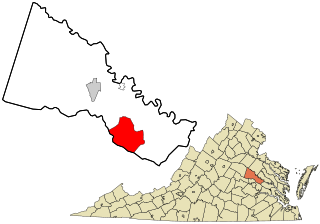
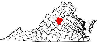
Orange County is a county located in the Central Piedmont region of the Commonwealth of Virginia. At the 2020 census, the population was 36,254. Its county seat is Orange. Orange County includes Montpelier, the 2,700-acre (1,100 ha) estate of James Madison, the 4th President of the United States and often known as the "Father of the Constitution". The county will celebrate its 290th anniversary in 2024.
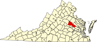
Hanover County is a county in the Commonwealth of Virginia. As of the 2020 census, the population was 109,979. Its county seat is Hanover Courthouse.

Goochland County is a county located in the Piedmont of the Commonwealth of Virginia. Its southern border is formed by the James River. As of the 2020 census, the population was 24,727. Its county seat is Goochland.
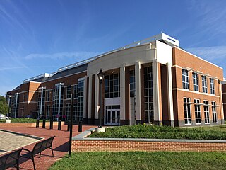
Ashland is a town in Hanover County, Virginia, United States, located 16 miles (26 km) north of Richmond along Interstate 95 and U.S. Route 1. As of the 2020 census it had a population of 7,565, up from 7,225 at the 2010 census.
Mechanicsville is an unincorporated area and census-designated place (CDP) in Hanover County, Virginia, United States. The population was 39,482 during the 2020 census, up from 36,348 in the 2010 census.

Doswell is an unincorporated community in Hanover County in the Central Region of the U.S. Commonwealth of Virginia. Originally called Hanover Junction, it was located on the Virginia Central Railroad at a crossing of the Richmond, Fredericksburg and Potomac Railroad, a north–south route. Both railroads are now owned by CSX Transportation, although the former Virginia Central line is leased to a short-line carrier, Buckingham Branch Railroad. The area near the Doswell train station is a popular train-watching site for railfans.

Manchester is a former independent city in Virginia in the United States. Prior to receiving independent status, it served as the county seat of Chesterfield County, between 1870 and 1876. Today, it is a part of the city of Richmond, Virginia.

The James River and Kanawha Canal was a partially built canal in Virginia intended to facilitate shipments of passengers and freight by water between the western counties of Virginia and the coast. Ultimately its towpath became the roadbed for a rail line following the same course.
Beaverdam is a small unincorporated community in Hanover County in the central region of the U.S. state of Virginia. The community was named after the beaver dams in the area.

Aldie is an unincorporated community and census-designated place (CDP) located between Chantilly and Middleburg in Loudoun County, Virginia, United States. The historic village of Aldie is located on the John Mosby Highway in a gap between the Catoctin Mountains and Bull Run Mountains, through which the Little River flows. Aldie traditionally serves as the gateway to the Loudoun Valley and beyond.

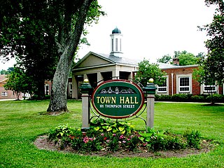
Hanover is an unincorporated community and census-designated place (CDP) in Hanover County, Virginia, United States. It is the county seat and is located at the junction of U.S. Route 301 and State Route 54 south of the Pamunkey River. While historically known as Hanover Courthouse, the U.S. Geological Survey, Census Bureau, Postal Service and residents refer to it as "Hanover". The population as of the 2010 census was 252.

Palmyra is a census-designated place (CDP) in and the county seat of Fluvanna County, Virginia, United States. The population as of the 2010 census was 104. Palmyra lies on the eastern bank of the Rivanna River along U.S. Route 15. The ZIP code for Palmyra and surrounding rural land is 22963.

The Hanover Tavern is a community center, theatre, and recreational tavern located in Hanover, Virginia. Originally built in 1733, it is one of the oldest taverns in the United States.

Hanover County Courthouse is a historic courthouse located in the community of Hanover Courthouse, the county seat of Hanover County, Virginia. Built about 1735, it is one of the nation's oldest courthouses still in use for that purpose. It is historically notable as the site of the Parson's Cause case, which was argued by Patrick Henry in 1763. It was designated a National Historic Landmark in 1973. A modern courthouse complex stands nearby, which now houses most of the county's judicial functions.
Maidens is a small unincorporated community in Goochland County, Virginia, United States. Sited on the north side of the James River, it is currently located at the junction of U.S. Route 522, State Route 6, and State Route 634.
This is a list of the National Register of Historic Places listings in Albemarle County, Virginia.

This is a list of the National Register of Historic Places listings in Richmond, Virginia.
This is a list of the National Register of Historic Places listings in Hanover County, Virginia.

Montpelier Station is an unincorporated community in Orange County, Virginia, United States. Montpelier Station is located along Virginia State Route 20 3.5 miles (5.6 km) west-southwest of Orange. Montpelier Station has a post office with ZIP code 22957.


