
Long Beach Airport is a public airport three miles northeast of downtown Long Beach, in Los Angeles County, California, United States. It is also called Daugherty Field, named after local aviator Earl Daugherty. The airport was an operating base for JetBlue, but this ended on October 6, 2020, as the carrier moved its operating base to LAX, despite the then ongoing COVID-19 pandemic. Long Beach Airport's largest airline is now Southwest Airlines as JetBlue has ended all services at Long Beach.

Naval Station Mayport is a major United States Navy base in Jacksonville, Florida. It contains a protected harbor that can accommodate aircraft carrier-size vessels, ship's intermediate maintenance activity (SIMA) and a military airfield with one asphalt paved runway (5/23) measuring 8,001 ft × 200 ft.

Hunter Army Airfield, located in Savannah, Georgia, United States, is a military airfield and subordinate installation to Fort Stewart located in Hinesville, Georgia.
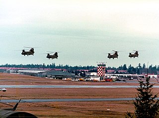
Gray Army Airfield, also known as Gray AAF, is a military airfield located within Joint Base Lewis–McChord near Tacoma, in Pierce County, Washington, United States.
Bisbee Douglas International Airport is a county-owned airport 9 miles northwest of Douglas and 17 miles east of Bisbee, both in Cochise County, Arizona, United States, that was formerly known as Douglas Army Airfield. The FAA's National Plan of Integrated Airport Systems for 2009–2013 categorizes it as a general aviation facility.

Siskiyou County Airport is a public airport located three miles (4.8 km) northeast of Montague, serving Siskiyou County, California, United States. It has one runway and is mostly used for general aviation.

Cape Field at Fort Glenn was a military site significant for its role in World War II. It consists of Fort Glenn, an airfield of the United States Army Air Corps later renamed Cape Air Force Base, and the adjacent Naval Air Facility Otter Point, both located on Umnak Island in the Aleutian Islands of southwestern Alaska. The site was listed on the National Register of Historic Places and declared a National Historic Landmark in 1987.
Yucca Army Airfield is a former military airfield located about 1 mile (1.6 km) west of Yucca, in Mohave County, Arizona, United States. It is on the east side of Interstate 40, 25 miles (40 km) south of Kingman. It is now used as a private facility owned by Fiat Chrysler Automobiles named Chrysler Arizona Proving Grounds.
Marine Corps Air Facility Walnut Ridge is a former United States Army and United States Marine Corps airfield located in Walnut Ridge, Arkansas. After it was closed, it was redeveloped into Walnut Ridge Regional Airport.
During World War II, the United States Army Air Forces (USAAF) established numerous airfields in Massachusetts for training pilots and aircrews of USAAF fighters and bombers.

Fort Sumner Municipal Airport is a village owned, public use airport located two nautical miles (4 km) northeast of the central business district of Fort Sumner, a village in De Baca County, New Mexico, United States. It is included in the National Plan of Integrated Airport Systems for 2011–2015, which categorized it as a general aviation airport.

Freeman Army Airfield is an inactive United States Army Air Forces base. It is located 2.6 miles (4.2 km) south-southwest of Seymour, Indiana.

Holtville Airport is a county-owned, public-use airport located five nautical miles (9 km) northeast of the central business district of Holtville, a city in Imperial County, California, United States. Holtville was a U.S. Navy airfield during World War II.
Naval Auxiliary Air Station Hollister is a former United States Navy air station.
Naval Air Station New Iberia, located near New Iberia, Louisiana, was a short-lived training facility of the United States Navy which operated for a mere five years in the 1960s. The naval base at New Iberia was actually designated NAAS, indicating that it was a Naval Auxiliary Air Station. The U.S. Navy airfield identifier for New Iberia was KNIL.
Cape Air Force Base also known as Fort Glenn Army Air Base, is a site significant for its role in World War II fighting, operating alongside Naval Air Facility Otter Point.

Hanau Army Airfield is a former military airfield located in Langendiebach, part of the municipality of Erlensee, some 5.2 km (3.2 mi) north-northeast of Hanau in Hesse, Germany.
Biancur Field, (Eglin Air Force Base Auxiliary Field #6,, is a satellite airfield located northwest of the Main Base, 5.9 miles north-northeast of Valparaiso, Florida. It is also known as site "Test Site B6".

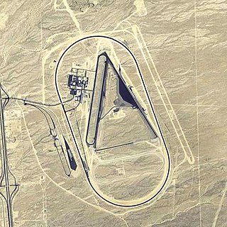
Victorville Army Airfield auxiliary fields were four airfields used during World War II to support the Victorville Army Airfield pilot training near Victorville, California, and Adelanto, California. After the war the Victorville Army Airfield was renamed George Air Force Base on January 13, 1948. The airfields were built in 1941 by the United States Army Air Corps just before the war. Victorville Army Airfield covered 2,200-acre in the Mojave Desert. The US Army held a groundbreaking ceremony on 12 July 1941. The base, called Victorville Army Flying School, was ready to use before the attack on Pearl Harbor on December 7, 1941. The Army built four runways in a triangle configuration, with one runway down the middle of the triangle. Seven hangars were built to support operation. On April 23, 1943, the base was renamed Victorville Army Airfield.
