Mooresville, Missouri

Last updated

Mooresville, Missouri
Livingston County Missouri Incorporated and Unincorporated areas Mooresville Highlighted.svg
Location of Mooresville, Missouri
Coordinates: 39°44′48″N93°43′15″W / 39.74667°N 93.72083°W / 39.74667; -93.72083
Country United States
State Missouri
County Livingston
Area
[1]
  Total0.18 sq mi (0.46 km2)
  Land0.18 sq mi (0.46 km2)
  Water0.00 sq mi (0.00 km2)
Elevation
[2]
915 ft (279 m)
Population
 (2020)
  Total98
  Density547.49/sq mi (211.04/km2)
Time zone UTC-6 (Central (CST))
  Summer (DST) UTC-5 (CDT)
ZIP code
64664
Area code 660
FIPS code 29-49790 [3]
GNIS feature ID2399393 [2]

Mooresville is a village in western Livingston County, Missouri, United States. The population was 98 at the 2020 census. [4]

Contents

History

Mooresville was platted in 1860 by W. B. Moore, and named for him. [5] A post office called Mooresville has been in operation since 1860. [6] The village was incorporated in 1874. [7]

Geography

According to the United States Census Bureau, the village has a total area of 0.18 square miles (0.47 km2), all land. [8]

Demographics

Historical population
CensusPop.Note
1880 172
1910 205
1920 193−5.9%
1930 137−29.0%
1940 17024.1%
1950 134−21.2%
1960 117−12.7%
1970 13112.0%
1980 129−1.5%
1990 100−22.5%
2000 89−11.0%
2010 912.2%
2020 987.7%
U.S. Decennial Census [9]

2010 census

As of the census [10] of 2010, there were 91 people, 42 households, and 27 families residing in the village. The population density was 505.6 inhabitants per square mile (195.2/km2). There were 48 housing units at an average density of 266.7 per square mile (103.0/km2). The racial makeup of the village was 100.0% White.

There were 42 households, of which 19.0% had children under the age of 18 living with them, 50.0% were married couples living together, 7.1% had a female householder with no husband present, 7.1% had a male householder with no wife present, and 35.7% were non-families. 31.0% of all households were made up of individuals, and 16.6% had someone living alone who was 65 years of age or older. The average household size was 2.17 and the average family size was 2.63.

The median age in the village was 49.9 years. 17.6% of residents were under the age of 18; 2.2% were between the ages of 18 and 24; 22% were from 25 to 44; 33% were from 45 to 64; and 25.3% were 65 years of age or older. The gender makeup of the village was 48.4% male and 51.6% female.

2000 census

As of the census [3] of 2000, there were 89 people, 40 households, and 25 families residing in the village. The population density was 489.8 inhabitants per square mile (189.1/km2). There were 48 housing units at an average density of 264.2 per square mile (102.0/km2). The racial makeup of the village was 100.00% White.

There were 40 households, out of which 22.5% had children under the age of 18 living with them, 60.0% were married couples living together, 2.5% had a female householder with no husband present, and 37.5% were non-families. 35.0% of all households were made up of individuals, and 17.5% had someone living alone who was 65 years of age or older. The average household size was 2.23 and the average family size was 2.92.

In the village, the population was spread out, with 22.5% under the age of 18, 5.6% from 18 to 24, 19.1% from 25 to 44, 27.0% from 45 to 64, and 25.8% who were 65 years of age or older. The median age was 48 years. For every 100 females, there were 85.4 males. For every 100 females age 18 and over, there were 81.6 males.

The median income for a household in the village was $21,875, and the median income for a family was $34,250. Males had a median income of $26,250 versus $13,750 for females. The per capita income for the village was $16,282. There were no families and 2.7% of the population living below the poverty line, including no under eighteens and none of those over 64.

Related Research Articles

<span class="mw-page-title-main">Airport Drive, Missouri</span> Village in Missouri, United States

Airport Drive is a village in Jasper County, Missouri, United States. The population was 766 at the 2020 census. It is part of the Joplin, Missouri Metropolitan Statistical Area. The community is still commonly referred to as "Stone's Corner," as the intersection of Route 43 and Route 171 is known.

<span class="mw-page-title-main">Brooklyn Heights, Missouri</span> Village in Missouri, United States

Brooklyn Heights is a village in Jasper County, Missouri, United States. The population was 101 at the 2020 census. It is part of the Joplin, Missouri Metropolitan Statistical Area.

<span class="mw-page-title-main">Evergreen, Missouri</span> Village in Missouri, United States

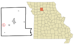
Evergreen is a village in Laclede County, Missouri, United States. The population was 28 at the 2010 census. It was named Twin Bridges at the 2000 census.

<span class="mw-page-title-main">Junction City, Missouri</span> Village in Missouri, United States

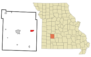
Junction City is a village in Madison County, Missouri, United States. The population was 283 at the 2020 census, down from 327 in 2010.

<span class="mw-page-title-main">Bakersfield, Missouri</span> Village in Missouri, United States

Bakersfield is a village in southeastern Ozark County in the Ozarks of southern Missouri, United States. The population was 186 at the 2020 census.

<span class="mw-page-title-main">Flemington, Missouri</span> Village in Missouri, United States

Flemington is a village in Polk County, Missouri, United States. The population was 148 at the 2010 census. It is part of the Springfield, Missouri Metropolitan Statistical Area.

<span class="mw-page-title-main">Halfway, Missouri</span> Village in Missouri, United States

Halfway is a village in Polk County, Missouri, United States. According to the 2010 census, the population of Halfway is 173. It is part of the Springfield, Missouri Metropolitan Statistical Area.

<span class="mw-page-title-main">Roscoe, Missouri</span> Village in Missouri, United States

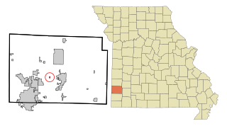
Roscoe is a village in St. Clair County, Missouri, United States. The population was 89 at the 2020 census.

<span class="mw-page-title-main">Country Life Acres, Missouri</span> Village in Missouri, United States

Country Life Acres is a village in St. Louis County, Missouri, United States. The population was 72 at the 2020 census.

<span class="mw-page-title-main">Glen Echo Park, Missouri</span> Former Village in Missouri, United States

Glen Echo Park was a village in St. Louis County, Missouri, United States. The population was 122 at the 2020 census. The community took its name from the nearby Glen Echo Country Club.

<span class="mw-page-title-main">Grantwood Village, Missouri</span> Town in Missouri, United States

Grantwood Village is a town in St. Louis County, Missouri, United States. The population was 863 at the 2010 census.

<span class="mw-page-title-main">Hillsdale, Missouri</span> Village in Missouri, United States

Hillsdale is a village in St. Louis County, Missouri, United States. Greenwood Cemetery is located in Hillsdale. The population was 1,478 at the 2010 census.

<span class="mw-page-title-main">Mackenzie, Missouri</span> Village in Missouri, United States

Mackenzie is an unincorporated community in St. Louis County, Missouri, United States. The population was 134 at the 2010 census.

<span class="mw-page-title-main">Marlborough, Missouri</span> Village in Missouri, United States

Marlborough is a village in St. Louis County, Missouri, United States. The population was 2,179 at the 2010 census.

<span class="mw-page-title-main">Norwood Court, Missouri</span> Village in Missouri, United States

Norwood Court is a village in St. Louis County, Missouri, United States. The population was 959 at the 2010 census.

<span class="mw-page-title-main">Pasadena Park, Missouri</span> Village in Missouri, United States

Pasadena Park is a village in St. Louis County, Missouri, United States. The population was 470 at the 2010 census. It is part of the Normandy School District, and is distinct from the city of Pasadena Hills.

<span class="mw-page-title-main">Velda Village Hills, Missouri</span> City in Missouri, United States

Velda Village Hills is a city in northeastern St. Louis County, Missouri, United States. The population was 1,055 at the 2010 census.

<span class="mw-page-title-main">Westwood, Missouri</span> Village in Missouri, United States

Westwood is a village in west St. Louis County, Missouri, United States. The population was 316 at the 2020 census.

<span class="mw-page-title-main">Hanley Hills, Missouri</span> Village in Missouri, United States

Hanley Hills is a village in St. Louis County, Missouri, United States. The population was 2,101 at the 2010 census.

<span class="mw-page-title-main">Uplands Park, Missouri</span> Village in Missouri, United States

Uplands Park is a village in St. Louis County, Missouri, United States. The population was 445 at the 2010 census. The village is one of many small majority black communities located in the Natural Bridge corridor of mid-St. Louis County, characterized by small homes on small lots.

References

  1. "ArcGIS REST Services Directory". United States Census Bureau. Retrieved August 28, 2022.
  2. 1 2 U.S. Geological Survey Geographic Names Information System: Mooresville, Missouri
  3. 1 2 "U.S. Census website". United States Census Bureau . Retrieved January 31, 2008.
  4. "Explore Census Data". data.census.gov. Retrieved January 20, 2022.
  5. Eaton, David Wolfe (1916). How Missouri Counties, Towns and Streams Were Named. The State Historical Society of Missouri. pp.  189.
  6. "Post Offices". Jim Forte Postal History. Retrieved October 30, 2016.
  7. "Livingston County Place Names, 1928–1945". The State Historical Society of Missouri. Archived from the original on June 24, 2016. Retrieved October 30, 2016.
  8. "US Gazetteer files 2010". United States Census Bureau. Archived from the original on July 2, 2012. Retrieved July 8, 2012.
  9. "Census of Population and Housing". Census.gov. Retrieved June 4, 2015.
  10. "U.S. Census website". United States Census Bureau . Retrieved July 8, 2012.