Mount Hope, New York

Last updated

Mount Hope, New York
Town of Mount Hope
Mount Hope, NY, town hall.jpg
Town Hall of Mount Hope
Orange County New York incorporated and unincorporated areas Mount Hope highlighted.svg
Location in Orange County and the state of New York.
USA New York location map.svg
Red pog.svg
Mount Hope, New York
Location within the state of New York
Coordinates: 41°27′58″N74°31′37″W / 41.46611°N 74.52694°W / 41.46611; -74.52694
Country United States
State New York
County Orange
Area
[1]
  Total25.50 sq mi (66.03 km2)
  Land25.13 sq mi (65.10 km2)
  Water0.36 sq mi (0.94 km2)  1.22%
Elevation
738 ft (225 m)
Population
 (2020)
  Total6,537
  Density260.13/sq mi (100.41/km2)
Time zone UTC-5 (Eastern (EST))
  Summer (DST) UTC-4 (EDT)
FIPS code 36-48857
GNIS feature ID0979241
Website townofmounthope.org

Mount Hope is a town in the northwestern part of Orange County, New York, United States, west of Middletown. The northern town line is the border of Sullivan County. The population was 6,537 at the 2020 census.

Contents

History

The first known settler of European descent arrived circa 1733.

The town of Mount Hope was created from the towns of Deerpark and Wallkill in 1825.

Geography

According to the United States Census Bureau, the town has a total area of 25.5 square miles (66 km2), of which 25.2 square miles (65 km2) is land and 0.3 square miles (0.78 km2) (1.22%) is water.

The Shawangunk Mountains lie on the western town line, and Shawangunk Creek flows through Mount Hope.

Transportation

New York State Route 211 is an east–west highway in the town.

Metro-North Railroad's Port Jervis Line has a station at nearby Otisville.

Demographics

Historical population
CensusPop.Note
1830 1,535
1840 1,5652.0%
1850 1,512−3.4%
1860 1,5754.2%
1870 1,84217.0%
1880 1,549−15.9%
1890 1,437−7.2%
1900 1,236−14.0%
1910 1,78644.5%
1920 1,708−4.4%
1930 1,8478.1%
1940 1,817−1.6%
1950 2,29826.5%
1960 2,291−0.3%
1970 2,96629.5%
1980 4,39848.3%
1990 5,97135.8%
2000 6,63911.2%
2010 7,0185.7%
2020 6,537−6.9%
U.S. Decennial Census [2]

As of the census [3] of 2000, there were 6,639 people, 1,582 households, and 1,218 families residing in the town. The population density was 263.5 inhabitants per square mile (101.7/km2). There were 1,714 housing units at an average density of 68.0 per square mile (26.3/km2). The racial makeup of the town was 78.63% white, 16.51% African American, 0.27% Native American, 1.48% Asian, 0.03% Pacific Islander, 1.84% from other races, and 1.25% from two or more races. Hispanic or Latino of any race were 14.61% of the population.

There were 1,582 households, out of which 40.5% had children under the age of 18 living with them, 63.3% were married couples living together, 9.3% had a female householder with no husband present, and 23.0% were non-families. 18.6% of all households were made up of individuals, and 8.0% had someone living alone who was 65 years of age or older. The average household size was 2.93 and the average family size was 3.34.

In the town, the population was spread out, with 20.6% under the age of 18, 7.3% from 18 to 24, 42.0% from 25 to 44, 23.1% from 45 to 64, and 7.0% who were 65 years of age or older. The median age was 36 years. For every 100 females, there were 186.2 males. For every 100 females age 18 and over, there were 216.1 males.

The median income for a household in the town was $56,948, and the median income for a family was $65,183. Males had a median income of $36,765 versus $30,208 for females. The per capita income for the town was $17,562. About 3.5% of families and 5.2% of the population were below the poverty line, including 7.0% of those under age 18 and 3.3% of those age 65 or over.

Communities and locations in Mount Hope

Related Research Articles

<span class="mw-page-title-main">Niles, New York</span> Town in New York, United States

Niles is a town in Cayuga County, New York, United States. The population was 1,194 at the 2010 census. Niles lies in the eastern part of the county, southeast of Auburn.

<span class="mw-page-title-main">Preble, New York</span> Town in New York, United States

Preble is a town in Cortland County, New York, United States. The population was 1,393 at the 2010 census. The town is named after Commodore Edward Preble, a naval hero.

<span class="mw-page-title-main">Crawford, New York</span> Town in New York, United States

Crawford is a town in the north of Orange County, New York, United States. The population was 9,130 at the 2020 census. The name comes from a settler who gave his name to a community in the hamlet now called Pine Bush.

<span class="mw-page-title-main">Otisville, New York</span> Village in New York, United States

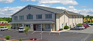
Otisville is a village in Orange County, New York, United States. The population was 969 at the 2020 census. It is part of the Poughkeepsie–Newburgh–Middletown, NY Metropolitan Statistical Area as well as the larger New York–Newark–Bridgeport, NY-NJ-CT-PA Combined Statistical Area.

<span class="mw-page-title-main">Pine Bush, New York</span> CDP in New York, United States

Pine Bush is a hamlet located in the town of Crawford and adjacent to Shawangunk, New York, within Orange and adjacent to Ulster counties in the U.S. It is roughly coterminous with the 12566 ZIP code and 744 telephone exchange in the 845 area code. These both extend into adjacent regions of the town of Shawangunk in Ulster County.. The population was 1,751 at the 2020 census.

<span class="mw-page-title-main">Wallkill, Orange County, New York</span> Town in New York, United States

Wallkill is a town in Orange County, New York, United States. The population was 30,486 at the 2020 census. It is centrally located in the county. Interstate 84 crosses New York State Route 17 in the southern part of the town. U.S. Route 6 and New York State routes 17K, 211 and 302 also cross portions of the town.

<span class="mw-page-title-main">Wawayanda, New York</span> Town in New York, United States

Wawayanda is a town in Orange County, New York, United States. The population was 7,534 as recorded by the 2020 census. The town of Wawayanda is in the western part of the county, south of Middletown.

<span class="mw-page-title-main">Piercefield, New York</span> Town in New York, United States

Piercefield is a town in St. Lawrence County, New York, United States. The population was 310 at the 2010 census.

<span class="mw-page-title-main">Bloomingburg, New York</span> Village in New York, United States

Bloomingburg, previously Bloomingburgh, is a village in the Sullivan County town of Mamakating, New York, United States. The population was 1,032 at the 2020 census.

<span class="mw-page-title-main">Cragsmoor, New York</span> CDP in New York, United States

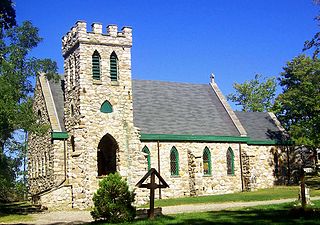
Cragsmoor is a hamlet in Ulster County, New York, United States. The population was 433 at the 2020 census.

<span class="mw-page-title-main">High Falls, New York</span> CDP in New York, United States

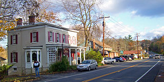
High Falls is a hamlet in Ulster County, New York, United States. The population was 700 at the 2020 census.

<span class="mw-page-title-main">Napanoch, New York</span> CDP in New York, United States

Napanoch is a hamlet in Town of Wawarsing, in Ulster County, New York, United States. It is at the junction of routes 209 and 55. The population was 1,131 at the 2020 census. Napanoch is on the Shawangunk Ridge National Scenic Byway, and is part of the Hudson River Valley National Heritage Area.

<span class="mw-page-title-main">Shawangunk, New York</span> Town in New York, United States

Shawangunk is a town in southwestern Ulster County, New York, United States. The population was 13,563 at the 2020 census. The town takes its name from its largest stream, the Shawangunk Kill. The name Shawangunk is from the language of the Lenape people. Kill is an abbreviation of the Dutch word for creek, Killitje. It is pronounced Shuh-Whan-Gung

<span class="mw-page-title-main">Walker Valley, New York</span> CDP in New York, United States

Walker Valley is a hamlet located in the western part of the Town of Shawangunk in Ulster County, New York, United States, generally thought of as coterminous with the 12588 ZIP code. The population was 1,269 at the 2020 census.

<span class="mw-page-title-main">Wawarsing, New York</span> Town in New York, United States

Wawarsing is a town in Ulster County, New York, United States. The population was 12,771 at the 2020 census. The name Wawarsing was once believed to mean "a place where the streams wind" in the Lenape language, referring to the geography in the hamlet of Wawarsing. Specifically, the joining of the Ver Nooy Kill and the Rondout Creek at Port Ben. The name Wawarsing was used by the Lenape to designate the current hamlet and the fields to the north and south of it for at least six miles in both directions. It is the only Lenape name known to refer to an exact location in Ulster County.

<span class="mw-page-title-main">Mount Pleasant, New York</span> Town in New York, United States

Mount Pleasant is a town in Westchester County, New York, United States, in the New York metropolitan area. As of the 2020 census, the town population was 44,436. The hamlets of Valhalla, Hawthorne, Pocantico Hills, and Thornwood, and the villages of Pleasantville, Sleepy Hollow, and a small portion of Briarcliff Manor lie within the town.

<span class="mw-page-title-main">Hull, Portage County, Wisconsin</span> Town in Wisconsin, United States

Hull is a town in Portage County, Wisconsin, United States. The population was 5,493 at the 2000 census. The unincorporated communities of Casimir and Jordan are located in the town.

<span class="mw-page-title-main">Hermon, New York</span> Town in New York, United States

Hermon is a town in St. Lawrence County, New York, United States. The population was 1,108 at the 2010 census. Hermon is named after Mount Hermon in Israel, which is the name corresponding to Mount Jabal al-Sheikh in Syria. The town contains a hamlet also called Hermon, and is in the south-central part of the county, southwest of Canton.

<span class="mw-page-title-main">Gardiner, New York</span> Town in New York, United States

Gardiner is a town in the south-central part of Ulster County, New York, United States. The population was 5,610 at the 2020 census.

<span class="mw-page-title-main">Plattekill, New York</span> Place in New York, United States

Plattekill is a town in Ulster County, New York, United States. The population was 10,424 in 2020, a slight decrease from 10,499 at the 2010 census. The name is derived from a stream, the Platte Kill.

References

  1. "2016 U.S. Gazetteer Files". United States Census Bureau. Retrieved July 5, 2017.
  2. "Census of Population and Housing". Census.gov. Retrieved June 4, 2015.
  3. "U.S. Census website". United States Census Bureau . Retrieved January 31, 2008.