Mount Darwin is a flat-topped mountain in the Sierra Nevada, on the border of between Fresno and Inyo counties in Kings Canyon National Park and the John Muir Wilderness of California.

Mount Mendel is a peak in Fresno County, California. It is in Kings Canyon National Park in the Evolution Region, of the Sierra Nevada and adjacent to Mount Darwin which is on the Sierra crest.
Mount Huxley is a 13,092-foot (3,990 m) mountain in the Sierra Nevada, in Fresno County. It is on the Goddard Divide in Kings Canyon National Park and rises above the Evolution Basin. Other nearby mountains in the group include Mount Darwin, Mount Fiske, Mount Haeckel, Mount Mendel, Mount Spencer, Mount Wallace, and Mount Lamarck. The area around the peaks, known as the Evolution Region, includes Evolution Basin, Evolution Valley, Evolution Meadow and Evolution Creek.

Mount Thompson is a 13,494-foot-elevation mountain summit located on the crest of the Sierra Nevada mountain range in California, United States. It is situated on the shared boundary of Kings Canyon National Park with John Muir Wilderness, and along the common border of Fresno County with Inyo County. It is also 18 miles (29 km) west of the community of Big Pine, one mile northwest of Mount Gilbert, and three miles east of Mount Fiske, which is the nearest higher neighbor. Mount Thompson ranks as the 62nd-highest summit in California. This mountain's name commemorates Almon Harris Thompson (1839–1906). The first ascent of the peak was made by Clarence H. Rhudy and H. F. Katzenbach in the summer of 1909.

Mount Fiske is a 13,503-foot-elevation mountain summit located near the crest of the Sierra Nevada mountain range, in Fresno County of northern California, United States. It is situated in northern Kings Canyon National Park, 23 miles (37 km) west of the community of Big Pine, 0.83 miles (1.34 km) east of Mount Huxley, and two miles south of Mount Darwin, which is the nearest higher neighbor. Mount Fiske ranks as the 60th highest summit in California.

Mount Haeckel is a 13,424-foot (4,092 m) mountain summit located on the crest of the Sierra Nevada mountain range in northern California, United States. It is situated on the shared boundary of Kings Canyon National Park with John Muir Wilderness, and along the common border of Fresno County with Inyo County. It is 21.5 miles (34.6 km) west of the community of Big Pine, 1.27 miles (2.04 km) south-southeast of Mount Darwin, and one mile north-northeast of Mount Fiske, which is the nearest higher neighbor. Mount Haeckel ranks as the 71st highest summit in California.

Red and White Mountain is a remote 12,816-foot-elevation mountain summit located on the crest of the Sierra Nevada mountain range in northern California, United States. It is situated in the John Muir Wilderness on the shared boundary of Sierra National Forest with Inyo National Forest, and along the common border of Fresno County with Mono County. It is eight miles northeast of Lake Thomas A Edison, and approximately 13 miles (21 km) southeast of the community of Mammoth Lakes. The nearest higher neighbor is Red Slate Mountain, 2 miles (3.2 km) to the north-northwest.

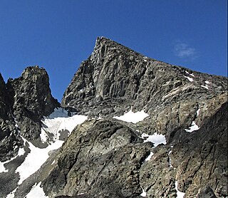
Picture Peak is a 13,140+ foot mountain summit located one mile east of the crest of the Sierra Nevada mountain range in Inyo County in northern California, United States. It is situated in the John Muir Wilderness, on land managed by Inyo National Forest. It is approximately 21 miles (34 km) west of the community of Big Pine, and 0.65 miles (1.05 km) east of parent Mount Haeckel. Topographic relief is significant as the north aspect rises over 2,000 feet above Hungry Packer Lake in approximately one-half mile (1 km). The first ascent of the summit was made July 1967, by Gary Colliver and Steve Thompson via the northeast face. This mountain's name has not been officially adopted by the U.S. Board on Geographic Names.

Mount Perkins is a 12,566-foot-elevation mountain summit located on the crest of the Sierra Nevada mountain range in northern California. It is situated on the common border of Fresno County with Inyo County, as well as the boundary between John Muir Wilderness and Kings Canyon National Park. It is 13.5 miles (21.7 km) northwest of the community of Independence, 1.65 miles (2.66 km) north of Mount Cedric Wright, 2.2 miles (3.5 km) east of Crater Mountain, and 1.4 miles (2.3 km) southeast of Mount Wynne. Climbing routes to the summit include the west slope, and the north and south ridges. The John Muir Trail traverses below the west base of the peak on its descent south from Pinchot Pass, providing an approach to the mountain.

The Hermit is a 12,328-foot-elevation (3,758-meter) mountain summit located west of the crest of the Sierra Nevada mountain range, in Fresno County of central California, United States. It is situated in northern Kings Canyon National Park, 2.5 miles (4.0 km) east of Emerald Peak, and 2.5 miles (4.0 km) west of Mount Darwin. Topographic relief is significant as the north aspect rises 2,500 feet above Evolution Valley in less than one mile. The John Muir Trail passes to the east and north of this landmark, providing an approach. This geographical feature was named by Sierra Club explorer Theodore Solomons in 1895 as he wrote: "The traveler will be greatly attracted by a very sharp peak or butte that rises on the south wall. From its isolated position as viewed from the valley we called it the Hermit."
Mount Hilgard is a 13,361-foot-elevation (4,072 meter) mountain summit located west of the crest of the Sierra Nevada mountain range in Fresno County of northern California, United States. It is situated in the John Muir Wilderness on land managed by Sierra National Forest, approximately eight miles east-southeast of Lake Thomas A Edison, and immediately above the west end of Lake Italy. The nearest higher neighbor is Mount Gabb, 1.75 miles (2.82 km) to the northeast, and Recess Peak is 2.2 miles (3.5 km) to the northwest. The John Muir Trail follows Bear Creek to the west of this remote peak, providing an approach. Mt. Hilgard ranks as the 82nd highest summit in California.

Seven Gables is a 13,080-foot-elevation (3,990-meter) mountain summit located in the Sierra Nevada mountain range in Fresno County of northern California, United States. It is situated between the east and south forks of Bear Creek in the John Muir Wilderness, on land managed by Sierra National Forest. It is set 9 miles (14 km) southeast of Lake Thomas A Edison, 1.2 miles (1.9 km) northwest of Gemini, and 3.2 miles (5.1 km) west-southwest of Feather Peak, the nearest higher neighbor. Topographic relief is significant as it rises nearly 3,500 feet above Upper Bear Creek Meadows in approximately two miles. Seven Gables ranks as the 133rd highest summit in California.

Mount Carillon is a 13,559-foot-elevation (4,133-meter) mountain summit located on the crest of the Sierra Nevada mountain range in California. It is situated on the common border of Tulare County with Inyo County, as well as the shared boundary of Sequoia National Park and John Muir Wilderness. It is set above the south shore of Tulainyo Lake, 12.5 miles (20.1 km) west of the community of Lone Pine, 1.25 miles (2.01 km) northeast of Mount Whitney, and 0.7 miles (1.1 km) east-northeast of Mount Russell, the nearest higher neighbor. Topographic relief is significant as it rises approximately 5,180 feet above Whitney Portal in approximately two miles. Carillon has subpeaks, unofficially called "The Cleaver" (13,383 ft, 0.4 mile to the northeast, and "Impala", on the southeast ridge.
Mount Lamarck is a 13,417-foot-elevation (4,090-meter) mountain summit located on the crest of the Sierra Nevada mountain range in northern California, United States. It is situated on the shared boundary of Kings Canyon National Park with John Muir Wilderness, and along the common border of Fresno County with Inyo County. It is 20 miles (32 km) southwest of the community of Bishop, and 1.9 miles (3.1 km) north of Mount Darwin. Subsidiary peak Mount Lamarck North (13,464 feet ranks as the 67th highest summit in California, and the sixth highest in the Evolution Region. Topographic relief is significant as the east aspect rises 4,290 feet above Lake Sabrina in three miles, and the west aspect rises 3,600 feet above Evolution Valley in three miles.

Mount Johnson is a 12,871-foot-elevation mountain summit located on the crest of the Sierra Nevada mountain range in California, United States. It is situated on the boundary between Kings Canyon National Park and John Muir Wilderness, and along the county line between Fresno County and Inyo County. It is also 18 miles (29 km) west of the community of Big Pine, 0.9 miles (1.4 km) southeast of Mount Gilbert, and one mile (1.6 km) west-northwest of Mount Goode. Mount Johnson ranks as the 187th-highest summit in California. Topographic relief is significant as the southwest aspect rises 3,670 feet above LeConte Canyon in 1.5 mile, and the north aspect rises 3,100 feet above South Lake in 2.5 miles.

Tunnabora Peak is a 13,563-foot-elevation (4,134-meter) mountain summit located on the crest of the Sierra Nevada mountain range in California. It is situated on the common border of Tulare County with Inyo County, as well as the shared boundary of Sequoia National Park and John Muir Wilderness. It is set above the north shore of Tulainyo Lake, 13 miles (21 km) west of the community of Lone Pine, 1.86 miles (2.99 km) north-northeast of Mount Whitney, and 0.9 miles (1.4 km) north-northwest of Mount Carillon. Tunnabora ranks as the 51st-highest peak in California. Topographic relief is significant as it rises approximately 5,200 feet above Whitney Portal in approximately three miles.

Silver Peak is an 11,878-foot-elevation (3,620 meter) mountain summit located in the Sierra Nevada mountain range in Fresno County, California, United States. It is set in the John Muir Wilderness, on land managed by Sierra National Forest. Silver Peak ranks as the 455th-highest summit in California, and topographic relief is significant as the east aspect rises nearly 2,300 feet above Beetlebug Lake in approximately one mile. It is six miles (9.7 km) north of Lake Thomas A Edison, and approximately 12 miles (19 km) south of the community of Mammoth Lakes. The peak is situated on Silver Divide, two miles northwest of Graveyard Peak. The first ascent of the summit was made prior to 1937 by an unknown party. Inclusion on the Sierra Peaks Section peakbagging list generates climbing interest.

Mount Bolton Brown is a 13,491-foot-elevation (4,112 meter) mountain summit located on the shared border of Fresno County and Inyo County in California, United States.
Scylla is a 12,956-foot-elevation (3,949 meter) mountain summit located west of the crest of the Sierra Nevada mountain range, in Fresno County, California, United States. This peak is situated in Kings Canyon National Park, 1.27 miles (2.04 km) southwest of Charybdis, 2.3 miles (3.7 km) southeast of Mount Goddard, and 2.57 miles (4.14 km) west of Mount McDuffie. Topographic relief is significant as the summit rises 3,150 feet above Enchanted Gorge in approximately one mile. The John Muir Trail provides one possible approach option to this remote peak. An ascent of the peak is non-technical via the northwest slope, and inclusion on the Sierra Peaks Section peakbagging list generates climbing interest in this peak.

Clyde Spires is a 13,267-foot-elevation (4,044 meter) mountain summit located on the crest of the Sierra Nevada mountain range in California, United States. It is situated on the boundary shared by Kings Canyon National Park with John Muir Wilderness, and along the common border of Fresno County with Inyo County. It is 20 miles (32 km) west of the community of Big Pine, and 0.5 miles (0.80 km) southeast of Mount Wallace, which is the nearest higher neighbor. The west spire is slightly higher than the east spire. Topographic relief is significant as the spires rise 1,665 feet above Echo Lake in 0.38 miles (0.61 km).