Florida's Turnpike, designated as unsigned State Road 91, is a controlled-access toll road in the U.S. state of Florida, maintained by Florida's Turnpike Enterprise (FTE). Spanning approximately 309 miles (497 km) along a northwest–southeast axis, the turnpike is in two sections. The SR 91 mainline runs roughly 265 miles (426 km), from its southern terminus at an interchange with Interstate 95 (I-95) in Miami Gardens to an interchange with I-75 in Wildwood at its northern terminus. The Homestead Extension of Florida's Turnpike continues from the southern end of the mainline for another 48 miles (77 km) to US Highway 1 in Florida City. The slogan for the road is "The Less Stressway". The mainline opened in stages between 1957 and 1964, while the extension was completed in 1974. The turnpike runs through Miami, Fort Lauderdale, and West Palm Beach, where it parallels I-95, and through Orlando, where it crosses I-4.

The John Kilpatrick Turnpike, pending Interstate 344 (I-344) signage as of Spring of 2024, is a controlled-access toll road in Oklahoma City, Oklahoma. The turnpike forms a partial beltway that runs from State Highway 152 (SH-152) and Interstate 240 (I-240) to an interchange with Interstate 35 (I-35) and Interstate 44 (I-44). At the eastern terminus, traffic continuing east merges with I-44 traffic, forming the Turner Turnpike. The Kilpatrick Turnpike is 31.0 miles (49.9 km) long.

The Turner Turnpike is a controlled-access toll road in central Oklahoma, connecting its two largest cities, Oklahoma City and Tulsa. Authorized by the Oklahoma Legislature in 1947 and opened in May 1953, it is the oldest of the state's eleven turnpikes. The route is signed as Interstate 44 for its entire length, but was constructed prior to its designation as such. The Turner Turnpike was named after Governor Roy J. Turner, who pushed for efforts to build this toll road to connect the state's two largest cities.
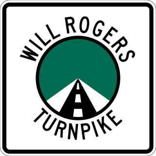
The Will Rogers Turnpike is a controlled-access toll road in the northeast portion of the U.S. state of Oklahoma. The highway begins as a continuation of the Creek Turnpike in Tulsa, continuing northward from the I-44/US-412 interchange there to the Missouri state line west of Joplin, Missouri. The turnpike carries the I-44 designation for its entire length. The turnpike is 88.5 miles (142.4 km) long and costs $4.75 to drive one way. The Will Rogers Turnpike opened to traffic on June 28, 1957. It was designated as I-44 in 1958. It is named for Will Rogers, "Oklahoma's Favorite Son".

The Cimarron Turnpike is a controlled-access toll road in north-central Oklahoma. The route travels 67 miles (108 km), from an interchange with Interstate 35 (I-35) north of Perry, to Westport, just west of Tulsa. The route also consists of a 7.2-mile (11.6 km) spur which runs from the mainline southwest to an interchange with U.S. Route 177 north of Stillwater.

State Highway 66 is a 192.7-mile (310.1 km) state highway in the U.S. state of Oklahoma, beginning at U.S. Highway 81 in El Reno and ending at U.S. Highway 60 near White Oak. The highway was designated in 1985 as a replacement for the decommissioned U.S. Highway 66. Although most of the highway follows Historic Route 66, the highway follows US 66's final alignment, joining Interstate 44 through Tulsa and Oklahoma City, while older versions of the route follow various city streets through both cities.

The Dallas North Tollway is a 30.2-mile (49 km) controlled-access toll road operated by the North Texas Tollway Authority (NTTA), which runs from Interstate 35E near Downtown Dallas, Texas (USA), to U.S. Highway 380, in Frisco, Texas. On December 20, 2023, the NTTA announced the Tollway's next extension which runs 6 miles (9.7 km) through Prosper and Celina and ends at FM 428.

The Cherokee Turnpike is a controlled-access toll road in eastern Oklahoma. Opened in 1991, the route is a four-lane freeway carrying US-412 from east of Kansas, Oklahoma to east of Chouteau, and has a total length of 32.8 miles (52.8 km) and a speed limit of 80 mph (130 km/h). An alternate route, US-412 Alternate, provides a free but not controlled-access route through the towns bypassed by the Turnpike with only a 55 mph (89 km/h) speed limit.
The Fort Bend Parkway Toll Road is the Fort Bend County portion of a controlled-access toll road connecting Sienna in eastern Fort Bend County to US 90A in southwestern Harris County. It is administered by the Fort Bend County Toll Road Authority (FBCTRA). The Harris County Toll Road Authority (HCTRA) administers the Harris County segment of the road — from just south of Beltway 8 at the county line to US 90A — and uses its purple pentagonal shield labeled as Fort Bend Toll Road. It is proposed to reach a northern terminus at the southwestern corner of Interstate 610 in the future, and SH 99 at its southern terminus.

State Highway 51, abbreviated to SH-51 or OK-51, is a major state highway in Oklahoma, United States. It runs for 332.8 miles (535.6 km) east–west across the state, running from the Texas state line to Arkansas. It is the third-longest state highway in the system.

The Indian Nation Turnpike, also designated State Highway 375 (SH-375), is a controlled-access toll road in southeastern Oklahoma, United States, running between Hugo and Henryetta, a distance of 105.2 miles (169.3 km). It is the longest tollway in the state.

The H. E. Bailey Turnpike is an 86.4-mile (139.0 km) controlled-access toll road in the southwestern region of the U.S. state of Oklahoma. The route, opened on April 23, 1964, is a four-lane freeway that connects Oklahoma City to Lawton in its northern section and Lawton to Wichita Falls, Texas along its southern section, roughly paralleling U.S. Route 277. The turnpike also includes an 8.2-mile (13.2 km) spur route that leads toward Norman, Oklahoma. Since 1982, it has been signed as a part of Interstate 44, and as such uses its mileposts. Travel along the full length of the toll road costs $5.50 for a two-axle vehicle.

The Chickasaw Turnpike, also designated State Highway 301 (SH-301), is a controlled-access toll road in the rural south central region of the U.S. state of Oklahoma. A two-lane freeway, it stretches for 13.3 miles (21.4 km) from north of Sulphur to just south of Ada. The Oklahoma Turnpike Authority (OTA) owns, maintains, and collects tolls on the turnpike. The first section of the Chickasaw Turnpike opened on September 1, 1991.

State Highway 165 (SH-165) is a state highway in Muskogee County, Oklahoma. It runs east along Peak Boulevard in the southern part of Muskogee from US-64 to the northern terminus of the southern section of the Muskogee Turnpike, then runs north as a freeway connecting the two sections of the turnpike. The total length of the highway is 8.21 miles (13.21 km).

The Creek Turnpike, also designated State Highway 364 (SH-364), is a 33.2-mile (53.4 km) controlled-access toll road that lies entirely in the U.S. state of Oklahoma. The turnpike forms a partial beltway around the south and east sides of Tulsa, Oklahoma's second largest city. The Creek Turnpike's western terminus is at the Turner Turnpike in Sapulpa, while its northeastern terminus is at the Will Rogers Turnpike in Fair Oaks; both ends of the Creek Turnpike connect with Interstate 44 (I-44). Along the way, the highway passes through the cities of Sapulpa, Jenks, Tulsa, and Broken Arrow, and the counties of Creek, Tulsa, Wagoner and Rogers. The road is maintained by the Oklahoma Turnpike Authority (OTA), except for a brief free section shared with U.S. Route 64 (US-64) and US-169, which is maintained by the Oklahoma Department of Transportation (ODOT).

Interstate 44 (I-44) is an Interstate Highway that runs diagonally through the U.S. state of Oklahoma, spanning from the Texas state line near Wichita Falls, Texas, to the Missouri border near Joplin, Missouri. It connects three of Oklahoma's largest cities: Oklahoma City, Tulsa, and Lawton. Most of I-44 in Oklahoma is a toll road. In southwestern Oklahoma, I-44 is the H. E. Bailey Turnpike and follows a diagonally northwest–southeast direction. From Oklahoma City to Tulsa, I-44 follows the Turner Turnpike. As I-44 leaves Tulsa, it becomes the Will Rogers Turnpike to the Missouri border. In the Lawton, Oklahoma City, and Tulsa metropolitan areas, I-44 is toll-free. In Oklahoma City, I-44 is also known as the Will Rogers Expressway.

In Oklahoma, U.S. Highway 62 (US 62) runs diagonally across the state, from the Texas state line in far southwestern Oklahoma to the Arkansas state line near Fayetteville. US-62 spends a total of 402.48 miles (647.73 km) in the Sooner State. The highway passes through fifteen of Oklahoma's counties. Along the way the route serves two of Oklahoma's largest cities, Lawton and Oklahoma City, as well as many regionally important cities, like Altus, Chickasha, Muskogee, and Tahlequah. Despite this, US-62 has no lettered spur routes like many other U.S. routes in Oklahoma do.
Oklahoma has an extensive turnpike system, maintained by the state government through the Oklahoma Turnpike Authority. All of Oklahoma's turnpikes are controlled-access highways. The majority have at least four lanes, though the Chickasaw Turnpike is two lanes.

U.S. Route 412 is a U.S. highway in the south-central portion of the United States, connecting Springer, New Mexico to Columbia, Tennessee. A 504.11-mile (811.29 km) section of the highway crosses the state of Oklahoma, traversing the state from west to east. Entering the state southwest of Boise City, US-412 runs the length of the Oklahoma Panhandle and serves the northern portion of the state's main body, before leaving the state at West Siloam Springs. Along the way, the route serves many notable cities and towns, including Boise City, Guymon, Woodward, Enid, and the state's second-largest city, Tulsa.

U.S. Route 64 (US-64) is a U.S. highway running from the Four Corners area to the Outer Banks of North Carolina. Between these two points, the highway passes through the entire width of Oklahoma; a total of 591.17 miles (951.40 km) of US-64 lies in the state of Oklahoma. US-64 enters the state from New Mexico, crossing the line between the two states between Clayton, New Mexico, and Boise City in Cimarron County. The route runs the full length of the Oklahoma Panhandle, then serves the northernmost tier of counties in the main body of the state before dipping southeastward to Tulsa, the state's second-largest city. From Tulsa, the highway continues southeast, leaving Oklahoma just west of Fort Smith, Arkansas. In addition to Tulsa, US-64 serves fifteen Oklahoma counties and the cities of Guymon, Woodward, Enid, and Muskogee.


