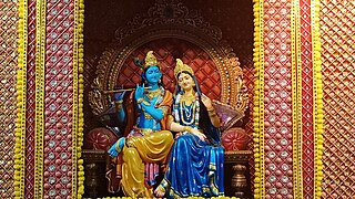
Braj, also known as Vraj, Vraja, Brij or Brijbhumi, is a region in India on both sides of the Yamuna river with its centre at Mathura-Vrindavan in Uttar Pradesh state encompassing the area which also includes Palwal, Ballabhgarh and Nuh in Haryana state, Deeg, Bharatpur, Karauli, and Dholpur in Rajasthan state and Morena District in Madhya Pradesh. Within Uttar Pradesh, it is very well demarcated culturally, the area stretches from the Mathura, Aligarh, Agra, Hathras and districts up to the Farrukhabad, Mainpuri and Etah districts. Braj region is associated with Radha and Krishna who according to scriptures were born in Barsana and Mathura respectively. It is the main centre of Krishna circuit of Hindu pilgrimage.

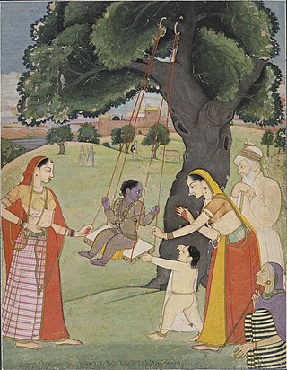
Vrindavan, also spelt Vrindaban and Brindaban, is a historical city in the Mathura district of Uttar Pradesh, India. It is located in the Braj Bhoomi region and holds religious importance for Hindus who believe that Krishna, one of the main deities in Hinduism, spent most of his childhood in this city. Vrindavan has about 5,500 temples dedicated to the worship of Krishna and his chief consort, Radha. It is one of the most sacred places for Vaishnava traditions.
Nanda is a cow-herd chief, and the foster-father of Krishna, featured in the Harivamsha and the Puranas. Nanda is the son of Parjanya, a ruler of the Vraja region, who is a son of the Yadava king, Devamidha. He is the chief of Gokulam, which is one of the most powerful territories of the Yadava tribe. He is sometimes referred to as a king.

Karauli is a city located in the Indian state of Rajasthan. It is located in the Braj region and holds religious importance in Hinduism. The city is the administrative center of Karauli District, and was formerly the capital of the erstwhile princely state of Karauli. Karauli District comes under Bharatpur Divisional Commissionerate.
Govardhan also called Giriraj, is a key pilgrimage centre in India and a municipal town; a nagar panchayat; seat of an MLA of Uttar Pradesh; a Tehsil, in Mathura district in India in the state of Uttar Pradesh. About 23 kilometres from Mathura, the town is on the road link between Mathura and Deeg.

Khetri Nagar is a town in the Neem Ka Thana district of Rajasthan in India. It is a part of the Shekhawati region. Khetri consists of two towns, "Khetri Town," founded by Raja Khet Singhji Nirwan, and "Khetri Nagar," which is about 10 km away from Khetri. Khetri Nagar, well known for its Copper Project, was built by and is under the control of Hindustan Copper Limited, a public sector undertaking under the Government of India. Khetri Nagar is also known as "Copper." There are many attached villages near Khetri Nagar, such as Manota Khurd; the people of this village were employed in mines.
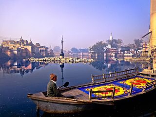
Mathura district situated along the banks of the river Yamuna is a district of Uttar Pradesh state of north-central India. The historic city of Mathura is the district headquarters. Mathura district is home to many important sites associated with goddess Radha and Lord Krishna, who was born in Mathura and grew up in the nearby town of Vrindavan. Both cities are some of the most sacred sites in the Vaishnava tradition, making Mathura district an important Hindu pilgrimage centre.

Kumher is a historical town and land of Yaduvanshi Sinsinwars the initial name of this town was Kuber. It is located in Deeg District of Rajasthan, India.

Gokul is a town in the Mathura district of the Indian state of Uttar Pradesh. It is located 15 kilometres (9.3 mi) south-east of Mathura.
Barsana is a historical town and nagar panchayat in the Mathura district of the state of Uttar Pradesh, India. The town holds cultural and religious significance as the birthplace of Hindu goddess Radha, the chief consort of Krishna. Barsana is situated in the Braj region. The main attraction of the town is the historical Radha Rani Temple which attracts huge number of devotees throughout the year.

Hodal is a town and a municipal council, located, on Palwal Road in Palwal district in the Haryana state of India.It is Part of Braj region. Its language is Braj bhasha & Haryanvi. It is located at 27°53′39″N77°22′09″E and has an average elevation of 190 meters.
Chandur Railway is a city and a municipal council in Amravati district in the state of Maharashtra, India. Chandur Railway is one of the three talukas of Chandur Railway subdivision in Amravati district.
Chaumuhan is a town and a nagar panchayat in the Mathura district of the Indian state of Uttar Pradesh.
Iglas is a town and tehsil in Aligarh district in the Indian state of Uttar Pradesh.
Khandela is a city and municipality in the Sikar district of the Indian state of Rajasthan.
Saraswati Nagar is a Town in Yamunanagar District in the Indian state of Haryana.
Payal is a city in Ludhiana district in the Punjab, India.

Radha Kund is a town and nagar panchayat in Vrindavan in the Indian state of Uttar Pradesh. It is also one of the pilgrimage sites dedicated to Hindu goddess Radha.
Rajura is a town and municipal council district]] of the Indian state of Maharashtra.
Kaniyur is a suburb of palani which is also a town panchayat in Tirupur District in the Indian state of Tamil Nadu. Kaniyur is also called Dravida Iyakkathin Thotti. It is one of the 'K' villages located near to Udumalaipettai.

