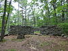
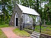
The pound was built in 1823 by the town, replacing an earlier wooden structure built in 1802, and is one of a few well-preserved pounds in southeastern New Hampshire. It remained in use until late in the 19th century, and was sold into private hands in 1918. It was given back to the town, and is now maintained by the Farmington Historical Society.
This is a list of properties on the National Register of Historic Places in Hampshire County, Massachusetts.
This is a list of the National Register of Historic Places listings in Belknap County, New Hampshire.
This is a list of the National Register of Historic Places listings in Carroll County, New Hampshire.
This is a list of the National Register of Historic Places listings in Cheshire County, New Hampshire.
This is a list of the National Register of Historic Places listings in Sullivan County, New Hampshire.
This is a list of the National Register of Historic Places listings in Rockingham County, New Hampshire.
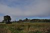
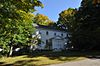
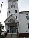
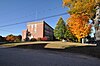
This is intended to be a complete list of the properties and districts on the National Register of Historic Places in Hillsborough County, New Hampshire, United States. Latitude and longitude coordinates are provided for many National Register properties and districts; these locations may be seen together in a map.
This is a list of the National Register of Historic Places listings in Merrimack County, New Hampshire.
This is a list of the National Register of Historic Places listings in Grafton County, New Hampshire.
This is a list of the National Register of Historic Places listings in Coös County, New Hampshire.
List of Registered Historic Places in Bronx County, New York :
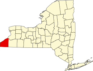
This is a list of the National Register of Historic Places listings in Chautauqua County, New York.
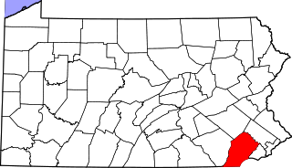
This is a list of the National Register of Historic Places listings in Dauphin County, Pennsylvania.
This is a list of the National Register of Historic Places listings in Riverside County, California.
This is a list of the National Register of Historic Places listings in Garfield County, Utah.
This is a list of the National Register of Historic Places listings in Kane County, Utah.
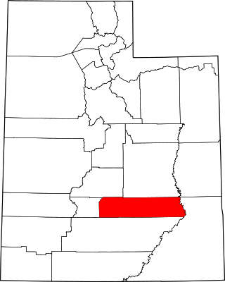
This is a list of the National Register of Historic Places listings in Tooele County, Utah.
This is a list of the National Register of Historic Places listings in Wayne County, Utah.
This is a list of the National Register of Historic Places listings in Hampshire County, West Virginia.
This is a list of the National Register of Historic Places listings in southern Chester County, Pennsylvania.
References
↑ The latitude and longitude information provided in this table was derived originally from the National Register Information System, which has been found to be fairly accurate for about 99% of listings. Some locations in this table may have been corrected to current GPS standards.
↑ Numbers represent an alphabetical ordering by significant words. Various colorings, defined here, differentiate National Historic Landmarks and historic districts from other NRHP buildings, structures, sites or objects.
↑ The eight-digit number below each date is the number assigned to each location in the National Register Information System database, which can be viewed by clicking the number.
↑ Address based on USPS website. Accessed March 27, 2016
This page is based on this Wikipedia article Text is available under the CC BY-SA 4.0 license; additional terms may apply. Images, videos and audio are available under their respective licenses.