National Register of Historic Places listings in Terrebonne Parish, Louisiana

Last updated

Location of Terrebonne Parish in Louisiana Map of Louisiana highlighting Terrebonne Parish.svg
Location of Terrebonne Parish in Louisiana

This is a list of the National Register of Historic Places listings in Terrebonne Parish, Louisiana.

Contents

This is intended to be a complete list of the properties and districts on the National Register of Historic Places in Terrebonne Parish, Louisiana, United States. The locations of National Register properties and districts for which the latitude and longitude coordinates are included below, may be seen in a map. [1]

There are 21 properties and districts listed on the National Register in the parish. Another property was once listed but has been removed.


    This National Park Service list is complete through NPS recent listings posted December 15, 2023. [2]

Map all coordinates using: OpenStreetMap

Current listings

[3] Name on the Register [4] ImageDate listed [5] Location City or townDescription
1 Ardoyne Plantation House
Ardoyne Plantation House Ardoyne Plantation.JPG
Ardoyne Plantation House
November 1, 1982
(#82000469)
Northwest of Houma on Louisiana Highway 311
29°38′57″N90°49′10″W / 29.6492°N 90.8194°W / 29.6492; -90.8194 (Ardoyne Plantation House)
Houma vicinity
2 Argyle
Argyle Argyle.JPG
Argyle
July 1, 1994
(#94000657)
3313 Bayou Black Dr.
29°34′22″N90°45′04″W / 29.5728°N 90.7511°W / 29.5728; -90.7511 (Argyle)
Houma
3 Armitage
Armitage Terrebonne Armitage.JPG
Armitage
April 12, 1984
(#84001366)
Louisiana Highway 20 and Colonial Dr.
29°45′51″N90°48′59″W / 29.7642°N 90.8164°W / 29.7642; -90.8164 (Armitage)
Schriever
4 Herman Albert Cook House
Herman Albert Cook House Cook House Houma.jpg
Herman Albert Cook House
February 24, 1995
(#95000107)
515 W. Main St.
29°35′49″N90°43′44″W / 29.5969°N 90.7289°W / 29.5969; -90.7289 (Herman Albert Cook House)
Houma
5 Daigleville School October 21, 2020
(#100005721)
8542 Main St.
29°35′52″N90°42′08″W / 29.5977°N 90.7023°W / 29.5977; -90.7023 (Daigleville School)
Houma
6 Ducros Plantation
Ducros Plantation DucrossWM.jpg
Ducros Plantation
November 7, 1985
(#85002759)
Louisiana Highway 20
29°45′13″N90°49′05″W / 29.7536°N 90.8181°W / 29.7536; -90.8181 (Ducros Plantation)
Schriever
7 Fifth District High School
Fifth District High School Fifth District High School 20180818 013051.png
Fifth District High School
June 18, 2018
(#100002590)
918 Roussell St.
29°35′30″N90°43′18″W / 29.5916°N 90.7218°W / 29.5916; -90.7218 (Fifth District High School)
Houma
8 Gibson Methodist Episcopal Church
Gibson Methodist Episcopal Church GibsonChurchWM.JPG
Gibson Methodist Episcopal Church
May 8, 1986
(#86001032)
S. Bayou Black Dr.
29°41′06″N90°59′16″W / 29.685°N 90.9878°W / 29.685; -90.9878 (Gibson Methodist Episcopal Church)
Gibson
9 Houma Elementary School
Houma Elementary School Houma Elementary School, Louisiana.jpg
Houma Elementary School
June 15, 2015
(#15000347)
711 Grinage St.
29°35′33″N90°43′26″W / 29.5926°N 90.7239°W / 29.5926; -90.7239 (Houma Elementary School)
Houma
10 Houma Historic District
Houma Historic District HoumaTerrebonneParishCourthouse.jpg
Houma Historic District
December 8, 1983
(#83003640)
Roughly bounded by E. Park Ave. and Main, Canal, Lafayette, Academy, High, Roussell, and Barrow Sts.; also 7717, 7719, 7725, 7801-09, 7815-17, 7819 W. Main, 407, 425, 507 Rousell, 7910, 7932, 7936, 7942 W. Park Ave.
29°35′50″N90°43′25″W / 29.5971°N 90.7236°W / 29.5971; -90.7236 (Houma Historic District)
Houma Second set of addresses represents a boundary adjustment, listed 2015-10-06.
11 Lapeyrouse Grocery October 21, 2020
(#100005699)
7243 Shoreline Dr.
29°18′27″N90°38′51″W / 29.3075°N 90.6474°W / 29.3075; -90.6474 (Lapeyrouse Grocery)
Chauvin vicinity
12 Magnolia August 4, 1983
(#83000548)
Louisiana Highway 311
29°42′53″N90°49′08″W / 29.7147°N 90.8189°W / 29.7147; -90.8189 (Magnolia)
Schriever
13 Montegut School
Montegut School Montegut School 2.JPG
Montegut School
October 7, 1993
(#93001036)
1137 Louisiana Highway 55
29°28′39″N90°33′20″W / 29.4775°N 90.5556°W / 29.4775; -90.5556 (Montegut School)
Montegut vicinity
14 Orange Grove Plantation House
Orange Grove Plantation House Orange Grove 1.JPG
Orange Grove Plantation House
March 26, 1980
(#80001764)
West of Houma on U.S. Route 90
29°35′19″N90°49′23″W / 29.5886°N 90.8231°W / 29.5886; -90.8231 (Orange Grove Plantation House)
Houma vicinityCirca-1840 Greek Revival briquette-entre-poteaux architecture; operates as an inn today. See Orange Grove Plantation House.
15 Polmer Store
Polmer Store Polmer Store.JPG
Polmer Store
May 30, 1996
(#96000607)
1849 Louisiana Highway 311
29°38′32″N90°48′50″W / 29.6422°N 90.8139°W / 29.6422; -90.8139 (Polmer Store)
Schriever vicinity
16 S.S. R.M. Parker Jr. (shipwreck and remains) December 7, 2018
(#100002561)
Address Restricted
Cocodrie vicinity
17 Residence Plantation House
Residence Plantation House Residence Plantation Houma.JPG
Residence Plantation House
September 8, 2001
(#01000943)
8951 Park Ave.
29°35′53″N90°41′21″W / 29.5981°N 90.6892°W / 29.5981; -90.6892 (Residence Plantation House)
Houma
18 St. George Plantation House
St. George Plantation House Stgeorge2.jpg
St. George Plantation House
October 5, 1982
(#82000470)
Louisiana Highway 24
29°44′20″N90°48′28″W / 29.7389°N 90.8078°W / 29.7389; -90.8078 (St. George Plantation House)
Schriever
19 Clifford Percival Smith House
Clifford Percival Smith House CliffhouseWM.jpg
Clifford Percival Smith House
April 20, 1989
(#89000327)
501 E. Park Ave.
29°35′59″N90°43′08″W / 29.5997°N 90.7189°W / 29.5997; -90.7189 (Clifford Percival Smith House)
Houma
20 Southdown Plantation
Southdown Plantation Southdown1.JPG
Southdown Plantation
January 18, 1974
(#74002188)
1 mile southwest of Houma on Louisiana Highway 311
29°35′17″N90°43′52″W / 29.5881°N 90.7311°W / 29.5881; -90.7311 (Southdown Plantation)
Houma
21 Wesley House
Wesley House WesleyhouseWM.JPG
Wesley House
August 11, 1982
(#82002799)
1210 E. Main St.
29°35′53″N90°42′34″W / 29.5981°N 90.7094°W / 29.5981; -90.7094 (Wesley House)
Houma

Former listing

[3] Name on the RegisterImageDate listedDate removedLocationCity or townDescription
1 St. Matthew's Episcopal Church
St. Matthew's Episcopal Church HoumaLA2009ChurchWhiteEpiscopalFront.jpg
St. Matthew's Episcopal Church
May 1, 1989
(#89000331)
March 31, 2015243 Barrow St.
29°35′48″N90°43′07″W / 29.5967°N 90.7186°W / 29.5967; -90.7186 (St. Matthew's Episcopal Church)
Houma St. Matthew's Church was destroyed by fire on November 11, 2010 [6] [7]

See also

Related Research Articles

<span class="mw-page-title-main">National Register of Historic Places listings in Orleans Parish, Louisiana</span>

The following properties are listed on the National Register of Historic Places in Orleans Parish, Louisiana. Orleans Parish is synonymous with the city of New Orleans.

<span class="mw-page-title-main">National Register of Historic Places listings in Natchitoches Parish, Louisiana</span>

This is a list of the National Register of Historic Places listings in Natchitoches Parish, Louisiana.

<span class="mw-page-title-main">National Register of Historic Places listings in Pointe Coupee Parish, Louisiana</span>

This is a list of the National Register of Historic Places listings in Pointe Coupee Parish, Louisiana.

<span class="mw-page-title-main">National Register of Historic Places listings in East Feliciana Parish, Louisiana</span>

This is a list of the National Register of Historic Places listings in East Feliciana Parish, Louisiana.

<span class="mw-page-title-main">National Register of Historic Places listings in West Feliciana Parish, Louisiana</span>

This is a list of the National Register of Historic Places listings in West Feliciana Parish, Louisiana.

<span class="mw-page-title-main">National Register of Historic Places listings in Iberville Parish, Louisiana</span>

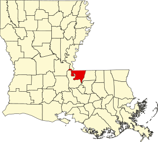
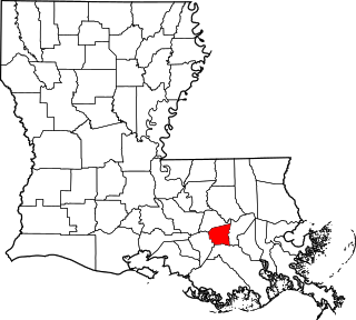
This is a list of the National Register of Historic Places listings in Iberville Parish, Louisiana.

<span class="mw-page-title-main">National Register of Historic Places listings in Ouachita Parish, Louisiana</span>

This is a list of the National Register of Historic Places listings in Ouachita Parish, Louisiana.

<span class="mw-page-title-main">National Register of Historic Places listings in St. James Parish, Louisiana</span>

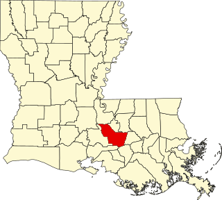
This is a list of the National Register of Historic Places listings in St. James Parish, Louisiana.

<span class="mw-page-title-main">National Register of Historic Places listings in St. Martin Parish, Louisiana</span>

This is a list of the National Register of Historic Places listings in St. Martin Parish, Louisiana.

<span class="mw-page-title-main">National Register of Historic Places listings in St. Mary Parish, Louisiana</span>

This is a list of the National Register of Historic Places listings in St. Mary Parish, Louisiana.

<span class="mw-page-title-main">National Register of Historic Places listings in St. Tammany Parish, Louisiana</span>

This is a list of the National Register of Historic Places listings in St. Tammany Parish, Louisiana.

<span class="mw-page-title-main">National Register of Historic Places listings in Tangipahoa Parish, Louisiana</span>

This is a list of the National Register of Historic Places listings in Tangipahoa Parish, Louisiana.

<span class="mw-page-title-main">National Register of Historic Places listings in Webster Parish, Louisiana</span>

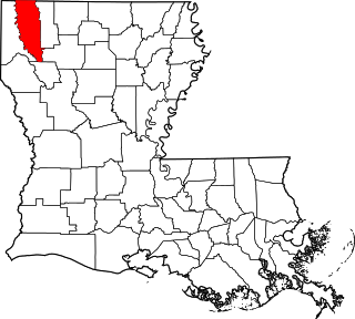
This is a list of the National Register of Historic Places listings in Webster Parish, Louisiana.

<span class="mw-page-title-main">National Register of Historic Places listings in St. John the Baptist Parish, Louisiana</span>

This is a list of the National Register of Historic Places listings in St. John the Baptist Parish, Louisiana.

<span class="mw-page-title-main">National Register of Historic Places listings in Vermilion Parish, Louisiana</span>

This is a list of the National Register of Historic Places listings in Vermilion Parish, Louisiana.

<span class="mw-page-title-main">National Register of Historic Places listings in Vernon Parish, Louisiana</span>

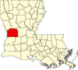
This is a list of the National Register of Historic Places listings in Vernon Parish, Louisiana.

<span class="mw-page-title-main">National Register of Historic Places listings in Washington Parish, Louisiana</span>

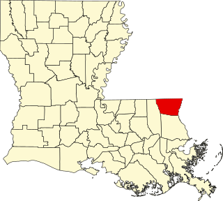
This is a list of the National Register of Historic Places listings in Washington Parish, Louisiana.

<span class="mw-page-title-main">National Register of Historic Places listings in Bossier Parish, Louisiana</span>

This is a list of the National Register of Historic Places listings in Bossier Parish, Louisiana.

<span class="mw-page-title-main">National Register of Historic Places listings in St. Charles Parish, Louisiana</span>

This is a list of the National Register of Historic Places listings in St. Charles Parish, Louisiana.

<span class="mw-page-title-main">National Register of Historic Places listings in Plaquemines Parish, Louisiana</span>

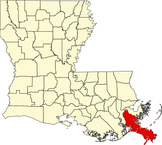
This is a list of the National Register of Historic Places listings in Plaquemines Parish, Louisiana.

References

  1. The latitude and longitude information provided in this table was derived originally from the National Register Information System, which has been found to be fairly accurate for about 99% of listings. Some locations in this table may have been corrected to current GPS standards.
  2. National Park Service, United States Department of the Interior, "National Register of Historic Places: Weekly List Actions", retrieved December 15, 2023.
  3. 1 2 Numbers represent an alphabetical ordering by significant words. Various colorings, defined here, differentiate National Historic Landmarks and historic districts from other NRHP buildings, structures, sites or objects.
  4. "National Register Information System". National Register of Historic Places . National Park Service. March 13, 2009.
  5. The eight-digit number below each date is the number assigned to each location in the National Register Information System database, which can be viewed by clicking the number.
  6. "Fire razes church in Houma". The News-Star . November 12, 2010. p. 6A. Retrieved December 17, 2023 via Newspapers.com.
  7. "Article 404 - Houma Today - Houma, LA".