New Stuyahok, Alaska

Last updated

New Stuyahok
Cetuyaraq
Street view of New Stuyahok, Alaska 12-Jan-2016.jpg
A street level view of New Stuyahok, Alaska
USA Alaska location map.svg
Red pog.svg
New Stuyahok
Location in Alaska
Coordinates: 59°27′7″N157°18′44″W / 59.45194°N 157.31222°W / 59.45194; -157.31222
CountryUnited States
State Alaska
Census Area Dillingham
Incorporated November 20, 1972 [1]
Government
   Mayor Justin Askoak [2]
   State senator Lyman Hoffman (D)
   State rep. Bryce Edgmon (I)
Area
[3]
  Total35.95 sq mi (93.12 km2)
  Land33.72 sq mi (87.33 km2)
  Water2.24 sq mi (5.80 km2)
Elevation
138 ft (42 m)
Population
 (2020)
  Total512
  Density15.19/sq mi (5.86/km2)
Time zone UTC-9 (Alaska (AKST))
  Summer (DST) UTC-8 (AKDT)
ZIP code
99636
Area code 907
FIPS code 02-53710
GNIS feature ID 1406972

New Stuyahok (Central Yupik : Cetuyaraq) is a city in Dillingham Census Area, Alaska, United States. At the 2010 census the population was 510, [4] up from 471 in 2000.

Contents

Geography

New Stuyahok is located at 59°27′7″N157°18′44″W / 59.45194°N 157.31222°W / 59.45194; -157.31222 (59.451850, -157.312106), [5] along the Nushagak River.

According to the United States Census Bureau, the city has a total area of 34.7 square miles (89.9 km2), of which 32.5 square miles (84.1 km2) is land and 2.2 square miles (5.8 km2), or 6.43%, is water. [4]

Demographics

Historical population
CensusPop.Note
1950 88
1960 14564.8%
1970 21649.0%
1980 33153.2%
1990 39118.1%
2000 47120.5%
2010 5108.3%
2020 5120.4%
U.S. Decennial Census [6]

New Stuyahok first appeared on the 1950 U.S. Census as an unincorporated village. It formally incorporated in 1972.

As of the census [7] of 2000, there were 471 people, 105 households, and 91 families residing in the city. The population density was 14.4 inhabitants per square mile (5.6/km2). There were 107 housing units at an average density of 3.3 per square mile (1.3/km2). The racial makeup of the city was 3.82% White, 92.78% Native American, and 3.40% from two or more races. 1.27% of the population were Hispanic or Latino of any race. There were 105 households, out of which 57.1% had children under the age of 18 living with them, 56.2% were married couples living together, 21.0% had a female householder with no husband present, and 13.3% were non-families. 11.4% of all households were made up of individuals, and 1.9% had someone living alone who was 65 years of age or older. The average household size was 4.49 and the average family size was 4.87.

In the city, the age distribution of the population shows 40.8% under the age of 18, 10.4% from 18 to 24, 27.8% from 25 to 44, 16.6% from 45 to 64, and 4.5% who were 65 years of age or older. The median age was 24 years. For every 100 females, there were 122.2 males. For every 100 females age 18 and over, there were 108.2 males.

The median income for a household in the city was $26,042, and the median income for a family was $26,458. Males had a median income of $31,250 versus $41,250 for females. The per capita income for the city was $7,931. About 32.6% of families and 31.7% of the population were below the poverty line, including 43.5% of those under age 18 and 15.4% of those age 65 or over.

Education

The "Chief" Ivan Blunka School of the Southwest Region School District serves the village. [8]

Related Research Articles

<span class="mw-page-title-main">Goodnews Bay, Alaska</span> City in Alaska, United States

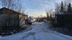
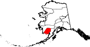
Goodnews Bay is a city in Bethel Census Area, Alaska, United States. As of the 2010 census, the population of the city was 243, up from 230 in 2000.

<span class="mw-page-title-main">Kwethluk, Alaska</span> City in Alaska, United States

Kwethluk is a city in Bethel Census Area in the U.S. state of Alaska. At the 2010 census the population was 721, up from 713 in 2000. It is the birthplace of Saint Olga of Alaska

<span class="mw-page-title-main">Lower Kalskag, Alaska</span> City in Alaska, United States

Lower Kalskag is a city in Bethel Census Area, Alaska, United States. It is twenty-six miles west of Aniak. At the 2010 census the population was 282, up from 267 in 2000.

<span class="mw-page-title-main">Tuluksak, Alaska</span> CDP in Alaska, United States

Tuluksak is a census-designated place (CDP) in Bethel Census Area, Alaska, United States. At the 2010 census the population was 373, down from 428 in 2000.

Upper Kalskag is a city in Bethel Census Area, Alaska, United States. It is thirty miles west of Aniak. At the 2010 census the population was 210, down from 230 in 2000.

<span class="mw-page-title-main">South Naknek, Alaska</span> CDP in Alaska, United States

South Naknek is a census-designated place (CDP) in Bristol Bay Borough, Alaska, United States. At the 2020 census the population was 67, down from 79 in 2010.

Ekwok is a city in Dillingham Census Area, Alaska, United States. At the 2020 census, the population was 111.

<span class="mw-page-title-main">Old Harbor, Alaska</span> City in Alaska, United States

Old Harbor is a city in Kodiak Island Borough, Alaska, United States. At the 2010 census the population was 218, down from 237 in 2000.

Newhalen is a city in Lake and Peninsula Borough, Alaska, United States. At the 2020 census, the population was 168.

<span class="mw-page-title-main">Pilot Point, Alaska</span> City in Alaska, United States

Pilot Point is a city in Lake and Peninsula Borough, Alaska, United States, on the Alaska Peninsula. As of the 2020 census, the population of the city was 70, up from 68 in 2010.

Koyuk is a city in the Nome Census Area, Alaska, United States. The population was 332 at the 2010 census, up from 297 in 2000.

<span class="mw-page-title-main">Atqasuk, Alaska</span> City in Alaska, United States

Atqasuk is a city in North Slope Borough, Alaska, United States. The population was 276 at the 2020 census and 233 as of the 2010 census.

<span class="mw-page-title-main">Kobuk, Alaska</span> City in Alaska, United States

Kobuk is a city in Northwest Arctic Borough, Alaska, United States. At the 2010 census the population was 151, up from 109 in 2000.

Thorne Bay is a city in Prince of Wales-Hyder Census Area, Alaska, United States. As of the 2020 census the population was 476, up from 471 in 2010.

Kotlik is a city in Kusilvak Census Area, Alaska, United States. At the 2010 census the population was 577, down from 591 in 2000.

<span class="mw-page-title-main">Koyukuk, Alaska</span> City in Alaska, United States

Koyukuk is a city in Yukon-Koyukuk Census Area, Alaska, United States. At the 2010 census the population was 96, down from 101 in 2000.

<span class="mw-page-title-main">Cordes Lakes, Arizona</span> CDP in Yavapai County, Arizona

Cordes Lakes is a census-designated place (CDP) in Yavapai County, Arizona, United States. The population was 2,058 at the 2000 census. The Agua Fria National Monument lies to the east and south of the community and Arcosanti is to the north.

<span class="mw-page-title-main">Gordonville, Missouri</span> Village in Missouri, United States

Gordonville is a village in Cape Giradeau County, Missouri, United States. The population was 625 at the 2020 census. It is part of the Cape Girardeau–Jackson, MO-IL Metropolitan Statistical Area.

<span class="mw-page-title-main">Nelsonville, Wisconsin</span> Village in Wisconsin, United States

Nelsonville is a village in Portage County, Wisconsin, United States. The population was 155 at the 2010 census.

Baldwin is a town in St. Croix County, Wisconsin, United States. The population was 903 at the 2000 census. The Village of Baldwin is located partially within the town. The unincorporated community of Dahl is also located in the town.

References

  1. "Directory of Borough and City Officials 1974". Alaska Local Government. XIII (2). Juneau: Alaska Department of Community and Regional Affairs: 57. January 1974.
  2. 2015 Alaska Municipal Officials Directory. Juneau: Alaska Municipal League. 2015. p. 108.
  3. "2020 U.S. Gazetteer Files". United States Census Bureau. Retrieved October 29, 2021.
  4. 1 2 "Geographic Identifiers: 2010 Demographic Profile Data (G001): New Stuyahok city, Alaska". U.S. Census Bureau, American Factfinder. Retrieved October 9, 2015.[ dead link ]
  5. "US Gazetteer files: 2010, 2000, and 1990". United States Census Bureau. February 12, 2011. Retrieved April 23, 2011.
  6. "Census of Population and Housing". Census.gov. Retrieved June 4, 2015.
  7. "U.S. Census website". United States Census Bureau . Retrieved January 31, 2008.
  8. "New Stuyahok." Southwest Region School District. Retrieved on March 26, 2017.

59°27′07″N157°18′44″W / 59.45185°N 157.312106°W / 59.45185; -157.312106