Sources
Bibliography
Clark, Malcolm (2016) "Hopton and Newton 1066 to 1275 and the Demise of Newton", in Barker, Darren, Hopton-on-Sea: Exploring the Past, pp.10–16. Great Yarmouth: Great Yarmouth Preservation Trust.
Related Research Articles
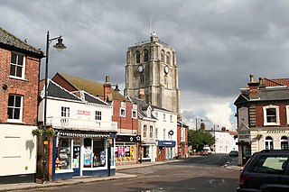
Beccles is a market town and civil parish in the English county of Suffolk. The town is shown on the milestone as 109 miles (175 km) from London via the A145 and A12 roads, 98 miles (158 km) north-east of London as the crow flies, 16 miles (26 km) south-east of Norwich and 33 miles (53 km) north-northeast of the county town of Ipswich. Nearby towns include Lowestoft to the east and Great Yarmouth to the north-east. The town lies on the River Waveney on the edge of The Broads National Park.

The River Waveney is a river which forms the boundary between Suffolk and Norfolk, England, for much of its length within The Broads. The "ey" part of the name means "river" thus the name is tautological.
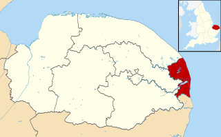
The Borough of Great Yarmouth is a local government district with borough status in Norfolk, England. It is named after its main town, Great Yarmouth.
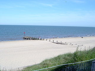
Hopton-on-Sea is a village, civil parish and seaside resort on the coast of East Anglia in the county of Norfolk. The village is 4 miles (6.4 km) south of Great Yarmouth, 4 1⁄2 miles (7.2 km) north-west of Lowestoft and near the UK's most easterly point, Lowestoft Ness.
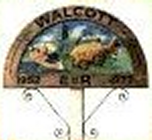
Walcott is a small village and civil parish on the North Norfolk coast in England between Mundesley and Happisburgh. The name is formed from the Anglian word 'walh' and the Anglo-Saxon 'cot' meaning 'cottage, hut, shelter or den'. The village is 19.1 miles (30.7 km) north east of Norwich, 11.9 miles (19.2 km) south east of Cromer and 137 miles (220 km) north east of London. The village lies 5.6 miles (9.0 km) east of the town of North Walsham.
Blundeston is a village and civil parish in the East Suffolk district of the English county of Suffolk. It is situated in the north of the county, about 2 miles (3 km) inland between Great Yarmouth and Lowestoft, close to the North Sea coast. Blundeston Prison was located on the southern edge of the village but closed, with the exception of the therapeutic community unit which transferred to HMP Warren Hill, and was sold in 2016. The old prison site is being redeveloped to include housing and community facilities.

Lothingland was a rural district in East Suffolk, England, named after the ancient half-hundred of Lothingland which was merged with Mutford half-hundred in 1763 to form Mutford and Lothingland.

Winterton-on-Sea is a village and civil parish on the coast of Norfolk, England. It is 8 mi (13 km) north of Great Yarmouth and 19 mi (31 km) east of Norwich.

Hemsby is a village, seaside resort and civil parish in the county of Norfolk, England. It is situated some 7.5 mi (12.1 km) north of the town of Great Yarmouth. In the 2001 census Hemsby had a population of 2,973 in 1,221 households; the population increased in the 2011 census to 3,275. Hemsby borders the villages of Winterton-on-Sea and Scratby. For the purpose of local government, the parish is in the district of Great Yarmouth.
The Norfolk and Suffolk Joint Railway (NSJR) was a British joint railway company.

Paston is a village and civil parish in the English county of Norfolk. The village is 4 miles (6.4 km) north-east of North Walsham and 9.1 miles (14.6 km) south-east of Cromer. It is 19.2 miles (30.9 km) north-east of the city of Norwich. The village sits astride the coast road between Mundesley and Bacton. The nearest railway station is at North Walsham for the Bittern Line which runs between Sheringham, Cromer and Norwich. The nearest airport is Norwich International.

Lowestoft North railway station was in Lowestoft, England. It closed in 1970.
Hopton-on-Sea was a railway station serving the village of Hopton-on-Sea in Norfolk on the Norfolk and Suffolk Joint Railway line between Great Yarmouth and Lowestoft. It opened in 1903 and closed in 1970.

Corton was a station in Corton, Suffolk on the Norfolk and Suffolk Joint Railway line between Great Yarmouth and Lowestoft. The station opened on 13 July 1903.

Thrandeston is a small village on the Norfolk/Suffolk border in England.

Lound is a village and civil parish in the north of the English county of Suffolk. It is in the East Suffolk district and part of the area known as Lothingland between Lowestoft and Great Yarmouth. Lound lies 4.5 miles (7.2 km) north of Lowestoft, 5 miles (8.0 km) south of Great Yarmouth and 2 miles (3.2 km) west of Hopton on Sea and the North Sea coast. The village lies just west of the main A47 dual carriageway between Great Yarmouth and Lowestoft.
The Yarmouth–Lowestoft line was an East Anglian railway line which linked the coastal towns of Yarmouth and Lowestoft. It opened on 13 July 1903 as the first direct railway link between the two towns and was constructed by the Great Eastern Railway and the Midland and Great Northern Railway in the hope of encouraging the development of holiday resorts along the coast. In the event, although the line was built to high standards and considerable cost, intermediate traffic did not develop and competition from buses and trams eroded the little that had been generated. Fish traffic was carried in large quantities until the 1930s when it fell into decline. In 1953, when major repairs to the Breydon Viaduct were required, it was decided to discontinue through services from the Midland and Great Northern to Lowestoft and to divert London trains to Lowestoft via Norwich. After the Midland and Great Northern and Yarmouth–Beccles line closed to passengers in 1959, the Yarmouth–Lowestoft line was upgraded to accommodate the diverted traffic, but after services were switched to Yarmouth Vauxhall in 1962, it was singled and the stations made unstaffed halts. With only a local service running between vandalised stations, the decision was taken to close the route on 4 May 1970 in favour of bus services which were judged adequate for most of the year.
Mutford and Lothingland was a hundred of Suffolk, with an area of 33,368 acres (135.04 km2). Lowestoft Ness, the most easterly point of Great Britain fell within its bounds.
Mutford and Lothingland Rural District was a rural district within the administrative county of East Suffolk between 1894 and 1934. It was created out of the earlier Mutford and Lothingland rural sanitary district.
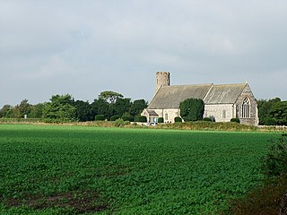
St Margaret's Church is the parish church of Hopton-on-Sea in the English county of Norfolk. It is dedicated to St Margaret of Antioch. St Margaret is also the dedication of the former church, which was destroyed by fire in 1865. The ruins of the former church remain standing, and are still consecrated. Both the old and new churches are Grade II* listed. Until 1974, Hopton-on-Sea was called Hopton ; the formal name for the benefice remains Hopton. The church is in the Diocese of Norwich, and is within the deanery of Lothingland and archdeaconry of Norfolk.
References
- 1 2 Clark, p. 11.
- ↑ Newton, Open Domesday. Retrieved 17 January 2020.
- ↑ Clark, p.13.
- ↑ Clark, p.12.
- 1 2 Clark, p.14.
- ↑ Ecclestone, AW (1971) Henry Manship's Great Yarmouth, pp.74, 77.
- ↑ "Norfolk Heritage Explorer: Newton Deserted Medieval Village" . Retrieved 15 January 2021.
- 1 2 3 4 Monument record COR 073 - Church of St Mary; Newton; The Gate. Formerly recorded as COR Misc, Suffolk Heritage Explorer, Suffolk County Council. Retrieved 17 January 2020.
- 1 2 "A Short History of Corton" . Retrieved 15 January 2021.
- ↑ Pratt, David, "RAF Hopton", in Barker, Darren, op. cit., pp.52–55.
- ↑ Clapham, Lucy (1 April 2014). "The day six Suffolk villages moved into Norfolk – and it definitely wasn't an April Fools' joke". Eastern Daily Press . Retrieved 15 January 2021.
- 1 2 Corton, Parish Histories, Suffolk Heritage Explorer, Suffolk County Council. Retrieved 17 January 2021.
- ↑ Chapman, Christopher (1985) 'Bleak and Lonely': Old St Margaret's Church, Hopton-on-Sea, Norfolk, p.1. Hopton-on-Sea: St Margaret's, Hopton.
- ↑ Clark, p.16.
Coordinates: 52°32′10″N1°44′31″E / 52.536°N 1.742°E (approx.)