
Kabwe is the capital of the Zambian Central Province and the Kabwe District, with a population estimated at 202,914 at the 2010 census. Named Broken Hill until 1966, it was founded when lead and zinc deposits were discovered in 1902. Kabwe also has a claim to being the birthplace of Zambian politics as it was an important political centre during the colonial period.
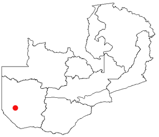
Senanga is the capital of the Senanga District, which is located in the Western Province of Zambia. The town is situated on the eastern bank of the Zambezi River, at the southern end of the Barotse Floodplain. It lies on the main road running parallel to the river from Livingstone and Sesheke to Mongu, which crosses the river by a pontoon ferry about 15 km (9 mi) south of Senanga. Recently the Kaunga Lyeti Bridge was completed to cross the Kaunga Lyeti River near the junction to Sioma, traveling from Sesheke and Katima Mulilo. On top of the bridgework, recent road projects have improved travel conditions and inspired economic confidence and growth.

Lufwanyama District with headquarters at Lufwanyama is a large rural undeveloped district in the west of Copperbelt Province. On a number of maps it is mixed up with Mpongwe District and Masaiti District. At one time these three districts were known as 'Ndola Rural'. As of the 2010 Zambian Census, the district had a population of 78,503 people. It has an area of 9849 square kilometres.

Kapiri Mposhi District is a district of Zambia, located in Central Province. The capital lies at Kapiri Mposhi. As of the 2010 Zambian Census, the district had a population of 240,638 people.

Chipata District is a district of Zambia, located in Eastern Province. The capital lies at Chipata. As of the 2010 Zambian Census, the district had a population of 455,783 people.

Kaputa District is a district of Zambia, located in Northern Province. The capital lies at Kaputa. As of the 2000 Zambian Census, the district had a population of 87,233 people.
Luampa District is a district of Zambia, located in Western Province. It was separated from Kaoma District in 2012.

Mitete District is a district of Zambia, located in Western Province. It was separated from Lukulu District in 2012.
Mulobezi District is a district of Zambia, located in Western Province. It was separated from Sesheke District in 2013.
Mwandi District is a district of Zambia, located in Western Province. The capital lies at Mwandi. It was separated from Sesheke District in 2012.

Nalolo District is a district of Zambia, located in Western Province. It was separated from Senanga District in 2012.

Chisamba District is a district of Central Province, Zambia. It covers a total surface area of 5,526 sq.km and is known for its agricultural activities with over 32,000 small scale farming families and 256 commercial farmers, the majority of whom are white Zambians. It shares borders with Lusaka, Chongwe, Chibombo, Kabwe, Kapiri Mposhi and Luano Districts. The District has a total population of 103,983 of which 51,955 are females and 52,028 are males.

Chitambo District is a district of Central Province, Zambia. It was separated from Serenje District in 2012 and is located some 357km north-east of Kabwe along the Great North Road. It shares borders with Serenje, Samfya, Lavushimanda and the Democratic Republic of Congo.

Luano District is a district of Central Province, Zambia. It was separated from Mkushi District in 2012.

Chilanga District is a district of Lusaka Province, Zambia. The capital of the district is Chilanga. It was separated from Kafue District in 2012.

Chirundu District is a district of Southern Province, Zambia. Its headquarters is Chirundu. It was separated from Siavonga District by President Michael Sata in 2012.

Senga District is a district of Northern Province, Zambia. It was separated from Mbala District in 2016.

Manyinga District is a district of North-Western Province, Zambia. It was separated from Kabompo District in 2012.

Chikankata District is a district of Southern Province, Zambia. It was separated from Mazabuka District in December 2011.

Zimba District is a district of Southern Province, Zambia. Its capital lies at Zimba. It was separated from Kalomo District in 2012.
