Paga is a town in Upper East Region of Ghana, lying north of Bolgatanga. Paga is the capital of Kassena Nankana West District, a district in the Upper East Region in the northern part of Ghana. The town is located on the border of Burkina Faso and is 166 km south of Ouagadougou via the N5 highway, the main road linking Ghana and Burkina Faso. The majority of the people of Paga are of the Kassena tribe.

Koforidua, also popularly known as K-dua or Koftown and now Kofcity, is a city and the capital of Eastern Region in southern Ghana. Koforidua was founded in 1875 by migrants from Ashanti. It is also called New Juaben. The city has a settlement city proper population of 183,727 people as of 2010, Koforidua is an amalgamation of two Municipalities; New Juaben North and South. The city has a blend of colonial and modern architecture.

Bawku is a town and is the capital of the Bawku Municipal District, district in the Upper East region of north Ghana, adjacent to the border with Burkina Faso. It is located approximately between latitudes 11o 111 and 100 401 North and longitude 0o 181w and 0o 61 E in the north-eastern corner of the region. The municipality has a total land area of about 257 km2. The Municipality was established by Legislative Instrument (L.I) 2103. The municipality has a total land area of about 257 km2. Bawku has a 2021 settlement population of 119,458 people. Hon. Ayariga Mahama is the Member of Parliament for Bawku Central Constituency.
Kwahu is an area and group of people that live in Ghana and are part of the Twi-speaking Akan group. The region has been dubbed Asaase Aban, or the Natural Fortress, given its position as the highest habitable elevation in the country. Kwahu lies in the Eastern Region of Ghana, on the west shore of Lake Volta. The Kwahus share the Eastern Region with the Akyem and Akuapem, as well as the Adangbe-Krobos. Among Kwahu lands, a significant migrant population works as traders, farm-hands, fisherfolk, and caretakers in the fertile waterfront 'melting pot' of Afram plains. These migrants are mostly from the Northern and Volta Regions, as well as, some indigenous Guans from the bordering Oti and Brong-Ahafo regions live in the Afram Plains area. Kwahus are traditionally known to be wealthy traders, owning a significant number of businesses and industries in Ghana.
Ejura is a town and the capital of Ejura/Sekyedumase, a district in the Ashanti Region of Ghana. Ejura has settlement population of 70,807 people. Ejura is the largest maize producing district in the Ashanti Region of Ghana. It is in the far north of the region, near the Afram River. Ejura is connected by highways with the towns of Mampong, Yeji and Techiman. Ejura is home to the Digya National Park / Kujani Game Reserve.
Begoro is a town and the capital of Fanteakwa district, a district in the Eastern Region of south Ghana. Begoro has a settlement population of 48,516 people, in 2013.

Mankessim is a town in the Central Region of Ghana, West Africa. It is approximately 75 km west of Accra, on the main road to Sekondi-Takoradi. It is the traditional headquarters of the Fante ethnic group of Ghana. Mankessim's history is linked to three famed warriors: Obrumankoma, Odapagyan and Oson, who helped the Fante people migrate from Techiman in the current Bono Region to Adoagyir in the Central Region. The town is located at an elevation of 75 meters above sea level and its population according to the 2010 Census was 38,313.
Akropong is a town in South Ghana and is the capital of the Akuapim North District, a district in the Eastern Region of South Ghana. This town is known for producing snails and palm oil. Akropong has a 2013 settlement population of 13,785 people.
Mpraeso is a town and the capital of Kwahu South district, a district in the Eastern Region of south Ghana, located at an altitude of 367 m on the Kwahu Plateau, which forms the south-west boundary of Lake Volta. Mpraeso has a 2013 settlement population of 11,190 people.

The Ningo-Prampram Constituency is one of the constituencies represented in the Parliament of Ghana. The constituency derives its name from the two towns located within the constituency. The towns are the much larger and older Ningo and the relatively younger Prampram which is much smaller. It elects one Member of Parliament (MP) by the first past the post system of election. Ningo-Prampram is located in the Ningo-Prampram District of the Greater Accra Region of Ghana. Central University College has a campus at Miotso near Prampram and plans are underway to relocate its other campuses to Ningo-Prampram. Hope City which was initially planned to be built at Kasoa has also been relocated here. Plans are also underway to build the new international airport at a location near Ningo.
Pepease is the second largest town in the Kwahu East District, in the Eastern Region of Ghana.

Madina is a suburb of Accra and in the La Nkwantanang Madina Municipal District, a district in the Greater Accra Region of southeastern Ghana. Madina is next to the University of Ghana and houses the Institute of Local Government. Madina is the twelfth most populous settlement in Ghana, in terms of population, with a population of 137,162 people. History has it that Madina was established by people from different ethnic backgrounds and some foreigners led by Alhaji Seidu Kardo. Madina is contained in the Madina electoral constituency of the republic of Ghana. It shares borders with Adentan Municipal on the west, the Accra Metropolitan Assembly to the South and the Akwapim South District. to the north.

Kwahu West Municipal District is one of the thirty-three districts in Eastern Region, Ghana. Originally it was formerly part of the then-larger Kwahu South District in 1988, which was created from the former Kwahu District Council, until the southwest part of the district was split off to create Kwahu West District in August 2004; which it later was elevated to municipal district assembly status on 1 July 2007 to become Kwahu West Municipal District. The municipality is located in the western part of Eastern Region and has Nkawkaw as its capital town.
Bechem is a town and is the capital of Tano South district of the Ahafo of Ghana, and Bechem is the district capital for the Tano South Constituency. Bechem is located close to the capital town of Bono, Sunyani. The town is known for the Bechem Presbyterian Secondary School. The school is a second cycle institution. The town has one of the best teacher training colleges in the country known as St. Joseph college (JOSCO) and it has two villages known to be Techimantia and Derma which both stand tall when it comes to tomato production in the country.
Nyakrom is a town in the Agona West Municipal District of the Central Region of Ghana. The town is known for the Nyakrom Day Secondary School. The school is a second cycle institution. Nyakrom is the sixty-second most populous settlement in Ghana, in terms of population, with a population of 22,911 people. Nyakrom has a Wesleyan Methodist Church. Catechist Henry Amoa Saah played important role in its planting and growth at the foundational stages. Nyakrom is known for having first rural bank in Ghana
Lashibi is a town in the Greater Accra Region of southeastern Ghana near the capital Accra. Lashibi is the twentieth-largest settlement in Ghana, in terms of population, with a population of 78,539 people.
Atibie is a small town in the Kwahu South District in the Eastern Region of Ghana. The Odweanoma Mountain is located along the Atibie road.

Bryan Acheampong is a Ghanaian politician and Member of Parliament of Abetifi constituency in the Eastern Region of Ghana. He is a member of the New Patriotic Party of Ghana. He succeeded Peter Wiafe Pepera, who died while in office. He was the Minister of State at the Ministry of Interior between February 2019 to 2020. In 2016, he bought Okwawu United F.C. and currently serves as the Minister of Agriculture.
The 2020–21 Ghana Premier League is the 65th season of top professional association football league in Ghana. The season started on 14 November 2020. 18 teams were competing in the league with each club playing each other twice, home and away, with the three clubs at the bottom of the league relegated to the Division One League. Hearts of Oak became champion for the first time since twelve years.
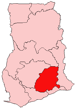
Adawso is a farming community in the Akuapem North Municipal District in the Eastern Region of Ghana. It is located along the Koforidua-Mamfe highway.


