Columbus is a Latinized version of the Italian surname "Colombo". It most commonly refers to:

Columbus is a city in, and the county seat of, Bartholomew County, Indiana, United States. The population was 50,474 at the 2020 Census. The city is known for its architectural significance, having commissioned numerous noted works of modern architecture and public art since the mid-20th century; the annual program Exhibit Columbus celebrates this legacy. Located about 40 mi (64 km) south of Indianapolis, on the east fork of the White River, it is the state's 20th-largest city. It is the principal city of the Columbus, Indiana metropolitan statistical area, which encompasses all of Bartholomew County. Columbus is the birthplace of former Indiana Governor and former Vice President of the United States, Mike Pence.

Interstate 70 (I-70) is a major east–west Interstate Highway in the United States that runs from I-15 near Cove Fort, Utah, to I-695 and Maryland Route 570 (MD 570) in Woodlawn, just outside Baltimore, Maryland. I-70 approximately traces the path of U.S. Route 40 east of the Rocky Mountains. West of the Rocky Mountains, the route of I-70 was derived from multiple sources. The Interstate runs through or near many major cities, including Denver, Topeka, Kansas City, St. Louis, Indianapolis, Columbus, Pittsburgh, and Baltimore. The sections of the Interstate in Missouri and Kansas have laid claim to be the first Interstate in the United States. The Federal Highway Administration (FHWA) has claimed the section of I-70 through Glenwood Canyon in Colorado, completed in 1992, to be the last piece of the Interstate Highway System, as originally planned, to open to traffic. The construction of I-70 in Colorado and Utah is considered an engineering marvel, as the route passes through the Eisenhower Tunnel, Glenwood Canyon, and the San Rafael Swell. The Eisenhower Tunnel is the highest point along the Interstate Highway System, with an elevation of 11,158 feet (3,401 m).

Bartholomew County is a county located in the U.S. state of Indiana. The population was 82,208 at the 2020 census. The county seat is Columbus. The county was determined by the U.S. Census Bureau to be home to the mean center of U.S. population in 1900.
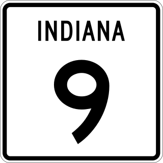
State Road 9 in the U.S. State of Indiana is a long north–south state highway in the eastern portion of Indiana. Its southern terminus is near Columbus at State Road 46, and the northern terminus is at the Michigan/Indiana border between Howe, Indiana, and Sturgis, Michigan, where it continues as M-66.

U.S. Route 33 (US 33) is a United States Numbered Highway that runs northwest–southeast for 709 miles (1,141 km) from northern Indiana to Richmond, Virginia, passing through Ohio and West Virginia en route. Although most odd-numbered U.S. routes are north–south, US 33 is labeled east–west throughout its route, except in Indiana where it is labeled north–south. It roughly follows a historic trail used by Native Americans from Chesapeake Bay to Lake Michigan.

Columbus East High School (CEHS) is one of three high schools in Columbus, Indiana, United States. East is a member of the Hoosier Hills Conference in athletics and has a total of 5 IHSAA state championships. It was founded in 1972 due to the growing educational demands of the community. As the population of the community rose, Columbus High School could not support all school age students. Columbus East was constructed and Columbus High School became Columbus North High School.

Columbus North High School (CNHS) is one of the public high schools located in Columbus, Indiana, United States. It is part of the Bartholomew Consolidated School Corporation (BCSC). Columbus North High School was previously known as Columbus High School. It was renamed Columbus North High School in 1973 upon the founding of Columbus East High School.

State Road 7 in the U.S. State of Indiana is located in southeast Indiana. It runs from northwest-to-southeast connecting the cities of Columbus and Madison.
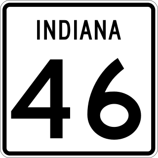
State Road 46 in the U.S. state of Indiana is an east–west state highway in the southern half of Indiana.

The Purdue University system is a public university system in the U.S. state of Indiana. A land-grant university with nearly 75,000 students across five institutions comprising six physical campuses, a statewide technology program, extension centers in each of Indiana's 92 counties, and continuing education programs. Additionally, there are another ~44,000 students enrolled in an online university. Each university in the system maintains its own faculty and admissions policies which are overseen by the Purdue University Board of Trustees. Purdue's main campus in West Lafayette is the best-known, noted for its highly regarded programs in engineering and adjacent subjects.

Columbus Municipal Airport is three miles north of Columbus, in Bartholomew County, Indiana, United States.

Interstate 65 (I-65) in the US state of Indiana traverses from the south-southeastern Falls City area bordering Louisville, Kentucky, through the centrally located capital city of Indianapolis, to the northwestern Calumet Region of the Hoosier State which is part of the Chicago metropolitan area. The Indiana portion of I-65 begins in Jeffersonville after crossing the Ohio River and travels mainly north, passing just west of Columbus prior to reaching the Indianapolis metro area. Upon reaching Indianapolis, the route alignment of I-65 begins to run more to the northwest and subsequently passes Lafayette on that city's east and north sides. Northwest of there, in west-central Jasper County, the route again curves more northward as it approaches the Calumet Region. Shortly after passing a major junction with I-80 and I-94, I-65 reaches its northern national terminus in Gary at I-90 which is carried on the Indiana East–West Toll Road. I-65 covers 261.27 miles (420.47 km) in the state of Indiana. This is one of the principal Interstate Highways that cross the state, and, more specifically, intersect at the city of Indianapolis, that has given the state the nickname of "Crossroads of America".

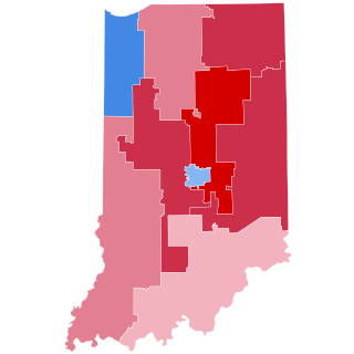
Indiana's 6th congressional district is a congressional district in the U.S. state of Indiana. The district takes in a portion of eastern and central Indiana as of the 2020 census, including Columbus and Richmond, some of Cincinnati's Indiana suburbs, most of Indianapolis' southern suburbs, and a sliver of Indianapolis itself.
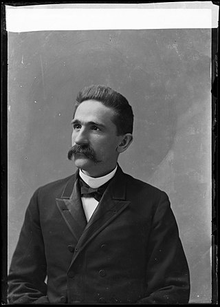
George William Cooper was an American lawyer and politician who served three terms as a U.S. Representative from Indiana from 1889 to 1895.
Columbus Township is one of twelve townships in Bartholomew County, Indiana, United States. As of the 2010 census, its population was 45,578 and it contained 20,516 housing units.
New Columbus is an unincorporated community in Adams Township, Madison County, Indiana, United States. It is also known as Ovid, and is marked by both names on highway signs at the town's borders.
The 2004 congressional elections in Indiana were elections for Indiana's delegation to the United States House of Representatives, which occurred along with congressional elections nationwide on November 2, 2004. Republicans held a majority of Indiana's delegation, 6-3, before the elections. The only incumbent to lose re-election was Democrat Baron Hill, who lost to Republican Mike Sodrel in the 9th district.

U.S. Route 31 (US 31) is a part of the United States Numbered Highway System that runs from Spanish Fort, Alabama, to Mackinaw City, Michigan. It enters the U.S. state of Indiana via the George Rogers Clark Memorial Bridge between Louisville, Kentucky, and Clarksville, Indiana. The 266.02 miles (428.12 km) of US 31 that lie within Indiana serve as a major conduit. Some of the highway is listed on the National Highway System. Various sections are rural two-lane highway and urbanized four- or six-lane divided expressway. The northernmost community along the highway is South Bend near the Michigan state line.
Michael Brinegar is an American swimmer specializing in distance freestyle and open water swimming who swam for Indiana University and competed in the 2020 Tokyo Olympics in the 800 and 1500-meter freestyle events.


