Shaker Heights is a city in Cuyahoga County, Ohio, United States. As of the 2020 census, the city's population was 29,439. Shaker Heights is an inner-ring streetcar suburb of Cleveland, abutting the eastern edge of the city's limits. It is a planned community developed by the Van Sweringen brothers, railroad moguls who envisioned the community as a suburban retreat from the industrial inner city of Cleveland.

Winter Quarters was an encampment formed by approximately 2,500 members of the Church of Jesus Christ of Latter-day Saints as they waited during the winter of 1846–47 for better conditions for their trek westward. It followed a preliminary tent settlement some 3½ miles west at Cutler's Park. Members of the LDS faith built more than 800 cabins at the Winter Quarters settlement. Located in present-day North Omaha overlooking the Missouri River, the settlement remained populated until 1848.

Shadwell is a census-designated place (CDP) in Albemarle County, Virginia. It is located by the Rivanna River near Charlottesville. The site today is marked by a Virginia Historical Marker to mark the birthplace of President Thomas Jefferson. It is listed on the National Register of Historic Places along with Clifton.
There were several historic mills around the metro Atlanta area, for which many of its current-day roads are still named. Most of the mills date back to the 1820s and 1830s, and were built along the area's many streams. The locations of many of these mills are shown on a map of 1875 showing U. S. military operations around Atlanta in 1864. This map is now located in the U. S. Library of Congress but can be seen on the webpage linked here.

The Nature Center at Shaker Lakes is a nonprofit organization in Shaker Heights, Ohio, that works to conserve a natural area, educate visitors about nature, and promote better environmental stewardship. It was founded in 1966 as the result of a volunteer effort to preserve the Shaker Parklands from becoming the route for a new freeway connecting Cleveland's east side to Downtown Cleveland.
Alton is a hamlet within the Town of Sodus, Wayne County, New York, United States. It is located six miles (10 km) southeast of the Village of Sodus and five miles (8 km) south of the Village of Sodus Point, at an elevation of 377 feet. The primary intersection in the hamlet is at N.Y. Route 14 and Ridge Road. N.Y. Route 104 passes just south of Alton.
Rideau Lakes is a township located within Leeds and Grenville United Counties in Eastern Ontario, Canada. The township was incorporated on 1 January 1998 by amalgamating the former townships of North Crosby, South Crosby, Bastard, South Burgess and South Elmsley with the village of Newboro.

Mill Creek Park is a metropolitan park located in Youngstown, Ohio. It stretches from the near west side of Youngstown to the southern borders of the city and neighboring Boardman, Ohio. The park "encompasses approximately 4400 acres (10.5 km²), 20 mi (32 km) of drives, and 15 mi (24 km) of foot trails" as well as a variety of bridges, ponds, streams, well-tended gardens, and waterfalls. The Trust for Public Land ranks one part of Mill Creek as the 142nd largest park located within the limits of a U.S. city.

Cuyahoga County, Ohio, United States is divided into 21 townships.
The Whitewater Shaker Settlement is a former Shaker settlement near New Haven in Crosby Township, Hamilton County, Ohio, United States. Established in 1824 and closed in 1916, it was listed on the National Register of Historic Places in 1974 as a historic district.

Kymulga Mill & Covered Bridge are two locally owned historic landmarks located at Kymulga Park in Talladega County, Alabama, United States. The park is on Grist Mill Road off State Route 76 about 4 miles northeast of the city of Childersburg.

Sabbathday Lake Shaker Village is a Shaker village near New Gloucester and Poland, Maine, in the United States. It is the last active Shaker community, with two members as of 2020. With a new member, it had expanded to three members by 2021. The community was established in either 1782, 1783, or 1793, at the height of the Shaker movement in the United States. The Sabbathday Lake meetinghouse was built in 1794. The entire property was declared a National Historic Landmark in 1974.

Darnley Cascade is a 4-metre-high (13 ft) cascade waterfall located at Crooks Hollow Conservation Area in Greensville, Hamilton, Ontario, Canada. Nearby attractions include Bruce Trail, Dundas Valley Conservation Area, Spencer Gorge/Webster's Falls Conservation Area, Hermitage ruins, Royal Botanical Gardens, Dundurn Castle, Christie Lake Conservation Area, Dundas Historical Society Museum and Carnegie Gallery.
West Union (Busro) is an abandoned Shaker community in Busseron Township, northwestern Knox County, Indiana, about fifteen miles (24 km) north of Vincennes. The settlement was inhabited by the Shakers (United Society of Believers in Christ's Second Appearing) from 1811 to 1827. Though short-lived, West Union was the westernmost Shaker settlement.

Rockefeller Park is a city park named in honor of oil magnate John D. Rockefeller Sr., located in Cleveland, Ohio. Part of the Cleveland Public Parks District, Rockefeller Park is immediately adjacent Wade Park to the southeast, and across Euclid Ave on its northwest border. Besides the distinction of being the largest park located completely within city limits, Rockefeller Park is a link in a chain of parkland that connects the heights region of the eastern suburbs to the city's lakefront. Following the path of Martin Luther King Jr. Drive and spanning a large section of Cleveland's East Sides, the park runs in a northwesterly path between suburban Shaker Heights, bisecting the University Circle neighborhood and terminating at Gordon Park on the city's lakefront, opened to the public in 1897. The park was dramatically expanded during the 1930s with labor provided by the Works Progress Administration. Landmarks found in Rockefeller Park include two separate entries on the National Register of Historic Places: one for its architecturally historic bridges, and one for its Cultural Gardens.
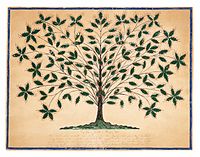
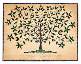
The Shakers are a sect of Christianity which practices celibacy, communal living, confession of sin, egalitarianism, and pacifism. After starting in England, it is thought that these communities spread into the cotton towns of North West England, with the football team of Bury taking on the Shaker name to acknowledge the Shaker community of Bury.The Shakers left England for the English colonies in North America in 1774. As they gained converts, the Shakers established numerous communities in the late-18th century through the entire 19th century. The first villages organized in Upstate New York and the New England states, and, through Shaker missionary efforts, Shaker communities appeared in the Midwestern states. Communities of Shakers were governed by area bishoprics and within the communities individuals were grouped into "family" units and worked together to manage daily activities. By 1836 eighteen major, long-term societies were founded, comprising some sixty families, along with a failed commune in Indiana. Many smaller, short-lived communities were established over the course of the 19th century, including two failed ventures into the Southeastern United States and an urban community in Philadelphia, Pennsylvania. The Shakers peaked in population by the 1840s and early 1850s, with a membership between 4,000 and 9,000. Growth in membership began to stagnate by the mid 1850s. In the turmoil of the American Civil War and subsequent Industrial Revolution, Shakerism went into severe decline. As the number of living Shakers diminished, Shaker communes were disbanded or otherwise ceased to exist. Some of their buildings and sites have become museums, and many are historic districts under the National Register of Historic Places. The only active community is Sabbathday Lake Shaker Village in Maine, which is composed of at least three active members.

The Union Village Shaker settlement was a village organized by Shakers in Turtlecreek Township, Warren County, Ohio.
The Becaguimec Stream is a minor tributary of the Saint John River in the Canadian Province of New Brunswick. It rises in the hilly woods along the county line dividing Carleton County, Canada from York County, Canada in the western region of the province. Its watershed is adjacent to the South Branch of the Southwest Miramichi River, the Nashwaak River, the Keswick River and the Nackawic Stream.

Mill Pond is a manmade freshwater reservoir in downtown Milton, Ontario, Canada.