
Kirkland is a city in King County, Washington, United States. A suburb east of Seattle, its population was 92,175 in the 2020 U.S. census which made it the sixth largest city in King County and the twelfth largest city in the state of Washington.
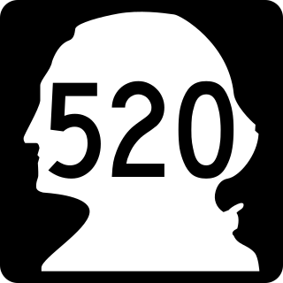
State Route 520 (SR 520) is a state highway and freeway in the Seattle metropolitan area, part of the U.S. state of Washington. It runs 13 miles (21 km) from Seattle in the west to Redmond in the east. The freeway connects Seattle to the Eastside region of King County via the Evergreen Point Floating Bridge on Lake Washington. SR 520 intersects several state highways, including Interstate 5 (I-5) in Seattle, I-405 in Bellevue, and SR 202 in Redmond.
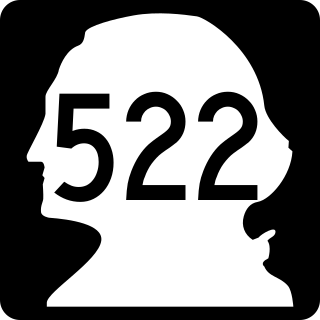
State Route 522 (SR 522) is a state highway in the U.S. state of Washington that serves the Seattle metropolitan area. Approximately 25 miles (40 km) long, it connects the city of Seattle to the northeastern suburbs of Kenmore, Bothell, Woodinville, and Monroe. Its western half is primarily an arterial street, named Lake City Way and Bothell Way, that follows the northern shore of Lake Washington; the eastern half is a grade-separated freeway that runs between Woodinville and Monroe. SR 522 connects several of the metropolitan area's major highways, including Interstate 5 (I-5), I-405, SR 9, and U.S. Route 2 (US 2).
Sound Transit (ST), officially the Central Puget Sound Regional Transit Authority, is a public transit agency serving the Seattle metropolitan area in the U.S. state of Washington. It operates the Link light rail system in Seattle and Tacoma, regional Sounder commuter rail, and Sound Transit Express bus service. The agency also coordinates the regional ORCA fare card system, which is also used by local transit operators. In 2019, Sound Transit services carried a total of 48 million passengers and averaged over 161,000 riders on weekdays.

The Downtown Seattle Transit Tunnel (DSTT), also referred to as the Metro Bus Tunnel, is a 1.3-mile-long (2.1 km) pair of public transit tunnels in Seattle, Washington, United States. The double-track tunnel and its four stations serve Link light rail trains on the 1 Line as it travels through Downtown Seattle. It runs west under Pine Street from 9th Avenue to 3rd Avenue, and south under 3rd Avenue to South Jackson Street. 1 Line trains continue north from the tunnel to Northgate station and south through the Rainier Valley past Seattle–Tacoma International Airport to Angle Lake station as part of Sound Transit's light rail network.

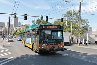
Transportation in Seattle is largely focused on the automobile like many other cities in western North America; however, the city is just old enough for its layout to reflect the age when railways and trolleys predominated. These older modes of transportation were made for a relatively well-defined downtown area and strong neighborhoods at the end of several former streetcar lines, now mostly bus lines.

Interstate 405 (I-405) is a north–south auxiliary Interstate Highway serving the Seattle region of Washington, United States. It bypasses Seattle east of Lake Washington, traveling through the Eastside area of King and Snohomish counties, providing an alternate route to I-5. The 30-mile (48 km) freeway serves the cities of Renton, Bellevue, Kirkland, and Bothell. I-405 terminates at I-5 in Tukwila and Lynnwood, and also intersects several major highways, including SR 167, I-90, SR 520, and SR 522.

The 1 Line, formerly Central Link, is a light rail line in Seattle, Washington, United States, and part of Sound Transit's Link light rail system. It serves 19 stations in the cities of Seattle, SeaTac, and Tukwila, traveling nearly 25 miles (40 km) between Northgate and Angle Lake stations. The line connects the University District, Downtown Seattle, the Rainier Valley, and Seattle–Tacoma International Airport. The 1 Line carried over 26 million total passengers in 2023, with an average of nearly 80,000 daily passengers on weekdays. It runs for 20 hours per day on weekdays and Saturdays, with headways of up to six minutes during peak hours, and reduced 18-hour service on Sundays and holidays.

Link light rail is a light rail rapid transit system serving the Seattle metropolitan area in the U.S. state of Washington. It is managed by Sound Transit in partnership with local transit providers, and consists of two non-connected lines: the 1 Line in King County, which travels for 26 miles (42 km) between Seattle and Seattle–Tacoma International Airport; and the T Line in Pierce County, which runs for 4 miles (6.4 km) between Downtown Tacoma and Tacoma Dome Station. In 2023, the system had a ridership of 23.9 million, or about 78,600 per weekday as of the fourth quarter of 2023, primarily on the 1 Line. Trains run at frequencies of 6 to 24 minutes.

The East Link Extension, also known as the 2 Line, is a future light rail line serving the Eastside region of the Seattle metropolitan area in the U.S. state of Washington. It will be part of Sound Transit's Link light rail system, running 18 miles (29 km) from west to east and serving 12 stations in Downtown Seattle, Mercer Island, Bellevue, and Redmond. The first section of the 2 Line, between South Bellevue and Redmond Technology stations, is scheduled to open on April 27, 2024. It is planned to be followed in 2025 by an extension east to Downtown Redmond and west to Seattle, where it will continue into the Downtown Seattle Transit Tunnel and share stations with the 1 Line through to Lynnwood City Center station.

University of Washington station is a light rail station on the University of Washington campus in Seattle, Washington, United States. The station is served by the 1 Line of Sound Transit's Link light rail system, which connects Northgate, Downtown Seattle, and Seattle–Tacoma International Airport. University of Washington station is at the intersection of Montlake Boulevard Northeast and Northeast Pacific Street, adjacent to Husky Stadium and the University of Washington Medical Center.

Roosevelt station is a light rail station located in the Roosevelt neighborhood of Seattle, Washington, United States. It is served by the 1 Line of Sound Transit's Link light rail system, which continues north to Northgate station and south to Downtown Seattle and SeaTac. The underground station consists of a single island platform connected to the surface via a mezzanine and two entrances along 12th Avenue Northeast at Northeast 65th and 67th streets.

Northgate is a light rail and bus station in the Northgate neighborhood of Seattle, Washington, United States. It is the northern terminus of the 1 Line on Sound Transit's Link light rail system. The transit center, located adjacent to the Northgate Mall, has four bus bays served by 22 routes. The station also has parking for 1,525 vehicles.

Bellevue Transit Center (BTC) is a bus station and future light rail station in Bellevue, Washington, a suburb of Seattle. It is the main transit hub for the Eastside of King County, serving 20 routes from King County Metro and Sound Transit Express. The transit center is the western terminus of the RapidRide B Line, which runs east to Redmond.

Wilburton station is a future Link light rail station in Bellevue, Washington, which will be served by the 2 Line. The elevated station is scheduled to open in April 2024 as part of the line's starter segment. It will serve the area immediately east of Downtown Bellevue, including Lake Bellevue and the Overlake Hospital Medical Center.

Shoreline North/185th station is a future Link light rail station on the Lynnwood Link Extension serving Shoreline, Washington. The station will be located in a trench on the east side of Interstate 5, on the north side of Northeast 185th Street. It will include an adjacent bus station and parking garage with 500 stalls. The station is scheduled to open in 2024, with the rest of the line.
Shoreline South/148th station is a planned elevated station on Sound Transit's Lynnwood Link Extension, part of the Link light rail system. It will be located at the intersection of Interstate 5 and State Route 523 in Shoreline and will open in 2024 with the rest of the line.

NE 130th Street is a future station on Sound Transit's Link light rail system in Seattle, Washington, United States. It would be built on a section of the Lynnwood Link Extension, adjacent to the intersection of Interstate 5 and Northeast 130th Street in northern Seattle. The station was originally deferred from Lynnwood Link but restored as an infill station project under the Sound Transit 3 ballot measure, with an opening tentatively set for 2026.

Sound Transit 3, abbreviated as ST3, was a ballot measure during the November 2016 elections in Seattle, Washington, proposing an expansion of the regional public transit system. The measure was proposed by Sound Transit, which was established by a similar initiative passed in 1996 and expanded by the Sound Transit 2 vote in 2008, who have operated regional transit systems in the Seattle metropolitan area since 1999. On November 8, 2016, Sound Transit 3 was approved by over 54 percent of voters in the Puget Sound region; voters in Pierce County rejected the measure, but the measure passed in King and Snohomish counties, and had an overall majority.
The RapidRide G Line is a future RapidRide bus service in Seattle, Washington, operated by King County Metro on Madison Street between Downtown Seattle and Madison Valley. The line is projected to open for service on August 31, 2024, and cost $133.4 million.
