
Interstate 215 (I-215) is a 54.5-mile-long (87.7 km) north–south auxiliary Interstate Highway in the Inland Empire region of the San Bernardino–Riverside urban area in Southern California. It has portions designated as the Barstow, Escondido, and Armed Forces Freeways. I-215 is a bypass auxiliary route of I-15, running from Murrieta to northern San Bernardino. While I-215 connects the city centers of both Riverside and San Bernardino, its parent I-15 runs to the west through Corona and Ontario.
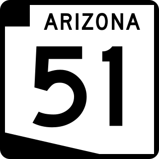
Arizona State Route 51 (SR 51), also known as the Piestewa Freeway, is a numbered state highway in Phoenix, Arizona. It connects Interstate 10 just outside Downtown Phoenix with Loop 101 on the north side of Phoenix, making it one of the area's major freeways. It is a largely north–south route and is known for traversing the Piestewa Peak Recreation Area. The peak was named after Lori Piestewa, the first Native American woman to die in combat in the U.S. military. Prior to this time, the freeway was known as the Squaw Peak Parkway, a name considered offensive by Native Americans. Rapid growth and increased traffic demand on the east side of Metro Phoenix made the Piestewa Freeway necessary.

King's Highway 403, or simply Highway 403, is a 400-series highway in the Canadian province of Ontario that travels between Woodstock and Mississauga, branching off from and reuniting with Highway 401 at both ends and travelling south of it through Hamilton and Mississauga. It is concurrent with the Queen Elizabeth Way (QEW) for 22 km (14 mi) from Burlington to Oakville. The Highway 403 designation was first applied in 1963 to a short stub of freeway branching off the QEW, and the entire route was completed on August 15, 1997, when the section from Brantford to the then-still independent Town of Ancaster was opened to traffic. The section of Highway 403 between Woodstock and Burlington was formally dedicated as the Alexander Graham Bell Parkway on April 27, 2016, in honour of Alexander Graham Bell.

Interstate 678 (I-678) is a north–south auxiliary Interstate Highway that extends for 14 miles (23 km) through two boroughs of New York City. The route begins at John F. Kennedy International Airport on Jamaica Bay and travels north through Queens and across the East River to the Bruckner Interchange in the Bronx, where I-678 ends and the Hutchinson River Parkway begins.
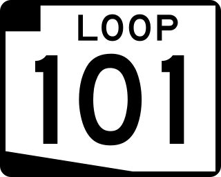
Arizona State Route 101 or Loop 101 is a semi-beltway looping around the Phoenix Metropolitan Area in central Arizona. It connects several suburbs of Phoenix, including Tolleson, Glendale, Peoria, Scottsdale, Mesa, Tempe, and Chandler. Construction began in the late-1980s and was completed in 2002.

Arizona State Route 202 (SR 202) or Loop 202 is a semi-beltway circling the eastern and southern areas of the Phoenix metropolitan area in central Arizona. It traverses the eastern end and the southern end of the city of Phoenix, in addition to the cities of Tempe, Mesa, Chandler, and Gilbert, and is a vital route in the metropolitan area freeway system. Loop 202 has three officially designated sections along its route; the Red Mountain Freeway, the SanTan Freeway, and the Congressman Ed Pastor Freeway, previously named the South Mountain Freeway. The Red Mountain Freeway runs from the Mini Stack Interchange with Interstate 10 (I-10) and State Route 51 (SR 51) in Phoenix to the SuperRedTan Interchange with U.S. Route 60 (US 60) in Mesa. The SanTan Freeway runs from there to an interchange with Interstate 10 (I-10) in Chandler. The Congressman Ed Pastor Freeway runs from there to I-10 in western Phoenix.

Alberta Provincial Highway No. 201, officially named Stoney Trail and Tsuut'ina Trail, is an approximately 92-kilometre (57 mi) freeway in Calgary, Alberta. It forms part of the CANAMEX Corridor which connects Calgary to Edmonton and Interstate 15 in the United States via Highways 2, 3, and 4. Planned for a total length of 101 kilometres, the final segment of the ring road is currently under construction to be completed by 2024 at the latest, delayed from an original target of 2022. The freeway serves as a bypass for the congested routes of 16 Avenue N and Deerfoot Trail through Calgary. At its busiest point near Beddington Trail in north Calgary, the six-lane freeway carried nearly 79,000 vehicles per day in 2019.

In the U.S. state of Arizona, Interstate 10 (I‑10), the major east–west Interstate Highway in the United States Sun Belt, runs east from California, enters Arizona near the town of Ehrenberg and continues through Phoenix and Tucson and exits at the border with New Mexico near San Simon. The highway also runs through the cities of Casa Grande, Eloy, and Marana. Segments of the highway are referred to as either the Papago Freeway, Inner Loop, or Maricopa Freeway within the Phoenix area and the Pearl Harbor Memorial Highway outside metro Phoenix.

Arizona State Route 303 or Loop 303, also known as the Bob Stump Memorial Parkway, is a freeway that serves the west part of the Phoenix metropolitan area. The freeway, originally a two-lane rural highway, was maintained by Maricopa County until 2004 when the Arizona Department of Transportation again took control of upgrading the interim road to a freeway.

State Route 30, also known as the Tres Rios Freeway, is a planned freeway in the southwest part of the Phoenix metropolitan area. It is planned as a reliever for Interstate 10 five miles to the south and will run through the communities of Buckeye, Goodyear, Avondale, and Phoenix.

State Route 24, also known as the Gateway Freeway or the Williams Gateway Freeway, is a freeway in the extreme southeastern region of the Phoenix Metropolitan Area. The roadway is planned as a controlled-access highway to move traffic from the southeastern suburbs of Phoenix to planned ones in northwestern Pinal County. It is the lowest-numbered state route in Arizona. The first mile from Loop 202 to Ellsworth Road opened on May 4, 2014. An extension to Ironwood Drive opened in 2022, with the completion of "Interim Phase II"; the first mile of this extension from Ellsworth Road to Williams Field Road opened on April 1, 2022, with the remainder following on August 11. Planning for future sections has been halted until studies for the Pinal North-South Freeway are completed to confirm how the two freeways will intersect.

County State-Aid Highway 81, also known as County Road 81, (County 81) is a county highway in Hennepin County, Minnesota, which runs from its interchange with Interstate 94 (I-94), CR 66, and CR 152 in the city of Minneapolis, and continues northwest to its terminus at Main Street in suburban Rogers. CR 81 is approximately 20 miles (32 km) long.

U.S. Route 60 (US 60) is an east–west United States Highway within Arizona. The highway runs for 369 miles (594 km) from a junction with Interstate 10 near Quartzsite to the New Mexico State Line near Springerville. As it crosses the state, US 60 overlaps at various points: I-17, I-10, SR 77, SR 260, US 191, and US 180. Between Wickenburg and Phoenix, the route is known as Grand Avenue. From Tempe to Apache Junction, it is known as the Superstition Freeway.

U.S. Route 281 (US 281) is a United States Numbered Highway that runs from the Mexican border in the Rio Grande Valley to the Canadian border near Dunseith, North Dakota. In the state of Texas, the highway is a major south–north corridor, connecting Brownsville to the Oklahoma state line at the Red River in Burkburnett. Several segments of U.S. 281 are concurrent with Interstate routes, including I-69C in the Rio Grande Valley, I-37 in San Antonio, and I-44 north of Wichita Falls.

Interstate 69 (I-69) in the US state of Kentucky is a 148.1-mile-long (238.3 km) freeway running from Fulton to Henderson. The route makes use of the entirety of the former Purchase Parkway and existing portions of I-24, the Western Kentucky Parkway, and the Pennyrile Parkway. Eventually, I-69 will leave the former Pennyrile Parkway just south of the Audubon Parkway interchange or remain on its current alignment and travel through Henderson on U.S. Route 41 (US 41) north into Indiana. The proposed route for the remainder of I-69 in Kentucky travels about 10 miles (16 km) to utilize an as-of-yet-unbuilt bridge into Indiana.
The metropolitan area of Phoenix in the U.S. state of Arizona contains one of the nation's largest and fastest-growing freeway systems, boasting over 1,405 lane miles (2,261 km) as of 2005.

State Highway 21 (SH 21), also known as Powers Boulevard, is an expressway in El Paso County, in eastern Colorado Springs. SH 21 currently extends from SH 16 in Fountain at its southern end to Interquest Parkway/SH 83 in the north side of Colorado Springs. Extensions to I-25 near North Gate Boulevard are in progress, and extensions south to I-25 near Pikes Peak International Raceway are proposed, and the road is planned to be converted to a freeway in the long-term future.
Many arterial roads in the Phoenix metropolitan area have the same name in multiple cities or towns. Some roads change names or route numbers across town borders, resulting in occasional confusion. For example, the road known as Apache Boulevard in Tempe continues east as Main Street in neighboring Mesa and then as Apache Trail in Apache Junction. Although Broadway Road maintains the same name through Goodyear, Avondale, Phoenix, Tempe, Mesa, and Apache Junction, each town uses a different reference point for address numbers.

Bell Road is a major east-west arterial road in the northern Phoenix, Arizona metropolitan area. It is one of the few roadways to cross the Agua Fria River in the northwestern part of the metro area, providing a vital link between the growing suburb of Surprise with Phoenix. As a result, the portion of Bell Road passing through Surprise and Sun City is the busiest arterial road in the state of Arizona.
Highway revolts have occurred in cities and regions across the United States. In many cities, there remain unused highways, abruptly terminating freeway alignments, and short stretches of freeway in the middle of nowhere, all of which are evidence of larger projects which were never completed. In some instances, freeway revolts have led to the eventual removal or relocation of freeways that had been built.
