
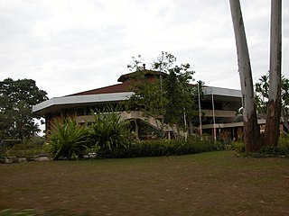
Lilongwe is the capital and most populated city of the African country of Malawi. It has a population of 989,318 as of the 2018 Census, up from a population of 674,448 in 2008. In 2020 that figure was 1,122,000. The city is located in the central region of Malawi, in the district of the same name, near the borders with Mozambique and Zambia, and it is an important economic and transportation hub for central Malawi. It is named after the Lilongwe River.
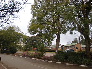
Zomba is a city in southern Malawi, in the Shire Highlands. It is the former capital city of Malawi.
Mzuzu is the capital of Malawi's Northern Region and is the third largest city, by population, in Malawi. The city has 221,272 residents and 20,000 commuters with about 1.7 million people living around the outskirts of the city. It is situated in Mzimba District. Mzuzu lies in a gap in the Viphya Mountains, and the agricultural region surrounding the city specialises in tea, rubber, and coffee cultivation. The Viphya Plantation south of the city is the largest man-made forest in Africa, and the Lunyangwa and Kaning'ina forest reserves lie east of the city.
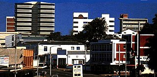
Blantyre is Malawi's centre of finance and commerce, and its second largest city, with an enumerated 800,264 inhabitants as of 2018. It is sometimes referred to as the commercial and industrial capital of Malawi as opposed to the political capital, Lilongwe. It is the capital of the country's Southern Region as well as the Blantyre District.

Dedza is the main township of Dedza District in the Central Region of Malawi.
Mchinji is a town and the capital of the Mchinji District in the Central Region of Malawi. Mchinji Boma, located 12 kilometres from the Zambian border and 109 km (68 mi) from the national capital, Lilongwe, is the major hub of government and general business. It has a major railroad junction, being the railhead nearest to Zambia. The area's economy is sustained by rain-fed agriculture.

Nkhotakota (Un-kho-tah-kho-tuh) is a town and one of the districts in the Central Region of Malawi. It is on the shore of Lake Malawi and is one of the main ports on Lake Malawi. As of 2018, Nkhotakota had a population estimated at 28,350. The district had a population of 301.000.
Balaka is a township in Southern Region, Malawi and headquarters for the Balaka District. The township was formerly a boma of Machinga District, before the Balaka District was created in 1998.
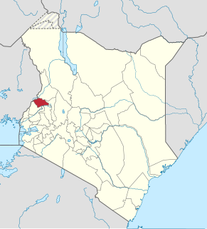
Trans-Nzoia County is a county in the former Rift Valley Province, Kenya, located between the Nzoia River and Mount Elgon, 380 km northwest of Nairobi. At its centre is the town of Kitale which is the capital and largest town. The county borders Bungoma to the west, Uasin Gishu and Kakamega to the south, Elgeyo-Marakwet to the east, West Pokot to the north and the republic of Uganda to the Northwest. Trans Nzoia covers an area of 2495.5 square kilometres.

Kitwe is the third largest city in terms of infrastructure development and second largest city in terms of size and population in Zambia. With a population of 517,543 Kitwe is one of the most developed commercial and industrial areas in the nation, alongside Ndola and Lusaka. It has a complex of mines on its north-western and western edges.

Molepolole is a large village in Kweneng District, Botswana.

Pakur is a town with a nagar palika in the Pakur subdivision of the Pakur district, Jharkhand state, India.
Ntchisi is a district in the Central Region of Malawi. The district covers an area of 1,655 km.² and has a population of 317,069. The capital is Ntchisi.

Zomba District is one of twelve districts in the Southern Region of Malawi, surrounded by the districts of Chiradzulu, Blantyre, Mulanje, Phalombe, Machinga, Balaka and the Republic of Mozambique to the east. The total land area is 2,363 km2, representing three percent of the total land area of Malawi. The capital is Zomba.

Pallikaranai is a neighborhood and a residential area in south Chennai, Tamil Nadu, India. Located in proximity to the IT industry in Old Mahabalipuram Road, Chennai's central business districts and the automobile hub in GST road has attracted more population to Pallikaranai in the 2000s. Pallikaranai became a part of the Chennai Corporation in July 2011.
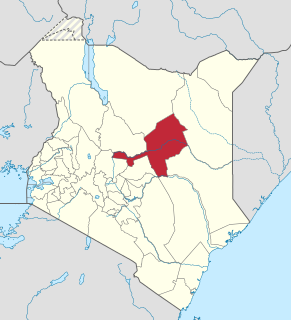
Isiolo County is a county in the former Eastern Province of Kenya. Its population is 268,002 and its capital and largest city is Isiolo. Isiolo County is to be the first county to be developed as part of the Kenya Vision 2030 program. Other upcoming urban centres are: Garbatulla, Modogashe, Kinna, Merti and Oldonyiro.
NBS Bank Limited, commonly referred to as NBS Bank, is a commercial bank in Malawi. It is licensed as a commercial bank, by the Reserve Bank of Malawi, central bank and national banking regulator.
Healthcare in Malawi and its limited resources are inadequate to fully address factors plaguing the population, including infant mortality and the very high burden of diseases, especially HIV/AIDS, malaria and tuberculosis.

Malosa is a small trading centre located in the Zomba District of Malawi. The Malosa mountain range and plateau neighbours the more famous Zomba Plateau and is separated by the Domasi Valley. Malosa is on the M3, 27 km from the city of Zomba. The earth road from the trading post leads from the edge of the main road right up to the base of the Malosa mountain range.
Case Medical Centre, also known as Case Hospital, is an urban, private, upscale, tertiary hospital in Kampala, the capital of Uganda and the largest city in that country. It is one of the five upscale private tertiary care hospitals in the city. The other four hospitals are: International Hospital Kampala, Kampala Hospital, Nakasero Hospital and Paragon Hospital.
