Somers Town is an inner-city district in North West London. It has been strongly influenced by the three mainline north London railway termini: Euston (1838), St Pancras (1868) and King's Cross (1852), together with the Midland Railway Somers Town Goods Depot (1887) next to St Pancras, where the British Library now stands. It was named after Charles Cocks, 1st Baron Somers (1725–1806). The area was originally granted by William III to John Somers (1651–1716), Lord Chancellor and Baron Somers of Evesham.

Mornington Crescent is a terraced street in Camden Town, Camden, London, England. It was built in the 1820s, on a greenfield site just to the north of central London. Many of the houses were subdivided into flats during the Victorian era, and what was the street's communal garden is now the Carreras Building. Mornington Crescent tube station which opened in 1907, takes its name from the street.

Bedford Square is a garden square in the Bloomsbury district of the Borough of Camden in London, England.

Bristol, the largest city in South West England, has an eclectic combination of architectural styles, ranging from the medieval to 20th century brutalism and beyond. During the mid-19th century, Bristol Byzantine, an architectural style unique to the city, was developed, and several examples have survived.

Portland Square is a Grade I listed square in the St Paul's area of Bristol.
There are 212 Grade II* listed buildings in Bristol, England.
The A400 road is an A road in London that runs from Charing Cross to Archway in North London. It passes some of London's most famous landmarks.

Park Square is a large garden square or private appendix to Regent's Park in London and is split from a further green, the long northern side of Park Crescent, by Marylebone Road and (single-entrance) Regent's Park tube station. It consists of two facing rows of large, very classically formed, stuccoed, terraced houses with decorative lower floor balconies and a colonnade of consecutive porticos by architect John Nash, and was built in 1823–24. Alike, shorter-length terraces flank its corners at right angles, equally Grade I listed buildings: Ulster Terrace, Ulster Place, St Andrew's Place and Albany Terrace.

There are 72 Grade II* listed buildings in the city of Brighton and Hove, England. The city, on the English Channel coast approximately 52 miles (84 km) south of London, was formed as a unitary authority in 1997 by the merger of the neighbouring towns of Brighton and Hove. Queen Elizabeth II granted city status in 2000.

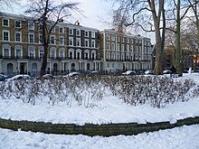
Cartwright Gardens is a crescent shaped park and street located in Bloomsbury, London.

John Johnson was an English architect who specialised in religious buildings and churches in the Gothic style. He was regularly employed by the civil engineer Sir John Kelk to design the homes and public buildings he funded. Johnson is best known for his collaboration with Alfred Meeson on designs for Alexandra Palace in north London; his designs for the Church of St Edward the Confessor in Romford, Essex; and for the Grade I listed St Mary's Church in Tidworth, Wiltshire, which was completed the year he died.

Spa Road in the City of Gloucester runs between the junction of Southgate Street and Llanthony Road in the north and Montpellier in the South. It is joined by Brunswick Road on its north side. It contains a number of listed buildings.

Regent Square is a public square and street in the London Borough of Camden in London, England. It is located near Kings Cross and Bloomsbury.

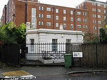
Argyle Square is a garden square in the London Borough of Camden in London, England. It is the main public park in Kings Cross.

Camley Street is a street in the London Borough of Camden in London, England. It lies in St Pancras and King's Cross: stretching over a kilometre from St Pancras railway station in the south, over the Regent's Canal, and to Agar Grove in the north.

Harrington Square is a garden square in the Camden Town area of London, England. It is located at the northern end of Hampstead Road and next to Mornington Crescent tube station.

Chalcot Square is a garden square in the Primrose Hill district of London, England.

Arlington Road is a street running between Mornington Crescent and Camden Town in London. Located in the Borough of Camden, it runs directly parallel to Camden High Street to its east. Heading north to south it is crossed by Inverness Street, Parkway and Delancey Street. It is located close to Gloucester Crescent. While primarily residential, it also features some commercial properties.

Norfolk Square is a rectangular garden square in Paddington in Central London. Located in the City of Westminster, it is part of the Tyburnia district north of Hyde Park. It runs east to west from London Street to Norfolk Place. Praed Street and Sussex Gardens are directly parallel to it north and south respectively.

Norland Square is a garden square in the Notting Hill area of London. Located in the Royal Borough of Kensington and Chelsea, runs northward from Holland Park Avenue to Queensdale Road. The mews street Norland Place runs eastwards of the Square.