Oberhof, Germany

Last updated
Oberhof
Oberhof stadtansicht d schmidt 08 2006.jpg
Oberhof in August 2006
Wappen Stadt Oberhof.svg
Location of Oberhof within Schmalkalden-Meiningen district
Oberhof in SM.pngBirxEinhausenGrabfeldLeutersdorfNeubrunnOberhofRohrRosaRoßdorfSchwarza
Germany adm location map.svg
Red pog.svg
Oberhof
Thuringia location map.svg
Red pog.svg
Oberhof
Coordinates: 50°42′19″N10°43′33″E / 50.70528°N 10.72583°E / 50.70528; 10.72583 Coordinates: 50°42′19″N10°43′33″E / 50.70528°N 10.72583°E / 50.70528; 10.72583
Country Germany
State Thuringia
District Schmalkalden-Meiningen
Government
   Mayor (201824) Thomas Schulz [1]
Area
  Total23.47 km2 (9.06 sq mi)
Elevation
823 m (2,700 ft)
Population
 (2021-12-31) [2]
  Total1,570
  Density67/km2 (170/sq mi)
Time zone UTC+01:00 (CET)
  Summer (DST) UTC+02:00 (CEST)
Postal codes
98559
Dialling codes 036842
Vehicle registration SM
Website www.oberhof.de

Oberhof is a town in the Schmalkalden-Meiningen district of Thuringia, Germany. Located in the Thuringian Forest mountain range, it is a winter sports center and health resort. With 1,625 inhabitants (December 2016), it is visited by 144,000 tourists every year (2016). [3] The town obtained its official city status in 1985.

Contents

History

Oberhof was first mentioned in a document in 1470. The village in the Black Forest department belonged to various Ernestine duchies, most recently to the Duchy of Saxe-Coburg and Gotha from 1826 to 1918. In 1830, Ernest I, Duke of Saxe-Coburg and Gotha had a hunting lodge built. In 1861 the first vacation guests came to the village. With the completion of the Brandleite Tunnel of the Neudietendorf-Ritschenhausen railway, Oberhof received a railroad connection in 1884, which enabled the expansion of tourism.

After the founding of the Oberhof Winter Sports Association, on the initiative of the Oberhof physician Kurt Weidhaas, in February 1904, the town developed into a center of winter sports. In 1906 the first bobsleigh run and the first ski jump were inaugurated. In 1931, world championships were held in the town for the first time, in two-man bobsleigh and Nordic combined on the Hindenburg ski jump.

From 1951 to 1956, the GDR Winter Sports Championships were held in Oberhof. In 1964, the construction of the large ski jump on the Rennsteig for ski jumping was completed and in 1971 the luge track was finished, on which the FIL World Luge Championships were held for the first time in 1973.

From 1968 to 1978, Oberhof was expanded and reconstructed with extensive demolition of the existing building fabric, which completely changed the character of the place. Walter Ulbricht, the chairman of the Council of State, called in his Berlin architect Hermann Henselmann for the planning. Both were fond of representative symbolic architecture. When Ulbricht was replaced, not all the plans were realized. The accommodation capacity of the hotels and homes was increased to 4500 beds. This included the construction of the large hotel complexes Panorama (1969) in the shape of ski jumps, Rennsteig (1973) in the shape of a racing stone and Fritz Weineck (1975). In 1971, the Obere Hof, with seven restaurants, was opened in the center of the village as an adventure center. A new residential area was built in prefabricated slab construction.

A high ropes course was built on the grounds of the spa park in 2001 and dismantled in 2016. In 2011, the resort had 3500 guest beds.

On October 7, 1985, Oberhof received the town charter.

Geography

Oberhof is located in the Thuringian Forest, a low mountain range, at an altitude of about 815 meters. The town is located on a plateau, which is why there are no great differences in altitude in the built-up area. About four kilometers to the southeast are the two highest mountains in Thuringia, the 983-meter-high Großer Beerberg and the 978-meter-high Schneekopf. Southwest of Oberhof there are also two Rennsteig passes: the pass at the Grenzadler (former state border between the Duchy of Saxe-Coburg and Gotha and Prussia) and the pass at the Rondell monument. Several rivers also rise near Oberhof, the Gera in the east, the Ohra in the north, the Hasel in the south and the Schönau in the west. The surroundings of Oberhof are completely forested, the most common tree species is spruce.

Climate

The climate of Oberhof is very harsh, therefore the place could not develop before 1900. Unlike the other villages of the Thuringian Forest, Oberhof is located unprotected to the north, west and east on a plateau. The nearest weather station is on the Schmücke about six kilometers away on the Rennsteig. The annual precipitation is very high with about 1300 mm, the average annual temperature is in the low range with 4.4 °C. The average July temperature is 12.8 °C, and the January temperature is -4.0 °C. Snow usually falls from mid-November to the end of March.

Like many low mountain regions dependent on winter sports, Oberhof is also affected by the effects of climate change. Thus, the region is no longer "snow-sure", as was still the case in the past.

The Band of the Berlin People's Police (Orchester der Berliner Volkspolizei) in Oberhof. Bundesarchiv Bild 183-09688-0005, Oberhof, Nordische Kombination, VP-Orchester.jpg
The Band of the Berlin People's Police (Orchester der Berliner Volkspolizei) in Oberhof.

International sports events

Attractions

Kanzlersgrund Schanzenanlage im Kanzlersgrund bei Oberhof.jpg
Kanzlersgrund

International relations

Oberhof, Germany is twinned with:

Related Research Articles

<span class="mw-page-title-main">Thuringia</span> State in Germany

Thuringia, officially the Free State of Thuringia, is a state of central Germany, covering 16,171 square kilometres (6,244 sq mi), the sixth smallest of the sixteen German states. It has a population of about 2.1 million.

<span class="mw-page-title-main">Thuringian Forest</span> Mountain range in the German state of Thuringia

The Thuringian Forest, is a mountain range in the southern parts of the German state of Thuringia, running northwest to southeast. Skirting from its southerly source in foothills to a gorge on its north-west side is the Werra valley. On the other side of the Forest is an upper outcrop of the North German Plain, the Thuringian Basin, which includes the city Erfurt. The south and south-east continuation of the range is the highland often called the Thuringian-Vogtlandian Slate Mountains.

<span class="mw-page-title-main">Saxe-Coburg and Gotha</span> Collective name for the duchies of Saxe-Coburg and Saxe-Gotha in Germany

Saxe-Coburg and Gotha, or Saxe-Coburg-Gotha, was an Ernestine, Thuringian duchy ruled by a branch of the House of Wettin, consisting of territories in the present-day states of Thuringia and Bavaria in Germany. It lasted from 1826 to 1918. In November 1918, Charles Edward, Duke of Saxe-Coburg and Gotha, was forced to abdicate. In 1920, the northern part of the duchy was merged with six other Thuringian free states to form the Free State of Thuringia: Saxe-Weimar-Eisenach, Saxe-Altenburg and Saxe-Meiningen, Schwarzburg-Rudolstadt and Schwarzburg-Sondershausen, as well as the People's State of Reuss. The southern part of the duchy, as southernmost of the Thuringian states, was the only one which, after a referendum, became part of the Free State of Bavaria.

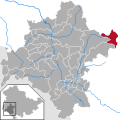
Gotha is a Kreis (district) in western central Thuringia, Germany. Neighboring districts are Unstrut-Hainich-Kreis, Sömmerda, the Kreis-free city Erfurt, Ilm-Kreis, Schmalkalden-Meiningen and the Wartburgkreis.

Schmalkalden-Meiningen is a Landkreis in the southwest of Thuringia, Germany. Its neighboring districts are the districts Wartburgkreis, Gotha, Ilm-Kreis, the district-free city Suhl, the district Hildburghausen, the Bavarian district Rhön-Grabfeld, and the district Fulda in Hesse.

<span class="mw-page-title-main">Saalfeld</span> Town in Thuringia, Germany

Saalfeld is a town in Germany, capital of the Saalfeld-Rudolstadt district of Thuringia. It is best known internationally as the ancestral seat of the Saxe-Coburg and Gotha branch of the Saxon House of Wettin.

<span class="mw-page-title-main">Sonneberg</span> Town in Thuringia, Germany

Sonneberg in Thuringia, Germany, is the seat of the Sonneberg district. It is in the Franconian south of Thuringia, neighboring its Upper Franconian twin town Neustadt bei Coburg.

<span class="mw-page-title-main">Hildburghausen</span> Town in Thuringia, Germany

Hildburghausen is a town in Thuringia in central Germany, capital of the district Hildburghausen.

<span class="mw-page-title-main">Ruhla</span> Town in Thuringia, Germany

Ruhla  is a town situated in the forest of Thuringia in the district of Wartburgkreis in Germany, immediately next to the Rennsteig. Thal and Kittelsthal are parts of the town.

<span class="mw-page-title-main">Gräfenroda</span> Ortsteil of Geratal in Thuringia, Germany

Gräfenroda is a village and a former municipality in the Ilm-Kreis district, in Thuringia, Germany. Since 1 January 2019, it is part of the municipality Geratal. It was the administrative seat of the former Verwaltungsgemeinschaft Oberes Geratal.

<span class="mw-page-title-main">Friedrichroda</span> Town in Gotha, Thuringia, Germany

Friedrichroda is a town in the district of Gotha, Thuringia, Germany. It is situated at the north foot of the Thuringian Forest, 21 km by rail southwest of the town of Gotha. It is surrounded by fir-clad hills and possesses numerous handsome villa residences, a Kurhaus and a sanatorium. In the immediate neighborhood is the beautiful ducal hunting seat of Reinhardsbrunn, built out of the ruins of the famous Benedictine monastery founded in 1085. On 1 December 2007, the former municipalities Ernstroda and Finsterbergen were incorporated by Friedrichroda.

<span class="mw-page-title-main">André Lange</span> German bobsledder

André Lange is a retired German bobsledder and one of the most successful bob pilots of all time. Competing at the 2002, 2006 and 2010 Winter Olympics, he has won four gold and one silver medals. Lange originally started his sledding career as a luger, taking up bobsleigh in 1993.

<span class="mw-page-title-main">Jens Müller (luger)</span> East German luger

Jens Müller is an East German-German luger who competed from 1985 to 2001. He won two medals at the Winter Olympics in men's singles with a gold at Calgary in 1988 and a bronze at Nagano in 1998.

<span class="mw-page-title-main">Coat of arms of Thuringia</span> Coat of arms of the German state of Thuringia

The coat of arms German state Thuringia was introduced in 1990. Like the 1949 coat of arms of Hesse it is based on the Ludovingian lion barry, also known as the "lion of Hesse", with the addition of eight mullets.

<span class="mw-page-title-main">Lichte</span> Ortsteil of Neuhaus am Rennweg in Thuringia, Germany

Lichte is a village and a former municipality in the district of Sonneberg in Thuringia, Germany, close to the Thuringian Rennsteig. Formerly in the district Saalfeld-Rudolstadt, it is part of the town Neuhaus am Rennweg since January 2019.

<span class="mw-page-title-main">Saxe-Römhild</span>

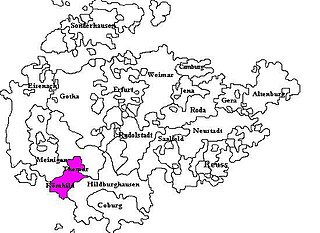
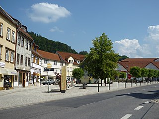
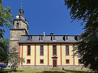
Saxe-Römhild was an Ernestine duchy in the southern foothills of the Thuringian Forest. It existed for only 30 years, from 1680 to 1710.

<span class="mw-page-title-main">Thuringian states</span> Several federal states within the German Reich

The Thuringian states refers to the following German federal states within the German Reich:

<span class="mw-page-title-main">Rennsteig</span> Long-distance trail in Germany

The Rennsteig is a ridge walk as well as an historical boundary path in the Thuringian Forest, Thuringian Highland and Franconian Forest in Central Germany. The long-distance trail runs for about 170 km from Eisenach and the Werra valley in the northwest to Blankenstein and the Selbitz river in the southeast.

<span class="mw-page-title-main">Ebertswiese</span>

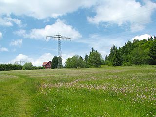
The Ebertswiese, is a boggy area of grassland in the Thuringian Forest in central Germany. It has been a nature conservation area since 1936 and is a recreation area in the municipality of Floh-Seligenthal on the Rennsteig trail. The River Spitter has its source within the reserve.

<span class="mw-page-title-main">Venues of the 1980 Winter Olympics</span>

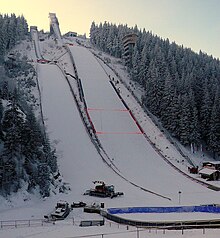
For the 1980 Winter Olympics in Lake Placid, New York, United States, a total of seven sports venues were used. All five of the venues used for the 1932 Winter Olympics were also used at the 1980 Winter Games with adjustments. These adjustments included electronic scoreboards, increased refrigeration, and the addition of a separate luge track. This was the last Winter Olympics where there were separate bobsleigh and luge tracks. The closest finish in Olympic history in cross-country skiing led skiing officials to time future events in hundredths of a second rather than tenths of a second. This would also apply to biathlon events. Eric Heiden won five gold medals at the speed skating oval while the "Miracle on Ice" took place between Americans and Soviets at the Olympic Center. In the late 1990s, the luge track was demolished and a new combination track was constructed in time for the only Winter Goodwill Games held. The sliding venue was named to the American National Register of Historical Places in February 2010.

References

  1. Gewählte Bürgermeister - aktuelle Landesübersicht, Freistaat Thüringen, accessed 14 July 2021.
  2. "Bevölkerung der Gemeinden, erfüllenden Gemeinden und Verwaltungsgemeinschaften in Thüringen Gebietsstand: 31.12.2021" (in German). Thüringer Landesamt für Statistik. June 2022.
  3. Gäste und Übernachtungen in Thüringen Dezember 2016

Commons-logo.svg Media related to Oberhof at Wikimedia Commons