Obertilliach

Last updated
Obertilliach
Obertilliach Pfarrkirche St Ulrich 04.jpg
St Ulrich parish church
Wappen at obertilliach.png
Obertilliach.png
Location within Lienz district
Austria adm location map.svg
Red pog.svg
Obertilliach
Location within Austria
Coordinates: 46°42′31″N12°36′58″E / 46.70861°N 12.61611°E / 46.70861; 12.61611 Coordinates: 46°42′31″N12°36′58″E / 46.70861°N 12.61611°E / 46.70861; 12.61611
Country Austria
State Tyrol
District Lienz
Government
   Mayor Matthias Scherer (ÖVP)
Area
[1]
  Total65.05 km2 (25.12 sq mi)
Elevation
1,450 m (4,760 ft)
Population
 (2018-01-01) [2]
  Total666
  Density10/km2 (27/sq mi)
Time zone UTC+1 (CET)
  Summer (DST) UTC+2 (CEST)
Postal code
9942
Area code 04847
Vehicle registration LZ
Website www.obertilliach.gv.at

Obertilliach is a municipality in the district of Lienz, in the Austrian state of Tyrol.

Contents

Geography

Tilliach Valley, view from Carnic Alps Obertilliach.JPG
Tilliach Valley, view from Carnic Alps

It is located in East Tyrol, in a high valley of the upper Gail River east of the Kartitsch Saddle known as Lesachtal, between the Gailtal Alps (Lienz Dolomites) in the north and the Carnic Alps in the south. Down the valley to the east lies the neighbouring municipality of Untertilliach, the mountain crest in the south marks the border with the Venetian Cadore region in Italy.

The municipal area comprises Obertilliach proper around the St Ulrich parish church and the small villages of Bergen, Leiten, and Rodarm. Compared to the nearby Puster Valley west of the Kartitsch Saddle, a more Alpine climate prevails in the high up region with harsh winters but plenty of sunshine. Originally an agricultural area, Obertilliach today largely depends on tourism and is a popular destination for biathletes and cross-country skiers as well as for hikers, mountaineers and paragliders in summer.

History

Bavarian settlement of the area is first mentioned in the late 11th century. In early medieval times, the slopes to the south were used by Italian peasants from Cadore to pasture their livestock. In the eighth century, Duke Tassilo III of Bavaria ceded the upper Gail Valley to the Benedictine monks of Innichen Abbey. The Tilliach area was acquired by the Prince-bishops of Brixen in about 1075.

From about 1100, the Bavarian House of Gorizia (Görz) residing at Lienz, nominally vassals of the Brixen bishops, consolidated their rule over the Tilliach region, contested by both the Prince-bishops of Salzburg and the Sponheim dukes of Carinthia in the east. When the last of the Counts of Gorizia died in 1500, their estates around Lienz fell to the Habsburg emperor Maximilian I and were incorporated into the County of Tyrol.

Longtime quarrels with the Republic of Venice were settled when the border with the Venetian Domini di Terraferma was established along the Carnic mountain crest. The Prince-Bishops of Brixen insisted upon their feudal rights in the Tilliach valley until the secularisation of the diocese in 1803; however, they were not able to effectively control the remote region. The present-day municipality was established in 1852.

Population

Historical population
YearPop.±%
1869803    
1880768−4.4%
1890727−5.3%
1900709−2.5%
1910639−9.9%
1923595−6.9%
1934682+14.6%
1939676−0.9%
1951759+12.3%
1961807+6.3%
1971822+1.9%
1981824+0.2%
1991783−5.0%
2001796+1.7%
2012712−10.6%

Politics

Seats in the municipal assembly (Gemeinderat):

Related Research Articles

Tyrol (state) State of Austria

Tyrol is a state (Land) in western Austria. It comprises the Austrian part of the historical Princely County of Tyrol. It is a constituent part of the present-day Euroregion Tyrol–South Tyrol–Trentino. The capital of Tyrol is Innsbruck.

Gail (river)

Gail is the name of a river in southern Austria, the largest right tributary of the Drava. Its drainage basin is 1,413.9 km2 (545.9 sq mi).

Lienz Place in Tyrol, Austria

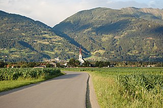
Lienz is a medieval town in the Austrian state of Tyrol. It is the administrative centre of the Lienz district, which covers all of East Tyrol. The municipality also includes the cadastral subdivision of Patriasdorf.

Puster Valley District in Italy

The Puster Valley is one of the largest longitudinal valleys in the Alps that runs in an east-west direction between Lienz in East Tyrol, Austria, and Mühlbach near Brixen in South Tyrol, Italy. The South Tyrolean municipalities of the Puster Valley constitute the Puster Valley district.

Lofer Place in Salzburg, Austria

Lofer is a market town in the district of Zell am See in the Austrian state of Salzburg.

County of Tyrol Estate of the Holy Roman Empire (1140-1806); county of Austria (1806-1919)

The (Princely) County of Tyrol was an estate of the Holy Roman Empire established about 1140. After 1253, it was ruled by the House of Gorizia and from 1363 by the House of Habsburg. In 1804, the county of Tyrol, unified with the secularised prince-bishoprics of Trent and Brixen, became a crown land of the Austrian Empire. From 1867, it was a Cisleithanian crown land of Austria-Hungary.

Sappada Comune in Friuli-Venezia Giulia, Italy

Sappada is a comune (municipality) in the Province of Udine, in the Italian region of Friuli-Venezia Giulia.

House of Gorizia Noble family in the Holy Roman Empire

The Counts of Gorizia, also known as the Meinhardiner, were a comital, princely and ducal dynasty in the Holy Roman Empire. Named after Gorizia Castle in Gorizia, they were originally "advocates" (Vogts) in the Patriarchate of Aquileia who ruled the County of Gorizia (Görz) from the early 12th century until the year 1500. Staunch supporters of the Emperors against the papacy, they reached the height of their power in the aftermath of the battle of Marchfeld between the 1280s and 1310s, when they controlled most of contemporary Slovenia, western and south-western Austria and north-eastern Italy mostly as (princely) Counts of Gorizia and Tyrol, Landgraves of Savinja and Dukes of Carinthia and Carniola. After 1335, they began a steady decline until their territories shrunk back to the original County of Gorizia by the mid 1370s. Their remaining lands were inherited by the Habsburg ruler Maximilian I.

Dellach Place in Carinthia, Austria

Dellach is a municipality in the district of Hermagor, in the Austrian state of Carinthia.

Kötschach-Mauthen Place in Carinthia, Austria

Kötschach-Mauthen is a market town in the district of Hermagor in Carinthia in Austria.

Lesachtal Place in Carinthia, Austria

Lesachtal is a municipality in Hermagor District, in the Austrian state of Carinthia. It comprises the western part of the eponymous valley formed by the upper Gail River, and stretches from the Carinthian border with East Tyrol down to Kötschach-Mauthen in the east.

Oberdrauburg Place in Carinthia, Austria

Oberdrauburg is a market town in the district of Spittal an der Drau at the western rim of the Austrian state of Carinthia.

Obervellach Place in Carinthia, Austria

Obervellach is a market town in the district of Spittal an der Drau, in the Austrian state of Carinthia.

Sachsenburg Place in Carinthia, Austria

Sachsenburg is a market town in the district of Spittal an der Drau in Carinthia, Austria.

Sillian Place in Tyrol, Austria

Sillian is a market town in the district of Lienz, in the Austrian state of Tyrol.

Anras Place in Tyrol, Austria

Anras is a municipality in the district of Lienz in the Austrian state of Tyrol.

Tristach Place in Tyrol, Austria

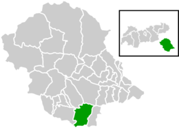
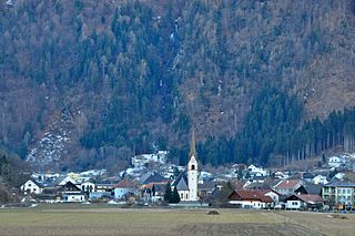
Tristach is a municipality in the district of Lienz in the Austrian state of Tyrol.

Kartitsch Place in Tyrol, Austria

Kartitsch is a municipality in the district of Lienz in the Austrian state of Tyrol.

Matrei in Osttirol Place in Tyrol, Austria

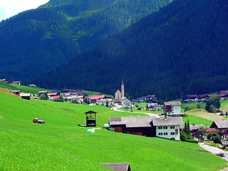
Matrei in Osttirol is a market town in the Lienz District in the Austrian state of Tyrol. It is situated about 29 km (18 mi) north of Lienz within the Hohe Tauern mountain range of the Central Eastern Alps. Its municipal area comprises parts of the Granatspitze Group and the Venediger Group, with the Großvenediger peak as its highest point. The population largely depends on tourism, seasonal agriculture and forestry.

Gailtal Alps

The Gailtal Alps, is a mountain range of the Southern Limestone Alps in Austria. It rises between the River Drava (Drau) and the Gail valley and through the southern part of East Tyrol. Its western group called "Lienz Dolomites", is sometimes counted as part of this range and sometimes seen as separate.

References

  1. "Dauersiedlungsraum der Gemeinden Politischen Bezirke und Bundesländer - Gebietsstand 1.1.2018". Statistics Austria. Retrieved 10 March 2019.
  2. "Einwohnerzahl 1.1.2018 nach Gemeinden mit Status, Gebietsstand 1.1.2018". Statistics Austria. Retrieved 9 March 2019.

Commons-logo.svg Media related to Obertilliach at Wikimedia Commons