
Fiordland National Park occupies the southwest corner of the South Island of New Zealand. It is by far the largest of the 14 national parks in New Zealand, with an area of 12,607 square kilometres (4,868 sq mi), and a major part of the Te Wahipounamu World Heritage site. The park is administered by the Department of Conservation.

Jackson Bay / Okahu is a gently curving bay 24 kilometres wide, located on the West Coast of New Zealand's South Island. It faces the Tasman Sea to the north, and is backed by the Southern Alps. The westernmost point of the bay is marked by the headland of Jackson Head; in the northeast the end of the bay is less well defined, but the small alluvial fan of the Turnbull and Okuru Rivers might be considered its farthest point. The small Open Bay Islands lie five kilometres off the coast at this point.

Te Wāhipounamu is a World Heritage Site in the south west corner of the South Island of New Zealand.

Mount Aspiring / Tititea is New Zealand's 23rd-highest mountain. It is the country's highest outside the Aoraki / Mount Cook region.

Waipa District is a municipality in the Waikato region of New Zealand that is administered by the Waipa District Council. Its most populous town is Cambridge. The seat of the council is at the second most populous town, Te Awamutu. The district is south and south-east of the city of Hamilton. It has five wards: Te Awamutu, Cambridge, Pirongia, Maungatautari and Kakepuku.

The Hollyford Track is a tramping track in New Zealand. Located at the northern edge of Fiordland, in the southwestern South Island, it is unusual among Fiordland's major tracks in that it is largely flat and accessible year-round. It follows the Hollyford River which in turn follows the course of the Hollyford Valley.

Granity is a small town on the West Coast of New Zealand's South Island, 28 kilometres (17 mi) north-east of Westport on State Highway 67. Karamea is 68 kilometres (42 mi) further north.
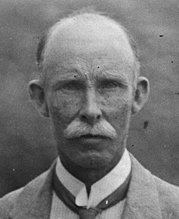
William Herbert Guthrie-Smith FRSNZ was a New Zealand farmer, author and conservationist.

An ice field is a large area of interconnected glaciers, usually found in a mountainous region. They are often found in the colder climates and higher altitudes of the world where there is sufficient precipitation for them to form. The higher peaks of the underlying mountain rock that protrude through the icefields are known as nunataks. Ice fields are larger than alpine glaciers, but smaller than ice caps and ice sheets. The topography of ice fields is determined by the shape of the surrounding landforms, while ice caps have their own forms overriding underlying shapes.

The New Zealand Electronic Text Collection is a freely accessible online archive of New Zealand and Pacific Islands texts and heritage materials that are held by the Victoria University of Wellington Library. It was named the New Zealand Electronic Text Centre until October 2012.

Lake Marian is an alpine lake at the southern end of the Darran Mountains in the Fiordland National Park in the South Island of New Zealand. The lake is located just above the treeline in a hanging valley leading northwest from the Hollyford Valley near The Divide pass. The valley is sheltered by steep snow-covered peaks of over 2,000 metres (6,600 ft) on all sides apart from the entrance.
David John Gunn, generally known as Davey or Davy, was a New Zealander and promoter of the Hollyford Track. A farmer and bushman, he ran his almost wild cattle in the glacier-cut Hollyford Valley in Fiordland, South Westland, New Zealand.

The Forgotten River is located in northern Fiordland, New Zealand and is a tributary of the Olivine River. The Forgotten River starts at the Forgotten River Col at the western edge of the Olivine Ice Plateau in the Five Finger Range. It flows south-westward to join the Olivine River as a hanging valley south of Four Brothers Pass.

Wright Upper Glacier is an ice apron at the upper west end of Wright Valley in Asgard Range, Antarctica. It is formed by a glacier flowing east from the inland ice plateau. Named by the Victoria University of Wellington Antarctic Expedition (VUWAE) (1958–59) for C.S. Wright, a member of the British Antarctic Expedition (1910–13), after whom the "Wright Glacier" was named.

The Haast-Hollyford road or Haast-Hollyford Highway is a long-standing proposal to link Haast via the Hollyford Valley to Milford Sound and Te Anau in the South Island of New Zealand. Proposals for this road have been mooted since the 1880s.

Charles Edward Douglas was a New Zealand surveyor and explorer, who came to be known as Mr. Explorer Douglas, owing to his extensive explorations of the West Coast of New Zealand and his work for the New Zealand Survey Department. He was awarded the Royal Geographical Society Gill Memorial Prize in 1897.
William Arthur Greener Penlington (1890–1982) was a New Zealand school principal and educationalist. He was born on Banks Peninsula in Akaroa, New Zealand in 1890 to an early-settler family.

The Humboldt Mountains or Humboldt Range are one of the many ranges which make up the Southern Alps in the South Island of New Zealand. They lie to the northwest of Lake Wakatipu in the Otago Region. Parts of the range lie within Fiordland National Park, and they form the southern extremity of Mount Aspiring National Park. The range was named by early explorer James McKerrow, and like many geographic features worldwide, it was named in honour of notable scientist Alexander von Humboldt.

Martins Bay is an indentation in the southwest coast of New Zealand's South Island. It lies immediately to the south of Big Bay and some 30 kilometres north of the mouth of Milford Sound at the northern tip of Fiordland. The Hollyford River reaches the Tasman Sea at Martins Bay.
Clara Cheeseman was a novelist from England who emigrated to New Zealand as a child.
