
Ontonagon County is a county in the Upper Peninsula of the U.S. state of Michigan. As of the 2020 Census, the population was 5,816, making it Michigan's third-least populous county. The county seat is Ontonagon. The county was set off in 1843, and organized in 1848. Its territory had been organized as part of Chippewa and Mackinac counties. With increasing population in the area, more counties were organized. After Ontonagon was organized, it was split to create Gogebic County. It is also the westernmost U.S. county that uses the Eastern Time Zone.

L'Anse is a village in northwest Michigan, United States, and the county seat of Baraga County. The population was 2,011 at the 2010 census. The village is located within L'Anse Township.

Watersmeet Township is a civil township of Gogebic County in the Upper Peninsula of the U.S. state of Michigan. The population was 1,417 at the 2010 census, slightly down from 1,472 at the 2000 census. Chippewa students made up half of the student body and winning high school basketball team in the early 2000s. It was featured in the 2007 documentary Nimrod Nation, shown on The Sundance Channel.

The Ojibwe, Ojibwa, Chippewa, or Saulteaux are an Anishinaabe people in what is currently southern Canada, the northern Midwestern United States, and Northern Plains.

The L'Anse Indian Reservation is the land base of the federally recognized Keweenaw Bay Indian Community of the historic Lake Superior Band of Chippewa Indians.. The reservation is located primarily in two non-contiguous sections on either side of the Keweenaw Bay in Baraga County in the Upper Peninsula of the U.S. state of Michigan.

The Bay Mills Indian Community (BMIC), is an Indian reservation forming the land base of one of the many federally recognized Sault Ste. Marie bands of Chippewa.

The Lac du Flambeau Band of Lake Superior Chippewa is a federally recognized Ojibwa Native American tribe, with an Indian reservation lying mostly in the Town of Lac du Flambeau in south-western Vilas County, and in the Town of Sherman in south-eastern Iron County in the U.S. state of Wisconsin. The Lac du Flambeau Indian Reservation, located at 45°59′05″N89°52′38″W, has a land area of 108.065 sq mi (279.887 km²) and a 2000 census resident population of 2,995 persons. Its major settlement is the unincorporated Lac du Flambeau, which had a population of 1,646 persons.

The Bad River LaPointe Band of the Lake Superior Tribe of Chippewa Indians or Bad River Tribe for short are a federally recognized tribe of Ojibwe people. The Bad River Reservation is located on the south shore of Lake Superior and has a land area of 156,000 acres in northern Wisconsin, straddling Ashland and Iron counties. The tribe has approximately 7,000 members, of whom about 1,800 lived on the reservation during the 2000 census.

The White Earth Indian Reservation is the home to the White Earth Band, located in northwestern Minnesota. It is the largest Indian reservation in the state by land area. The reservation includes all of Mahnomen County, plus parts of Becker and Clearwater counties in the northwest part of the state along the Wild Rice and White Earth rivers. It is about 225 miles (362 km) from Minneapolis–Saint Paul and roughly 65 miles (105 km) from Fargo–Moorhead.
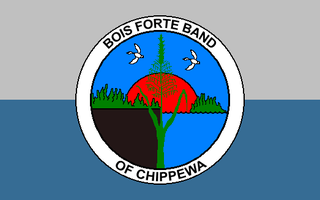
Bois Forte Indian Reservation is an Indian reservation formed for the Bois Forte Band of Chippewa.

The Fond du Lac Indian Reservation is an Indian reservation in northern Minnesota near Cloquet in Carlton and Saint Louis counties. Off-reservation holdings are located across the state in Douglas County, in the northwest corner of Wisconsin. The total land area of these tribal lands is 153.8375 square miles (398.437 km2). It is the land-base for the Fond du Lac Band of Lake Superior Chippewa. Before the establishment of this reservation, the Fond du Lac Band of Lake Superior Chippewa were located at the head of Lake Superior, closer to the mouth of the Saint Louis River, where Duluth has developed.

The Grand Portage Indian Reservation is the Indian reservation of the Grand Portage Band of Minnesota Chippewa Tribe, a federally recognized tribe in Minnesota.

The Leech Lake Reservation is an Indian reservation located in the north-central Minnesota counties of Cass, Itasca, Beltrami, and Hubbard. The reservation forms the land base for the federally recognized Leech Lake Band of Ojibwe, one of six bands comprising the Minnesota Chippewa Tribe, organized in 1934. The Leech Lake Reservation has the highest population of any reservation in Minnesota, with a resident population of 10,660 indicated by the 2010 United States census.

The Lac Courte Oreilles Tribe is one of six federally recognized bands of Ojibwe people located in present-day Wisconsin. The band is based at the Lac Courte Oreilles Indian Reservation, at 45°52′59″N91°19′13″W in northwestern Wisconsin, which surrounds Lac Courte Oreilles. The main reservation's land is in west-central Sawyer County, but two small plots of off-reservation trust land are located in Rusk, Burnett, and Washburn counties. The Reservation was established in 1854 by the second Treaty of La Pointe.

The Grand Traverse Band of Ottawa and Chippewa Indians is a federally recognized Native American tribe located in northwest Michigan on the Leelanau Peninsula. Sam McClellan is the current tribal chairman, elected in June 2016 to a four-year term after succeeding Al Pedwaydon, who served from 2012 to 2016.

The Treaty of La Pointe may refer to either of two treaties made and signed in La Pointe, Wisconsin between the United States and the Ojibwe (Chippewa) Native American peoples. In addition, the Isle Royale Agreement, an adhesion to the first Treaty of La Pointe, was made at La Pointe.

Indigenous peoples of the Northeastern Woodlands include Native American tribes and First Nation bands residing in or originating from a cultural area encompassing the northeastern and Midwest United States and southeastern Canada. It is part of a broader grouping known as the Eastern Woodlands. The Northeastern Woodlands is divided into three major areas: the Coastal, Saint Lawrence Lowlands, and Great Lakes-Riverine zones.

The Sandy Lake Tragedy was the culmination in 1850 of a series of events centered in Sandy Lake, Minnesota that resulted in the deaths of several hundred Lake Superior Chippewa. Officials of the Zachary Taylor Administration and Minnesota Territory sought to relocate several bands of the tribe to areas west of the Mississippi River. By changing the location for fall annuity payments, the officials intended the Chippewa to stay at the new site for the winter, hoping to lower their resistance to relocation. Due to delayed and inadequate payments of annuities and lack of promised supplies, about 400 Ojibwe, mostly men and 12% of the tribe, died of disease, starvation and cold. The outrage increased Ojibwe resistance to removal. The bands effectively gained widespread public support to achieve permanent reservations in their traditional territories.
The Lake Superior Chippewa are a large number of Ojibwe (Anishinaabe) bands living around Lake Superior; this territory is considered part of northern Michigan, Wisconsin, and Minnesota in the United States. They migrated into the area by the seventeenth century, encroaching on the Eastern Dakota people who historically occupied the area. The Ojibwe defeated the Eastern Dakota and had their last battle in 1745, after which the Dakota Sioux migrated west into the Great Plains. While sharing a common culture and Anishinaabe language, this group of Ojibwe is highly decentralized, with at least twelve independent bands in this region.

Lac Vieux Desert Band of Lake Superior Chippewa is a band of the Lake Superior Chippewa, many of whom reside on the Lac Vieux Desert Indian Reservation, located near Watersmeet, Michigan. It is approximately 45 miles southeast of Ironwood, Michigan in Gogebic County.


