Maseru is the capital and largest city of Lesotho. It is also the capital of the Maseru District. Located on the Caledon River, Maseru lies directly on the Lesotho–South Africa border. Maseru had a population of 330,760 in the 2016 census. The city was established as a police camp and assigned as the capital after the country became a British protectorate in 1869. When the country achieved independence in 1966, Maseru retained its status as capital. The name of the city is a Sesotho word meaning "red sandstones".

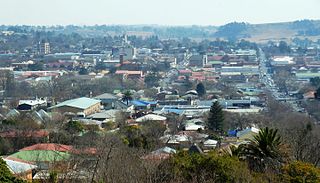
Kroonstad, officially named Maokeng, is the fourth largest town in the Free State and lies two hours' drive on the N1 from Gauteng. It is the second-largest commercial and urban centre in the Northern Free State, and an important railway junction on the main line from Cape Town to Johannesburg. Maokeng is Sesotho and means "place of the thorn trees ".
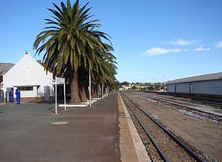
Colenso is a town in KwaZulu-Natal, South Africa. It is located on the southern bank of the Tugela River on the R103 road. The original settlement was contained within a loop on the river, but it subsequently expanded southwards and eastwards. It lies on the main Durban - Johannesburg railway line some 190 km (118 mi) north-west of Durban.
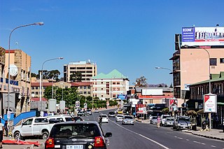
Bethlehem is a city in the eastern Free State province of South Africa that is situated on the Liebenbergs river along a fertile valley just north of the Rooiberg Mountains on the N5 road. It is the fastest growing city in the Free state province, with its target of being the third largest city after Bloemfontein and Welkom.

Petrus Steyn, officially renamed Mamafubedu, is a small farming town between Tweeling and Kroonstad, 35 km north-east of Lindley in the Free State province of South Africa. It is at the centre of an agricultural area known for wheat, maize, sunflower, potato, cattle, hunting, sheep production and forms part of the breadbasket in the Free State. It is the highest town above sea level in the Free State. In 2012 the town's name was changed to Mamafubedu. Farming industries in Mamafubedu provide potatoes worldwide.
Reitz is a small maize, wheat and cattle farming town located in the east of the Free State province of South Africa.

Warden is a town situated in the Free State province of South Africa on the N3 highway between Johannesburg and Durban.

Edenville is a small farming town situated in the northern Free State province of South Africa.

Heilbron is a small farming town in the Free State province of South Africa which services the cattle, dairy, sorghum, sunflower and maize industries. Raw stock beneficiation occurs in leisure foods, dairy products and stock feeds. It also serves as a dormitory town for the Gauteng metropolis.

Edenburg is a town situated about 80 kilometres (50 mi) south of Bloemfontein in the Free State province of South Africa. As of 2001, it had a population of 14,566.
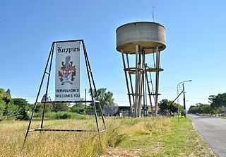
Koppies is a small town situated near the Renoster River in the Free State province of South Africa.

The R34 is a long provincial route in South Africa that connects Vryburg with Richards Bay via Kroonstad and Newcastle. It passes through three provinces, North West, the Free State and KwaZulu-Natal.

The R57 is a provincial route in South Africa that connects Vanderbijlpark with Phuthaditjhaba via Sasolburg, Heilbron and Reitz.

The R82 is a provincial route in South Africa that connects Johannesburg with Kroonstad via Vereeniging and Sasolburg. It starts just south of the M1 Johannesburg Municipal Highway's interchange with the N12 Southern Bypass, going south, meeting the R59, R54, R42 & R28 routes at Vereeniging before crossing the Vaal River into the Free State & proceeding to Kroonstad. It is an alternative, but longer route to the N1 National Route between Johannesburg & Kroonstad.

Port Alfred is a small town with a population of just under 26,000 in the Eastern Cape province of South Africa. It is situated on the eastern seaboard of the country at the mouth of the Kowie River, almost exactly halfway between the larger cities of Gqeberha and East London and 30 kilometres (19 mi) west of Cannon Rocks.

Vredendal is a town in the northern Olifants River Valley in the Western Cape province of South Africa, with a population of 16,164 people. It lies 250 kilometres (160 mi) north of Cape Town on the banks of the Olifants River at the southern edge of Little Namaqualand.

The T1 or Lusaka–Livingstone Road is the main highway of the Southern Province of Zambia. It begins 55 kilometres south of the city of Lusaka and heads south-west to the principal tourist destination, Victoria Falls in Livingstone, via Mazabuka, Monze, Choma and Kalomo, measuring approximately 430 kilometres (267 mi). The entire route is part of Trans-African Highway network number 4 or Cairo-Cape Town Highway between Cairo and Cape Town.
Klawer is a town in the Matzikama Municipality in the Western Cape province of South Africa. It is situated on the right bank of the Olifants River, 17 kilometres (11 mi) south-east of Vredendal and 240 kilometres (150 mi) north of Cape Town. According to the 2011 census, it has a population of 6,234 people in 1,680 households. The name Klawer comes from the Afrikaans word for a type of wild clover which grows here after the rains.
The R716 is a Regional Route in South Africa that connects Vanderbijlpark with the R26 between Villiers and Frankfort. It passes through Deneysville and Oranjeville.