Ormesby

Last updated

Ormesby
Ormesby High Street - geograph.org.uk - 477665.jpg
Ormesby High Street
North Yorkshire UK location map (2023).svg
Red pog.svg
Ormesby
Location within North Yorkshire
Population10,714 (2011 census wards) [1] [2]
OS grid reference NZ534166
Unitary authority
Ceremonial county
Region
Country England
Sovereign state United Kingdom
Places
Post town MIDDLESBROUGH
Postcode district TS7 and TS3
Dialling code 01642
Police Cleveland
Fire Cleveland
Ambulance North East
UK Parliament
List of places
UK
England
Yorkshire
54°32′57″N1°10′54″W / 54.54917°N 1.18167°W / 54.54917; -1.18167

Ormesby a village in North Yorkshire, England. Its governance is split between two unitary authorities, to the north Middlesbrough and to the south Redcar and Cleveland, both are part of the devolved Tees Valley area. It is in the Middlesbrough part of the Teesside built up area. [3]

Contents

Spencer Beck to the east and the B1380 road to the south form the boundary of Redcar and Cleveland with Middlesbrough's borough. The Ormesby ward, including Overfields and Ormesby Hall, had a population of 5,942 at the 2011 census. [1] The Park End and Beckfield ward, which also includes Priestfields and Netherfields, is the area of Ormesby in borough of Middlesbrough.

History

Ormesby manor and church are recorded in the Domesday Book of 1086 as the property of 'Orme', to whose name the suffix by (derived from a Viking word for habitation or dwelling place) was added to make Ormesby.

The manor of Ormesby was extensive and stretched about 4 miles (6.4 km) from the banks of the River Tees to the brow of the hill south of Ormesby village. Its east and west boundaries were defined by the becks, Spencer Beck and Ormesby Beck – beck being the Old Norse word for stream (coming from the same root as the word "beach") and is still used present day Northern England. A Middle Beck ran parallel to the others, through the middle of the village and along Church Lane, dividing the manor into two strips of land of roughly the same size.

The village itself was likely centred on Church Lane, being part of the ancient road that linked the River Tees to Guisborough and Stokesley.

In medieval times, a substantial part of the manor was granted to Gisborough Priory. At this time, a grange, also known as a 'priory farm', was established in the general location of the existing Grange Farm and Ormesby Hall. It is possible, therefore, that the grange farmhouse may have occupied the site of the 17th-century house built by the Pennymans and now incorporated into the present Ormesby Hall.

The records from Gisborough Priory suggest that the grange was accompanied by a settlement consisting of two rows of properties facing each other across Church Lane. [4]

Sundial Row Sundial Row, Ormesby.jpg
Sundial Row

A surviving remnant of the original Ormesby village is the High Street's 18th-century Sundial Row, a terrace of ex-almshouses and stables which are now private houses. Alongside the almshouses is a betting shop which was once a school, it bears the inscription:

THIS PUBLICK SCHOOL HOUSE WAS ERECTED IN THE YEAR 1744 AND REBUILT IN 1773.

These buildings, together with the Grade I listed National Trust property, Ormesby Hall form the centrepieces to a conservation area. [5] [6] [7]

1900s

Miss Elizabeth Caroline Brown, who died in 1905, was a noted local benefactor and paid for the erection of a number of buildings in Ormesby including Ormesby House and the now demolished Ormesby School.

Jubilee Bank was built in the Arts and Crafts vernacular style Jubilee Bank Ormesby.jpg
Jubilee Bank was built in the Arts and Crafts vernacular style

Ormesby Hall estate built a row of three brick and tile cottages, where numbers 2–6 Church Lane are now located, at the beginning of the 20th century. Some thirty years later, to mark the Silver Jubilee of King George V in 1935, Colonel Pennyman pulled down the old Black Lion Inn and the cottages on Church Lane to erected Jubilee Bank.

Jubilee Bank was created as a row of twenty-eight estate workers' cottages to replace the four previous buildings. Architects, Kitching & Co of Middlesbrough, designed both rows in the fashionable Arts and Crafts vernacular style. A row of four cottages, opposite Ormesby House, were demolished in the 1960s. Mudd's Cottage, currently numbered 38, and the old Vicarage (now known as Hambleton House) still survive.

Ormesby was an ancient parish in the North Riding of Yorkshire. It included the townships of Eston, Morton, Normanby and Upsall, as well as a township of Ormesby covering the village itself but also stretching northwards to the banks of the River Tees. Each township became a separate civil parish in 1866. [8]

The northernmost tip of Ormesby township, covering the banks of the Tees, was added to the borough of Middlesbrough in 1858. [9] The rest of the township of Ormesby was made a local government district in 1865, governed by a local board. [10] Such local government districts were reconstituted as urban districts in 1894. [11] The urban district of Ormesby saw significant development at its northern end close to Middlesbrough, in an area which became known as North Ormesby. The south of the district, including the old village of Ormesby, remained more rural. As such it was decided in 1913 to split Ormesby; North Ormesby was absorbed into Middlesbrough, whilst the parish of Ormesby was reduced to just cover the southern more rural parts and was downgraded from an urban district to a rural parish within the Middlesbrough Rural District. [12] When the Middlesbrough Rural District was abolished in 1932, Ormesby passed to the Stokesley Rural District. [8]

In 1961 the parish had a population of 5288. [13] On 1 April 1968 the parish was abolished to form Teesside, part also went to Guisborough, [14] and Ormesby became part of the County Borough of Teesside. Six years later in 1974 the county borough was abolished and replaced by the larger new county of Cleveland, which was divided into districts. North Ormesby went back to a re-established borough of Middlesbrough as it had been prior to 1968, whilst the area of the pre-1968 parish of Ormesby was included in the Langbaurgh district (renamed Langbaurgh-on-Tees in 1988), but the parish of Ormesby was not re-established, instead becoming an unparished area. Cleveland was abolished in 1996 and the district council became a unitary authority, changing its name to Redcar and Cleveland at the same time.

Governance

2023 local elections results

In the 2023 local elections, the following members were returned to Redcar and Cleveland Borough Council: [15]

WardCouncillorParty
OrmesbyIan Hart Liberal Democrats
OrmesbyCarole Morgan Liberal Democrats
OrmesbyGlyn Nightingale Liberal Democrats

Landmarks

Queen Victoria's Diamond Jubilee Memorial

The 1897 memorial on Church Lane
BackQueen Victoria MemorialFront
Ormesby Elizabeth Caroline Brown back.jpg Ormesby Elizabeth CarolineBrown cross.jpg Ormesby Elizabeth Caroline Brown front.jpg
Inscription: "This lamp was erected to commemorate the Diamond Jubilee of Her Most Gracious Majesty Queen Victoria by Elizabeth Caroline Brown of Ormesby House A.D. 1897."Brown erected a stone column, with a lamp at the top, to commemorate HRH Queen Victoria's Diamond Jubilee, in 1897. The memorial was originally sited at the junction of Church Lane and Ormesby High Street. The lamp, which was damaged when being moved, has since been replaced with a cross.

Ormesby Hall

Ormesby Hall Ormesby Hall.jpg
Ormesby Hall

The manor of Ormesby was acquired by the Pennyman family when they bought up lands formerly owned by Gisborough Priory. As soon as the first parcel of land was acquired, in about 1600, they set about building what would have been little more than a large farmhouse and was probably on the site of the medieval grange buildings. More of the surrounding land was bought until the family owned the whole manor of Ormesby.

They had to sell the land's eastern half in 1715, only to buy it again in 1771 and sold it again to a John Brown of Liverpool. This subdivision of the estate inevitably influenced the way in which Ormesby developed over the next 200 years. [16] With some of the Ormesby manor changing hands, more than once, a second house was built by the new owners, in the 1700s.

From the Victorian period the park was used by the Pennyman family, as well as the local community, for sports, with cricket and football in the summer (the cricket pitch remains) and golf in the winter months. Horticultural shows, garden fetes and political rallies followed. The Hall was, from 1664 until 1852, the seat of the Pennyman of Ormesby baronetcy.

Ormesby Hall Stables Ormesby Hall Stables 1.jpg
Ormesby Hall Stables

Today, Ormesby Hall, is open to the public. The stable block housed the horses of the Cleveland Police Mounted Section, until it was disbanded in 2013. [17]

Ormesby House

Ormesby House, a 1904 rebuild in the Jacobethan style Ormesby House 1.jpg
Ormesby House, a 1904 rebuild in the Jacobethan style

Rebuilding on the former 18th century Ormesby Manor House's site, a new Ormesby Manor House was built in 1904 by its owner, Miss Elizabeth Caroline Brown. The architect, Fred Rowntree, designed the detached house in a Jacobethan style with red brick, concrete dressings and to be set back into its gardens. It is probable that the subterranean remains of the house survive under the early 20th century house.

Religion

The Parish Church of St Cuthbert The Parish Church of St, Cuthberts, Ormesby - geograph.org.uk - 43381.jpg
The Parish Church of St Cuthbert

Throughout the 19th century, Ormesby underwent many changes. Only minor alterations and extensions were carried out to Ormesby Hall, but the adjacent St Cuthbert's Parish Church was largely rebuilt. This took place between 1875 and 1907 to designs in the Decorated style by architects W. S. & W.L. Hicks. The new building incorporated the Anglo Saxon foundations, carved work and re-dressed masonry from the 12th-century church.

The oak lych-gate to St Cuthbert's churchyard Ormesby St Cuthberts Church entrance.jpg
The oak lych-gate to St Cuthbert's churchyard

In 1883 the attractive oak lych-gate was added to the Church Lane entrance to the churchyard. Elizabeth Brown paid for the erection of the church's tower, spire and her own cast-iron railed (grade II listed) churchyard monument. [18]

Schools

Schools in Ormesby are: Ormesby Primary School, St Gabriel's RC Primary School, Overfields Primary School, Pennyman Primary School and Outwood Academy Ormesby.

See also

Related Research Articles

<span class="mw-page-title-main">Guisborough</span> Market town in North Yorkshire, England

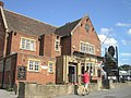
Guisborough is a market town and civil parish in the borough of Redcar and Cleveland, North Yorkshire, England. It lies north of the North York Moors National Park. Roseberry Topping, midway between the town and Great Ayton, is a landmark in the national park. At the 2011 census, the civil parish with outlying Upleatham, Dunsdale and Newton under Roseberry had a population of 17,777, of which 16,979 were in the town's built-up area. It was governed by an urban district and rural district in the North Riding of Yorkshire.

<span class="mw-page-title-main">Eston</span> Area of Redcar and Cleveland, North Yorkshire, England

Eston is an area of Redcar and Cleveland in North Yorkshire, England. The local authority ward covering the area had a population of 7,005 at the 2011 census. It is part of Greater Eston, which includes the outlying settlements of Grangetown, Normanby, South Bank, Teesville and part of Ormesby.

<span class="mw-page-title-main">Middlesbrough</span> Town in North Yorkshire, England

Middlesbrough is a town in the Middlesbrough unitary authority borough of North Yorkshire, England. The town lies near the mouth of the River Tees and north of the North York Moors National Park. The built-up area had a population of 148,215 at the 2021 UK census. It is the largest town of the wider urban Tees Valley area, which had a population of 678,400 in 2021.

<span class="mw-page-title-main">Redcar and Cleveland</span> Borough in North Yorkshire, England

Redcar and Cleveland is a unitary authority area with borough status in North Yorkshire, England.

<span class="mw-page-title-main">Thornaby-on-Tees</span> Town and civil parish in North Yorkshire, England

Thornaby-on-Tees, commonly referred to as Thornaby, is a town and civil parish on the River Tees's southern bank. It is in the Borough of Stockton-on-Tees, North Yorkshire, England. The parish had a population of 24,741 at the 2011 census, in the Teesside built-up area.

<span class="mw-page-title-main">Ingleby Barwick</span> Town and civil parish in North Yorkshire, England

Ingleby Barwick is a town and civil parish in the Borough of Stockton-on-Tees, North Yorkshire, England. It is south of the River Tees and north-east of the River Leven.

<span class="mw-page-title-main">Tees Valley</span> Combined authority area in Northern England

Tees Valley is a combined authority area in Northern England, around the lower River Tees. The area is not a geographical valley; the local term for the valley is Teesdale. The combined authority covers five council areas: Darlington, Hartlepool, Middlesbrough, Redcar and Cleveland and Stockton-on-Tees.

<span class="mw-page-title-main">Marton, Middlesbrough</span> Area of Middlesbrough, North Yorkshire, England

Marton or Marton-in-Cleveland is an area of Middlesbrough, North Yorkshire, England. Until the 1950s, it was a small village next to the hamlet of Tollesby in Yorkshire's North Riding.

<span class="mw-page-title-main">Redcar (UK Parliament constituency)</span> Parliamentary constituency in the United Kingdom, 1974 onwards

Redcar is a constituency represented in the House of Commons of the UK Parliament since 2019 by Jacob Young, a Conservative.

<span class="mw-page-title-main">Teesville</span> Area of Redcar and Cleveland borough, North Yorkshire, England

Teesville is an area in the borough of Redcar and Cleveland, North Yorkshire, England. A ward covering the area had a population of 6,517 at the 2011 census. It is part of Greater Eston, which includes the area and the settlements of Eston, Normanby, South Bank, Teesville and part of Ormesby.

<span class="mw-page-title-main">Normanby, Redcar and Cleveland</span> Area of Redcar and Cleveland, North Yorkshire, England

Normanby is an area in the borough of Redcar and Cleveland, North Yorkshire, England. A ward covering the area had a population of 6,930 at the 2011 census. It is part of Greater Eston, which includes the area and the outlying settlements of Eston, Grangetown, South Bank, Teesville and part of Ormesby.

<span class="mw-page-title-main">South Bank, Redcar and Cleveland</span> Town in North Yorkshire, England

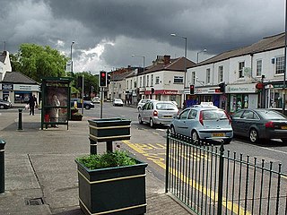
South Bank is a former industrial town in the Redcar and Cleveland borough in North Yorkshire, England on the south bank of the River Tees. It is 3 miles (4.8 km) east of Middlesbrough and 6 miles (9.7 km) south-west of Redcar. The town is served by South Bank railway station.

<span class="mw-page-title-main">Nunthorpe</span> Village and civil parish in North Yorkshire, England

Nunthorpe is a village and civil parish in the Borough of Middlesbrough in North Yorkshire, England.

<span class="mw-page-title-main">Netherfields</span> Area of Middlesbrough, North Yorkshire, England

Netherfields is an area in the Park End and Beckfield ward of the Borough of Middlesbrough, North Yorkshire, England. It forms the north-east side of the Ormesby.

<span class="mw-page-title-main">Grangetown, North Yorkshire</span> Area of Redcar and Cleveland in North Yorkshire, England

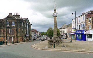
Grangetown is an area in the borough of Redcar and Cleveland, North Yorkshire, England. The area is 3 miles (4.8 km) east of Middlesbrough and 4 miles (6.4 km) from south-west of Redcar.

<span class="mw-page-title-main">North Ormesby</span> Area of Middlesbrough, North Yorkshire, England

North Ormesby is a part of Middlesbrough, North Yorkshire, England. The area has gained the common nickname of Doggy, it is of unknown origin. Population of the now former "North Ormesby and Brambles Farm" ward was 6,268, at the 2011 census, with Brambles Farm being south-east of the area. The area became its own ward in 2015.

<span class="mw-page-title-main">Greater Eston</span> Unparished area in North Yorkshire, England

Greater Eston is part of the Borough of Redcar and Cleveland, North Yorkshire, England. The name is used by the borough council to describe the centres of Eston, Grangetown, Normanby, Ormesby, South Bank and Teesville.

<span class="mw-page-title-main">County Borough of Teesside</span> Former district in northern England

The County Borough of Teesside was a county borough in the north-east of England, which existed for just six years. It was created in 1968 to cover the Teesside conurbation which had grown up around the various port and industrial towns near the mouth of the River Tees. The council was based in Middlesbrough, the area's largest town. The county borough was abolished in 1974 on the creation of the new county of Cleveland, which covered a larger area, with the county borough's territory being split between three of the four districts created in the new county.

<span class="mw-page-title-main">Eston Nab</span> Rocky outcrop in North Yorkshire, England

Eston Nab is a rocky outcrop hill in the town of Eston, Redcar and Cleveland, North Yorkshire, England.

<span class="mw-page-title-main">Redcar and Cleveland Borough Council</span> Unitary authority in England

Redcar and Cleveland Borough Council is the local authority for Redcar and Cleveland in the ceremonial county of North Yorkshire, England. Since 1996 it has been a unitary authority, having the powers of a non-metropolitan county and district council combined. The council was created in 1974 as Langbaurgh Borough Council and was a district-level authority until 1996 when it was renamed and became a unitary authority, taking over county-level functions from the abolished Cleveland County Council. The council is based at the Civic Centre in Redcar.

References

  1. 1 2 UK Census (2011). "Local Area Report – Ormesby Ward (as of 2011) (E05001518)". Nomis. Office for National Statistics . Retrieved 11 May 2021.
  2. UK Census (2011). "Local Area Report – Beckfield Ward (as of 2011) (E05001484)". Nomis. Office for National Statistics . Retrieved 29 June 2021.
  3. UK Census (2011). "Local Area Report – Middlesbrough Built-up area (1119885093)". Nomis. Office for National Statistics . Retrieved 12 August 2018.
  4. "Redcar and Cleveland – Historic Origins and Development of Ormesby". Archived from the original on 25 August 2011. Retrieved 9 August 2010.
  5. "National Trust – Ormesby Hall".
  6. "Redcar and Cleveland – Ormesby Conservation Area Draft". Archived from the original on 25 August 2011. Retrieved 9 August 2010.
  7. "Ormesby Hall Draft Conservation Area 2008" (PDF). Archived from the original (PDF) on 12 June 2011. Retrieved 9 August 2010.
  8. 1 2 "Ormesby Ancient Parish / Civil Parish". A Vision of Britain through Time. GB Historical GIS / University of Portsmouth. Retrieved 19 September 2023.
  9. Middlesbrough Improvement Act 1858 (21 & 22 Vict. c. 140)
  10. "No. 22991". The London Gazette . 14 July 1865. p. 3533.
  11. Local Government Act 1894
  12. "Local Government Board's Provisional Order Confirmation (No. 18) Act 1913". legislation.gov.uk. The National Archives. Retrieved 19 September 2023.
  13. "Population statistics Ormesby AP/CP through time". A Vision of Britain through Time. Retrieved 7 May 2024.
  14. "Cleveland Registration District". UKBMD. Retrieved 7 May 2024.
  15. "Redcar & Cleveland May 2023 Election Results". May 2023.
  16. Atkinson, Rev. J. C. "History of Cleveland Ancient and Modern,” J. Richardson, London, Vol. I (appendage), 1874, pp. 1/6.
  17. "Redcar and Celevland: Appendix – 5 Historic Origins and Development of Ormesby". Archived from the original on 25 August 2011. Retrieved 3 September 2010.
  18. "Ormesby Hall Draft Conservation Area Appraisal". Archived from the original on 25 August 2011. Retrieved 9 August 2010.

Commons-logo.svg Media related to Ormesby at Wikimedia Commons