Owen, Wisconsin

Last updated
Owen, Wisconsin
Owen Wisconsin downtown.jpg
The old downtown, looking north up Central Avenue toward the Owen Company's Woodland Hotel
Clark County Wisconsin Incorporated and Unincorporated areas Owen Highlighted.svg
Location of Owen in Clark County, Wisconsin.
Coordinates: 44°56′54″N90°33′53″W / 44.94833°N 90.56472°W / 44.94833; -90.56472 Coordinates: 44°56′54″N90°33′53″W / 44.94833°N 90.56472°W / 44.94833; -90.56472
Country Flag of the United States.svg  United States
State Flag of Wisconsin.svg  Wisconsin
County Clark
Area
[1]
  Total2.41 sq mi (6.24 km2)
  Land2.33 sq mi (6.04 km2)
  Water0.08 sq mi (0.20 km2)
Elevation
[2]
1,243 ft (379 m)
Population
 (2010) [3]
  Total940
  Estimate 
(2019) [4]
928
  Density397.77/sq mi (153.55/km2)
Time zone UTC-6 (Central (CST))
  Summer (DST) UTC-5 (CDT)
Area code(s) 715 & 534
FIPS code 55-60825 [5]
GNIS feature ID1577195 [2]
Website cityofowen.com

Owen is a city in Clark County in the U.S. state of Wisconsin. The population was 940 at the 2010 census. Owen is located directly east of the village of Withee, which is about half the size of Owen.

Contents

History

In 1880 the Wisconsin Central Railroad built its line through what would become Owen, on its way from Abbotsford to Chippewa Falls. [6]

In 1893 the John S. Owen Company of Eau Claire managed to buy from J.D. Spaulding 400 square miles of virgin timber that ran from the current site of Owen north through Taylor County and into Rusk County. Near where the railroad crossed Brick Creek and that creek flowed into the Popple River, the company built a warehouse, a boarding house, and five log buildings clustered around the rail line. They dammed Brick Creek to make a mill pond and built a sawmill, a planing mill, and a company store. A one-room school was built in 1894. Early on, John's son Aloney moved to the settlement to oversee local operations. [6]

In 1904 the Village of Owen incorporated, with 315 people. In 1906 the Owen Company started the Owen Box and Crating factory, the Woodland Hotel, and began providing electrical service within the village of Owen. [7] In 1907 the Owens organized the State Bank of Owen, headed by J.G. Owen. [6]

Bird's eye view of Owen, Wis. LCCN2007663070.tif
Bird's eye view of Owen in 1912

By 1914, Owen's population was 1,000. The Owens organized the State Bank of Withee, headed by A.R. Owen. The Owens also had a hand in a bottling works, a theater, a telephone company, and three hotels. They donated land for a city park and churches. In 1915 the company opened a retail lumber store. [6]

By 1918 the Owen Company was running 25 miles of railroad in Clark and Taylor Counties, hauling logs from their timber holdings in to their sawmill. At one point they thought their supply might last for five or six years, but it ended up lasting 40. The last log was sawed in 1932. [6]

Geography

Owen is located at 44°56′54″N90°33′53″W / 44.94833°N 90.56472°W / 44.94833; -90.56472 (44.948330, -90.564740). [8]

According to the United States Census Bureau, the city has a total area of 1.84 square miles (4.77 km2), of which, 1.77 square miles (4.58 km2) is land and 0.07 square miles (0.18 km2) is water. [9]

Demographics

Historical population
CensusPop.
1910 745
1920 1,08345.4%
1930 1,1021.8%
1940 1,083−1.7%
1950 1,034−4.5%
1960 1,0986.2%
1970 1,031−6.1%
1980 998−3.2%
1990 895−10.3%
2000 9364.6%
2010 9400.4%
2019 (est.)928 [4] −1.3%
U.S. Decennial Census [10]

2010 census

As of the census [3] of 2010, there were 940 people, 419 households, and 252 families living in the city. The population density was 531.1 inhabitants per square mile (205.1/km2). There were 485 housing units at an average density of 274.0 per square mile (105.8/km2). The racial makeup of the city was 96.7% White, 0.5% African American, 0.1% Native American, 0.1% Asian, 2.0% from other races, and 0.5% from two or more races. Hispanic or Latino of any race were 3.8% of the population.

There were 419 households, of which 27.7% had children under the age of 18 living with them, 44.4% were married couples living together, 8.4% had a female householder with no husband present, 7.4% had a male householder with no wife present, and 39.9% were non-families. 35.8% of all households were made up of individuals, and 16.2% had someone living alone who was 65 years of age or older. The average household size was 2.23 and the average family size was 2.87.

The median age in the city was 40.4 years. 23.7% of residents were under the age of 18; 8.8% were between the ages of 18 and 24; 22.1% were from 25 to 44; 25.5% were from 45 to 64; and 19.9% were 65 years of age or older. The gender makeup of the city was 48.2% male and 51.8% female.

2000 census

As of the census [5] of 2000, there were 936 people, 412 households, and 255 families living in the city. The population density was 510.9 people per square mile (197.5/km2). There were 455 housing units at an average density of 248.4 per square mile (96.0/km2). The racial makeup of the city was 98.61% White, 0.64% African American, 0.43% Native American, 0.11% Asian, and 0.21% from two or more races. Hispanic or Latino of any race were 0.43% of the population.

There were 412 households, out of which 26.5% had children under the age of 18 living with them, 48.3% were married couples living together, 10.2% had a female householder with no husband present, and 37.9% were non-families. 32.3% of all households were made up of individuals, and 21.6% had someone living alone who was 65 years of age or older. The average household size was 2.27 and the average family size was 2.84.

In the city, the population was spread out, with 23.3% under the age of 18, 9.1% from 18 to 24, 23.9% from 25 to 44, 20.6% from 45 to 64, and 23.1% who were 65 years of age or older. The median age was 41 years. For every 100 females, there were 90.2 males. For every 100 females age 18 and over, there were 86.5 males.

The median income for a household in the city was $27,368, and the median income for a family was $37,955. Males had a median income of $27,431 versus $20,547 for females. The per capita income for the city was $14,981. About 9.4% of families and 13.4% of the population were below the poverty line, including 19.4% of those under age 18 and 13.8% of those age 65 or over.

Related Research Articles

Happy Valley is a census-designated place (CDP) in Kenai Peninsula Borough, Alaska, United States. At the 2010 census the population was 593, up from 489 in 2000.

Grayson, California Census-designated place in California, United States

Grayson is a census-designated place (CDP) in Stanislaus County, California, United States. The population was 952 at the 2010 census, down from 1,077 at the 2000 census. It is part of the Modesto Metropolitan Statistical Area.

Waimalu, Hawaii Census-designated place in Hawaii, United States

Waimalu is a census-designated place (CDP) in Honolulu County, Hawaiʻi, United States. The population was 13,817 at the 2020 census.

Cissna Park, Illinois Village in Illinois, United States

Cissna Park is a village in Pigeon Grove Township, Iroquois County, Illinois, United States. The population was 846 at the 2010 census.

Maysville, Iowa City in Iowa, USA

Maysville is a city in Scott County, Iowa, United States. The population was 156 at the time of the 2020 census.

Washington, Iowa City in Iowa, United States

Washington is a city in and the county seat of Washington County, Iowa, United States. It is part of the Iowa City, Iowa Metropolitan Statistical Area. The population was 7,352 at the time of the 2020 census.

Buffalo Center, Iowa City in Iowa, United States

Buffalo Center is a city in Winnebago County, Iowa, United States. The population was 857 at the time of the 2020 census. Its ZIP code is 50424.

Red Chute is a census-designated place (CDP) in Bossier Parish, Louisiana, United States. The population was 6,261 at the 2010 census. It is part of the Shreveport–Bossier City Metropolitan Statistical Area.

Lastrup, Minnesota City in Minnesota, United States

Lastrup is a city in Morrison County, Minnesota, United States. The population was 120 at the 2020 census.

Elko, Minnesota Former neighborhood in United States

Elko was a city in Scott County, Minnesota, United States. The population was 472 at the 2000 census. In January 2007, Elko merged with New Market to become Elko New Market.

Dickinson is a town in Franklin County, New York, United States. The population was 823 at the 2010 census. The town was named after Philemon Dickinson, a brigadier general of the New Jersey militia during the American Revolutionary War.

Constableville is a village in Lewis County, New York, United States. The population was 242 at the 2010 census. The village is named after William Constable, the son of an early landowner.

Burnham, Pennsylvania Borough in Pennsylvania, United States

Burnham is a borough in Mifflin County, Pennsylvania, United States. The population was 2,054 at the 2010 census.

Midtown is a census-designated place (CDP) in Roane County, Tennessee, United States. Its population was 1,360 as of the 2010 census. Twice in the 1990s residents voted to incorporate as a town, and for a time the community maintained a municipal government, but the incorporation was challenged in court and eventually overturned after the state statute under which Midtown incorporated was ruled unconstitutional. It was a city at the time of the 2000 census, when the population was 1,306. It is included in the Knoxville Metropolitan Area.

Green Valley Farms, Texas Census-designated place in Texas, United States

Green Valley Farms is a census-designated place (CDP) in Cameron County, Texas, United States. The population was 1,272 at the 2010 census, up from 720 at the 2000 census. It is part of the Brownsville–Harlingen Metropolitan Statistical Area.

Laona, Wisconsin Town in Wisconsin, United States

Laona is a town in Forest County, Wisconsin, United States. The population was 1,212 at the 2010 census. The census-designated place of Laona is located in the town. The unincorporated community of Blackwell Junction is also located partially in the town.

Cudahy, Wisconsin City in Wisconsin, United States

Cudahy is a city in Milwaukee County, Wisconsin, United States. The population was 18,267 at the 2010 census.

Thorp, Wisconsin City in Wisconsin, United States

Thorp is a city in Clark County in the U.S. state of Wisconsin. The population was 1,621 at the 2010 census. The city is located partially within the Town of Thorp and partially within the Town of Withee.

Withee, Wisconsin Village in Wisconsin, United States

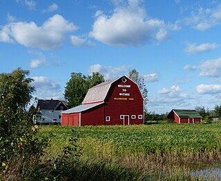
Withee is a village in Clark County in the U.S. state of Wisconsin. The population was 487 at the 2010 census. The village is located mostly within the Town of Hixon, with a small portion extending south into the Town of Longwood.

Withee is a town in Clark County in the U.S. state of Wisconsin. The population was 885 at the 2000 census. The unincorporated community of Lombard is located in the town.

References

  1. "2019 U.S. Gazetteer Files". United States Census Bureau. Retrieved August 7, 2020.
  2. 1 2 "US Board on Geographic Names". United States Geological Survey. 2007-10-25. Retrieved 2008-01-31.
  3. 1 2 "U.S. Census website". United States Census Bureau . Retrieved 2012-11-18.
  4. 1 2 "Population and Housing Unit Estimates". United States Census Bureau. May 24, 2020. Retrieved May 27, 2020.
  5. 1 2 "U.S. Census website". United States Census Bureau . Retrieved 2008-01-31.
  6. 1 2 3 4 5 Lacey, Patricia A. (July 2004). "Owen High School" (PDF). National Register of Historic Places - Registration Form. US Dept. of the Interior - National Park Service. Retrieved 2016-05-01.
  7. Leonhardt, Kris (2022-01-04). "It's electrifying - The advent of Clark County's electrical service". Multi Media Channels LLC. The Sentinel & Rural News.
  8. "US Gazetteer files: 2010, 2000, and 1990". United States Census Bureau. 2011-02-12. Retrieved 2011-04-23.
  9. "US Gazetteer files 2010". United States Census Bureau. Archived from the original on 2012-01-24. Retrieved 2012-11-18.
  10. "Census of Population and Housing". Census.gov. Retrieved June 4, 2015.