
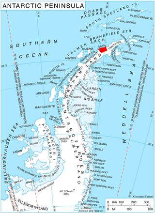
The Antarctic Peninsula, known as O'Higgins Land in Chile and Tierra de San Martín in Argentina, and originally as Graham Land in the United Kingdom and the Palmer Peninsula in the United States, is the northernmost part of mainland Antarctica.

Alexander Island, which is also known as Alexander I Island, Alexander I Land, Alexander Land, Alexander I Archipelago, and Zemlja Alexandra I, is the largest island of Antarctica. It lies in the Bellingshausen Sea west of Palmer Land, Antarctic Peninsula from which it is separated by Marguerite Bay and George VI Sound. The George VI Ice Shelf entirely fills George VI Sound and connects Alexander Island to Palmer Land. The island partly surrounds Wilkins Sound, which lies to its west. Alexander Island is about 390 kilometres (240 mi) long in a north–south direction, 80 kilometres (50 mi) wide in the north, and 240 kilometres (150 mi) wide in the south. Alexander Island is the second-largest uninhabited island in the world, after Devon Island.


Livingston Island is an Antarctic island in the Southern Ocean, part of the South Shetlands Archipelago, a group of Antarctic islands north of the Antarctic Peninsula. It was the first land discovered south of 60° south latitude in 1819, a historic event that marked the end of a centuries-long pursuit of the mythical Terra Australis Incognita and the beginning of the exploration and utilization of real Antarctica. The name Livingston, although of unknown derivation, has been well established in international usage since the early 1820s.
This is a list of extreme points in Antarctica.

The Usarp Mountains are a major Antarctic mountain range, lying west of the Rennick Glacier and trending north to south for about 190 kilometres (118 mi). The feature is bounded to the north by Pryor Glacier and the Wilson Hills.

The Prince Charles Mountains are a major group of mountains in Mac. Robertson Land in Antarctica, including the Athos Range, the Porthos Range, and the Aramis Range. The highest peak is Mount Menzies, with a height of 3,228 m (10,591 ft). Other prominent peaks are Mount Izabelle and Mount Stinear. These mountains, together with other scattered peaks, form an arc about 420 km (260 mi) long, extending from the vicinity of Mount Starlight in the north to Goodspeed Nunataks in the south.
The Porthos Range is the second range south in the Prince Charles Mountains of Antarctica, extending for about 30 miles in an east-to-west direction between Scylla Glacier and Charybdis Glacier. First visited in December 1956 by the Australian National Antarctic Research Expeditions (ANARE) southern party under W.G. Bewsher (1956-57) and named after Porthos, a character in Alexandre Dumas, père's novel The Three Musketeers, the most popular book read on the southern journey.
On the continent of Antarctica, the Aramis Range is the third range south in the Prince Charles Mountains, situated 11 miles southeast of the Porthos Range and extending for about 30 miles in a southwest–northeast direction. It was first visited in January 1957 by Australian National Antarctic Research Expeditions (ANARE) southern party led by W.G. Bewsher, who named it for a character in Alexandre Dumas' novel The Three Musketeers, the most popular book read on the southern journey.
Mount Bris is a broad ice-covered mountain with precipitous and partly ice-free slopes except to the southeast, the summit of Korten Ridge on Davis Coast in Graham Land, Antarctica. The peak rises to 1,673 metres (5,490 ft) 1 nautical mile (2 km) west of the head of Sabine Glacier and 11 nautical miles (20 km) south of Cape Kater. It is linked to Tsarevets Buttress and Detroit Plateau by Podvis Col to the southeast, and surmounting Sabine Glacier to the northeast, Temple Glacier to the southwest, and Kasabova Glacier to the northwest.

Noville Peninsula is a high ice-covered peninsula about 30 nautical miles (60 km) long, between Peale and Murphy Inlets on the north side of Thurston Island in Antarctica. It was delineated from aerial photographs made by U.S. Navy Operation HIGHJUMP in December 1946, and named for George O. Noville, executive officer of the Byrd Antarctic Expedition, 1933–35.
Mount Cox is a mountain 1,960 metres (6,430 ft) high in the north-central part of the Emlen Peaks, 5 nautical miles (9 km) north of Killer Nunatak, Victoria Land, Antarctica. The topographical feature was first mapped by the United States Geological Survey (USGS) from surveys and from U.S. Navy air photos, 1960–63, and named by the Advisory Committee on Antarctic Names for Allen N. Cox, U.S. Navy, crew chief in R4D (Skytrain) aircraft during 1962–63 in support of the USGS Topo East-West survey. Cox returned to the Antarctic in the 1963–64 and 1964–65 seasons. The mountain lies situated on the Pennell Coast, a portion of Antarctica lying between Cape Williams and Cape Adare.
Dodd Nunatak is a nunatak 2.5 nautical miles (5 km) west of Mount Cox in the northwest portion of the Emlen Peaks in the Usarp Mountains, a major mountain range within Victoria Land, Antarctica. The geographical feature was first mapped by the United States Geological Survey from surveys and U.S. Navy air photos, 1960–63, and was named by the Advisory Committee on Antarctic Names for Walter H. Dodd of the Public Information Office, National Science Foundation, who worked at McMurdo Station, Hut Point Peninsula, Ross Island, in the 1966–67 and 1967–68 austral summer months. The nunatak lies situated on the Pennell Coast, a portion of Antarctica lying between Cape Williams and Cape Adare.

Mount Schimansky is a ridge-like mountain 6 nautical miles (11 km) northwest of Heintz Peak of the Welch Mountains, in Palmer Land. Mapped by the United States Geological Survey (USGS) in 1974. Named by Advisory Committee on Antarctic Names (US-ACAN) for Lieutenant Commander John A. Schimansky, U.S. Navy, Commander of LC-130 aircraft of Squadron VXE-6 on many aerial photographic and ice-sensing missions over the Antarctic continent during Operation Deep Freeze, 1970 and 1971.

Satovcha Peak is the mostly ice-covered peak rising to 1587 m in Havre Mountains, northern Alexander Island in Antarctica. It surmounts Bongrain Ice Piedmont to the northeast and Lennon Glacier to the southwest. Its south slopes are precipitous and partly ice-free. The vicinity was visited on 4 January 1988 by the geological survey party of Christo Pimpirev and Borislav Kamenov, and Philip Nell and Peter Marquis.
Mount Pontida is the ice-covered mountain rising to 1965 m in Havre Mountains, northern Alexander Island in Antarctica. It surmounts Hadzhiev Glacier to the north, Foreman Glacier to the southeast and Wubbold Glacier to the southwest. British mapping in 1971. The feature is named after the hypothetical lost land of Pontida located in Black Sea.
Breze Peak is the mostly ice-covered peak rising to 1634 m in eastern Havre Mountains, northern Alexander Island in Antarctica. It surmounts Russian Gap to the northeast and Foreman Glacier to the west. The peak was visited on 8 January 1988 by the geological survey team of Christo Pimpirev and Borislav Kamenov, and Philip Nell and Peter Marquis.


