The history of Panama includes the history of the Isthmus of Panama prior to European colonization.

This is a demography of the population of Panama including population density, ethnicity, education level, health of the populace, economic status, religious affiliations, and other aspects of the population. Panama's 2020 census has been postponed due to the COVID-19 pandemic but the government are currently assessing additional implications. They are evaluating the preparatory processes that can begin now, such as procurement.

Colombia is a unitary republic made up of thirty-two departments and a Capital District. Each department has a governor (gobernador) and an Assembly, elected by popular vote for a four-year period. The governor cannot be re-elected in consecutive periods. Departments are country subdivisions and are granted a certain degree of autonomy.

Los Santos is a province in Panama, reaching from the La Villa river in the North to the Pacific Ocean in the south and east. It is part of the Azuero Peninsula, bounded by the province of Herrera to the north and northeast, and by Mariato District of Veraguas Province to the West. The City of Las Tablas is the capital and most populous city. There are seven administrative districts under the jurisdiction of Los Santos Province. Los Santos's area is 3,809.4 km ², and its population is 95,540 inhabitants in 2019.
Chitré is a city and corregimiento, the capital of the Panamanian province of Herrera. with a population of 9,092 as of 2010, and a metropolitan area population of 80,000 inhabitants. It is also the seat of Chitré District. Chitré is located about 7 km inland from the Gulf of Parita on the Azuero Peninsula. The name Chitré comes from the native tribe Chitra. In the city, there is a district, also called Chitré, which is subdivided into five corregimientos. The corregimientos are San Juan Bautista, Llano Bonito, Monagrillo, La Arena and Chitré.

The University of Panama was founded on October 7, 1935. Initially, it had 175 students learning education, commerce, natural sciences, pharmacy, pre-engineering or law. As of 2008, it had 74,059 students distributed in 228 buildings across the country.

The Granadine Confederation was a short-lived federal republic established in 1858 as a result of a constitutional change replacing the Republic of New Granada. It consisted of the present-day nations of Colombia and Panama and parts of northwestern Brazil. In turn, the Granadine Confederation was replaced by the United States of Colombia after another constitutional change in 1863.

The Colombian Civil War began on 8 May 1860 and lasted until November 1862. It was an internal conflict between the newly formed conservative Granadine Confederation and a more liberal rebel force from the newly seceded region of Cauca, composed of dissatisfied politicians commanded by General Tomás Cipriano de Mosquera, its former president. The Granadine Confederation, created a few years earlier in 1858 by Mariano Ospina Rodríguez, was defeated in the capital Bogotá, with Mosquera deposing the newly elected president Bartolomé Calvo on July 18, 1861. Forming a provisional government, with himself as president, Mosquera continued to pursue the conservative forces until their final defeat in 1862. The resulting formation of the new United States of Colombia would have significant cultural and economic consequences for Colombia.

Bartolomé Calvo Díaz de Lamadrid was a Colombian lawyer, journalist, and statesman, who became President of the Granadine Confederation, in what is now Colombia, in 1861 in his role as Inspector General, because no elections were held on that year to decide the presidency. He also served as Governor of Panama and Ambassador to Ecuador, and worked in a number of newspapers.
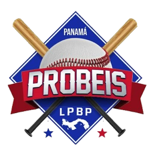
The Panamanian Professional Baseball League, commonly known as Probeis, is a professional baseball winter league consisting of three teams based in Panama. Originally founded in 1946, the league has run in its current form since 2011.

Antioquia State was one of the states of Colombia. Today the area of the former state makes up most of modern day Antioquia Department, Colombia.

Bolívar State was one of the states of Colombia. Today the area of the former state makes up most of modern-day Bolívar Department, Sucre Department, Córdoba Department and Atlántico Department in northern Colombia.

Boyacá State was one of the states of Colombia.

Cauca State was one of the states of Colombia.

Santander State was one of the states of Colombia. Today the area of the former state makes up most of modern-day areas of the Santander Department and Norte de Santander Department in northeastern Colombia.

States of Colombia existed from February 27, 1855, in the Republic of New Granada and the Granadine Confederation, where they were called "federal states". In the United States of Colombia they were called "sovereign states".

Cundinamarca State was one of the states of Colombia. It was created on 15 June 1857 as Estado Federal de Cundinamarca, in 1858 was recognized as Estado de la Federación, and in the constitution of 1863 renamed as Estado Soberano of the United States of Colombia.
The Copa Rommel Fernández 2013 season starts on November 17, 2013.
The United States of Venezuela was the official name of Venezuela, adopted in its 1864 constitution under the Juan Crisóstomo Falcón government. This remained the official name until 1953, when the constitution of that year renamed it the Republic of Venezuela. In 1999 under newly elected president Hugo Chávez and his modification to the Constitution, Venezuela's official name became the Bolivarian Republic of Venezuela.