Converse County is a county located in the U.S. state of Wyoming. As of the 2020 United States Census, the population was 13,751. Its county seat is Douglas.

Wyoming is a town in Kent County, Delaware, United States. It was named after the Wyoming Valley in Pennsylvania. It is part of the Dover, Delaware, Metropolitan Statistical Area. The population was 1,680 in 2020.

Clearwater Township is a civil township of Kalkaska County in the U.S. state of Michigan. As of the 2020 census, the township population was 2,497.

The Charter Township of Oakland is a charter township on the north Oakland County outskirts of Metro Detroit, in the U.S. state of Michigan. It is colloquially referred to as "Oakland Township". The population was 20,067 at the 2020 census.

Douglas is a city in Converse County, Wyoming, United States. The population was 6,120 at the 2010 census. It is the county seat of Converse County and the home of the Wyoming State Fair.
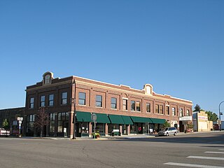
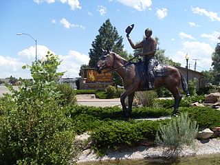
Glenrock is a town in Converse County, Wyoming, United States. The population was 2,576 at the 2010 census.

Rolling Hills is a town in Converse County, Wyoming, United States, four miles north of Glenrock. It is a planned community incorporated as a town in 1984. The population at the 2010 census was 440.

Torrington is a city in, and the county seat of, Goshen County, Wyoming, United States. The population was 6,501 at the 2010 census.
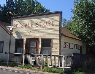
Bellvue is an unincorporated community and U.S. Post Office in Larimer County, Colorado. It is a small agricultural community located in Pleasant Valley, a narrow valley just northwest of Fort Collins near the mouth of the Poudre Canyon between the Dakota Hogback ridge and the foothills of the Rocky Mountains. The ZIP Code of the Bellvue Post Office is 80512.

Ayres Natural Bridge Park is a county park in Converse County, Wyoming in the United States. It occupies 150 acres (0.6 km²) between the towns Glenrock and Douglas about 6 kilometers south of Interstate 25 exit 151. The park's name is derived from the rock formation of the same name. Ayres is the surname of the family who donated the land which had been part of their ranch.

Fort Fetterman was constructed in 1867 by the United States Army on the Great Plains frontier in Dakota Territory, approximately 11 miles northwest of present-day Douglas, Wyoming. Located high on the bluffs south of the North Platte River, it served as a major base for the start of several United States military expeditions against warring Native American tribes. The fort is listed on the National Register of Historic Places.

Buffalo Creek is an unincorporated community and U.S. Post Office in Jefferson County, Colorado, United States. The ZIP Code of the Buffalo Creek Post Office is 80425.
Freedom is an unincorporated community in both northeastern Caribou County, Idaho, and northwestern Lincoln County, Wyoming, in the United States; the Wyoming portion of the community is also a census-designated place (CDP). The population was 247 at the 2020 census.
Garrett is an unincorporated community in northern Albany County, Wyoming, United States, along the North Laramie River. It lies along local roads north of the city of Laramie, the county seat of Albany County. Its elevation is 6,785 ft (2,068 m), and it is located at 42°6′48″N105°36′36″W. Although Garrett is unincorporated, it once had a post office, with the ZIP code of 82058. The building remains, though is no longer in use. Garrett is also home to River Bridge School, a one-room schoolhouse that is part of Albany County School District #1. Aside from the schoolhouse, the land is privately owned.

Wyoming has one of the highest wind power potentials of any state in the United States. In 2019, Wyoming had wind powered electricity generating capacity of 1,589 MW, which produced 9.85% of its electric generation, with an additional 3,753 MW under construction. However, the wind generation in that year was Wyoming's third-lowest in the 2010s. By 2020, wind capacity increased to 2738 MW and 8448 gigawatt-hours of electricity were produced from wind in 2021, more than double 2019 production. Additional wind capacity and needed transmission lines are under construction or planned, despite political headwinds from Wyoming's strong coal and oil sectors.
Gleasondale is a village straddling the border between the towns of Hudson and Stow in Middlesex County, Massachusetts, United States. It is located along the Assabet River. For many decades it was home to various mills, though it is now primarily residential. According to the Geographic Names Information System (GNIS), Gleasondale is a "populated place" named after Benjamin W. Gleason and Samuel J. Dale.
Binford is a populated place in Albany County, Wyoming, United States. A post office was established in Binford in February 1897 and named for Adelyn F. Binford, the first postmaster. Post office service continued until 1937.

Wyoming Highway 95 is an overall east–west Wyoming State Road located in central Converse County and serves the towns of Glenrock, Rolling Hills, and areas northeast of those communities.

Costilla is a census-designated place in Taos County, New Mexico, United States. Its population was 205 as of the 2010 census. Costilla has a post office with ZIP code 87524. State roads 196 and 522 intersect in the community.
The Big Muddy oil field is an oil field in Converse County, Wyoming, between Casper and Glenrock.
