Related Research Articles
National Wildlife RefugeSystem is a designation for certain protected areas of the United States managed by the United States Fish and Wildlife Service. The National Wildlife Refuge System is the system of public lands and waters set aside to conserve America's fish, wildlife, and plants. Since President Theodore Roosevelt designated Florida's Pelican Island National Wildlife Refuge as the first wildlife refuge in 1903, the system has grown to over 562 national wildlife refuges and 38 wetland management districts encompassing more than 150,000,000 acres (607,028 km2).

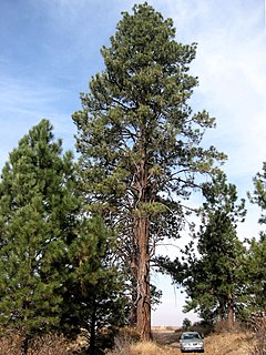
The Pahranagat National Wildlife Refuge is a protected wildlife refuge, at the southern end of the Pahranagat Valley and administered by the U.S. Fish and Wildlife Service. It is 90 miles (140 km) north of Las Vegas, Nevada, in Lincoln County, Nevada. The 5,380-acre (21.8 km2) refuge was created on August 16, 1963, and is part of the larger Desert National Wildlife Refuge Complex, which also includes the Ash Meadows National Wildlife Refuge, the Desert National Wildlife Refuge, and the Moapa Valley National Wildlife Refuge.

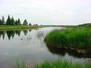
The Cache River is a 92-mile-long (148 km) waterway in southernmost Illinois, in a region sometimes called Little Egypt. The basin spans 737 square miles (1,910 km2) and six counties: Alexander, Johnson, Massac, Pope, Pulaski and Union. Located at the convergence of four major physiographic regions, the river is part of the largest complex of wetlands in Illinois. The Cache River Wetlands — America's northernmost cypress/tupelo swamp — harbors 91 percent of the state's high quality swamp and wetland communities. It provides habitat for more than 100 threatened and endangered species in Illinois. In 1996, the Cache was designated a Wetland of International Importance by the Ramsar Convention.
The Klamath Basin National Wildlife Refuge Complex is a wildlife preserve operated by the United States Fish and Wildlife Service in the Klamath Basin of southern Oregon and northern California near Klamath Falls, Oregon. It consists of Bear Valley, Klamath Marsh and Upper Klamath National Wildlife Refuge (NWR) in southern Oregon and Lower Klamath, Tule Lake, and Clear Lake NWR in northern California.

Sam D. Hamilton Noxubee National Wildlife Refuge is a 48,000 acres (190 km2) National Wildlife Refuge located in the U.S. state of Mississippi, in Noxubee, Oktibbeha, and Winston Counties. The refuge serves as a resting and feeding area for migratory birds and as example of proper land stewardship. Also, the refuge extensively manages land for the endangered red-cockaded woodpecker.

The Chase Lake Prairie Project is an effort to restore and protect the largest remaining region in the lower 48 states for waterfowl production. Located in U.S. state of North Dakota and consisting of 5,500,000 acres (22,000 km2) spread across 11 counties, this region is composed of thousands of lakes and ponds and grassland prairie. 97% of the land area is privately owned, with the U.S. Fish and Wildlife Service working with landowners to protect wetlands and associated prairie regions in a collaborative effort to ensure the region continues to provide habitat for the millions of birds and other wildlife that are dependent on the ecosystem.
The Cypress Creek National Wildlife Refuge is located in the Cache River watershed in southernmost Illinois, largely in Pulaski County, but with extensions into Union, Alexander, and Johnson counties. The refuge was established in 1990 under the authority of the Emergency Wetlands Resources Act of 1986. The refuge protects over 16,000 acres (65 km2) of the Cache River wetlands, and has a purchase boundary of 36,000 acres (146 km²) contiguous.

Glacial Ridge National Wildlife Refuge was created on October 12, 2004, the 545th National Wildlife Refuge in the United States. Its creation was the result of cooperation between at least 30 agencies or governmental entities. The creation of the refuge was spearheaded by The Nature Conservancy, and the initial endowment of 2,300 acres (9.3 km2) of land was donated by the Conservancy. In light of its planned final size of 37,756 acres (153 km2), it is described by the US Fish and Wildlife Service as "the largest tallgrass prairie and wetland restoration project in U.S. history."

The Yolo Bypass Wildlife Area is located within the Yolo Bypass in Yolo County, California. The wildlife area is managed by the California Department of Fish and Wildlife with the intent of restoring and managing a variety of wildlife habitats in the Yolo Basin, a natural basin in the north part of the Sacramento-San Joaquin River Delta. The creation of the wildlife area was spearheaded by the Yolo Basin Foundation. The California Department of Fish and Wildlife and Yolo Basin Foundation are the core partners in the operation of this unique community resource. Located at 38.550515°N 121.626291°W
Crane Meadows National Wildlife Refuge was established in 1992 to preserve a large, natural wetland complex. The refuge is located in central Minnesota and serves as an important stop for many species of migrating birds. Located within a large watershed that includes Rice, Skunk and Mud Lakes, Platte and Skunk Rivers, Rice and Buckman Creeks, and sedge meadow wetlands, it harbors one of the largest nesting populations of greater sandhill cranes in Minnesota. Habitats include native tallgrass prairie, oak savanna, and wetlands with stands of wild rice. With a total authorized acquisition boundary of 13,540 acres (54.8 km2) encompassing this important wetland complex and adjacent uplands, Crane Meadows National Wildlife Refuge presently exists as scattered parcels totaling about 2,000 acres (8.1 km2). Existing ownership lies in Little Falls Township and Agram Township in Morrison County.

Hamden Slough National Wildlife Refuge is a National Wildlife Refuge of the United States in Minnesota. Eastern hardwood forests stretching from the Atlantic seaboard give way to the western prairie at the area, in Audubon Township, near Audubon, Minnesota. Prior to settlement, its diverse vegetation was attractive to wildlife: waterfowl, upland birds, bison, wolves, and other prairie wildlife. When fully restored, the refuge will provide the largest contiguous block of wetland prairie habitat in the region, encompassing nearly 6,000 acres (24 km2).
Fox River National Wildlife Refuge, managed by staff at Horicon National Wildlife Refuge, encompasses 1,054 acres (4.27 km2) of wetland and upland habitat along the Fox River in the Town of Buffalo, in Marquette County, Wisconsin.
Whittlesey Creek National Wildlife Refuge is part of a large wetland complex on Lake Superior, near Ashland, Wisconsin. These coastal wetlands are a significant part of the wildlife habitat and aquatic resources of the south shore of Lake Superior.
Located within 11 counties in the Sacramento Valley and the Sacramento-San Joaquin Delta of California, North Central Valley Wildlife Management Area consists of conservation easements acquired on privately owned wetlands. The landscape is very flat, bordered by the Sierra and Coast ranges and is surrounded by intensive agriculture.

Butte Sink Wildlife Management Area is located in Colusa, Butte, and Sutter Counties. It is wetlands managed as part of the Sacramento National Wildlife Refuge Complex and is not open to the public.
Willow Creek-Lurline Wildlife Management Area is located in the Sacramento Valley of California. The landscape is very flat, bordered by the Sierra and Coast ranges and surrounded by intensive agriculture. The objective of this wildlife management area is to protect fall/winter habitat for waterfowl through the acquisition of conservation easements on privately owned wetlands. It is not open to the public.
Detroit Lakes Wetland Management District is located in northwest Minnesota and includes the counties of Becker, Clay, Mahnomen, Norman, and Polk - an area of approximately 6,000 square miles (16,000 km2). The district is divided into three general landscape areas, roughly equal in size. From west to east, these are: the Red River Valley floodplain, the glacial moraine/prairie pothole region, and the hardwood/coniferous forest. The district currently manages over 42,000 acres (170 km2) of public land in 165 waterfowl production areas (WPAs). Additionally, district staff are responsible for more than 300 wetland and upland easements on private property, totaling more than 11,000 acres (45 km2).
The Fergus Falls Wetland Management District was established in 1962 with the initiation of the Accelerated Small Wetlands Acquisition Program. It is located in west central Minnesota and includes the counties of Douglas, Grant, Otter Tail, Wadena and Wilkin.
The Morris Wetland Management District includes 244 waterfowl production areas, encompassing over 50,000 acres (200 km2) scattered throughout an eight-county area. Like other wetland management districts in the prairie states, the goal of the Morris District is to restore and protect sufficient wetland and grassland habitat to meet the needs of prairie wildlife, particularly breeding waterfowl, as well as provide places for public recreation.

The Windom Wetland Management District acquires and manages Waterfowl Production Areas, enforces wetland easements, and provides conservation assistance to landowners in 12 southwestern Minnesota counties. The landscape is dominated by intense, row-crop agriculture, which has led to the drainage of most wetlands and widespread water quality problems. Deteriorating drainage tile systems and the abundance of historic wetland basins provide unlimited opportunities for wetland restorations.
References


The Congressional Research Service (CRS), known as Congress's think tank, is a public policy research arm of the United States Congress. As a legislative branch agency within the Library of Congress, CRS works primarily and directly for Members of Congress, their Committees and staff on a confidential, nonpartisan basis.