Pauls Valley, Oklahoma

Last updated

Pauls Valley, Oklahoma
Pauls Valley water tower, August 2019.jpg
Water tower in Pauls Valley
OKMap-doton-PaulsValley.PNG
Location of Pauls Valley, Oklahoma
Coordinates: 34°44′16″N97°13′51″W / 34.73778°N 97.23083°W / 34.73778; -97.23083
Country United States
State Oklahoma
County Garvin
Area
[1]
  Total8.49 sq mi (21.99 km2)
  Land8.32 sq mi (21.56 km2)
  Water0.17 sq mi (0.43 km2)
Elevation
[2]
873 ft (266 m)
Population
 (2020)
  Total5,992
  Density719.85/sq mi (277.94/km2)
Time zone UTC-6 (Central (CST))
  Summer (DST) UTC-5 (CDT)
ZIP code
73075
Area code 405
FIPS code 40-57550 [3]
GNIS feature ID2411387 [2]
Website www.paulsvalley.com
Kerr-McGee Service Station in Pauls Valley, 1982 Field Brothers Kerr-Mac Service Station Pauls Valley, Oklahoma.jpg
Kerr-McGee Service Station in Pauls Valley, 1982

Pauls Valley is a city in and the county seat of Garvin County, Oklahoma, United States. The population was 5,992 at the 2020 census, a decline of 3.2 percent from the figure of 6,187 in 2010. [4] It was settled by and named for Smith Paul, a North Carolina native who married a Chickasaw woman and became a citizen of the Chickasaw Nation before the Civil War. The town economy is largely based on agriculture and oil production. [5]

Contents

History

The area that eventually became the city of Pauls Valley was one of the earliest European-American settlements in what was then known as Indian Territory. Smith Paul, born in 1809 in New Bern, North Carolina, discovered the fertile bottom land which is now Pauls Valley while a member of a wagon train traveling to California. Paul described the land as "a section where the bottom land was rich and blue stem grass grew so high that a man on horseback was almost hidden in its foliage." [5]

The Tri-Party Treaty of January 1, 1837, ceded this part of what is now the State of Oklahoma to the Chickasaw Nation. When the Chickasaw people were relocated to Indian Territory that year, Smith Paul moved with them and married Ela-Teecha, a Chickasaw woman. In 1847, the Pauls established a plantation on the rich Garvin County bottom land, where Rush Creek joined the Washita River, which became known to locals as "Smith Paul's Valley". [6] Mail to the Pauls was often addressed to "Smith Paul's Large Farm". By 1871, postal service was established in the area, although the post office was designated "Paul's Valley, Arkansas", because the Indian Territory was being administered out of Arkansas at that time. [7]

The Atchison, Topeka and Santa Fe Railway (a.k.a. Santa Fe Railway) shortened the name to "Paul's Valley" when it built a track through the community in 1887, completing its connection between Kansas and the Gulf Coast. The railroad brought growth and prosperity to Smith Paul's Valley. The first newspaper was published in 1887. The Pauls Valley town site was laid out in 1892, though the plat was not approved by the Dawes Commission until 1903.

At the time of its founding, Pauls Valley was located in Pickens County, Chickasaw Nation. [8]

A U.S. courthouse was built in 1895. The first white school in Indian Territory was established, and brick buildings were built downtown. In 1909, the streets were bricked. [9] Today, Pauls Valley has more brick streets—17,986 square yards (15,039 m2)—than any other town in the United States. [10]

From 1948–1954, Pauls Valley was home to the Pauls Valley Raiders, a minor league baseball team. The Pauls Valley Raiders were a member of the Class D Sooner State League and an affiliate of the New York Giants (1952–1953). The Pauls Valley Raiders played at Wacker Park. [11] [12]

When the Santa Fe Railway discontinued its Lone Star route in 1979, the 1905 building fell into disuse. By 1985, the railroad had obtained a permit to raze the old depot. Adrienne Grimmet, who was then president of the Pauls Valley Historical Society, started a campaign to save the old structure. Her efforts resulted in the city's buying the depot and turning it over to the historical society for conversion into a museum. Individuals donated their time and skills, and local businesses either donated or discounted the cost of materials to perform the necessary renovations, which began in 1991. [13]

In 1999, Amtrak began its Heartland Flyer service between Oklahoma City and Fort Worth, passing through Pauls Valley. City officials agreed to build a new waiting room for Amtrak passengers adjacent to the old depot. The new Pauls Valley station has a climate-controlled waiting area and restrooms, but is unstaffed, having no ticketing or baggage handling facilities. It also has a 10-car parking lot outside. The architecture was designed to be compatible with the old Santa Fe-style building. [13]

The Oklahoma Cartoonists Hall of Fame, located in the Toy and Action Figure Museum, was opened in Pauls Valley in 2005. [14]

Geography

Pauls Valley is located east of the center of Garvin County. It is 57 miles (92 km) south of Oklahoma City, at the junction of Interstate 35 and State Highway 19. [7]

According to the United States Census Bureau, the city has a total area of 8.7 square miles (22.6 km2), of which 8.6 square miles (22.2 km2) is land and 0.2 square miles (0.4 km2), or 1.90%, is water. [15] The Washita River, a tributary of the Red River, flows through the city north of the downtown area.

The Pauls Valley City Lake, located about 3 miles (5 km) northeast of the center of town, offers recreational opportunities, including fishing, camping, swimming, Jet Skiing, hunting, and a pavilion for groups to use.

Demographics

Historical population
CensusPop.Note
1900 1,467
1910 2,68983.3%
1920 3,69437.4%
1930 4,23514.6%
1940 5,10420.5%
1950 6,89635.1%
1960 6,856−0.6%
1970 5,769−15.9%
1980 5,664−1.8%
1990 6,1508.6%
2000 6,2561.7%
2010 6,187−1.1%
2020 5,992−3.2%
U.S. Decennial Census [16]

As of the census [3] of 2000, there were over 6,000 people, 2,475 households, and 1,591 families residing in the city. The population density was 749.9 inhabitants per square mile (289.5/km2). There were 3,007 housing units at an average density of 360.4 per square mile (139.2/km2). The racial makeup of the city was 79.27% White, 5.29% African American, 7.40% Native American, 0.66% Asian, 0.06% Pacific Islander, 3.47% from other races, and 3.85% from two or more races. Hispanic or Latino of any race were 7.53% of the population.

There were 2,475 households, out of which 30.5% had children under the age of 18 living with them, 46.6% were married couples living together, 14.1% had a female householder with no husband present, and 35.7% were non-families. 32.0% of all households were made up of individuals, and 17.4% had someone living alone who was 65 years of age or older. The average household size was 2.38 and the average family size was 3.00.

In the city, the population was spread out, with 24.4% under the age of 18, 9.2% from 18 to 24, 27.1% from 25 to 44, 20.6% from 45 to 64, and 18.7% who were 65 years of age or older. The median age was 38 years. For every 100 females, there were 88.5 males. For every 100 females age 18 and over, there were 84.6 males.

The median income for a household in the city was $26,654, and the median income for a family was $32,348. Males had a median income of $27,014 versus $18,965 for females. The per capita income for the city was $15,553. About 12.9% of families and 20.7% of the population were below the poverty line, including 23.0% of those under age 18 and 17.7% of those age 65 or over.

Economy

Agricultural is the primary economic activity in the Pauls Valley area. Corn, wheat, hay, and cotton have been grown successfully in the region, and cattle production is a major activity. Petroleum industry services is the second largest activity in the region. The nearby Golden Trend oil and gas field is still one of the major producing fields in Oklahoma. In more recent years, the town has attracted some light manufacturing plants such as plastics products. [7]

Established in 1921, the Pauls Valley Chamber of Commerce is today a 200-member business association with the mission of advancing the commercial, industrial, educational, civic, general business and cultural climate of Pauls Valley. It is a partner with businesses active on the I-35 corridor of central Oklahoma. Pauls Valley is located on Exits 70 and 72.

Major employers include Walmart Distribution Center, Walmart Supercenter, Pauls Valley Public Schools, Amor Flexibles North America, Seth Wadley Auto Group, Covercraft, Garvin County Community Living Center, and the City of Pauls Valley. Pauls Valley is also the home of Field's Pies, which are sold in grocery stores across Oklahoma and surrounding states.

Education

Pauls Valley Public Schools provides basic education through high school for Pauls Valley. [17]

Public schools:

Transportation

Railroad

The Pauls Valley station is one of only five Amtrak passenger stations still operating in Oklahoma. It shares property with the railroad station that was originally built by the Santa Fe Railroad in 1905. The Amtrak facility handles two trains per day (the Heartland Flyer ). Amtrak does not provide either ticketing or baggage services at this station. [13]

Air

Pauls Valley Municipal Airport (PVJ) is a city-owned, general aviation facility located 2 miles (3 km) south of the Pauls Valley business district. [lower-alpha 1] The street address is 500 Airport Road. The airport is open Monday through Friday between 8:00 AM and 5:00 PM Central Time. [19]

Bus

Notable people

Notes

  1. PVJ is the FAA Identifier Code. There is no ICAO identifier for this facility. [18]

Related Research Articles

<span class="mw-page-title-main">Stephens County, Oklahoma</span> County in Oklahoma, United States

Stephens County is a county located in the U.S. state of Oklahoma. As of the 2020 census, its population was 42,848. Its county seat is Duncan. The county was created at statehood, partly from the Chickasaw Nation in Indian Territory and partly from Comanche County in Oklahoma Territory. It was named for Texas politician John Hall Stephens.

<span class="mw-page-title-main">Murray County, Oklahoma</span> County in Oklahoma, United States

Murray County is a county located in the southern part of the U.S. state of Oklahoma. As of the 2020 census, the population was 13,904. The county seat is Sulphur. The county was named for William H. Murray, a member and president of the Oklahoma Constitutional Convention and later a Governor of Oklahoma.

<span class="mw-page-title-main">McClain County, Oklahoma</span> County in Oklahoma, United States

McClain County is a county located in south central Oklahoma. As of the 2020 census, the population was 41,662. Its county seat is Purcell. The county was named for Charles M. McClain, an Oklahoma constitutional convention attendee.

<span class="mw-page-title-main">Love County, Oklahoma</span> County in Oklahoma, United States

Love County is a county on the southern border of the U.S. state of Oklahoma. As of the 2020 census, the population was 10,146. Its county seat is Marietta. The county was created at statehood in 1907 and named for Overton Love, a prominent Chickasaw farmer, entrepreneur and politician.

<span class="mw-page-title-main">Grady County, Oklahoma</span> County in Oklahoma, United States

Grady County is a county located in the U.S. state of Oklahoma. As of the 2020 census, the population was 54,795. Its county seat is Chickasha. It was named for Henry W. Grady, an editor of the Atlanta Constitution and southern orator.

<span class="mw-page-title-main">Garvin County, Oklahoma</span> County in Oklahoma, United States

Garvin County is a county in south-central Oklahoma, United States. As of the 2020 census, the population was 25,656. Its county seat is Pauls Valley. In 1906, delegates to Constitution Convention formed Garvin County from part of the Chickasaw Nation, Indian Territory. The county was named for Samuel J. Garvin, a local Chickasaw rancher, merchant and banker. Its economy is largely based on farming, ranching and oil production.

<span class="mw-page-title-main">Carter County, Oklahoma</span> County in Oklahoma, United States

Carter County is a county in the U.S. state of Oklahoma. As of the 2020 census, the population was 48,003. Its county seat is Ardmore. The county was named for Captain Ben W. Carter, a Cherokee who lived among the Chickasaw.

<span class="mw-page-title-main">Newton, Kansas</span> City in Harvey County, Kansas

Newton is a city in and the county seat of Harvey County, Kansas, United States. As of the 2020 census, the population of the city was 18,602. Newton is located 25 miles (40 km) north of Wichita. The city of North Newton is located immediately north and exists as a separate political entity. Newton is located at the intersection of Interstate 135, U.S. Route 50, and U.S. Route 81 highways.

<span class="mw-page-title-main">Chanute, Kansas</span> City in Neosho County, Kansas

Chanute is a city in Neosho County, Kansas, United States. Founded on January 1, 1873, it was named after railroad engineer and aviation pioneer Octave Chanute. As of the 2020 census, the population of the city was 8,722. Chanute is home of Neosho County Community College.

<span class="mw-page-title-main">Ardmore, Oklahoma</span> City in Oklahoma, United States

Ardmore is the county seat of Carter County, Oklahoma, United States. The population was 24,725 at the time of the 2020 census, a 1.8% increase over the 2010 census figure of 24,283. The Ardmore micropolitan statistical area had an estimated population of 48,491 in 2013. Ardmore is 90 miles (140 km) from both Oklahoma City and Dallas/Fort Worth, Texas, at the junction of Interstate 35 and U.S. Highway 70, and is generally considered the hub of the 13-county region of South Central Oklahoma, also known by state tourism pamphlets as "Chickasaw Country" and previously "Lake and Trail Country". It is also a part of the Texoma region. Ardmore is situated about 9 miles (14 km) south of the Arbuckle Mountains and is located at the eastern margin of the Healdton Basin, one of the most oil-rich regions of the United States.

<span class="mw-page-title-main">Gene Autry, Oklahoma</span> Town in Oklahoma, United States

Gene Autry is a town in Carter County, Oklahoma, United States. The population was 154 at the time of the 2020 census, down just slightly from the 158 reported in the 2010 census. It is part of the Ardmore, Oklahoma Micropolitan Statistical Area.

<span class="mw-page-title-main">Lindsay, Oklahoma</span> City in Oklahoma, United States

Lindsay is a city in Garvin County, Oklahoma, United States. The population was 2,840 at the 2010 census. It once promoted itself as "The Broomcorn Capital of the World" but no longer uses that slogan, as broomcorn is no longer raised in the area.

<span class="mw-page-title-main">Maysville, Oklahoma</span> Town in Oklahoma, United States

Maysville is a town in Garvin and McClain counties, Oklahoma, United States. The population was 1,232 at the 2010 census, down from 1,313 in 2000.

<span class="mw-page-title-main">Paoli, Oklahoma</span> Town in Oklahoma, United States

Paoli is a town in Garvin County, Oklahoma, United States. The population was 610 at the 2010 census. It was named after Paoli, Pennsylvania, an unincorporated community near Philadelphia from which many of the railroad workers who built the town came.

<span class="mw-page-title-main">Wynnewood, Oklahoma</span> City in Oklahoma, United States

Wynnewood is a city in Garvin County, Oklahoma, United States. It is 67 miles (108 km) south of Oklahoma City. The population was 1,927 at the time of the 2020 census. Located in what was then the Chickasaw Nation of Indian Territory, it began as a village called "Walner" in 1886, on the proposed route of the Gulf, Colorado and Santa Fe Railway. Railroad workers from Pennsylvania named the community for Wynnewood, a community outside of Philadelphia. The name became official on April 6, 1887.

<span class="mw-page-title-main">Minco, Oklahoma</span> City in Oklahoma, United States

Minco is a city in Grady County, Oklahoma, United States. The population was 1,500 at the 2020 census, a 8.1% decrease from 2010.

<span class="mw-page-title-main">Marietta, Oklahoma</span> City in Oklahoma, United States.

Marietta is a city and county seat in Love County, Oklahoma, United States. The population was 2,626 at the 2010 census, a 7.4 percent increase from the figure of 2,445 in 2000. Marietta is part of the Ardmore, Oklahoma, Micropolitan Statistical Area. For tourism purposes, the Oklahoma Department of Tourism includes it in 'Chickasaw Country'. It is also a part of the Texoma region.

<span class="mw-page-title-main">Thackerville, Oklahoma</span> Town in Oklahoma, United States

Thackerville is a town in Love County, Oklahoma, United States. It is located near the Texas state border. The population was 400 at the 2020 census.

<span class="mw-page-title-main">Purcell, Oklahoma</span> City in Oklahoma, United States

Purcell is a city in and the county seat of McClain County, Oklahoma, United States. As of the 2020 census, the city population was 6,651, a 13% increase from 2010.

<span class="mw-page-title-main">Davis, Oklahoma</span> City in Oklahoma, United States

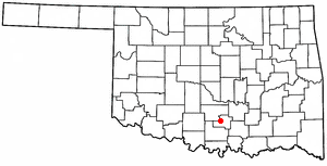
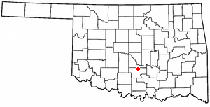
Davis is a city in Garvin and Murray counties in the U.S. state of Oklahoma. The population is 2,823 as of the 2020 census.

References

  1. "ArcGIS REST Services Directory". United States Census Bureau. Retrieved September 20, 2022.
  2. 1 2 "City of Pauls Valley". Geographic Names Information System . United States Geological Survey, United States Department of the Interior . Retrieved October 10, 2023.
  3. 1 2 "U.S. Census website". United States Census Bureau . Retrieved January 31, 2008.
  4. Census:Viewer:Pauls Valley, Oklahoma Population. Retrieved March 14, 2022.
  5. 1 2 Lough, D. Keith. "Garvin County". Encyclopedia of Oklahoma History and Culture. Oklahoma Historical Society. Archived from the original on May 28, 2013. Retrieved October 5, 2013.
  6. "Pauls Valley, Oklahoma". LASR. 2009. Retrieved November 20, 2009.
  7. 1 2 3 Tower, Michael. "Pauls Valley". Encyclopedia of Oklahoma History & Culture. Oklahoma Historical Society. Retrieved October 4, 2016.
  8. Charles Goins, Historical Atlas of Oklahoma (Norman: University of Oklahoma Press, 2006), plate 105.
  9. "Pauls Valley Historical Society". Pauls Valley Chamber of Commerce. Retrieved October 4, 2016.
  10. "Pauls Valley". Heartland Flyer. Retrieved November 20, 2009.
  11. "Wacker Park in Pauls Valley, OK history and teams on StatsCrew.com". www.statscrew.com.
  12. "Parks – Pauls Valley, Oklahoma".
  13. 1 2 3 "Pauls Valley, OK (PVL)". The Great American Stations. Amtrak. Retrieved May 25, 2024.
  14. Bru-Hed (December 12, 2005). "New Cartoonists Hall of Fame Collection & Museum!". Comics Buyer's Guide . Archived from the original on June 17, 2013. Retrieved March 25, 2012.
  15. "Geographic Identifiers: 2010 Demographic Profile Data (G001): Pauls Valley city, Oklahoma". American Factfinder. U.S. Census Bureau. Retrieved January 23, 2017.[ dead link ]
  16. "Census of Population and Housing". Census.gov. Retrieved March 14, 2022.
  17. "Pauls Valley Public Schools" . Retrieved November 20, 2009.
  18. "Airline and Airport Code Search." Accessed October 30, 2016.
  19. "Pauls Valley Muni" AirportIQ5010. September 15, 2016 Accessed October 30, 2016.
  20. "Greyhound Bus Stations in Oklahoma". Greyhound. Retrieved January 10, 2021.
  21. Henry E. Chambers, History of Louisiana, Vol. 2 (Chicago and New York City: The American Historical Society, Inc., 1925, p. 71)
  22. "Roger Eason Stats". Pro-Football-Reference.com.
  23. "Stanford University's Official Athletic Site - Football". www.gostanford.com. Archived from the original on August 10, 2011.