Pelham, Alabama

Last updated

Pelham, Alabama
Flag of Pelham, Alabama.png
Seal of Pelham, Alabama.svg
Logo of Pelham, Alabama.png
Shelby County Alabama Incorporated and Unincorporated areas Pelham Highlighted 0158848.svg
Location of Pelham in Shelby County, Alabama
Coordinates: 33°18′16″N86°47′5″W / 33.30444°N 86.78472°W / 33.30444; -86.78472
CountryUnited States
State Alabama
County Shelby
Incorporated July 10, 1964 [1]
Government
   Mayor Gary W. Waters
Area
[2]
  Total39.243 sq mi (101.639 km2)
  Land38.737 sq mi (100.330 km2)
  Water0.506 sq mi (1.311 km2)
Elevation
[3]
830 ft (253 m)
Population
 (2020) [4]
  Total24,318
  Estimate 
(2022) [5]
24,755
  Density639/sq mi (246.7/km2)
Time zone UTC–6 (Central (CST))
  Summer (DST) UTC–5 (CDT)
ZIP Code
35124
Area code(s) 205 and 659
FIPS code 01-58848
GNIS feature ID2404497 [3]
Website pelhamalabama.gov

Pelham is a city in Shelby County, Alabama, United States. The population was 24,318 at the 2020 census, [4] It incorporated on July 10, 1964 and is a suburb located in the Birmingham metropolitan area, Alabama which was home to nearly 1.2 million residents as of the 2020 census. [6] It was named for Confederate Civil War officer John Pelham. [6]

Contents

Geography

Pelham is located at 33°18′16″N86°47′5″W / 33.30444°N 86.78472°W / 33.30444; -86.78472 (33.304581, -86.784620). [7]

According to the United States Census Bureau, the city has a total area of 39.243 square miles (101.64 km2), of which 38.737 square miles (100.33 km2) is land and 0.506 square miles (1.31 km2), is water. [2]

Oak Mountain State Park, Alabama's largest state park, is located in Pelham.

The city is located along U.S. Route 31, which runs directly through the city, as well as I-65, with access from exits 242 and 246. Downtown Birmingham is 20 mi (32 km) north, and Montgomery is 72 mi (116 km) south, both via US-31 or I-65.

Demographics

Historical population
CensusPop.Note
1970 931
1980 6,759626.0%
1990 9,76544.5%
2000 14,36947.1%
2010 21,35248.6%
2020 24,31813.9%
2022 (est.)24,755 [5] 1.8%
U.S. Decennial Census [8]
2020 Census [4]

2020 census

Pelham city, Alabama – Racial and Ethnic Composition
(NH = Non-Hispanic)
Note: the US Census treats Hispanic/Latino as an ethnic category. This table excludes Latinos from the racial categories and assigns them to a separate category. Hispanics/Latinos may be of any race.
Race / EthnicityPop 2010 [9] Pop 2020 [10]  % 2010% 2020
White alone (NH)15,77615,98281.2%65.72%
Black or African American alone (NH)1,5793,1037.5%12.76%
Native American or Alaska Native alone (NH)49340.3%0.14%
Asian alone (NH)5095942.4%2.44%
Pacific Islander alone (NH)13170.1%0.07%
Some Other Race alone (NH)291076.9%9.5%
Mixed Race/Multi-Racial (NH)2239391.6%3.86%
Hispanic or Latino (any race)3,1743,64914.9%15.01%
Total21,35224,318100.00%100.00%

As of the 2020 census, there were 24,318 people and 9,489 households, and 6,681 families residing in the city. [11] The population density was 626.4 inhabitants per square mile (241.9/km2). There were 9,777 housing units. The racial makeup was 65.72% White, 12.76% African American, 0.14% Native American, 2.44% Asian, 0.07% Native Hawaiian, and 3.86% from two or more races. Hispanic or Latino of any race were 15.01% of the population. [12]

2010 census

As of the 2010 census, there were 21,352 people, 8,149 households, and 5,764 families living in the city. The population density was 547.2 inhabitants per square mile (211.3/km2). There were 8,541 housing units at an average density of 224.8 per square mile (86.8/km2). The racial makeup of the city was 81.2% White, 7.5% Black or African American, 0.3% Native American, 2.4% Asian, 6.9% from other races, and 1.6% from two or more races. 14.9% of the population were Hispanic or Latino of any race.

Of the 8,149 households 34.7% had children under the age of 18 living with them, 58.4% were married couples living together, 8.7% had a female householder with no husband present, and 29.3% were non-families. 24.1% of households were one person and 6.2% were one person aged 65 or older. The average household size was 2.62 and the average family size was 3.14.

The age distribution was 26.0% under the age of 18, 6.8% from 18 to 24, 32.9% from 25 to 44, 24.9% from 45 to 64, and 9.4% 65 or older. The median age was 35.3 years. For every 100 females, there were 95.0 males. For every 100 females age 18 and over, there were 96.8 males.

The median household income was $67,622 and the median family income was $80,690. Males had a median income of $56,277 versus $42,269 for females. The per capita income for the city was $30,467. About 3.8% of families and 6.5% of the population were below the poverty line, including 9.1% of those under age 18 and 1.7% of those age 65 or over.

2000 census

As of the 2000 census, there were 14,369 people, 5,637 households, and 4,002 families living in the city. The population density was 378.2 inhabitants per square mile (146.0/km2). There were 5,894 housing units at an average density of 155.1 per square mile (59.9/km2). The racial makeup of the city was 90.02% White, 3.97% Black or African American, 0.35% Native American, 1.68% Asian, 2.82% from other races, and 1.16% from two or more races. 6.42% of the population were Hispanic or Latino of any race.

Of the 5,637 households 35.5% had children under the age of 18 living with them, 59.3% were married couples living together, 8.9% had a female householder with no husband present, and 29.0% were non-families. 25.3% of households were one person and 5.8% were one person aged 65 or older. The average household size was 2.54 and the average family size was 3.05.

The age distribution was 25.6% under the age of 18, 7.4% from 18 to 24, 35.7% from 25 to 44, 22.7% from 45 to 64, and 8.6% 65 or older. The median age was 35 years. For every 100 females, there were 94.8 males. For every 100 females age 18 and over, there were 91.6 males.

The median household income was $54,808 and the median family income was $79,794. Males had a median income of $42,659 versus $32,382 for females. The per capita income for the city was $25,611. About 3.4% of families and 4.6% of the population were below the poverty line, including 5.7% of those under age 18 and 2.4% of those age 65 or over.

City government

The City of Pelham operates under the Mayor/Council Act. The mayor serves as the city's chief executive and the City Council act much like a board of directors. The city also has a chief of police, fire chief, finance director / city clerk, building inspector, permits clerk, revenue director, director of golf, parks manager, waterworks superintendent, librarian, and departments thereof.

Mayors of Pelham, 1964–present

NamePartyTermOccupation
Paul Yeager SrDemocratic1964–1972Farmer
Burk DunnawayDemocratic1972–1984Junk Dealer
Bobby HayesRepublican1984–2008Police Officer
Don MurphyRepublican2008–2012Real Estate Broker
Gary WatersRepublican2012–presentFire Chief

Education

Pelham High School Pelham High School.JPG
Pelham High School

Pelham City Schools operates public schools and has done so since it was established on July 1, 2014. [13] It operates Pelham High School.

Previously it was in the Shelby County School System. Prior to 2014 some portions of Pelham bordering Chelsea attended public schools in Chelsea; residents there were concerned about the separation of Pelham due to the distance of schools in Pelham from their areas. [14]

Notable people

Related Research Articles

<span class="mw-page-title-main">Etowah County, Alabama</span> County in Alabama, United States

Etowah County is a county located in the northeastern part of the U.S. state of Alabama. As of the 2020 census the population was 103,436. Its county seat is Gadsden. Its name is from a Cherokee word meaning "edible tree". In total area, it is the smallest county in Alabama, but one of the most densely populated. Etowah County comprises the Gadsden Metropolitan Statistical Area.

<span class="mw-page-title-main">Covington County, Alabama</span> County in Alabama, United States

Covington County, is a county located in the south central portion of the U.S. state of Alabama. As of the 2020 census the population was 37,570. Its county seat is Andalusia. Its name is in honor of Brigadier General Leonard Covington of Maryland and Mississippi, who died in the War of 1812.

<span class="mw-page-title-main">Crenshaw County, Alabama</span> County in Alabama, United States

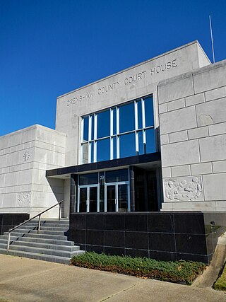
Crenshaw County is a county located in the south central portion of the U.S. state of Alabama. It is located immediately south of the Montgomery metropolitan area. As of the 2020 census, the population was 13,194. Its county seat is Luverne. Its name is in honor of an Alabama judge, Anderson Crenshaw.

<span class="mw-page-title-main">Marshall County, Alabama</span> County in Alabama, United States

Marshall County is a county of the state of Alabama, United States. As of the 2020 census the population was 97,612. Its county seat is Guntersville. A second courthouse is in Albertville. Its name is in honor of John Marshall, famous Chief Justice of the United States. Marshall County is a dry county, with the exception of the five cities of Albertville, Arab, Grant, Guntersville, and Boaz. Marshall County comprises the Albertville, AL Micropolitan Statistical Area, which is also included in the Huntsville-Decatur-Albertville, AL Combined Statistical Area.

<span class="mw-page-title-main">Shelby County, Alabama</span> County in Alabama, United States

Shelby County is located in the central portion of the U.S. state of Alabama. As of the 2020 census the population was 223,024, making it the sixth-most populous county in Alabama. The county seat is Columbiana. Its largest city is Alabaster. The county is named in honor of Isaac Shelby, Governor of Kentucky from 1792 to 1796 and again from 1812 to 1816. Shelby County is included in the Birmingham–Hoover, AL Metropolitan Statistical Area.

<span class="mw-page-title-main">Talladega County, Alabama</span> County in Alabama, United States

Talladega County is one of the sixty-seven counties located in the east central portion of the U.S. state of Alabama. As of the 2020 census, the population was 82,149. Its county seat is Talladega.

<span class="mw-page-title-main">Tallapoosa County, Alabama</span> County in Alabama, United States

Tallapoosa County is located in the east-central portion of the U.S. state of Alabama. As of the 2020 census, the population was 41,311. Its county seat is Dadeville. Its largest city is Alexander City.

<span class="mw-page-title-main">Florala, Alabama</span> Town in Alabama, United States

Florala is a town in Covington County, Alabama, United States. At the 2020 census, the population was 1,923.

Selmont-West Selmont is a census-designated place (CDP) in Dallas County, Alabama, United States. At the 2020 census, the population was 2,158.

<span class="mw-page-title-main">Sardis City, Alabama</span> Town in Alabama, United States

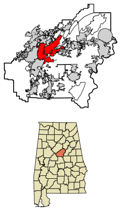
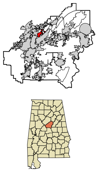
Sardis City is a town in Etowah and Marshall counties in the U.S. state of Alabama. It is part of the Gadsden Metropolitan Statistical Area. It originally incorporated in May 1963 under the name of "Sardis". It became Sardis City in the 1980s. At the 2020 census, the population was 1,814.

<span class="mw-page-title-main">Argo, Alabama</span> City in Alabama, United States

Argo is a city in Jefferson and St. Clair counties, Alabama, United States. It incorporated in 1987. At the 2020 census, the population was 4,368.

<span class="mw-page-title-main">Graysville, Alabama</span> City in Alabama, United States

Graysville is a city in northwestern Jefferson County, Alabama, United States, located north of Adamsville. At the 2020 census, the population was 1,950.

<span class="mw-page-title-main">McDonald Chapel, Alabama</span> CDP in Alabama, United States

McDonald Chapel is a census-designated place in Jefferson County, Alabama, United States. It is northeast of the Birmingham suburb of Pleasant Grove. At the 2020 census, the population was 739. Large portions of this area were damaged by violent tornadoes in 1956, 1998, and 2011. The 1998 tornado was rated F5 on the Fujita scale.

<span class="mw-page-title-main">Midfield, Alabama</span> Town in Alabama, United States

Midfield is a town in Jefferson County, Alabama, United States, located two miles south of the Birmingham suburb of Fairfield. It incorporated in 1953. As of the 2020 census, it had a population of 5,211.

<span class="mw-page-title-main">Fort Deposit, Alabama</span> Town in Alabama, United States

Fort Deposit is a town in Lowndes County, Alabama, United States. Since 1890, it has been the largest town in Lowndes County. At the 2010 census the population was 1,344, up from 1,270 in 2000. It is part of the Montgomery Metropolitan Statistical Area.

<span class="mw-page-title-main">Gordonville, Alabama</span> Town in Alabama, United States

Gordonville is a town in Lowndes County, Alabama, United States. At the 2010 census the population was 326, up from 318 in 2000. It is part of the Montgomery Metropolitan Statistical Area. It incorporated effective January 20, 1990.

<span class="mw-page-title-main">Mosses, Alabama</span> Town in Alabama, United States

Mosses is a town in Lowndes County, Alabama, United States. At the 2010 census the population was 1,029, down from 1,101 in 2000. It is part of the Montgomery Metropolitan Statistical Area. It incorporated in 1979.

<span class="mw-page-title-main">White Hall, Alabama</span> Town in Alabama, United States

White Hall is a town in Lowndes County, Alabama, United States. The community was named for a plantation that was destroyed in an 1882 tornado. At the 2010 census the population was 858, down from its record high of 1,014 in 2000. It is part of the Montgomery Metropolitan Statistical Area.

<span class="mw-page-title-main">Indian Springs Village, Alabama</span> Rural Area in Alabama, United States

Indian Springs Village is a rural town in Shelby County, Alabama, United States, in the Birmingham metropolitan area. It incorporated effective November 14, 1990. At the 2010 census the population was 2,363, up from 2,225 in 2000.

<span class="mw-page-title-main">Pine Apple, Alabama</span> Town in Alabama, United States

Pine Apple is a town in Wilcox County, Alabama, United States. It incorporated in 1872. Per the 2020 census, the population was 143. It has two places on the National Register of Historic Places, the Hawthorne House and the Pine Apple Historic District.

References

  1. "Municipalities of Alabama Incorporation Dates" (PDF). Alabama League of Municipalities. Retrieved March 18, 2024.
  2. 1 2 "2023 U.S. Gazetteer Files". United States Census Bureau. Retrieved March 17, 2024.
  3. 1 2 U.S. Geological Survey Geographic Names Information System: Pelham, Alabama
  4. 1 2 3 "Explore Census Data". United States Census Bureau . Retrieved March 18, 2024.
  5. 1 2 "City and Town Population Totals: 2020–2022". United States Census Bureau. March 18, 2024. Retrieved March 18, 2024.
  6. 1 2 "Pelham - Encyclopedia of Alabama". Encyclopedia of Alabama. Retrieved April 15, 2018.
  7. "US Gazetteer files: 2010, 2000, and 1990". United States Census Bureau. February 12, 2011. Retrieved April 23, 2011.
  8. "Census of Population and Housing". United States Census Bureau. Retrieved June 4, 2015.
  9. "P2 HISPANIC OR LATINO, AND NOT HISPANIC OR LATINO BY RACE – 2010: DEC Redistricting Data (PL 94-171) – Pelham city, Alabama". United States Census Bureau.
  10. "P2 HISPANIC OR LATINO, AND NOT HISPANIC OR LATINO BY RACE - 2020: DEC Redistricting Data (PL 94-171) – Pelham city, Alabama". United States Census Bureau.
  11. "US Census Bureau, Table P16: Household Type". United States Census Bureau. Retrieved March 18, 2024.
  12. "How many people live in Pelham city, Alabama". USA Today. Retrieved March 18, 2024.
  13. "School System." City of Pelham. Retrieved on January 16, 2019.
  14. Reed, Martin J. (June 17, 2013). "Pelham opposition growing to separating from Shelby County school system". AL.COM . Retrieved January 16, 2019.
  15. "John Green on Twitter". Twitter. Retrieved January 14, 2017.
  16. "School Directory (Sport Schedule & Roster)". AHSAA. Archived from the original on December 3, 2013. Retrieved November 10, 2012.
  1. ^ "US Gazetteer files: 2010, 2000, and 1990". United States Census Bureau. February 12, 2011. https://www.census.gov/geo/www/gazetteer/gazette.html. Retrieved April 23, 2011.
  2. ^ "American FactFinder". United States Census Bureau. https://archive.today/20200212063637/http://factfinder.census.gov/. Retrieved January 31, 2008.
  3. ^ "2010 Census Interactive Population Search". United States Census Bureau. https://web.archive.org/web/20131013222920/http://2010.census.gov/2010census/popmap/. Retrieved August 10, 2011.