Pelham Gardens, Bronx

Last updated

Pelham Gardens
Pelham Gardens, Bronx
Location in New York City
Coordinates: 40°51′40″N73°50′42″W / 40.861°N 73.845°W / 40.861; -73.845
Country Flag of the United States.svg  United States
State Flag of New York.svg  New York
City New York City
Borough The Bronx
Community District Bronx 11 [1]
Area
[2]
  Total1.96 km2 (0.757 sq mi)
Population
 (2011) [2]
  Total15,388
  Density7,800/km2 (20,000/sq mi)
Economics
   Median income $68,552
ZIP Codes
10469
Area code 718, 347, 929, and 917
Website www.pelhamgardens.nyc

Pelham Gardens is a neighborhood located in the Northeast section of the Bronx, New York City. Its boundaries, starting from the north and moving clockwise are East Gun Hill Road to the north and east, Pelham Parkway to the south, and the IRT Dyre Avenue Line ( 5 train) to the west ending at the esplanade. Eastchester Road is the primary thoroughfare through Pelham Gardens.

Contents

Pelham Gardens is located in Bronx Community Board 11, and its ZIP Code is 10469. The area is patrolled by the New York City Police Department's 49th Precinct. [3]

History

The area was originally home to the Siwanoy, a Native American tribe affiliated with the Algonquian peoples. The name Pelham Gardens derives from Thomas Pell, who purchased the land from the Siwanoy on June 27, 1654 at Treaty Oak, located next to Shore Road in what is now Pelham Bay Park. The town of Westchester was established at this time at what is now Westchester Square; the entire area was part of Westchester County, New York until it was transferred to the city of New York City in 1895. The oldest house in the area is what was once a farmhouse, located at the corner of Woodhull Avenue and Fielding Street.

The neighborhood is socioeconomically diverse, with a considerable working class population as well as many upper middle class professionals, particularly in the eastern area of the community. The proximity to major hospitals and a high concentration of private medical facilities has drawn many health care professionals into the areas, as well as police officers, lawyers, and small business owners, particularly in the fields of construction and food services. [4]

Land use and terrain

Pelham Gardens is dominated by single family homes with some small apartment buildings and 2-3 family homes. Many private homes have basement studio apartments but are classified as one family. The total land area is roughly two square miles. The area its largely flat but contains a significant valley between Eastchester Road and Laconia Avenue, with the most significant low point on Seymour Avenue. This dip was likely caused thousands of years ago by a glacier.

Demographics

Based on data from the 2010 United States Census, the population of the combined Allerton-Pelham Gardens neighborhood was 28,903, an increase of 393 (1.4%) from the 28,510 counted in 2000. Covering an area of 726.98 acres (294.20 ha), the neighborhood had a population density of 39.8 inhabitants per acre (25,500/sq mi; 9,800/km2). [5] The racial makeup of the Allerton-Pelham Gardens neighborhood was 25.3% (7,316) White, 32.5% (9,391) African American, 0.2% (55) Native American, 7.9% (2,282) Asian, 0.0% (12) Pacific Islander, 0.9% (252) from other races, and 1.4% (412) from two or more races. Hispanic or Latino of any race were 31.8% (9,183) of the population. [6]

Demographically, the neighborhood has historically been home to a large Italian-American population as well as a sizable Jewish population, which has dramatically decreased since the 1970s. Smaller numbers of Irish-Americans and German-Americans have also made this largely Catholic community home since significant development began in the 1920s, with a construction boom in the 1950s. Large numbers of Puerto Rican families have moved into the area since the 1980s, with smaller but significant numbers of Filipino-Americans, African-Americans, Dominican-Americans, Albanian-Americans, Korean Americans, and Vietnamese Americans. [7] [8]

The entirety of Community District 11, which comprises Pelham Gardens, Allerton, and Morris Park, had 116,180 inhabitants as of NYC Health's 2018 Community Health Profile, with an average life expectancy of 79.9 years. [9] :2,20 This is lower than the median life expectancy of 81.2 for all New York City neighborhoods. [10] :53 (PDF p. 84) [11] Most inhabitants are youth and middle-aged adults: 22% are between the ages of between 0–17, 30% between 25–44, and 24% between 45–64. The ratio of college-aged and elderly residents was lower, at 9% and 14% respectively. [9] :2

As of 2017, the median household income in Community District 11 was $48,018. [12] In 2018, an estimated 21% of Pelham Gardens and Morris Park residents lived in poverty, compared to 25% in all of the Bronx and 20% in all of New York City. One in eight residents (12%) were unemployed, compared to 13% in the Bronx and 9% in New York City. Rent burden, or the percentage of residents who have difficulty paying their rent, is 55% in Pelham Gardens and Morris Park, compared to the boroughwide and citywide rates of 58% and 51% respectively. Based on this calculation, as of 2018, Pelham Gardens and Morris Park are considered high-income relative to the rest of the city and not gentrifying. [9] :7

Police and crime

Pelham Gardens and Morris Park are patrolled by the 49th Precinct of the NYPD, located at 2121 Eastchester Road. [3] The 49th Precinct ranked 43rd safest out of 69 patrol areas for per-capita crime in 2010. [13] As of 2018, with a non-fatal assault rate of 64 per 100,000 people, Pelham Gardens and Morris Park's rate of violent crimes per capita is slightly more than that of the city as a whole. The incarceration rate of 372 per 100,000 people is lower than that of the city as a whole. [9] :8

The 49th Precinct has a lower crime rate than in the 1990s, with crimes across all categories having decreased by 71.7% between 1990 and 2022. The precinct reported 7 murders, 17 rapes, 273 robberies, 367 felony assaults, 133 burglaries, 611 grand larcenies, and 371 grand larcenies auto in 2022. [14]

Fire safety

Pelham Gardens is served by the New York City Fire Department (FDNY)'s Engine Co. 97 at 1454 Astor Avenue. [15] > [16]

Health

As of 2018, preterm births and births to teenage mothers are slightly more common in Pelham Gardens and Morris Park than in other places citywide. In Pelham Gardens and Morris Park, there were 90 preterm births per 1,000 live births (compared to 87 per 1,000 citywide), and 19.7 births to teenage mothers per 1,000 live births (compared to 19.3 per 1,000 citywide). [9] :11 Pelham Gardens and Morris Park has a low population of residents who are uninsured. In 2018, this population of uninsured residents was estimated to be 12%, the same as the citywide rate of 12%. [9] :14

The concentration of fine particulate matter, the deadliest type of air pollutant, in Pelham Gardens and Morris Park is 0.0074 milligrams per cubic metre (7.4×10⁻⁹ oz/cu ft), less than the city average. [9] :9 Fifteen percent of Pelham Gardens and Morris Park residents are smokers, which is slightly higher than the city average of 14% of residents being smokers. [9] :13 In Pelham Gardens and Morris Park, 32% of residents are obese, 14% are diabetic, and 31% have high blood pressure—compared to the citywide averages of 24%, 11%, and 28% respectively. [9] :16 In addition, 23% of children are obese, compared to the citywide average of 20%. [9] :12

Eighty-three percent of residents eat some fruits and vegetables every day, which is lower than the city's average of 87%. In 2018, 80% of residents described their health as "good", "very good", or "excellent", slightly higher than the city's average of 78%. [9] :13 For every supermarket in Pelham Gardens and Morris Park, there are 17 bodegas. [9] :10

The nearest large hospitals are Calvary Hospital, Montefiore Medical Center's Jack D. Weiler Hospital, and NYC Health + Hospitals/Jacobi in Morris Park. The Albert Einstein College of Medicine campus is also located in Morris Park. [17]

Post office and ZIP Code

Pelham Gardens is located within ZIP Code 10469 east of Bronxwood Avenue. [18] The United States Postal Service operates the Baychester Station at 1525 East Gun Hill Road. [19]

Education

Pelham Gardens and Morris Park generally have a lower rate of college-educated residents than the rest of the city as of 2018. While 32% of residents age 25 and older have a college education or higher, 24% have less than a high school education and 44% are high school graduates or have some college education. By contrast, 26% of Bronx residents and 43% of city residents have a college education or higher. [9] :6 The percentage of Pelham Gardens and Morris Park students excelling in math rose from 32% in 2000 to 48% in 2011, though reading achievement remained constant at 37% during the same time period. [20]

Pelham Gardens and Morris Park's rate of elementary school student absenteeism is slightly higher than the rest of New York City. In Pelham Gardens and Morris Park, 23% of elementary school students missed twenty or more days per school year, a little more than the citywide average of 20%. [9] :6 [10] :24 (PDF p. 55) Additionally, 74% of high school students in Pelham Gardens and Morris Park graduate on time, about the same as the citywide average of 75%. [9] :6

Library

The New York Public Library (NYPL) operates the Eastchester branch at 1385 East Gun Hill Road. It has operated since 1950 and moved to its current one-story, 7,500-square-foot (700 m2) location in 1985. [21]

Transportation

The following MTA Regional Bus Operations bus routes serve Pelham Gardens: [22]

The following New York City Subway stations serve Pelham Gardens: [23]

Notable residents

Related Research Articles

<span class="mw-page-title-main">Throggs Neck</span> Neighborhood of the Bronx in New York City

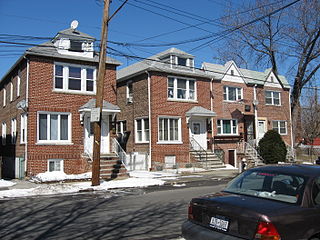
Throggs Neck is a neighborhood and peninsula in the south-eastern portion of the borough of the Bronx in New York City. It is bounded by the East River and Long Island Sound to the south and east, Westchester Creek on the west, and Baisley Avenue and the Bruckner Expressway on the north.

<span class="mw-page-title-main">Pelham Bay (neighborhood), Bronx</span> Neighborhood of the Bronx in New York City

Pelham Bay is a middle class residential neighborhood in the borough of the Bronx, in New York City. It is named for Pelham Bay Park, New York City's largest park, which lies on the neighborhood's northeastern border; and for Pelham Bay, a body of water in that park. The neighborhood is bounded roughly by Pelham Parkway on the north, the New England Thruway (I-95) on the east, the Bruckner Expressway (I-95) on the south, and the Hutchinson River Parkway on the west.

Baychester is a neighborhood geographically located in the northeast part of the Bronx, New York City. Its boundaries are East 222nd Street to the northeast, the New England Thruway (I-95) to the east, Gun Hill Road to the southwest, and Boston Road to the northwest. Eastchester Road is the primary thoroughfare through Baychester.

Allerton is a working-class neighborhood geographically located in the East Bronx section of the Bronx, New York City. It is named in honor of Daniel Allerton, an early Bronx settler who purchased and farmed this area with his wife Hustace. It consists of two subsections called Bronxwood and Laconia. Its boundaries, starting from the north and moving clockwise, are Adee Avenue, Boston Road, and Gun Hill Road to the northeast; the IRT Dyre Avenue Line to the east; Waring Avenue to the south; and Bronx River Parkway to the west. White Plains Road and Boston Road are the primary thoroughfares through Allerton.

<span class="mw-page-title-main">Soundview, Bronx</span> Neighborhood of the Bronx in New York City

Soundview is a neighborhood on the Clason Point peninsula, on the southern section of the borough of the Bronx in New York City. Its boundaries, starting from the north and moving clockwise, are the Cross-Bronx Expressway to the north, White Plains Road to the east, Lacombe Avenue to the south, and the Bronx River to the west. The Bruckner Expressway bisects the neighborhood horizontally along the center and the Bronx River Parkway runs north to south. Soundview Avenue is the primary thoroughfare through Soundview.

<span class="mw-page-title-main">Fordham, Bronx</span> Neighborhood of the Bronx in New York City

Fordham Manor is a neighborhood located in the western Bronx, New York City. Fordham is roughly bordered by East 196th Street to the north, the Harlem River to the west, Fordham Road to the south, and Southern Boulevard to the east. The neighborhood's primary thoroughfares are Fordham Road and Grand Concourse.

<span class="mw-page-title-main">Williamsbridge, Bronx</span> Neighborhood of the Bronx in New York City

Williamsbridge is a neighborhood geographically located in the north-central portion of the Bronx in New York City. Its boundaries, starting from the north and moving clockwise are East 222nd Street to the north, Boston Road to the east, East Gun Hill Road to the south, and the Bronx River to the west. White Plains Road is the primary thoroughfare through Williamsbridge.

<span class="mw-page-title-main">Country Club, Bronx</span> Neighborhood of the Bronx in New York City

Country Club is a residential neighborhood located in the East Bronx in New York City. The neighborhood's boundaries are Middletown Road and Watt Avenue to the north, Eastchester Bay to the east, Layton Avenue and the Throggs Neck neighborhood to the south, and the New England Thruway and Pelham Bay neighborhood to the west. Pelham Bay Park, the largest public park in New York City, is located just north of Country Club.

<span class="mw-page-title-main">Bedford Park, Bronx</span> Neighborhood of the Bronx in New York City

Bedford Park is a residential neighborhood in the northwest Bronx, New York City, adjacent to the New York Botanical Garden. Its boundaries, starting from the north and moving clockwise, are: Mosholu Parkway to the north, Webster Avenue to the east, East 196th Street to the south, and Jerome Avenue to the west.

<span class="mw-page-title-main">Eastchester, Bronx</span> Neighborhood of the Bronx in New York City

Eastchester is a working-class neighborhood in the northeast Bronx in New York City. Its boundaries, starting from the north and moving clockwise are the Bronx-Westchester County border to the north, the New England Thruway to the east, Baychester Avenue to the south, and the intersection of 233rd Street and Baychester Avenue to the west. Boston Road is the primary thoroughfare through Eastchester and Dyre Avenue is the main commercial street. Eastchester includes the sub-neighborhood of Edenwald.

<span class="mw-page-title-main">Morris Park, Bronx</span> Neighborhood of the Bronx in New York City

Morris Park is a neighborhood in the New York City borough of the Bronx. Its approximate boundaries, starting from the north and moving clockwise, are Neill Avenue and Pelham Parkway to the north, Eastchester Road to the east, the Amtrak Northeast Corridor tracks and Sackett Avenue to the east and south, and Bronxdale Avenue and White Plains Road to the west. It borders the neighborhoods of Van Nest to its southwest and Pelham Parkway to its northeast. Williamsbridge Road and Morris Park Avenue are the primary thoroughfares.

<span class="mw-page-title-main">Van Nest, Bronx</span> Neighborhood of the Bronx in New York City

Van Nest is a working-class neighborhood geographically located in the East Bronx section of the Bronx, New York City. Going clockwise, its boundaries are Bronxdale Avenue to the northeast, the Amtrak tracks to the southeast, and Bronx Park to the west. Van Nest predated Morris Park by 20 years and is considered the older of the two communities. Morris Park Avenue and White Plains Road are the primary commercial thoroughfares through Van Nest.

<span class="mw-page-title-main">Crotona Park East, Bronx</span> Neighborhood of the Bronx in New York City

Crotona Park East, also known as Crotona or East Morrisania, is a residential neighborhood geographically located in the southwest Bronx in New York City. Crotona Park East is considered part of the South Bronx. Its boundaries, starting from the north and moving clockwise are the Cross-Bronx Expressway to the north, the Bronx River to the east, East 167th Street to the south, and Crotona/Prospect Avenues to the west. Southern Boulevard is the primary thoroughfare through the area. The neighborhood is adjacent to, but distinct from, the nearby park named Crotona Park.

<span class="mw-page-title-main">Bronx Community Board 11</span> Community District in New York, United States

Bronx Community Board 11 (CB11) is a small unit of the City of New York (NYC), whose district encompasses the neighborhoods of Allerton, Indian Village, Morris Park, Pelham Gardens, Pelham Parkway (neighborhood), Van Nest and other areas in the borough of the Bronx. Coterminous with the 49th NYPD Precinct, its district is delimited by Bronx Park East and the Bronx River Parkway to the west, Adee Avenue, Boston Road and East Gun Hill Road to the north, the Hutchinson River Parkway to the east, and East Tremont Avenue to the south.

<span class="mw-page-title-main">Pelham Parkway (neighborhood), Bronx</span> Neighborhood of the Bronx in New York City

Pelham Parkway is a working- and middle-class residential neighborhood geographically located in the center of the Bronx, a borough of New York City in the United States. Its boundaries, starting from the north and moving clockwise are: Waring Avenue to the north, the IRT Dyre Avenue Line tracks to the east, Neill Avenue to the South, and Bronx River Parkway to the west. White Plains Road is the primary commercial thoroughfare through Pelham Parkway. The neighborhood is named after Pelham Parkway, a major west–east parkway that travels through the East Bronx.

<span class="mw-page-title-main">West Farms, Bronx</span> Neighborhood of the Bronx in New York City

West Farms is a residential neighborhood in The Bronx, New York City. Its boundaries, are: Bronx Park to the north, the Bronx River Parkway to the east, the Cross-Bronx Expressway to the south, and Southern Boulevard to the west. East Tremont Avenue is the primary thoroughfare through West Farms.

<span class="mw-page-title-main">Castle Hill, Bronx</span> Neighborhood of the Bronx in New York City

Castle Hill is a neighborhood located in the southeast section of the borough of the Bronx in New York City. Its boundaries are Waterbury Avenue and Westchester Avenue to the north, Westchester Creek to the east, the East River to the south, and White Plains Road to the west. Unionport is a subsection of Castle Hill, typically considered north of Lafayette Avenue.

<span class="mw-page-title-main">Clason Point, Bronx</span> Neighborhood of the Bronx in New York City

Clason Point is a peninsula and a neighborhood in the East Bronx, New York City. The area includes a collection of neighborhoods including Harding Park, and Soundview. Its boundaries, starting from the north and moving clockwise, are: Lafayette Avenue to the north, White Plains Road/Pugsley Creek Park to the east, the East River to the south, and the Bronx River to the west.

<span class="mw-page-title-main">Westchester Square, Bronx</span> Neighborhood of the Bronx in New York City

Westchester Square is a residential neighborhood geographically located in the eastern section of the New York City borough of the Bronx. Its boundaries, starting from the north and moving clockwise are: East Tremont Avenue and Silver Street, Blondell Avenue and Westchester Creek to the east, Waterbury Avenue to the south and Castle Hill Avenue to the west. The main roadways through Westchester Square are East Tremont Avenue, Westchester Avenue and Williamsbridge Road.

References

  1. "NYC Planning | Community Profiles". communityprofiles.planning.nyc.gov. New York City Department of City Planning. Retrieved March 3, 2018.
  2. 1 2 "Pelham Gardens neighborhood in New York" . Retrieved January 1, 2016.
  3. 1 2 "NYPD – 49th Precinct". www.nyc.gov. New York City Police Department . Retrieved October 3, 2016.
  4. Wilson, Claire. "AutosIf You're Thinking of Living In/Pelham Gardens, the Bronx; Attractive, Affordable and Unheralded", The New York Times , December 8, 2002. Accessed August 14, 2016. "Interns and residents from the medical facilities rent apartments in the two- or three-family houses in Pelham Gardens and are part of a professional mix that includes small-business owners and merchants from Arthur Avenue as well as judges, nurses, professors and up-and-coming chefs."
  5. Table PL-P5 NTA: Total Population and Persons Per Acre - New York City Neighborhood Tabulation Areas*, 2010, Population Division - New York City Department of City Planning, February 2012. Accessed June 16, 2016.
  6. Table PL-P3A NTA: Total Population by Mutually Exclusive Race and Hispanic Origin - New York City Neighborhood Tabulation Areas*, 2010, Population Division - New York City Department of City Planning, March 29, 2011. Accessed June 14, 2016.
  7. Bronx Community District 11 Archived 2009-03-20 at the Wayback Machine
  8. Plambeck, Joseph (October 15, 2011). "The Merits of Safe and Sound". The New York Times. Retrieved January 1, 2016.
  9. 1 2 3 4 5 6 7 8 9 10 11 12 13 14 15 "Morris Park and Bronxdale (Including Allerton, Bronxdale, Indian Village, Morris Park, Pelham Gardens, Pelham Parkway and Van Nest)" (PDF). nyc.gov. NYC Health. 2018. Retrieved March 2, 2019.
  10. 1 2 "2016-2018 Community Health Assessment and Community Health Improvement Plan: Take Care New York 2020" (PDF). nyc.gov . New York City Department of Health and Mental Hygiene. 2016. Retrieved September 8, 2017.
  11. Short, Aaron (June 4, 2017). "New Yorkers are living longer, happier and healthier lives". New York Post. Retrieved March 1, 2019.
  12. "NYC-Bronx Community District 11--Pelham Parkway, Morris Park & Laconia PUMA, NY" . Retrieved July 17, 2018.
  13. "Pelham Parkway: Baychester, Westchester Square – DNAinfo.com Crime and Safety Report". www.dnainfo.com. Archived from the original on April 15, 2017. Retrieved October 6, 2016.
  14. "49th Precinct CompStat Report" (PDF). www.nyc.gov. New York City Police Department . Retrieved July 22, 2018.
  15. "Engine Company 97". FDNYtrucks.com. Retrieved March 14, 2019.
  16. "FDNY Firehouse Listing – Location of Firehouses and companies". NYC Open Data; Socrata . New York City Fire Department. September 10, 2018. Retrieved March 14, 2019.
  17. "Best 30 Hospitals in Bronx, NY with Reviews". Yellow Pages. Retrieved March 14, 2019.
  18. "Williams Bridge, New York City-Bronx, New York Zip Code Boundary Map (NY)". United States Zip Code Boundary Map (USA). Retrieved March 17, 2019.
  19. "Location Details: Baychester". USPS.com. Retrieved March 7, 2019.
  20. "Morris Park / Bronxdale – BX 11" (PDF). Furman Center for Real Estate and Urban Policy. 2011. Retrieved October 5, 2016.
  21. "About the Eastchester Library". The New York Public Library. Retrieved March 14, 2019.
  22. "Bronx Bus Map" (PDF). Metropolitan Transportation Authority. October 2018. Retrieved December 1, 2020.
  23. "Subway Map" (PDF). Metropolitan Transportation Authority. September 2021. Retrieved September 17, 2021.
  24. Bermudez, Adam (February 13, 2014). "State AG Overhauls National Puerto Rican Day Parade". The Bronx Chronicle. Retrieved July 11, 2020. Ten new directors were appointed, including Pelham Gardens resident and former Secretary of State Lorraine Cortes-Vazquez, currently Executive Vice President for Multicultural Markets & Engagement at AARP.
  25. Cohen, Jason (April 23, 2020). "'He was a champion of Italian Americans': COVID-19 claims Bronx legend, Phil Foglia". Bronx Times . Archived from the original on April 23, 2020. Retrieved May 4, 2020.
  26. Guiliano, Bob (September 30, 2017). "Boxing champ Jake LaMotta's ties to the Bronx recalled". Bronx Times.