
Greenwich is a town in southwestern Fairfield County, Connecticut, United States. As of the 2010 census, the town had a total population of 61,171, with a census-estimated increase to 62,574 in 2018. The largest town on Connecticut's Gold Coast, Greenwich is home to many hedge funds and other financial service firms. Greenwich is a principal community of the Bridgeport–Stamford–Norwalk–Danbury metropolitan statistical area, which comprises all of Fairfield County.

Bradford Township is a township in Clearfield County, Pennsylvania, United States. The population was 3,034 at the 2010 census.

Ridge Spring is a town in Saluda County, South Carolina, United States. The population was 737 at the 2010 census. It is part of the Augusta-Richmond Metropolitan Statistical Area.
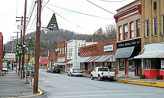
Glenville is a town in and the county seat of Gilmer County, West Virginia, United States, along the Little Kanawha River. The population was 1,537 at the 2010 census. It is the home of Glenville State College.
Mianus, formerly Mayamus and Upper Landing, is a neighborhood in the town of Greenwich in the U.S. state of Connecticut. Unlike other Greenwich neighborhoods such as Cos Cob or Old Greenwich, Mianus does not have its own ZIP code or post office. Mianus lies partly in the Cos Cob ZIP code, partly in the Riverside ZIP code area, and partly in the Old Greenwich ZIP code area. It lies at an elevation of 23 feet and is home to an elementary school. Mianus was also home to the Mianus Motor Works, a marine-engine manufacturer.
Cos Cob is a neighborhood and census-designated place in the town of Greenwich, Connecticut. It is located at 41.033 north, 73.6 west, on the Connecticut shoreline in southern Fairfield County. It had a population of 6,770 at the 2010 census.

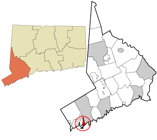
Byram is a neighborhood/section and census-designated place (CDP) in the town of Greenwich in Fairfield County, Connecticut, United States. It had a population of 4,146 at the 2010 census, and a census-estimated population of 4,216 in 2018. An endcap of Connecticut's Gold Coast, Byram is the southernmost point in the town of Greenwich and the U.S. state of Connecticut. It is separated from Port Chester, Westchester County, New York, by the Byram River. Byram was once known as East Port Chester.

The Greenwich Council of the Boy Scouts of America was founded in 1912. Its headquarters resides at 63 Mason Street in Greenwich, Connecticut.

Riverside is a neighborhood/section in the town of Greenwich in Fairfield County, Connecticut, United States. As of the 2010 census, it had a population of 8,416.
Old Greenwich is a coastal neighborhood/section and census-designated place in Greenwich in Fairfield County, Connecticut, United States, and is among America's wealthiest communities. As of the 2010 census it had a population of 6,611.

Glenville is a neighborhood and census-designated place in the town of Greenwich in Fairfield County, Connecticut, United States. As of the 2010 census, it had a population of 2,327. It is located in the western part of Greenwich at the falls of the Byram River, which provided waterpower when this was a mill village. The area is home to Glenville Elementary school, Western Civic Center and a volunteer fire station, the Glenville Fire Department.

Penn Township is one of thirteen townships in Parke County, Indiana, United States. As of the 2010 census, its population was 810 and it contained 368 housing units.

Galena Township is one of twenty-one townships in LaPorte County, Indiana. As of the 2010 census, its population was 1,899 and it contained 967 housing units.

Jackson Township is one of fifteen townships in Wayne County, Indiana, United States. As of the 2010 census, its population was 4,660 and it contained 2,136 housing units.

West Riverside is a neighborhood of the city of New Orleans. A subdistrict of the Uptown/Carrollton Area, its boundaries as defined by the City Planning Commission are: Magazine Street to the north, Napoleon Avenue to the east, the Mississippi River to the south and Exposition, Tchoupitoulas and Webster Streets to the west. This has not traditionally been a separate neighborhood as most of this area has been considered part of Uptown New Orleans throughout most of its history. This name was only artificially created by the City Planning Commission and most residents do not identify with it.

Wilton Center is a neighborhood/section and census-designated place (CDP) in the town of Wilton in Fairfield County, Connecticut, United States. As of the 2010 census it had a population of 732. The CDP partially overlaps the Wilton Center Historic District.

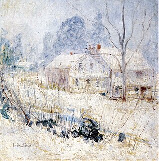
The New Mill and Depot Building of the former Hawthorne Woolen Mill are located in Greenwich, Connecticut, United States. The two structures were built on an existing textile mill complex in the 1870s.
Greenwich is a census-designated place (CDP) in Fairfield County, Connecticut, United States. It is one of several CDPs within the town of Greenwich and corresponds to the historic municipal center of the town and surrounding residential and commercial areas. As of the 2010 census, the population of the Greenwich CDP was 12,942, out of 61,171 in the entire town.
Greenwich Library is the main library in the Greenwich library system of Greenwich, Connecticut, United States. The Greenwich Library system consists of the Main Library and its Byram Shubert and Cos Cob branches.

The Gold Coast, also known as Lower Fairfield County or Southwestern Connecticut not limited to the Connecticut panhandle, is an affluent part of Western Connecticut that includes the entire southern portion of Fairfield County as defined by the U.S. Census Bureau, Super-Public Use Microdata Area (Super-PUMA) Region 09600. The area is about 50 miles northeast of New York City, and is home to many wealthy Manhattan business executives. Parts of the region are served by the Western Connecticut Council of Governments.

