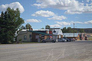
Pendroy is an unincorporatedhamlet in Teton County, Montana, United States.[2] There is a reservations-only bar and restaurant there, a small grocery, and the post office serving ZIP code 59467; but no other stores, gas service or travelers' lodgings.[3]
Established with the construction of the Great Northern Railway, the town boasted a depot, roundhouse, and section house by 1916. It is named for nearby homesteader Levi "Boots" Pendroy, friend of railway founder James J. Hill.[4]
Condon is an unincorporated community and census-designated place in Missoula County, Montana, United States. Located along the Swan River and Montana Highway 83, Condon is situated between the Swan Range to the east and the Mission Mountains to the west, providing ready access to the Bob Marshall Wilderness and Mission Mountains Wilderness, respectively. Its population was 343 as of the 2010 census.
Turner is an unincorporated village in Blaine County, Montana, United States. Turner is located on Montana State Highway 241, 41.5 miles (66.8 km) east-northeast of Chinook. It is 12 miles south of the Canadian border. Its population was 61 as of the 2010 census.
Hogeland is an unincorporated rural village in Blaine County, Montana, United States. Hogeland is 23 miles (37 km) north-northeast of Harlem. Hogeland has a post office with ZIP code 59529.
Springdale is a census-designated place and unincorporated community in Park County, Montana, United States. Its population was 42 at the 2010 census. The community is located near Interstate 90 and the Yellowstone River. Springdale has its own ZIP code, 59082.
Crane is a census-designated place and unincorporated community in Richland County, Montana, United States. Its population was 102 according to the 2010 census. Crane has a post office with the ZIP code 59217. Montana Highway 16 passes through Crane.
Whitewater is a census-designated place and unincorporated community in Phillips County, Montana, United States. Its population was 64 as of the 2010 census. Whitewater has a post office with ZIP code 59544.
Brady is a census-designated place and unincorporated community in Pondera County, Montana, United States. Its population was 140 as of the 2010 census. Brady has a post office with ZIP code 59416. The community is located along Interstate 15.
Dupuyer is a census-designated place and unincorporated community in Pondera County, Montana, United States. Its population was 86 as of the 2010 census. The community is located along U.S. Route 89 and Dupuyer Creek. Dupuyer has a post office with ZIP code 59432.
Sand Coulee is a census-designated place and unincorporated community in Cascade County, Montana, United States. Its population was 212 as of the 2010 census. Sand Coulee has a post office with ZIP code 59472.
Stockett is a census-designated place and unincorporated community in Cascade County, Montana, United States. Its population was 169 as of the 2010 census. Stockett has a post office with ZIP code 59480.
Kila is a census-designated place and unincorporated community in Flathead County, Montana, United States. Its population was 392 as of the 2010 census. Kila has a post office with ZIP code 59920, which opened on May 27, 1901. The community is located along U.S. Route 2, 10 miles from Kalispell.
Marion is a census-designated place and unincorporated community in Flathead County, Montana, United States. Its population was 886 as of the 2010 census. Marion has a post office with ZIP code 59925.
Olney is a census-designated place and unincorporated community in Flathead County, Montana, United States. Its population was 191 as of the 2010 census. Olney has a post office with ZIP code 59927. The most recent 2020 census states the population is 146 according to census.gov. The community is located along U.S. Route 93.
Peerless is an unincorporated community in Daniels County, Montana, United States. Peerless is 19 miles (31 km) west of Scobey. The community has a post office with ZIP code 59253.
Lindsay is an unincorporated hamlet in Dawson County, Montana, United States, located on Montana Highway 200S and the Upper Sevenmile Creek, 22.3 miles (35.9 km) west-northwest of Glendive. The community has a post office with ZIP code 59339, a public school, and a cooperative.
Hall is an unincorporated community in Granite County, Montana, United States. Hall is located on Montana Highway 1, 6.2 miles (10.0 km) west-southwest of Drummond. The community has a post office with ZIP code 59837.
Helmville is an unincorporated community in Powell County, Montana, United States. Helmville is located in the central section of the county near Montana Highway 141, 13 miles (21 km) southeast of Ovando. The community has a post office with ZIP code 59843.
Canyon Creek is a small community of less than 200 citizens in Lewis and Clark County, Montana, United States. Canyon Creek is located along Secondary Highway 279, 18 miles (29 km) northwest of Helena. The community has an Antique and General Store with a U.S. Post Office, Volunteer Fire Station, Elementary School and a RV Park; it has a zip code of 59633.
McAllister is an unincorporated community in Madison County, Montana, United States. McAllister is located on U.S. Route 287, 6.6 miles (10.6 km) north of Ennis. The community has a post office with ZIP code 59740.
Silver Star is an unincorporated community in Madison County, Montana, United States. Silver Star is located on Montana Highway 41, 10.3 miles (16.6 km) north-northeast of Twin Bridges. The community has a post office in operation today, and still has its own ZIP code, 59751.
This page is based on this Wikipedia article Text is available under the CC BY-SA 4.0 license; additional terms may apply. Images, videos and audio are available under their respective licenses.