Phillip, Australian Capital Territory

Last updated

Phillip
Canberra,  Australian Capital Territory
Phillip from Swinger hill.jpg
Looking towards the centre of Phillip from Swinger Hill
Australia Capital Territory location map.svg
Red pog.svg
Phillip
Coordinates 35°20′58″S149°05′25″E / 35.34944°S 149.09028°E / -35.34944; 149.09028
Population5,197 (2021 census) [1]
 • Density2,000/km2 (5,180/sq mi)
Established1966
Postcode(s) 2606
Elevation596 m (1,955 ft)
Area2.6 km2 (1.0 sq mi)
Location
District Woden Valley
Territory electorate(s) Murrumbidgee
Federal division(s) Bean
Suburbs around Phillip:
Lyons Curtin Hughes
Chifley Phillip Garran
Pearce Mawson O'Malley

Phillip (postcode: 2606) is a suburb of Canberra, Australia in the district of Woden Valley. It is located in the centre of the district and contains the district's main commercial centre, Woden Town Centre. Phillip had a residential population of 5,197 at the 2021 census. 67.0% of the population lived in flats. [1] Many more flats are being planned or built.

Contents

The suburb is named after Arthur Phillip, the first Governor of New South Wales. The suburb name was gazetted on 12 May 1966. Streets in Phillip use names associated with the First, Second and Third Fleets; streets in the Swinger Hill were named after architects. [2]

As the commercial and geographical centre of Woden, Phillip contains many of the district's key facilities. As well as the Woden Town Centre, which includes the Westfield Woden shopping centre, a bus interchange and the Lovett Tower (the tallest commercial office building in Canberra), it has its own commercial area located along Botany, Townshend and Parramatta Streets. Eddison Park, including Woden Skate Park and Disc Golf Course, and the Woden Cemetery are located in the suburb. Phillip also contains a number of sporting facilities, including the Phillip Enclosed Oval, which has been known as Football Park since 1981 and was the headquarters of Australian rules football in Canberra during the 1980s and 1990s, [3] and the Phillip Swimming & Ice Skating Centre, home to the CBR Brave of the Australian Ice Hockey League. The Canberra College is situated in Phillip.

Swinger Hill

Swinger Hill shops Swinger Hill Shops January 2015.jpg
Swinger Hill shops

The Swinger Hill housing estate is located in Phillip but separated by Hindmarsh and Athllon Drives from the main part of Phillip. The name Swinger Hill follows the pattern of calling local trigonometrical points after the surveyor who surveyed them, in this case Louis Walter Henry Swinger (1901–1943). He was a member of The Institution of Surveyors (NSW) and worked in Canberra as a surveyor with the Department of the Interior.

Swinger Hill Triangulation Station as photographed at dawn Swinger Hill Triangulation Station as photographed at dawn.jpg
Swinger Hill Triangulation Station as photographed at dawn

The Swinger Hill development was built in the 1970s, some years after Phillip itself, as an estate of mixed townhouses. Some of the houses in Barnet Close in Swinger Hill are listed by the Royal Australian Institute of Architects as significant twentieth century architecture, and were given heritage listing in the ACT in late 2011. [4] [5] [6]

Population

At the 2021 census, there were 5,197 people in Phillip an increase from 1,689 at the 2001 census. [7] 52.2% of people were born in Australia. The next most common countries of birth were India (8.0%), Nepal (6.3%) and the Philippines (5.1%). 55.4% of people spoke only English at home. Other languages spoken at home included Nepali (5.9%), Malayalam (4.8)%, Tagalog and Filipino (4.4%) and Mandarin (3.5%). The most common responses for religion were No Religion (39.5%), Catholic (18.7%) and Hinduism (10.4%). 67.0% of its occupied dwellings were flats and all but three of the rest (32.8%) were semi-detached, terraces or townhouses. [1]

Geology

The rocks underneath Phillip are from the Silurian period and are from 417 to 414 million years old.

Deakin Volcanics green-grey and purple coloured rhyodacite is found in the west half and south east corner of Phillip and under the cemetery area, and Deakin Volcanics purple and green tuff is found around Hindmarsh Drive on the east side of Phillip. The volcano that produced these rocks may have been in Lyons. A small strip of shale from the older and lower Yarralumla Formation is just to the west of Easty Street. [8]

Related Research Articles

<span class="mw-page-title-main">Weston, Australian Capital Territory</span> Suburb of Canberra, Australian Capital Territory

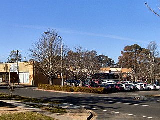
Weston is a suburb of Canberra, Australian Capital Territory, Australia. At the 2021 census, Weston had a population of 4,000 people.

<span class="mw-page-title-main">Deakin, Australian Capital Territory</span> Suburb of Canberra, Australian Capital Territory

Deakin is a suburb of Canberra, Australian Capital Territory, Australia. Development began in the 1920s, although the vast majority of the suburb was built after 1945. It is a largely residential suburb. It includes The Lodge, and the Royal Australian Mint.

<span class="mw-page-title-main">Red Hill, Australian Capital Territory</span> Suburb of Canberra, Australian Capital Territory

Red Hill is a suburb of Canberra, Australian Capital Territory, Australia. The suburb is named after the northernmost hill of the ridge to the west of the suburb. The ridge is a reserve and managed as part of the Canberra Nature Park. The hill is an element of the central Canberra design axis.

<span class="mw-page-title-main">Woden Valley</span> Place in Australian Capital Territory

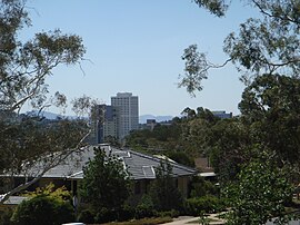
Woden Valley is a district in the Australian Capital Territory in Australia. The district is subdivided into divisions (suburbs), sections and blocks.

<span class="mw-page-title-main">Weston Creek</span> Place in Australian Capital Territory

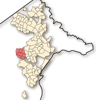
Weston Creek is a district in the Australian Capital Territory in Australia. The district is subdivided into divisions (suburbs), sections and blocks. The district comprises eight residential suburbs, situated to the west of the Woden Valley district and approximately 13 kilometres (8.1 mi) southwest of the Canberra City centre. Situated adjacent to the district was the large Stromlo Forest pine plantation until the forest was destroyed by bushfires in 2001 and 2003.

<span class="mw-page-title-main">Waramanga, Australian Capital Territory</span> Suburb of Canberra, Australian Capital Territory

Waramanga is a suburb of Canberra, Australian Capital Territory, Australia in the district of Weston Creek.

<span class="mw-page-title-main">Duffy, Australian Capital Territory</span> Suburb of Canberra, Australian Capital Territory

Duffy is a suburb of Canberra, Australian Capital Territory, Australia, located in the district of Weston Creek.

<span class="mw-page-title-main">Woden Town Centre</span> Place in Australian Capital Territory

<span class="mw-page-title-main">Garran, Australian Capital Territory</span> Suburb of Canberra, Australian Capital Territory

Garran is a suburb in the Woden district of Canberra in the Australian Capital Territory. Garran was named after Sir Robert Garran who made numerous contributions to the development of higher education in Canberra. The streets in Garran are named after Australian writers. The suburb was first settled in 1966 and has an area of 2.74 km2.

<span class="mw-page-title-main">Belconnen, Australian Capital Territory</span> Suburb of Canberra, Australian Capital Territory

Belconnen is the most inner suburb of the larger district of Belconnen in Canberra, Australia. Sharing its name with the larger district which encapsulates it, the suburb is surrounded with well developed infrastructure, and planning which allows it sunset views from the Brindabellas on its western side. The suburb contains important amenities for the District of Belconnen including the Belconnen Town Centre and Lake Ginninderra as well as its own well populated residential areas. It is bounded by Ginninderra Drive, Aikman Drive, Eastern Valley Way, Belconnen Way and Coulter Drive. It has a number of parks such as Margaret Timpson Park, Eastern Valley Oval and on the foreshores of Lake Ginninberra, Diddams Close Park and John Knight Memorial Park.

Latham is a residential suburb in the Belconnen district of Canberra, located within the Australian Capital Territory, Australia. The suburb is named for John Latham, Chief Justice of the High Court of Australia from 1935 to 1952. Streets in Latham have the names of Australian judges.

<span class="mw-page-title-main">Gungahlin, Australian Capital Territory</span> Suburb of Canberra, Australian Capital Territory

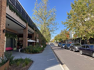
Gungahlin is a suburb in the Canberra, Australia district with the same name; Gungahlin. The postcode is 2912. Gungahlin is the name for the entire district, and also the town centre, but it is also the name of the suburb which Gungahlin Town Centre is in.

Chifley is a suburb of Canberra, Australia, in the district of Woden Valley. The suburb's area is 1.6 square kilometres (0.62 sq mi).

<span class="mw-page-title-main">Hughes, Australian Capital Territory</span> Suburb of Canberra, Australian Capital Territory

Hughes is a suburb in the Canberra, Australia district of Woden. The postcode is 2605. The area of the suburb is 1.81 km2.

<span class="mw-page-title-main">Farrer, Australian Capital Territory</span> Suburb of Canberra, Australian Capital Territory

Farrer is a suburb in the Canberra, Australia district of Woden. The postcode is 2607.

<span class="mw-page-title-main">Lyons, Australian Capital Territory</span> Suburb of Canberra, Australian Capital Territory

Lyons is a suburb in the Canberra, Australia district of Woden. The postcode is 2606.

<span class="mw-page-title-main">Mawson, Australian Capital Territory</span> Suburb of Canberra, Australian Capital Territory

Mawson is a suburb in the Canberra, Australia district of Woden Valley.

<span class="mw-page-title-main">Pearce, Australian Capital Territory</span> Suburb of Canberra, Australian Capital Territory

Pearce is a suburb in the Canberra, Australia district of Woden. The postcode is 2607. It was named after the longest-serving Senator and longest-serving Minister in Australia's federal history, Sir George Pearce.

<span class="mw-page-title-main">Torrens, Australian Capital Territory</span> Suburb of Canberra, Australian Capital Territory

Torrens is a suburb in the Woden Valley district of Canberra, Australia. It is named after Sir Robert Torrens, a former Premier of South Australia and instigator of the Torrens title system of land registration. The suburb was gazetted on 12 May 1966.

<span class="mw-page-title-main">Emu Ridge, Australian Capital Territory</span> Place in Australian Capital Territory

Emu Ridge is a housing estate in the suburb of Belconnen, located in the district of Belconnen, in Canberra, within the Australian Capital Territory (ACT) of Australia. Emu Ridge is bounded by Benjamin Way, College Street, Eastern Valley Way and Belconnen Way; Hennessy Street and Condell Street are the two main thoroughfares, with many cul-de-sacs off these.

References

  1. 1 2 3 Australian Bureau of Statistics (28 June 2022). "Phillip". 2021 Census QuickStats. Retrieved 4 September 2022. OOjs UI icon edit-ltr-progressive.svg
  2. "Suburb Name search results". ACT Planning & Land Authority. Retrieved 3 February 2014.
  3. "Zeltner back in Canberra". The Canberra Times. Canberra, ACT. 1 February 1981. p. 19.
  4. "Heritage (Decision about Provisional Registration for Swinger Hill Cluster Housing, Phillip) Notice 2011" (PDF). ACT Government. August 2011. Archived from the original (PDF) on 20 February 2014. Retrieved 3 February 2014.
  5. "Swinger Hill Stage 1 and 2, Phillip". Canberra House. Archived from the original on 18 January 2013. Retrieved 3 February 2014.
  6. "1970s Swinger Hill townhouses added to ACT Heritage Register". The Canberra Times . 9 December 2011. Retrieved 3 February 2014.
  7. Australian Bureau of Statistics (9 March 2006). "Phillip". 2001 Census QuickStats. Retrieved 4 September 2022. OOjs UI icon edit-ltr-progressive.svg
  8. Henderson, G. A. M.; Matveev, G. (1980). Geology of Canberra, Queanbeyan and Environs (Map). 1:50000.