Phillips, Wisconsin | |
---|---|
Coordinates: 45°41′30″N90°24′7″W / 45.69167°N 90.40194°W | |
Country | United States |
State | Wisconsin |
County | Price |
Area | |
• Total | 3.34 sq mi (8.64 km2) |
• Land | 2.63 sq mi (6.81 km2) |
• Water | 0.71 sq mi (1.84 km2) |
Elevation | 1,444 ft (440 m) |
Population | |
• Total | 1,478 |
• Estimate (2019) [4] | 1,336 |
• Density | 508.37/sq mi (196.31/km2) |
Time zone | UTC-6 (Central (CST)) |
• Summer (DST) | UTC-5 (CDT) |
Zip Code | 54555 |
Area code(s) | 715 & 534 |
FIPS code | 55-62450 [5] |
GNIS feature ID | 1571294 [2] |
Website | cityofphillips |
Phillips is a city and the county seat of Price County, Wisconsin, United States. The population was 1,478 at the 2010 census. [6]
The town of Phillips was platted in 1876 and named after Elijah B. Phillips, the general manager of the Wisconsin Central Railway. It began as a logging town. [7]
In the dry summer of 1894, a devastating fire spread from the southwest and destroyed the town. The population evacuated, and 13 people died in the blaze. [8] [9] The town was rebuilt and expanded in subsequent years, and a memorial to the disaster now stands on the shore of Lake Duroy. [10]
Phillips is located at 45°41′30″N90°24′7″W / 45.69167°N 90.40194°W (45.691560, -90.401915). [11] It is on highway SR 13, 77 miles north of Marshfield, and 74 miles south of Ashland.
According to the United States Census Bureau, the city has a total area of 3.51 square miles (9.09 km2), of which, 2.79 square miles (7.23 km2) is land and 0.72 square miles (1.86 km2) is water. [12]
Census | Pop. | Note | %± |
---|---|---|---|
1900 | 1,820 | — | |
1910 | 1,948 | 7.0% | |
1920 | 1,973 | 1.3% | |
1930 | 1,901 | −3.6% | |
1940 | 1,915 | 0.7% | |
1950 | 1,775 | −7.3% | |
1960 | 1,524 | −14.1% | |
1970 | 1,511 | −0.9% | |
1980 | 1,522 | 0.7% | |
1990 | 1,592 | 4.6% | |
2000 | 1,675 | 5.2% | |
2010 | 1,478 | −11.8% | |
2019 (est.) | 1,336 | [4] | −9.6% |
U.S. Decennial Census [13] |
As of the census [3] of 2010, there were 1,478 people, 695 households, and 338 families living in the city. The population density was 529.7 inhabitants per square mile (204.5/km2). There were 868 housing units at an average density of 311.1 per square mile (120.1/km2). The racial makeup of the city was 95.1% White, 0.7% African American, 0.7% Native American, 1.4% Asian, 0.1% Pacific Islander, 0.1% from other races, and 2.0% from two or more races. Hispanic or Latino people of any race were 1.5% of the population.
There were 695 households, of which 23.9% had children under the age of 18 living with them, 34.0% were married couples living together, 11.4% had a female householder with no husband present, 3.3% had a male householder with no wife present, and 51.4% were non-families. 45.0% of all households were made up of individuals, and 24.3% had someone living alone who was 65 years of age or older. The average household size was 2.00 and the average family size was 2.79.
The median age in the city was 44.8 years. 20.2% of residents were under the age of 18; 7.4% were between the ages of 18 and 24; 22.9% were from 25 to 44; 25.9% were from 45 to 64; and 23.6% were 65 years of age or older. The gender makeup of the city was 47.6% male and 52.4% female.
As of the census [5] of 2000, there were 1,675 people, 721 households, and 395 families living in the city. The population density was 605.5 people per square mile (233.5/km2). There were 839 housing units at an average density of 303.3 per square mile (116.9/km2). The racial makeup of the city was 96.96% White, 1.19% Native American, 0.72% Asian, 0.12% from other races, and 1.01% from two or more races. Hispanic or Latino people of any race were 0.36% of the population.
There were 721 households, out of which 28.3% had children under the age of 18 living with them, 39.8% were married couples living together, 11.4% had a female householder with no husband present, and 45.1% were non-families. 39.8% of all households were made up of individuals, and 21.9% had someone living alone who was 65 years of age or older. The average household size was 2.14 and the average family size was 2.89.
In the city, the population was spread out, with 22.7% under the age of 18, 7.3% from 18 to 24, 24.1% from 25 to 44, 21.7% from 45 to 64, and 24.1% who were 65 years of age or older. The median age was 42 years. For every 100 females, there were 83.9 males. For every 100 females age 18 and over, there were 80.0 males.
The median income for a household in the city was $31,471, and the median income for a family was $38,889. Males had a median income of $32,333 versus $24,028 for females. The per capita income for the city was $16,480. About 7.2% of families and 12.5% of the population were below the poverty line, including 15.4% of those under age 18 and 21.4% of those age 65 or over.
Phillips is the county seat of Price County. The current mayor is Charles Peterson. [14]
Year | Republican | Democratic | Third parties |
---|---|---|---|
2020 | 57.1%408 | 41.0% 293 | 2.0% 14 |
2016 | 53.0%329 | 41.9% 260 | 5.1% 32 |
2012 | 42.5% 291 | 55.9%383 | 1.6% 11 |
2008 | 38.4% 266 | 60.0%416 | 1.6% 11 |
2004 | 46.1% 380 | 52.9%436 | 1.0% 8 |
2000 | 53.3%390 | 43.3% 317 | 3.4% 25 |
Phillips is served by the Price County Airport (KPBH), located one mile northwest of the city. In 2017, the airport handled approximately 18,100 operations per year, almost 50 per day, with roughly 84% general aviation, 15% air taxi and 1% military. The airport has a 5,220 foot asphalt runway with approved GPS approaches (Runway 1-19) and a 3,951 foot asphalt crosswind runway (Runway 6-24), also with GPS approaches. [16]
Bus service is provided by Bay Area Rural Transit.
Greenwood is a city in Clark County in the U.S. state of Wisconsin. The population was 1,026 at the 2010 census.
Boyceville is a village in Dunn County, Wisconsin, United States. The population was 1,100 at the 2020 census.
Forest is a town in Fond du Lac County, Wisconsin, United States. The population was 1,108 at the 2000 census. The unincorporated communities of Banner, Dotyville, and Graham Corners are located in the town.
Markesan is a city in Green Lake County, Wisconsin, United States. The population was 1,476 at the 2010 census. The center of population of Wisconsin is located in Markesan.
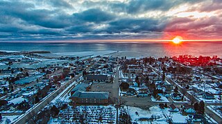
Kewaunee is a city in Kewaunee County, Wisconsin, United States. The population was 2,837 at the 2020 census. Located on the northwestern shore of Lake Michigan, the city is the county seat of Kewaunee County. Its Menominee name is Kewāneh, an archaic name for a species of duck.
Polar is a town in Langlade County, Wisconsin, United States. The population was 984 at the 2010 census.
Grand Chute is a town in Outagamie County, Wisconsin, United States. The population was 23,831 at the 2020 census. The unincorporated community of Apple Creek is partially located in the town. It was the birthplace of U.S. Senator Joseph McCarthy.
Glenwood City is a city in St. Croix County, Wisconsin, United States. The population was 1,242 at the 2010 census. Glenwood City is the site of the yearly St. Croix County fair and is known as the "City of 57 Hills."
Independence is a city in Trempealeau County, Wisconsin, United States. The population was 1,498 at the 2020 census. It is located at the confluence of Elk Creek and the Trempealeau River.
Osseo is a city located in Trempealeau County, Wisconsin, at the confluence of the North and South Forks of the Buffalo River. The population was 1,701 at the 2010 census.
Dorchester is a village in Clark and Marathon counties in the U.S. state of Wisconsin, along the 45th parallel. It is part of the Wausau, Wisconsin Metropolitan Statistical Area. The population was 876 at the 2010 census. Of this, 871 were in Clark County, and only 5 were in Marathon County.
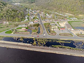
De Soto is a village mostly in Vernon County but also in Crawford County in Wisconsin, United States. The population was 287 at the 2010 census. Of this, 179 were in living in Vernon County, and 108 were living in Crawford County. The downtown and business area is located in Crawford County.
Fairchild is a village in Eau Claire County, Wisconsin, United States. The population was 550 at the 2010 census. The village is located within the Town of Fairchild.
Crandon is a town in Forest County, Wisconsin, United States. The population was 650 at the 2010 census. The City of Crandon is located adjacent to the town.
Lake Mills is a city in Jefferson County, Wisconsin, United States. The population was 6,211 at the 2020 census. The city is located partially within the Town of Lake Mills.
Shullsburg is a town in Lafayette County, Wisconsin, United States. The population was 354 at the 2010 census. The city of Shullsburg is located within the town but is separate from it. The unincorporated community of Dunbarton is located partially in the town.
Mishicot is a town in Manitowoc County, Wisconsin, United States. The population was 1,409 at the 2000 census. The Village of Mishicot is located within the town. The unincorporated communities of Fisherville, Kingsbridge, and Tisch Mills are also located partially in the town.
Spencer is a village in Marathon County, Wisconsin. It is part of the Wausau, Wisconsin Metropolitan Statistical Area. The population was 1,925 at the 2010 census.
Somerset is a town in St. Croix County, Wisconsin, United States. The population was 4,036 at the 2010 census. The Village of Somerset is adjacent to the town.
Wautoma is a city and the county seat of Waushara County, Wisconsin, United States. The population was 2,218 at the 2010 census.