Placid Lakes, Florida

Last updated
Placid Lakes, Florida
Highlands County Florida Incorporated and Unincorporated areas Placid Lakes Highlighted.svg
Location in Highlands County and the state of Florida
Coordinates: 27°15′31″N81°24′9″W / 27.25861°N 81.40250°W / 27.25861; -81.40250 Coordinates: 27°15′31″N81°24′9″W / 27.25861°N 81.40250°W / 27.25861; -81.40250
Country Flag of the United States.svg  United States
State Flag of Florida.svg  Florida
County Highlands
Area
  Total18.32 sq mi (47.4 km2)
  Land18.29 sq mi (47.4 km2)
  Water0.02 sq mi (0.05 km2)  0.11%
Elevation
128 ft (39 m)
Population
 (2000)
  Total3,054
  Density166.9/sq mi (64.4/km2)
Time zone UTC-5 (Eastern (EST))
  Summer (DST) UTC-4 (EDT)
Area code(s) 863
FIPS code 12-57407 [1]
GNIS feature ID1867188 [2]

Placid Lakes is an unincorporated community in Highlands County, Florida, United States. The population was 3,054 according to the 2000 census, at which time it was a census-designated place (CDP). Placid Lakes is a predominantly residential community southwest of the town of Lake Placid and due south of Lake June.

Contents

Geography

Placid Lakes is located at 27°15′31″N81°24′9″W / 27.25861°N 81.40250°W / 27.25861; -81.40250 (27.258691, -81.402605). [3]

According to the United States Census Bureau, the CDP has a total area of 18.32 square miles (47 km2), of which 18.29 square miles (47 km2) is land and 0.02 square miles (0 km2) (0.11%) is water.

Demographics

As of the census [1] of 2000, there were 3,054 people, 1,344 households, and 990 families residing in the CDP. The population density was 64.5/km2 (166.9/mi2). There were 1,615 housing units at an average density of 34.1/km2 (88.3/mi2). The racial makeup of the CDP was 89.69% White, 5.27% African American, 0.79% Native American, 1.05% Asian, 0.03% Pacific Islander, 1.96% from other races, and 1.21% from two or more races. Hispanic or Latino of any race were 10.51% of the population.

There were 1,344 households, out of which 21.1% had children under the age of 18 living with them, 62.6% were married couples living together, 8.6% had a female householder with no husband present, and 26.3% were non-families. 21.9% of all households were made up of individuals, and 15.1% had someone living alone who was 65 years of age or older. The average household size was 2.27 and the average family size was 2.59.

In the CDP, the population was spread out, with 19.0% under the age of 18, 4.4% from 18 to 24, 18.6% from 25 to 44, 22.9% from 45 to 64, and 35.2% who were 65 years of age or older. The median age was 53 years. For every 100 females, there were 92.1 males. For every 100 females age 18 and over, there were 90.7 males.

The median income for a household in the CDP was $31,914, and the median income for a family was $36,925. Males had a median income of $27,222 versus $17,813 for females. The per capita income for the CDP was $18,287. About 4.4% of families and 6.0% of the population were below the poverty line, including 7.0% of those under age 18 and 3.0% of those age 65 or over.

Geographic features

Related Research Articles

Chignik Lagoon, Alaska Census-designated place in Alaska, United States

Chignik Lagoon is a census-designated place (CDP) in Lake and Peninsula Borough, Alaska, United States. At the 2010 census the population was 78.

Sylvan Shores, Florida Unincorporated community in Florida, United States

Sylvan Shores is an unincorporated community and former census-designated place (CDP) in Highlands County, Florida, United States, located immediately northeast of the town of Lake Placid. As of the 2000 census, the CDP population was 2,424.

Lake Kathryn, Florida Census-designated place in Florida

Lake Kathryn is a census-designated place (CDP) in Lake County, Florida, United States. The population was 920 at the 2010 census. The area is also known as Lake Kathryn Heights. It is part of the Orlando–Kissimmee Metropolitan Statistical Area.

Lake Mack-Forest Hills, Florida Census-designated place in Florida

Lake Mack-Forest Hills is a census-designated place (CDP) in Lake County, Florida, United States. It contains the unincorporated communities of Forest Hills and Lake Mack Park. The population was 1,010 at the 2010 census, up from 989 at the 2000 census. It is part of the Orlando–Kissimmee–Sanford Metropolitan Statistical Area.

Okahumpka, Florida Census-designated place in Florida

Okahumpka is an unincorporated community and census-designated place (CDP) in Lake County, Florida, United States. The population was 267 at the 2010 census. It is part of the Orlando–Kissimmee Metropolitan Statistical Area.

Pine Lakes, Florida Census-designated place in Florida

Pine Lakes is an unincorporated community and census-designated place (CDP) in Lake County, Florida, United States. The population was 862 at the 2010 census, up from 755 at the 2000 census. It is part of the Orlando–Kissimmee Metropolitan Statistical Area.

Silver Lake, Florida Census-designated place in Florida

Silver Lake is a census-designated place (CDP) in Lake County, Florida, United States. The population was 1,879 at the 2010 census. It is part of the Orlando–Kissimmee Metropolitan Statistical Area.

Palmetto Estates, Florida CDP in Florida, United States

Palmetto Estates is a census-designated place (CDP) in Miami-Dade County, Florida, United States. The population was 13,675 at the 2000 census.

Candler-McAfee, Georgia neighborhood of Atlanta in DeKalb, Georgia, United States

Candler-McAfee is a census-designated place in unincorporated DeKalb County, Georgia, United States. It is located east of Atlanta approximately 10 miles (16 km) east of Downtown Atlanta and to the south of Decatur, Georgia The population was 23,025 at the 2010 census.

South Miami Heights, Florida CDP in Florida, United States

South Miami Heights is a census-designated place (CDP), originally known as Eureka, in Miami-Dade County, within the U.S. state of Florida. The population was 35,696 as of the 2010 census.

Crystal Lake, Polk County, Florida CDP in Florida, United States

Crystal Lake is a census-designated place (CDP) in Polk County, Florida, United States. The population was 5,341 at the 2000 census, an increase from 5,300 in 1990. The 2010 Census reported a population of 5,514. It is part of the Lakeland–Winter Haven Metropolitan Statistical Area.

Lake Telemark, New Jersey Census-designated place in New Jersey, United States

Lake Telemark is an unincorporated community and census-designated place (CDP) located within Rockaway Township, in Morris County, New Jersey, United States. As of the 2010 United States Census, the CDP's population was 1,255.

Cedar Crest, New Mexico Census-designated place in New Mexico, United States

Cedar Crest is a census-designated place (CDP) in Bernalillo County, New Mexico, United States. The population was 958 at the 2010 census. It is part of the Albuquerque Metropolitan Statistical Area.

Cumberland Head, New York Census-designated place in New York, United States

Cumberland Head is a census-designated place and region of the town of Plattsburgh in Clinton County, New York, United States. The population was 1,627 at the 2010 census.

Galeville, New York Census-designated place in New York, United States

Galeville is a hamlet in Onondaga County, New York, United States. The population was 4,617 at the 2010 census.

Perry Heights, Ohio CDP in Ohio, United States

Perry Heights is a census-designated place (CDP) in Stark County, Ohio, United States. The population was 8,900 at the 2000 census. It is part of the Canton-Massillon, OH Metropolitan Statistical Area. It was originally known as Genoa.

New Boston-Morea, Pennsylvania CDP in Pennsylvania, United States

New Boston-Morea is a census-designated place (CDP) in Schuylkill County, Pennsylvania, United States. The population was 441 at the 2000 census. It uses the Mahanoy City zip code of 17948.

Three Lakes, Washington CDP in Washington, United States

Three Lakes is a census-designated place (CDP) in Snohomish County, Washington, United States. The population was 3,184 at the 2010 census.

North Brookfield (CDP), Massachusetts CDP in Massachusetts, United States

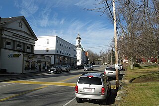
North Brookfield is a census-designated place (CDP) in the town of North Brookfield in Worcester County, Massachusetts, United States. The population was 2,265 at the 2010 census.

Winthrop (CDP), Maine Census-designated place in Maine, United States

Winthrop is a census-designated place (CDP) comprising the primary settlement in the town of Winthrop in Kennebec County, Maine, United States. The population was 2,650 at the 2010 census, out of 6,092 in the town of Winthrop as a whole.

References

  1. 1 2 "U.S. Census website". United States Census Bureau . Retrieved 2008-01-31.
  2. "US Board on Geographic Names". United States Geological Survey. 2007-10-25. Retrieved 2008-01-31.
  3. "US Gazetteer files: 2010, 2000, and 1990". United States Census Bureau. 2011-02-12. Retrieved 2011-04-23.