Plantersville, Mississippi

Last updated

Plantersville, Mississippi
Lee County Mississippi Incorporated and Unincorporated areas Plantersville Highlighted.svg
Location of Plantersville, Mississippi
Usa edcp location map.svg
Red pog.svg
Plantersville, Mississippi
Location in the United States
Coordinates: 34°12′42″N88°39′49″W / 34.21167°N 88.66361°W / 34.21167; -88.66361
Country United States
State Mississippi
County Lee
Government
   Mayor Shelton Shannon
Area
[1]
  Total2.10 sq mi (5.44 km2)
  Land2.09 sq mi (5.42 km2)
  Water0.01 sq mi (0.02 km2)
Elevation
308 ft (94 m)
Population
 (2020)
  Total868
  Density414.72/sq mi (160.14/km2)
Time zone UTC-6 (Central (CST))
  Summer (DST) UTC-5 (CDT)
ZIP code
38862
Area code 662
FIPS code 28-58440
GNIS feature ID0675959

Plantersville is a town in Lee County, Mississippi. The population was 868 at the 2020 census.

Contents

Geography

Plantersville is located at 34°12′42″N88°39′49″W / 34.21167°N 88.66361°W / 34.21167; -88.66361 (34.211530, -88.663681). [2]

According to the United States Census Bureau, the town has a total area of 1.5 square miles (3.9 km2), of which 1.4 square miles (3.6 km2) is land and 0.69% is water.

Demographics

Historical population
CensusPop.Note
1900 187
1910 165−11.8%
1920 27566.7%
1930 34625.8%
1940 49543.1%
1950 479−3.2%
1960 57219.4%
1970 91059.1%
1980 9201.1%
1990 1,04613.7%
2000 1,1449.4%
2010 1,1551.0%
2020 868−24.8%
U.S. Decennial Census [3]

2020 census

Plantersville Racial Composition [4]
RaceNum.Perc.
White 34439.63%
Black or African American 47454.61%
Pacific Islander 10.12%
Other/Mixed 303.46%
Hispanic or Latino 192.19%

As of the 2020 United States Census, there were 868 people, 390 households, and 246 families residing in the town.

2000 census

As of the census [5] of 2000, there were 1,144 people, 416 households, and 301 families residing in the town. The population density was 792.7 inhabitants per square mile (306.1/km2). There were 474 housing units at an average density of 328.4 per square mile (126.8/km2). The racial makeup of the town was 55.33% White, 42.40% African American, 0.17% Native American, 0.44% from other races, and 1.66% from two or more races. Hispanic or Latino of any race were 1.92% of the population.

There were 416 households, out of which 37.3% had children under the age of 18 living with them, 48.6% were married couples living together, 18.3% had a female householder with no husband present, and 27.6% were non-families. 22.4% of all households were made up of individuals, and 6.7% had someone living alone who was 65 years of age or older. The average household size was 2.69 and the average family size was 3.18.

In the town, the population was spread out, with 29.5% under the age of 18, 10.5% from 18 to 24, 29.2% from 25 to 44, 21.0% from 45 to 64, and 9.8% who were 65 years of age or older. The median age was 33 years. For every 100 females, there were 86.3 males. For every 100 females age 18 and over, there were 82.8 males.

The median income for a household in the town was $26,333, and the median income for a family was $32,237. Males had a median income of $28,125 versus $20,069 for females. The per capita income for the town was $12,852. About 19.9% of families and 24.2% of the population were below the poverty line, including 31.8% of those under age 18 and 25.8% of those age 65 or over.

Education

The Town of Plantersville is served by the Lee County School District. [6]

Notable person

Related Research Articles

<span class="mw-page-title-main">Bronson, Iowa</span> City in Iowa, United States

Bronson is a city in Woodbury County, Iowa, United States. It is part of the Sioux City metropolitan area. The population was 294 at the 2020 census.

<span class="mw-page-title-main">Stockholm, Maine</span> Town in the state of Maine, United States

Stockholm is a town in Aroostook County, Maine, United States. The population was 250 at the 2020 census.

<span class="mw-page-title-main">Clifton, Maine</span> Town in the state of Maine, United States

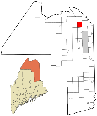
Clifton is a town in Penobscot County, Maine, United States. The population was 840 at the 2020 census. It is part of the Bangor Metropolitan Statistical Area.

<span class="mw-page-title-main">Thomson, Minnesota</span> Former City in Minnesota, United States

Thomson was a city in Carlton County, Minnesota, United States, located along the Saint Louis River. The population was 159 at the 2010 census.

<span class="mw-page-title-main">Westford, New York</span> Town in New York, United States

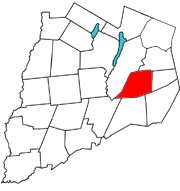
Westford is a town in Otsego County, New York, United States. The population was 868 at the 2010 census. It is southeast of Cooperstown.

<span class="mw-page-title-main">Marshville, North Carolina</span> Town in North Carolina, United States

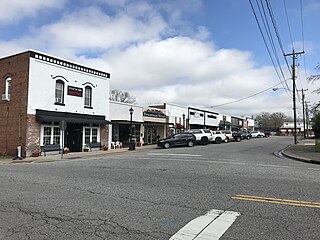
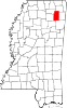
Marshville is a town in Union County, North Carolina, United States. Its population was 2,402 at the 2010 census. Marshville is known as the birthplace of country music singer Randy Travis.

<span class="mw-page-title-main">Carnot-Moon, Pennsylvania</span> Census-designated place in Pennsylvania, United States

Carnot-Moon is a census-designated place (CDP) in central Moon Township, Allegheny County, Pennsylvania, United States. The population was 13,151 at the 2020 census.

<span class="mw-page-title-main">Pymatuning North, Pennsylvania</span> Census-designated place in Pennsylvania, United States

Pymatuning North is a census-designated place (CDP) in Crawford County, Pennsylvania, United States. The population was 311 at the 2010 census.

<span class="mw-page-title-main">Fairdale, Pennsylvania</span> Census-designated place in Pennsylvania, United States

Fairdale is a community and census-designated place (CDP) in Greene County, Pennsylvania, United States. The population was 2,059 at the 2010 census.

<span class="mw-page-title-main">Bayside, Texas</span> Town in Texas, United States

Bayside is a town in southern Refugio County, in the U.S. state of Texas. The population was 325 at the 2010 census.

<span class="mw-page-title-main">Washburn, Clark County, Wisconsin</span> Town in Wisconsin, United States

Washburn is a town in Clark County in the U.S. state of Wisconsin. The population was 304 at the 2000 census. The unincorporated community of Shortville is located in the town.

<span class="mw-page-title-main">Oak Grove, Dodge County, Wisconsin</span> Town in Wisconsin, United States

Oak Grove is a town in Dodge County, Wisconsin, United States. The population was 1,126 at the 2000 census. The unincorporated community of Minnesota Junction is located in the town. The unincorporated community of Rolling Prairie is also located partially in the town.

<span class="mw-page-title-main">McMillan, Wisconsin</span> Town in Wisconsin, United States

McMillan is a town in Marathon County, Wisconsin, United States. It is part of the Wausau, Wisconsin Metropolitan Statistical Area. The population was 1,968 at the 2010 census. The unincorporated community of McMillan is located in the town. A section of the Mead Wildlife Area is also located in the town.

<span class="mw-page-title-main">Freedom, Sauk County, Wisconsin</span> Town in Wisconsin, United States

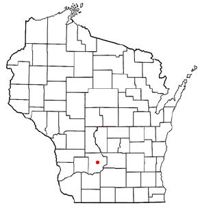
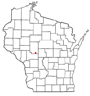
The Town of Freedom is a located in Sauk County, Wisconsin, United States. The population was 416 at the 2000 census. The unincorporated community of La Rue is located within the town. The town was named from the American ideal of freedom.

Arbor Vitae is a town in Vilas County, Wisconsin, United States. The population was 3,153 at the 2000 census. The unincorporated community of Arbor Vitae is located in the town.

<span class="mw-page-title-main">Van Tassell, Wyoming</span> Town in Wyoming, United States

Van Tassell is a town in Niobrara County, Wyoming, United States. The population was 15 at the 2010 census.

Howland is a town in Penobscot County, Maine, United States, which was settled in 1818. It was named after John Howland, one of the passengers on the Mayflower. The population was 1,094 at the 2020 census.

Clear Lake is a town in Polk County, Wisconsin, United States. The population was 800 at the 2000 census. The Village of Clear Lake is located within the town.

Darien is a town in Walworth County, Wisconsin, United States. The population was 1,651 at the 2020 census. The Village of Darien is located within the town. The unincorporated community of Bardwell is located in the town. The unincorporated communities of Allen's Grove and Fairfield are also located partially in the town.

<span class="mw-page-title-main">Plainfield, Wisconsin</span> Village in Wisconsin, United States

Plainfield is a village in Waushara County, Wisconsin, United States. The village is located almost entirely within the Town of Plainfield. A tiny portion extends into adjacent Town of Oasis. The population was 897 at the 2010 census.

References

  1. "2020 U.S. Gazetteer Files". United States Census Bureau. Retrieved July 24, 2022.
  2. "US Gazetteer files: 2010, 2000, and 1990". United States Census Bureau. February 12, 2011. Retrieved April 23, 2011.
  3. "Census of Population and Housing". Census.gov. Retrieved June 4, 2015.
  4. "Explore Census Data". data.census.gov. Retrieved December 8, 2021.
  5. "U.S. Census website". United States Census Bureau . Retrieved January 31, 2008.
  6. "2020 CENSUS - SCHOOL DISTRICT REFERENCE MAP: Lee County, MS" (PDF). U.S. Census Bureau. Archived (PDF) from the original on August 1, 2022. Retrieved July 31, 2022. - Text list
  7. Salter, Sid (April 19, 2017). "Sid Salter: Steve Holland is a walking contradiction". Clarion Ledger. Retrieved January 19, 2023.