Related Research Articles

Colorado is a state of the Western United States encompassing most of the southern Rocky Mountains as well as the northeastern portion of the Colorado Plateau and the western edge of the Great Plains. It is the 8th most extensive and 21st most populous U.S. state. The estimated population of Colorado is 5,758,736 as of 2019, an increase of 14.5% since the 2010 United States Census.

Adams County is the fifth-most populous of the 64 counties of the U.S. state of Colorado. As of the 2010 census, the population was 441,603. The county seat is Brighton. The county is named for Alva Adams, an early Governor of the State of Colorado in 1887–1889.

Golden is the Home Rule Municipality that is the county seat of Jefferson County, Colorado, United States. Golden lies along Clear Creek at the base of the Front Range of the Rocky Mountains. Founded during the Pike's Peak Gold Rush on June 16, 1859, the mining camp was originally named "Golden City" in honor of Thomas L. Golden. Golden City served as the capital of the provisional Territory of Jefferson from 1860 to 1861, and capital of the official Territory of Colorado from 1862 to 1867. In 1867, the territorial capital was moved about 12 miles (19 km) east to Denver City. As of the 2010 census, the city population was 18,867.

Teller County is one of the 64 counties in the U.S. state of Colorado. As of the 2010 census, the population was 23,350. The county seat is Cripple Creek, and the most populous city is Woodland Park.

Park County is one of the 64 counties in the U.S. state of Colorado. As of the 2010 census, the population was 16,206. The county seat is Fairplay. The county was named after the large geographic region known as South Park, which was named by early fur traders and trappers in the area.

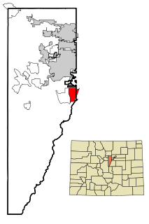
Jefferson County, is one of the 64 counties in the U.S. state of Colorado. As of the 2010 census, the population was 534,543, making it the fourth-most populous county in Colorado. The county seat is Golden, and the most populous city is Lakewood.

Gilpin County is the second-least extensive of the 64 counties of the U.S. state of Colorado, behind only the City and County of Broomfield. As of the 2010 census, the population was 5,441. The county seat is Central City. The county was formed in 1861, while Colorado was still a Territory, and was named after Colonel William Gilpin, the first territorial governor.

Arapahoe County is one of the 64 counties in the U.S. state of Colorado. As of the 2010 census, the population was 572,003, making it the third-most populous county in Colorado. The county seat is Littleton, and the most populous city is Aurora. The county was named for the Arapaho Native American tribe who once lived in the region.

Arvada is a Home Rule Municipality in Jefferson and Adams counties, a part of the Denver-Aurora-Lakewood, CO Metropolitan Statistical Area of the U.S. state of Colorado. As of the 2010 census the population was 106,433, and in 2018 the estimated population was 120,492, ranking Arvada as the seventh most populous municipality in Colorado. The Olde Town Arvada historic district is 7 miles (11 km) northwest of the Colorado State Capitol in Denver.

Westminster is a Home Rule Municipality in Adams and Jefferson counties in the U.S. state of Colorado. Westminster is a northwest suburb of Denver. The Westminster Municipal Center is located 9 miles (14 km) north-northwest of the Colorado State Capitol. As of the 2010 census the population of Westminster was 106,114, and as of 2018 the estimated population was 113,479. Westminster is the seventh most populous city in Colorado and the 237th most populous city in the United States. Westminster is a part of the Denver-Aurora-Lakewood, CO Metropolitan Statistical Area and the Denver-Aurora-Boulder Combined Statistical Area. In July 2006, it was ranked as the 24th best place to live in the US by Money magazine.
Columbine is a census-designated place (CDP) in Arapahoe and Jefferson counties in the U.S. state of Colorado. Located mostly in Jefferson County, it lies immediately west of the Denver suburb of Littleton.

Superior is a Statutory Town in Boulder County in the U.S. state of Colorado, with a small, uninhabited segment of land area extending into Jefferson County. According to the 2010 census, the population of the city was 12,483.

Indian Hills is a census-designated place (CDP) in Jefferson County, Colorado. The population was 1,280 at the 2010 census. The Indian Hills Post Office has the ZIP Code 80454.

Eagle Lake is a city in southeastern Colorado County, Texas, United States. The population was 3,639 at the 2010 census. It is home to a golf course, the largest private lake in Texas, and the Eagle Lake Regional Airport, which serves light aircraft.

The Territory of Jefferson was an extralegal and unrecognized United States territory that existed from October 24, 1859 until the creation of the Colorado Territory on February 28, 1861. The Jefferson Territory included land officially part of the Kansas Territory, the Nebraska Territory, the New Mexico Territory, the Utah Territory, and the Washington Territory, but the area was remote from the governments of those five territories. The government of the Jefferson Territory, while democratically elected, was never legally recognized by the United States government, although it managed the territory with relatively free rein for 16 months. Many of the laws enacted by the Jefferson Territorial Legislature were reenacted and given official sanction by the new Colorado General Assembly in 1861.

Littleton is the Home Rule Municipality in Arapahoe, Douglas, and Jefferson counties that is the county seat of Arapahoe County, Colorado, United States. The city is a part of the Denver-Aurora-Lakewood, CO Metropolitan Statistical Area. The city population was 41,737 at the 2010 United States Census, ranking as the 20th most populous municipality in the State of Colorado.

Idledale is a census-designated place (CDP), unincorporated community, and a U.S. Post Office in Jefferson County, Colorado, United States. The Idledale Post Office has the ZIP Code 80453. As of the 2010 census, the population of the CDP was 252.

Eldorado Mountain is a mountain summit on the eastern flank of the Front Range of the Rocky Mountains of North America. The 8,344-foot (2,543 m) peak is located 8.1 miles (13.1 km) south by west of downtown Boulder, Colorado, United States. The mountain is largely in Boulder County but it straddles the border and its southern flanks are located in Jefferson County. Its name was probably borrowed from the nearby community of Eldorado Springs.

The following outline is provided as an overview of and topical guide to the U.S. state of Colorado:
Lakewood is a Home Rule Municipality which is the most populous municipality in Jefferson County, Colorado, United States. Lakewood is the fifth most populous city in the State of Colorado and the 172nd most populous city in the United States. The city population was 142,980 at the 2010 United States Census. Lakewood is west of Denver and is part of the Denver-Aurora-Lakewood, CO Metropolitan Statistical Area.
References
- 1 2 "Plastic, Colorado". Geographic Names Information System . United States Geological Survey.
- ↑ Hall, Johnathan (December 7, 2019). "Plastic (Jefferson County, Colorado): Community Profile". RoadsideThoughts. Johnathan Hall. Retrieved December 10, 2019.
| This Colorado state location article is a stub. You can help Wikipedia by expanding it. |